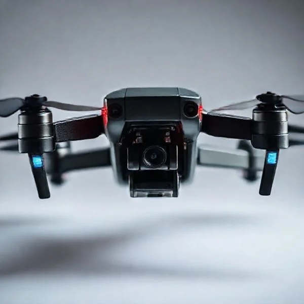
The unidentified drone swarms first emerged in late 2024, primarily originating in Morris and Hunterdon Counties before rapidly expanding across North and Central Jersey. This geographical progression saw clusters of 5 to 15 large-scale drones appearing nightly, moving progressively toward more densely populated regions and critical infrastructure.
🎯 Key Takeaways
- Sightings began in late November 2024, initially concentrated in Morris and Hunterdon counties.
- The drones typically appear in swarms of 5 to 15 units during evening hours.
- Geographic movement has trended eastward and southward toward Somerset, Bergen, and Monmouth counties.
- Official reports describe the crafts as significantly larger than standard consumer hobbyist drones.
- State and federal agencies, including the FBI, are actively investigating the flight patterns.
The unidentified drone activity in New Jersey began as a series of isolated reports in Morris County during mid-November 2024 and rapidly escalated into a statewide phenomenon by early December. You are likely tracking these events to understand the patterns of these large, sophisticated aircraft that have bypassed traditional detection and prompted high-level federal investigations. Understanding the specific timeline and movement of these drones is crucial for residents, local officials, and drone enthusiasts who need to distinguish between recreational hobbyists and these massive, coordinated incursions.
Prime for Young Adults — 6 Months Free
Exclusive Offer Amazon Prime for Young Adults, Students and 18–24s get six months of Prime free, then half price.
Start 6 Months Free As an Amazon Associate I earn from qualifying purchases.
This situation matters practically because it represents a significant shift in how we monitor our local airspace. The drones involved are not your average consumer models; they are reportedly four to six feet in diameter and capable of sustained flight over critical infrastructure. By mapping the progression from the initial “hotspots” in North Jersey to the subsequent sightings along the coast, you can see a clear pattern of movement that defies simple explanation. This guide breaks down exactly where these drones appeared and how the situation developed week by week.
Chronological Timeline of the New Jersey Drone Sightings
The timeline of the New Jersey drone incursions is marked by a sudden onset in late autumn, followed by a rapid increase in the number of aircraft spotted per night. Unlike typical drone sightings which are usually one-off events, these incidents involved groups of drones flying in coordinated formations over several hours.
The November 2024 Kick-off
The first significant reports emerged on November 18, 2024, centered primarily in Morris County. Residents in towns like Denville, Rockaway, and Morris Township reported seeing large, multi-rotor aircraft with blinking red and green lights hovering at altitudes between 500 and 1,000 feet. By November 25, the activity expanded toward Bedminster, specifically around the Trump National Golf Club, where multiple drones were observed flying in a grid-like pattern.
- November 18-20: Initial reports in Morris County near Picatinny Arsenal.
- November 21-24: Sightings spread to Hunterdon County; residents report drones following the path of the Raritan River.
- November 25-30: Heavy activity reported in Somerset County, with local law enforcement confirming sightings of aircraft significantly larger than commercial “prosumer” models.
The December Escalation and Swarm Reports
As December began, the frequency of sightings moved from “occasional” to “nightly.” On December 4, 2024, one of the most significant events occurred when more than 15 drones were reported simultaneously over the Somerset and Middlesex County lines. This was the first time “swarming” behavior was officially documented by multiple local police departments. By December 10, the sightings had pushed further south and east, reaching the Jersey Shore and prompting the FAA to issue temporary flight restrictions (TFRs) in specific corridors.
- December 4: Massive swarm reported over Somerset; drones seen flying in formation.
- December 7-9: Sightings move into Monmouth and Ocean Counties, with reports near Earle Naval Weapons Station.
- December 12-15: New reports emerge in Burlington and Mercer Counties, indicating a southern shift toward the state capital and Joint Base McGuire-Dix-Lakehurst.
Geographic Mapping: Tracking the Spread Across NJ Counties
Visualizing the movement of these drones reveals a distinct “hub-and-spoke” pattern. The activity did not start everywhere at once; it originated in a specific northern corridor and expanded outward in waves. Mapping these sightings helps identify which regions are currently seeing the most activity and where the drones might be heading next.
The Morris-Somerset Core (The Initial Hub)
Morris County remains the epicenter of the phenomenon. The highest concentration of reports has consistently come from the area surrounding the Picatinny Arsenal and the Boonton Reservoir. From this central point, the drones appeared to move westward into Hunterdon County and southward into Somerset. You can think of this region as the primary “operations zone” where the drones are most frequently seen hovering for extended periods rather than just passing through.
- Key Towns: Denville, Rockaway, Morristown, and Bedminster.
- Topography: Wooded hills and large reservoirs which provide significant cover and fewer flight obstructions.
- Activity Level: High; nightly sightings were common throughout late November.
The Eastern and Southern Expansion
Following the initial surge in the northwest, the mapping data shows a clear southeast trajectory. By early December, the “drone front” had crossed the Garden State Parkway. Activity became concentrated along the Monmouth and Ocean County coastlines. This shift is particularly notable because it moved the drones away from the hilly terrain of North Jersey and into the more densely populated, flat coastal plains. This movement suggests the operators—whoever they may be—are comfortable navigating varied environments, from deep woods to open Atlantic shoreline.
Prime for Young Adults — 6 Months Free
Exclusive Offer Amazon Prime for Young Adults, Students and 18–24s get six months of Prime free, then half price.
Start 6 Months Free As an Amazon Associate I earn from qualifying purchases.- Primary Corridor: Movement along the I-287 and Route 18 corridors.
- Coastal Hotspots: Manasquan, Wall Township, and Middletown.
- Southern Reach: Isolated reports as far south as Stafford Township and the Pine Barrens, suggesting a massive operational range of over 60 miles from the initial Morris County sightings.
By analyzing this geographical spread, it becomes clear that the drones are not tethered to a single stationary launch site. Instead, the mapping suggests either a mobile launch platform or a series of coordinated sites across the state, allowing the aircraft to “blanket” New Jersey counties in a systematic fashion.
Technical Characteristics of the Unidentified Drone Swarms
The sightings across New Jersey weren’t just isolated incidents of hobbyist flyers; the technical sophistication of these swarms suggested a much higher level of hardware. Witnesses and local law enforcement reported aircraft that were significantly larger than standard consumer models. These drones often operated in groups of five to fifteen, moving with a precision that hinted at advanced autonomous swarm technology and high-end GPS synchronization.
Dimensions and Propulsion Systems
Many reports described the drones as having wingspans or diameters of four to six feet. Unlike the high-pitched whine of a racing drone, these units emitted a low-frequency hum, suggesting heavy-duty motors and large-diameter propellers designed for endurance rather than speed. This indicates they were likely equipped with high-capacity lithium-polymer batteries or even hybrid gas-electric systems, allowing them to remain airborne for several hours at a time—far exceeding the 20-30 minute limit of most retail accessories.
Lighting and Navigation Patterns
The visual signature of these drones was a primary focus for investigators. They typically featured fixed or flashing red and green lights, alongside powerful white spotlights that could illuminate the ground from several hundred feet up. Practical Tip: For enthusiasts flying at night, using high-lumen anti-collision strobes is essential for visibility, but the “grid-like” search patterns seen in NJ suggest these drones were using pre-programmed waypoints rather than manual piloting.
- Endurance: Flight times reported reached up to three or four hours.
- Altitude: Stable hovering observed between 500 and 1,000 feet.
- Coordination: Multiple units maintaining fixed distances while moving at 25-35 mph.
- Weather Resistance: Continued operation during high-wind gusts and low-temperature NJ nights.
Official Responses and Investigative Efforts by NJ Authorities
The rapid spread of these sightings triggered an unprecedented mobilization of New Jersey state and federal resources. As the “drone fever” moved from rural counties toward more populated suburban hubs, the priority shifted from simple observation to active identification and threat assessment. Local police departments were flooded with calls, leading to the creation of specialized task forces to track the flight paths across the state’s jagged geography.
Multi-Agency Coordination
The investigation involved a “who’s who” of regulatory and security agencies. The Federal Aviation Administration (FAA) worked alongside the FBI and the New Jersey State Police to monitor radar data and civilian reports. Because many of these drones operated near sensitive infrastructure—like reservoirs and power grids—authorities utilized mobile command centers equipped with radio frequency scanners to attempt to “sniff out” the control signals of the operators.
Legislative and Public Safety Measures
In response to the sightings, there has been a renewed push for stricter Remote ID enforcement across the state. Authorities encouraged drone owners to ensure their broadcast modules were fully functional to avoid being mistaken for the unidentified swarms. Practical Example: Some NJ municipalities have since discussed implementing local ordinances that require additional lighting accessories for any craft weighing over 250 grams, aiming to make civilian drones more distinguishable from “mystery” aircraft.
Prime for Young Adults — 6 Months Free
Exclusive Offer Amazon Prime for Young Adults, Students and 18–24s get six months of Prime free, then half price.
Start 6 Months Free As an Amazon Associate I earn from qualifying purchases.- Ground Patrols: Increased police presence in areas with frequent “hot spot” sightings.
- Radar Analysis: Reviewing secondary radar data from Newark and Philadelphia airports.
- Public Reporting: The establishment of dedicated hotlines for real-time drone sighting submissions.
- Counter-UAS Tech: Discussion of signal-jamming technology (though heavily regulated by the FCC).
Conclusion
The spread of drones across New Jersey has transformed the way we view the sky and highlighted the incredible pace of aerial technology. From mysterious swarms to the everyday hobbyist, it is clear that the Garden State is a central hub for the modern drone evolution. Understanding the technical capabilities and the regulatory responses helps every pilot stay informed and responsible while enjoying this rapidly growing field.
To stay ahead of the curve, make sure your gear is up to date and your flight data is always logged. Take the next step by checking your drone’s Remote ID status and investing in high-visibility accessories for your next flight. Stay safe, stay compliant, and keep your eyes on the horizon!
❓ Frequently Asked Questions
How did the drone activity progress geographically across the state?
The sightings began in rural and suburban areas of Northwest Jersey, specifically Morris and Hunterdon. Within weeks, reports spread eastward into more urban areas like Bergen County and southward into Somerset and Monmouth, suggesting a widening area of operation.
What makes these NJ drone sightings different from normal hobbyist flights?
The scale and coordination distinguish these incidents. Unlike typical hobbyist drones, these are described as being roughly the size of a large pizza box or larger, flying in sophisticated ‘swarm’ patterns, and operating at altitudes and durations that exceed consumer battery life.
Are these drones considered a threat to NJ residents?
While there have been no reports of physical harm or property damage, the lack of identification has caused significant concern regarding privacy and airspace security. Authorities are treating them as a ‘suspicious occurrence’ while maintaining public safety protocols.
Which specific NJ towns have had the highest concentration of reports?
Towns such as Morristown, Bedminster, Clinton, and Mahwah have emerged as ‘hotspots’ for sightings. These locations often see multiple consecutive nights of activity before the drones appear to move to an adjacent municipality.
What is the FAA and FBI’s current stance on the NJ drones?
Both agencies have acknowledged the reports and are coordinating with local police to track flight paths and identify launch points. They have increased monitoring over critical infrastructure but have not yet released a definitive origin for the craft.
Can residents use drone detection accessories to track them?
Some enthusiasts use RF scanners and high-powered optics to observe the swarms, but federal law prohibits interfering with or ‘jamming’ the drones. Public reporting to local law enforcement remains the recommended course of action for tracking the spread.