
Let’s clear the air and dispel some of the most common misconceptions about drone GPS and mobile location. In this article, I aim to educate and inform you about the basics of this topic, as well as address any misconceptions that may exist. With clear and concise explanations, I will dive into the relevance of this subject in the current drone industry, discuss future prospects and developments, and provide ways for you to get involved and learn more about drone GPS and mobile location. So, let’s get started and debunk some myths about drone GPS and mobile location.
Introduction
As drones continue to soar in popularity, their capabilities and features have become increasingly advanced. One crucial aspect of drone technology is GPS and mobile location. These technologies play a key role in the navigation, tracking, and overall performance of drones. In this article, I will delve into the importance of GPS and mobile location in drones, how they work, the challenges they face in terms of accuracy, and the benefits of precise GPS and mobile location. Additionally, I will address common misconceptions surrounding drone GPS and mobile location, providing clarity and insight into these vital components.
Prime for Young Adults — 6 Months Free
Exclusive Offer Amazon Prime for Young Adults, Students and 18–24s get six months of Prime free, then half price.
Start 6 Months Free As an Amazon Associate I earn from qualifying purchases.Background
Recommended Best Deal Products
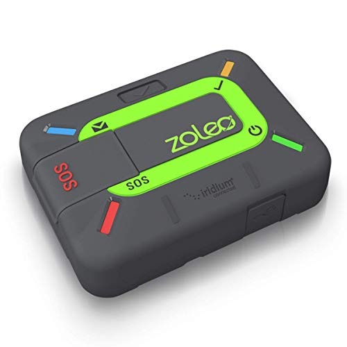


Before we dive into the intricacies of drone GPS and mobile location, it’s essential to understand their significance in the broader context of drone technology. GPS (Global Positioning System) is a satellite-based navigation system that allows devices, including drones, to determine their precise location and track their movements with utmost precision. On the other hand, mobile location refers to the use of mobile networks and cellular signals to determine a device’s location. Both GPS and mobile location are critical for drones to operate efficiently and effectively.
Main Points
The Importance of GPS and Mobile Location in Drones
GPS and mobile location are vital for drones for several reasons. Firstly, they enable drones to navigate and fly autonomously, reducing the need for constant human intervention. Drones equipped with GPS and mobile location capabilities can follow pre-programmed flight paths, accurately adhere to waypoints, and safely return to their starting point without any assistance. This level of autonomy is invaluable for various applications of drones, such as aerial photography, surveillance, package delivery, and search and rescue operations.
Moreover, GPS and mobile location provide crucial data for real-time tracking and monitoring of drones. This allows operators to know the exact location of their drones at all times, enhancing safety and security. In the event of an emergency or loss of communication with the drone, GPS and mobile location can assist in retrieval efforts, minimizing the risk of losing the drone or valuable data it may carry.
How GPS Works in Drones
GPS relies on a network of satellites orbiting the Earth to transmit precise timing signals. Drones equipped with GPS receivers receive these signals and use them to calculate their position, velocity, and altitude. This information is then used to navigate the drone accurately, maintain a stable flight, and perform various tasks. GPS technology has revolutionized the drone industry by providing an accurate, reliable, and globally accessible positioning system for unmanned aerial vehicles.
Challenges with Drone GPS Accuracy
While GPS technology is incredibly advanced, it is not without its limitations, particularly in the context of drones. One significant challenge is the availability and strength of satellite signals. Drones flying in urban areas or dense foliage environments may experience interference or signal blockage, leading to reduced GPS accuracy. Additionally, atmospheric conditions, such as ionospheric disturbances, can also affect GPS accuracy. These challenges can result in inaccurate positioning, which can be problematic for drones that require precise navigation and control.
Factors Affecting Mobile Location Accuracy in Drones
Mobile location accuracy in drones is reliant on cellular signals and network infrastructure. Several factors can influence the accuracy of mobile location, including signal strength, network congestion, and the availability of communication towers. Drones operating in remote or rural areas may experience weaker cellular signals, leading to less accurate mobile location data. Moreover, network congestion in highly populated areas can hinder the timely retrieval of mobile location information, impacting the performance of drones reliant on this data.
The Role of Satellite Signals in Drone GPS
GPS signals are transmitted by a network of satellites orbiting the Earth. These signals encompass precise timing information, which drones use to calculate their position. However, satellite signals can be affected by various factors, including multipath interference, where signals bounce off obstacles before reaching the drone, resulting in inaccurate positioning. Additionally, signal degradation due to atmospheric conditions, radio frequency interference, or obstructions like buildings or trees can also impact the reception and accuracy of GPS signals.
Prime for Young Adults — 6 Months Free
Exclusive Offer Amazon Prime for Young Adults, Students and 18–24s get six months of Prime free, then half price.
Start 6 Months Free As an Amazon Associate I earn from qualifying purchases.The Impact of Terrain and Obstacles on GPS and Mobile Location
The terrain and physical obstacles can significantly affect the accuracy of both GPS and mobile location in drones. Tall buildings, dense forests, and mountainous areas can obstruct satellite signals and weaken cellular connectivity, leading to decreased accuracy. For example, in urban environments with towering skyscrapers, drones may struggle to receive strong GPS signals, resulting in imprecise navigation and potential flight hazards. It is crucial for drone operators to consider the impact of terrain and obstacles when planning flights and relying on GPS and mobile location data.
The Benefits of Precise Drone GPS and Mobile Location
Precise GPS and mobile location are crucial for the safe and efficient operation of drones. Accurate positioning allows drones to navigate complex flight paths, maintain stable hovering, and execute precise maneuvers without the risk of collisions or accidents. Additionally, precise GPS and mobile location data enable drones to conduct highly detailed aerial surveys, maps, and inspections, making them invaluable tools in industries such as agriculture, construction, and infrastructure management. Furthermore, accurate GPS and mobile location data enhance the overall reliability and effectiveness of drones, contributing to increased productivity and operational efficiency.
Common Misconception: Drones Have Accurate GPS at All Times
One common misconception about drones is that they have accurate GPS at all times. While GPS technology has indeed revolutionized the drone industry, there are instances where GPS accuracy may be compromised. As mentioned earlier, environments with obstacles, such as buildings or dense foliage, can obstruct satellite signals, leading to reduced GPS accuracy. Additionally, atmospheric conditions and interference from other devices can also impact the accuracy of GPS signals. It is essential for drone operators to be aware of these limitations to ensure safe and successful operations.
Common Misconception: Mobile Location Is Always Reliable in Drones
Another misconception is that mobile location is always reliable in drones. While mobile location can provide valuable data for drones, its accuracy is contingent on cellular signal strength and network availability. Drones operating in remote or rural areas may face challenges in obtaining accurate mobile location data due to weaker cellular signals. Network congestion in urban areas can also affect the timely retrieval of mobile location information, potentially hindering drone operations. It is crucial for drone operators to consider the limitations of mobile location and rely on alternate positioning methods when necessary.
Common Misconception: GPS and Mobile Location are Interchangeable in Drones
Some individuals may perceive GPS and mobile location as interchangeable terms when discussing drones. However, these two technologies are distinct and serve different purposes. GPS relies on satellite signals to provide precise positioning information, while mobile location utilizes cellular signals for location determination. While both technologies contribute to drone navigation and tracking, their accuracy, availability, and reliability can vary. Understanding the differences between GPS and mobile location is essential for drone operators to make informed decisions regarding positioning and flight planning.
Examples
Recommended Best Deal Products


To illustrate the importance of precise GPS and mobile location in drones, let’s consider a hypothetical search and rescue operation. Suppose a drone is deployed to locate a missing hiker in a vast forested area. The drone’s GPS and mobile location capabilities allow it to autonomously navigate through the dense foliage, following a pre-programmed search pattern. The precise GPS positioning ensures that the drone covers the entire search area efficiently, while mobile location data enables real-time tracking of the drone’s movements.
Without accurate GPS and mobile location, the drone’s search efforts could be significantly hindered. Inaccurate GPS could lead to the drone missing critical areas of the search or wasting time searching in redundant locations. Unreliable mobile location could make it challenging to track the drone’s progress and locate its exact position in an emergency. By relying on precise GPS and mobile location, the drone can effectively aid in the search and potentially save lives.
Prime for Young Adults — 6 Months Free
Exclusive Offer Amazon Prime for Young Adults, Students and 18–24s get six months of Prime free, then half price.
Start 6 Months Free As an Amazon Associate I earn from qualifying purchases.Visual Aids
Incorporating visual aids can enhance the understanding of drone GPS and mobile location. Charts, graphs, and images can illustrate the concepts and clarify complex information. For example, a graph depicting the signal strength and accuracy of GPS in various environments, ranging from open fields to urban areas, can visually demonstrate the challenges drones may face in terms of GPS accuracy. Similarly, a diagram showcasing the interactions between satellites, drones, and cellular networks can help visualize how GPS and mobile location work together.
Conclusion
Recommended Best Deal Products


GPS and mobile location are essential components of drone technology, playing a vital role in navigation, tracking, and overall performance. While GPS provides precise position, velocity, and altitude information based on satellite signals, mobile location uses cellular signals to determine a device’s location. These technologies enable drones to operate autonomously, conduct complex tasks, and enhance safety and security.
However, challenges such as signal interference, atmospheric conditions, and obstruction from terrain and obstacles can impact the accuracy of both GPS and mobile location in drones. It is crucial for drone operators to understand these limitations and consider alternate positioning methods when necessary.
By debunking common misconceptions surrounding drone GPS and mobile location, we can ensure a clear understanding of these technologies and their implications for the drone industry. As drones continue to advance and play a more significant role in various sectors, it is important to stay informed and updated on the latest developments and practices in drone GPS and mobile location.
FAQs
What are the basics one should know about drone GPS and mobile location?
Drone GPS and mobile location are crucial for navigation, tracking, and autonomous operation of drones. GPS relies on satellite signals to calculate precise positions, while mobile location uses cellular signals for location determination. However, challenges such as signal interference, atmospheric conditions, and terrain obstructions can impact the accuracy of both GPS and mobile location.
Are there any common misconceptions related to drone GPS and mobile location?
Yes, there are common misconceptions surrounding drone GPS and mobile location. One misconception is that drones have accurate GPS at all times, while in reality, GPS accuracy can be compromised by obstacles and environmental factors. Another misconception is that mobile location is always reliable in drones, whereas its accuracy depends on cellular signal strength and network availability. Additionally, GPS and mobile location are not interchangeable terms, as they serve different purposes and have varying accuracy and reliability.
How is drone GPS and mobile location relevant to the current drone industry?
Drone GPS and mobile location are essential for the safe and efficient operation of drones in various industries, including aerial photography, surveillance, package delivery, and search and rescue operations. Accurate positioning allows drones to navigate complex flight paths and execute precise maneuvers without the risk of accidents. Furthermore, precise GPS and mobile location data enhance the overall reliability and effectiveness of drones, contributing to increased productivity and operational efficiency.
What are the future prospects or developments expected in drone GPS and mobile location?
The future of drone GPS and mobile location holds exciting prospects for advancements in accuracy, reliability, and autonomous capabilities. Technological innovations, such as the integration of additional satellite constellations, improved anti-jamming capabilities, and enhanced machine learning algorithms, are expected to enhance GPS and mobile location in drones. Furthermore, the development of 5G networks and improved mobile communication infrastructure may contribute to more robust and reliable mobile location data for drones.
How can someone get involved or learn more about drone GPS and mobile location?
To get involved or learn more about drone GPS and mobile location, individuals can explore online resources, industry publications, and reputable drone technology forums. Participating in drone-related communities, attending workshops, and pursuing specialized courses or certifications can also provide valuable insights and knowledge in this field. Additionally, keeping up with industry news and developments through conferences and trade shows can further expand understanding and awareness of drone GPS and mobile location.