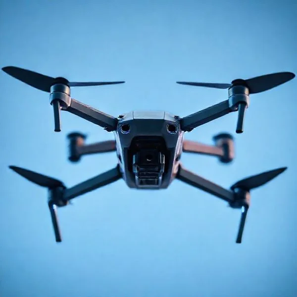
Drones have revolutionized our ability to uncover hidden truths by accessing restricted or remote locations previously invisible to the human eye. This aerial technology has exposed secret military bases, lost civilizations, and bizarre natural phenomena that were never meant to be documented.
🎯 Key Takeaways
- Drones offer perspectives of restricted areas impossible to see from ground level.
- Thermal and zoom accessories enhance the ability to find hidden objects.
- Many ‘forbidden’ captures have led to significant archaeological breakthroughs.
- Legal restrictions apply to flying over sensitive or private military locations.
- Aerial footage can expose environmental crimes or rare animal behavior.
Drones have become the ultimate whistleblowers of the modern age, peeling back the veil on locations once deemed inaccessible or strictly forbidden. From uncovering uncontacted tribes in the Amazon to capturing top-secret military hardware in the Nevada desert, these flying cameras provide a perspective that was never meant for public consumption. You are no longer limited by physical fences or dense foliage; a high-quality drone can bypass traditional barriers to reveal truths that have been hidden for decades or buried by government bureaucracy.
Understanding these captures is crucial because they challenge official narratives and broaden our understanding of human history and current global secrets. Whether it is a forgotten civilization hidden beneath a forest canopy or a clandestine facility operating in the shadows, drone footage provides the raw, unedited evidence needed to see what is happening behind closed doors. This technology has effectively democratized surveillance, moving it out of the hands of intelligence agencies and into the hands of the curious public.
Unmasking Hidden History: Lost Ruins and Ancient Secrets Revealed
For centuries, the earth has done an excellent job of swallowing history. Thick jungles and shifting sands have hidden massive structures that archaeologists could only dream of finding on foot. However, the advent of consumer drones equipped with high-definition cameras and thermal imaging has changed the game. You are now seeing “ghost” structures and ancient sites that were never intended to be rediscovered by the modern eye.
The Amazon’s Uncontacted Tribes and Geoglyphs
One of the most shocking captures occurred in the deep reaches of the Brazilian Amazon. Drones recorded footage of an uncontacted tribe, capturing individuals in a clearing who had never seen modern technology. This was “forbidden” imagery not because of a government cover-up, but because of the extreme isolation required for the tribe’s survival. Additionally, drones flying over deforested areas of the Amazon have revealed massive geometric earthworks—geoglyphs—that suggest a much larger, more complex civilization existed there than previously thought.
- The Discovery: Intricate circles and squares carved into the earth, invisible from the ground.
- The Context: These sites reveal a pre-Columbian population that managed the rainforest on a massive scale.
- The Reveal: Drones showed that the Amazon wasn’t always a “pristine” wilderness, but a highly engineered landscape.
Ireland’s Hidden “Ghost” Henge
During a record-breaking heatwave in 2018, a drone pilot in Ireland captured something spectacular: the silhouette of a prehistoric “henge” or ritual enclosure. The drought caused the grass to dry at different rates depending on the soil depth, revealing the footprint of a site dating back to 2,500 BC. This structure had been completely invisible to the naked eye for thousands of years. The footage revealed a massive, circular ritual site near Newgrange that historians didn’t even know existed. It proved that sometimes, you need a bird’s-eye view and specific environmental conditions to see what has been hiding in plain sight.
Into the Void: Exploring Restricted Zones and Forbidden Government Sites
Governments rely on “out of sight, out of mind” to keep their most sensitive projects under wraps. Tall fences, armed guards, and “No Fly Zone” signs are usually enough to keep the public away. However, drones have managed to breach these invisible walls, bringing back imagery that has sparked international debates and forced official responses. When you fly a drone over a restricted zone, you are often looking at things that were scrubbed from satellite maps or hidden behind mountainous terrain.
The Secrets of Area 51 and Tonopah
Area 51 is perhaps the most famous “secret” location on Earth. While the site is heavily guarded, daring drone operators have captured footage of the surrounding perimeter and the nearby Tonopah Test Range. These captures have revealed unusual hangar designs and experimental aircraft that aren’t supposed to exist in the public record. In one instance, a drone captured a “black project” aircraft being towed across the tarmac, providing aviation enthusiasts with a glimpse of aerospace technology that won’t be declassified for another twenty years.
- The “Janet” Flights: Drones have tracked the unmarked white-and-red planes that ferry workers from Las Vegas to the secret base.
- The Hangars: Footage showed massive new constructions that suggest the base is expanding its drone and stealth capabilities.
- The Security Response: These captures led to the implementation of aggressive “anti-drone” jamming technology around the base.
The Chernobyl Exclusion Zone’s Forbidden Relics
While the Chernobyl Exclusion Zone is open to limited tourism, many areas remain strictly off-limits due to extreme radiation or structural instability. Drones have flown into the heart of the “Woodpecker”—the massive Duga over-the-horizon radar system. This Soviet-era behemoth was designed to detect incoming nuclear missiles and was one of the most secretive installations in the USSR. Drone footage has taken us to the top of the rusting 150-meter-tall structure and inside the control rooms where no human can safely linger. These captures reveal the eerie, frozen-in-time nature of a superpower’s collapse, showing us the decaying machinery of the Cold War that was meant to stay secret forever.
Nature’s Mysteries: Strange Wildlife Behaviors and Remote Phenomena
One of the most profound benefits of modern drone technology is the ability to witness the natural world without human presence altering the scene. From high above, researchers and hobbyists have captured behaviors that were previously only theoretical. Drones act as a “silent observer,” allowing us to see how animals interact when they think no one is watching.
Unseen Predator-Prey Interactions
Drones have fundamentally changed our understanding of marine life. In several viral instances, drone pilots have captured orcas hunting great white sharks off the coast of South Africa—a behavior rarely seen from the surface. These aerial perspectives provide a tactical view of how apex predators coordinate their movements in real-time.
- Social Dynamics: Drones have revealed complex nursing behaviors in humpback whales that boats simply cannot get close enough to see.
- Migration Patterns: Aerial footage has uncovered “hidden” migration paths of land mammals through dense forests that are invisible from the ground.
- Environmental Anomalies: Pilots have discovered “fairy circles” and strange geometric vegetation patterns in remote deserts that suggest underground water movements or ancient geological shifts.
Tips for Wildlife Observation
To capture these rare moments without causing distress to the animals, specific gear is essential. Using a high-quality zoom lens is the best way to maintain a respectful distance while still getting a clear shot. Additionally, low-noise propellers are a must-have accessory to reduce the acoustic footprint of your drone, ensuring that the “unseen” stays truly natural.
The Ethics of Aerial Discovery: Privacy and the Impact of Unplanned Revelations
With great perspective comes great responsibility. As drones become more accessible, the line between “discovery” and “intrusion” often blurs. While finding a hidden shipwreck is an exciting archaeological win, accidentally filming into a private residence or a sacred cultural site raises significant ethical questions. Understanding the impact of your footage is just as important as the flight itself.
Respecting the Invisible Boundaries
Capturing something “no one was supposed to see” often means you have stumbled upon something sensitive. Whether it is a government facility, a private estate, or a protected environmental zone, drone pilots must navigate the legalities of airspace. Privacy laws are evolving rapidly, and what was a “gray area” five years ago can now lead to heavy fines or equipment seizure.
- Check Local Restrictions: Always use apps like B4UFLY to ensure you aren’t over restricted airspace, even if the scenery looks inviting.
- Consent and Context: If your drone captures people or private property, consider the ethical implications before posting to social media.
- Data Security: Use encrypted SD cards to protect your footage, especially if you are documenting sensitive environmental data or remote locations.
Cultural Sensitivity and Sacred Sites
Some of the most breathtaking drone finds occur in remote areas that hold deep cultural significance to local communities. Flying over ancient ruins or indigenous lands requires more than just a permit; it requires a level of respect. Many “unplanned revelations” can inadvertently expose fragile sites to looters or unwanted tourism, potentially damaging the very history we seek to admire.
Conclusion
Drones have opened a window into a world that was once reserved for those with expensive helicopters or satellite access. From uncovering forgotten history in overgrown forests to witnessing the raw power of nature in the deep ocean, these devices continue to provide us with perspectives that challenge our understanding of the planet. However, the thrill of discovery must always be balanced with a commitment to privacy and ethical flying.
Next Steps: To ensure your next flight captures the best possible footage, invest in a set of ND filters to handle harsh lighting and a high-capacity, rugged external hard drive for backing up those once-in-a-lifetime finds. Ready to start your own aerial exploration? Ensure your gear is prepped, check your local regulations, and take to the skies responsibly. What will you discover on your next flight?
💬 Quick Questions & Answers
What is the most famous drone discovery?
Captures of uncontacted tribes in the Amazon are among the most globally recognized drone discoveries.
Can consumer drones see through buildings?
No, but specialized thermal sensors can detect heat signatures through thin materials or roofs.
Is it legal to film Area 51 with a drone?
No, restricted military airspace is strictly off-limits and flying there can lead to federal prosecution.
How do drones find hidden ruins?
They use aerial mapping and LiDAR sensors to see patterns through dense forest canopies.
Have drones ever caught a crime in progress?
Yes, drones have documented illegal logging, poaching, and unauthorized chemical dumping worldwide.
❓ Frequently Asked Questions
Why are drone discoveries considered so controversial?
They often bypass physical barriers like fences or remote terrain, raising questions about privacy and the right to keep secrets. Many ‘forbidden’ shots challenge official narratives by revealing what is hidden behind closed doors.
What kind of accessories help drones capture ‘unseen’ footage?
High-zoom lenses allow for distant monitoring without detection, while thermal cameras reveal heat patterns invisible to the naked eye. LiDAR sensors are particularly vital for finding structures hidden under heavy vegetation.
Can a drone really find lost cities?
Yes, aerial surveys have uncovered dozens of ancient Mayan sites and other ruins that were completely hidden by jungle growth. They provide a ‘big picture’ view that ground-based explorers often miss due to perspective.
What happens if a drone captures a crime?
This footage is often used as evidence in court, though the legality depends on whether the drone was operating in public airspace. It has become a vital tool for environmental groups to document illegal activities.
Are there ‘forbidden’ places where it is legal to fly?
While most government sites are restricted, many remote natural wonders or abandoned urban locations are legal to film as long as local drone regulations are followed and privacy is respected.
How has drone technology changed archaeological research?
It has made site identification significantly faster, allowing researchers to map vast areas without disturbing the ground. This non-invasive approach preserves history while documenting it with precision.