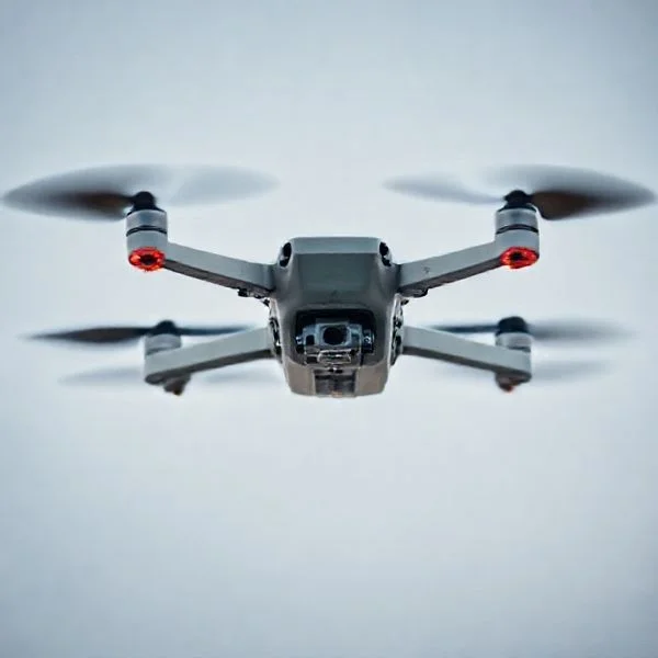
A GPS drone uses satellite positioning to provide unparalleled flight stability and automated safety features like Return to Home. Unlike toy drones, these devices can hold their exact position even in wind, making them the gold standard for beginners and pros.
🎯 Key Takeaways
- GPS drones offer automated Return to Home (RTH) during signal loss or low battery.
- Satellite connectivity enables precise, hands-off hovering by resisting wind drift.
- Intelligent flight modes like ‘Follow Me’ rely entirely on GPS coordinate tracking.
- Geofencing technology uses GPS to prevent drones from entering restricted No-Fly Zones.
- GPS is the primary differentiator between professional aerial tools and basic toy drones.
A GPS drone is a quadcopter equipped with a dedicated Global Positioning System module that allows it to communicate with multiple satellite constellations to determine its exact location on Earth. Unlike standard drones that rely solely on internal sensors for balance, a GPS drone knows its precise latitude, longitude, and altitude at all times. This technology acts as a digital anchor, providing the craft with spatial awareness that transforms it from a manual flying machine into an intelligent, autonomous robot.
Prime for Young Adults — 6 Months Free
Exclusive Offer Amazon Prime for Young Adults, Students and 18–24s get six months of Prime free, then half price.
Start 6 Months Free As an Amazon Associate I earn from qualifying purchases.
For you as a pilot, this technology is the ultimate safety net. It eliminates the constant stress of manual correction, especially in outdoor environments where wind and signal interference are common. By using satellite data, the drone can perform complex tasks like holding a stationary hover in high winds or navigating back to your feet automatically if something goes wrong. Understanding these features is essential because they represent the difference between a successful flight and a total loss of your equipment.
Core Differences: GPS Hardware vs. Standard Flight Controllers
Recommended Best Deal Products
The primary distinction between a GPS drone and a “non-GPS” or “toy” drone lies in how the flight controller interacts with the environment. A standard drone uses an Inertial Measurement Unit (IMU), which consists of gyroscopes and accelerometers. These sensors tell the drone if it is tilted or moving, but they cannot tell the drone if it is drifting over the ground. If you let go of the sticks on a standard drone, the wind will simply carry it away. You must constantly adjust the controls to keep it in one spot.
The Physics of “Hands-Off” Stability
In contrast, a GPS-enabled drone uses satellite coordinates to create a 3D lock on its position. When you release the control sticks, the drone enters a “Position Hold” mode. The flight controller continuously monitors its coordinates; if a gust of wind pushes the drone a few inches to the left, the GPS module detects the change in location and immediately commands the motors to push back to the original spot. This results in a rock-solid hover that requires zero input from you.
- Drift Resistance: Standard drones drift with the wind; GPS drones fight the wind to maintain a static coordinate.
- Altitude Precision: By combining GPS data with barometric sensors, these drones maintain a consistent height without vertical “bobbing.”
- Orientation Awareness: The drone always knows which way “Home” is, regardless of which way the camera is facing.
Flight Precision and Mapping
Because the drone understands its location in a global grid, it can execute flights with centimeter-level precision. Standard flight controllers are “reactive,” meaning they only react to movement after it happens. GPS systems are “proactive,” utilizing data from satellites to ensure the drone stays within a geofenced area. This allows for smoother video capture and more predictable flight paths, as the drone isn’t constantly wobbling while the pilot tries to maintain a steady position manually.
Critical Safety Features: Return to Home and Signal Redundancy
The most significant advantage of GPS technology is the “Return to Home” (RTH) suite of features. This is the primary reason why professional and hobbyist pilots invest in GPS-enabled hardware. Every time you power on a GPS drone, it searches for a “satellite lock.” Once it connects to a sufficient number of satellites (usually 8 to 12), it records its current coordinates as the “Home Point.” This becomes the designated safe zone for the drone to return to in the event of an emergency.
Automated Failsafes for Signal Loss
One of the biggest fears for any drone pilot is a “flyaway” caused by signal interference. With a standard drone, if the connection between your remote and the aircraft is severed, the drone will continue flying in its last known direction until it hits an obstacle or runs out of battery. A GPS drone handles this through a Signal Loss RTH trigger. The moment the flight controller detects a loss of communication with the remote, it pauses for a few seconds, climbs to a pre-set safe altitude to avoid trees or buildings, and uses its GPS coordinates to fly back to the Home Point autonomously.
Intelligent Low Battery Management
Battery management is another area where GPS technology provides a critical safety layer. Modern GPS drones don’t just wait for the battery to hit zero. Instead, the flight controller performs real-time calculations based on the drone’s current distance from the Home Point and the power required to fly back against the wind. This is known as Smart RTH.
Prime for Young Adults — 6 Months Free
Exclusive Offer Amazon Prime for Young Adults, Students and 18–24s get six months of Prime free, then half price.
Start 6 Months Free As an Amazon Associate I earn from qualifying purchases.- The Warning Phase: When the battery reaches a level where it can just barely make it back home, the drone will send an alert to your screen.
- The Critical Trigger: If you ignore the warning and the battery reaches a critical threshold, the drone will override your controls and initiate an automatic return.
- Dynamic Landing: If the battery is too low to even make it back home, the drone will use its GPS data to find a clear spot to land vertically before power is lost completely.
Enhanced Pilot Confidence
Beyond the automated triggers, you can also initiate RTH manually with the press of a button. If you lose visual line of sight or become disoriented regarding the drone’s position, the RTH feature acts as a “panic button.” The drone will stop, rotate, and fly back to you at a consistent speed and altitude. This level of redundancy ensures that even if you make a piloting error, the technology is designed to recover the aircraft safely without human intervention.
Enhancing Flight Stability: Precise Hovering and Wind Resistance
One of the most immediate benefits of a GPS drone is its ability to stay exactly where you put it. In the early days of RC flight, pilots had to constantly adjust their joysticks to prevent the craft from drifting. With a GPS-enabled drone, the onboard computer uses satellite data to “lock” its position in 3D space, providing a level of control that was once reserved for professional-grade equipment.
The Power of Rock-Solid Hovering
When you take your hands off the controller, a GPS drone won’t just float away with the breeze. It uses its coordinates to maintain a fixed position. This is a game-changer for photographers and videographers who need a stable platform to frame their shots perfectly. It allows you to focus on the art of the image rather than the mechanics of the flight.
- Hands-Free Safety: If you get distracted or need to check your surroundings, the drone stays “parked” in the air.
- Reduced Pilot Fatigue: You don’t have to fight the drone’s natural movement, allowing for longer, more relaxed flying sessions.
- Crisper Imagery: Stability allows for smoother video and slightly longer shutter speeds in low light without resulting in a blurry mess.
Fighting the Elements with Wind Compensation
GPS drones are remarkably resilient against wind. When a gust of wind pushes the drone, the GPS system detects the slight change in position instantly. The flight controller then automatically tilts the motors to push back against the wind, effectively fighting to return to its original spot. Tip: Even with this technology, always check your drone’s maximum wind resistance rating, as extreme gusts can still overcome the motors’ power.
Intelligent Flight Capabilities Enabled by Satellite Navigation
Beyond safety and stability, GPS opens up a world of creative possibilities. By knowing its exact location relative to the planet, your drone can perform complex maneuvers that would be nearly impossible for a human pilot to execute manually. These smart features turn a standard flight into a cinematic production.
Automated Flight Paths and Waypoints
Imagine being able to draw a line on a map and having your drone follow it perfectly. This is the magic of waypoint navigation. You can set specific coordinates for the drone to visit at specific altitudes, allowing you to focus entirely on controlling the camera while the aircraft handles the navigation. This is particularly useful for complex storytelling or professional applications.
- Repeatable Shots: Great for time-lapse videos where you need to fly the exact same path at different times of the day or season.
- Site Inspections: Professionals use this to check fences, rooftops, or farmland consistently and safely.
- Complex Maneuvers: Execute smooth, sweeping curves that look like they were filmed by a high-budget Hollywood crew.
Creative Cinematic Tools: Follow Me and ActiveTrack
GPS drones can act as your personal camera crew. Through “Follow Me” modes, the drone locks onto the GPS signal of your controller or smartphone. Whether you are mountain biking, running, or driving, the drone maintains a set distance and altitude to keep you in the frame automatically.
Prime for Young Adults — 6 Months Free
Exclusive Offer Amazon Prime for Young Adults, Students and 18–24s get six months of Prime free, then half price.
Start 6 Months Free As an Amazon Associate I earn from qualifying purchases.- Dynamic Action Shots: Capture high-speed movement without needing a second operator to pilot the craft.
- Orbit Mode: The drone circles a specific GPS coordinate, keeping the subject perfectly centered for a professional 360-degree view.
- Point of Interest: Set a landmark as a target, and the drone will keep its nose pointed at that spot regardless of how you move the aircraft in the sky.
Conclusion: Elevating Your Aerial Experience
A GPS drone is far more than just a high-tech toy; it is a sophisticated piece of equipment that prioritizes safety, stability, and creativity. By utilizing satellite data, these drones eliminate much of the stress associated with flying, making the hobby accessible to beginners while providing powerful tools for professionals. Whether you are relying on Return to Home for peace of mind or using Waypoints to capture the perfect cinematic shot, GPS technology is the backbone of modern flight.
To get the most out of your experience, always ensure you have a strong satellite lock (usually 10+ satellites) before takeoff. Ready to take to the skies with total confidence? Explore our latest range of GPS-enabled drones and accessories to find the perfect match for your next adventure!
❓ Frequently Asked Questions
How does GPS technology prevent drone loss?
By constantly tracking its coordinates, the drone knows its exact location relative to the pilot; if connection is lost, it uses this data to fly back to the ‘Home Point’ automatically.
What is the difference between GLONASS and GPS in drones?
GPS is the US satellite system, while GLONASS is Russian; drones using both (Dual GPS) connect to more satellites for faster and more reliable positioning.
Can I turn off GPS mode on my drone?
Most advanced drones allow you to switch to ‘ATTI’ or manual mode, which disables GPS positioning for high-speed flight or indoor use.
How many satellites does a drone need for a stable lock?
Most drones require a minimum of 7 to 10 satellites to establish a secure GPS lock before they allow for automated flight features.
What is geofencing in the context of GPS drones?
Geofencing uses GPS coordinates to create virtual boundaries, preventing the drone from accidentally flying into ‘No-Fly Zones’ like airports or high-security areas.
Why are GPS drones more expensive than toy drones?
The higher cost covers the GPS module, more sophisticated flight controllers, and the complex software required to process real-time satellite data.