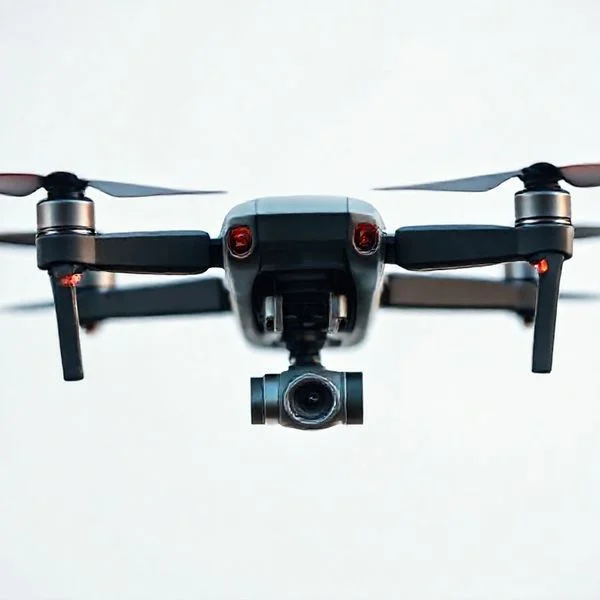
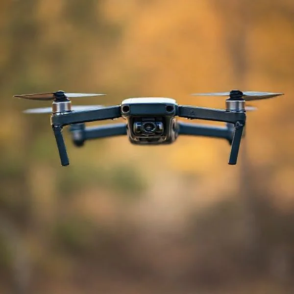
The most effective way to track a drone operator is through Remote ID technology, which broadcasts the pilot’s location to smartphone apps like DroneScanner. You can also identify a pilot’s position by observing Return to Home (RTH) patterns or reporting the drone’s serial number to the FAA for official investigation.
🎯 Key Takeaways
- Use Remote ID apps like DroneScanner to find the pilot’s broadcasted GPS coordinates.
- Observe the drone’s flight path during low battery to find the Return to Home point.
- Document the drone’s registration number for official reporting to the FAA or police.
- Maintain a clear line of sight to the drone to identify pilot maneuvering locations.
- Avoid using signal jammers as they are illegal under federal communications law.
If a drone is hovering over your property or flying in restricted airspace, you don’t need high-tech military equipment to find the pilot. Most modern drones broadcast their location and the pilot’s position through a digital “license plate” system known as Remote ID. By using specific smartphone apps, you can access this data in real-time, pinpointing exactly where the operator is standing and where the drone took off.
Prime for Young Adults — 6 Months Free
Exclusive Offer Amazon Prime for Young Adults, Students and 18–24s get six months of Prime free, then half price.
Start 6 Months Free As an Amazon Associate I earn from qualifying purchases.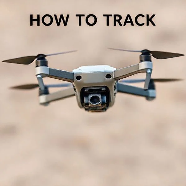
Knowing how to track an operator is essential for documenting privacy violations or reporting safety hazards to authorities. While you cannot legally interfere with the drone’s flight through jamming or physical force, you have every right to use publicly available broadcast data to identify who is behind the controller. This guide focuses on the legal, civilian-accessible tools you can use right now to gain transparency over the airspace around you.
Understanding Remote ID Technology and Civilian Access
Recommended Best Deal Products


Remote ID is the standard technology that allows drones to broadcast identification and location information while in flight. Think of it as a continuous digital signal that says, “Here is my serial number, my current altitude, and my pilot’s location.” In the United States, the FAA requires most drones to transmit this information via Bluetooth or Wi-Fi signals that any modern smartphone can pick up within a specific range.
Apps to Locate Drone Pilots in Real-Time
You don’t need a specialized hardware receiver to see Remote ID data; you just need the right software. Several civilian-grade apps are designed to scan these local broadcasts and display the results on an interactive map. These apps work by using your phone’s internal radio to “listen” for the broadcast frames sent out by the drone’s internal transmitter.
- DroneScanner: This is arguably the most user-friendly tool for both iOS and Android. It identifies nearby drones and shows the pilot’s ground position or the original takeoff point. It translates the raw Bluetooth/Wi-Fi packets into a readable format, showing you the drone’s manufacturer and speed.
- OpenSky: While primarily used for flight planning, OpenSky helps users see surrounding air traffic. It provides excellent situational awareness and can help you verify if a drone has the legal right to be in that specific airspace or if it is flying in a restricted “No Fly Zone.”
- AirHub: This app focuses on professional drone operations but includes tools to monitor local traffic. It is excellent for seeing the telemetry data that drones are legally required to broadcast under current FAA Part 89 regulations.
When using these apps, you will typically see the drone’s altitude, speed, and unique serial number. Most importantly, if the drone is compliant with modern “Standard Remote ID,” the app will mark a “Pilot Location” icon on your screen. This icon updates in real-time, showing you if the pilot is moving or standing in a fixed spot, such as a park bench or a vehicle.
Limitations of Remote ID Tracking
While Remote ID is powerful, it is not a universal tracking solution for every single craft in the sky. To track a pilot successfully with an app, the drone must be equipped with a Remote ID broadcast module. Older drones manufactured before 2022 might not have this hardware built-in unless the owner has added an external broadcast module. Additionally, the range of these apps is limited by your phone’s Bluetooth or Wi-Fi antenna, typically reaching between 500 and 1,500 feet depending on environmental interference and obstacles like buildings or trees.
How to Track a Drone Operator Like a Pro: A Practical Walkthrough
Tracking a drone operator is a critical skill for security personnel, privacy-conscious property owners, and law enforcement. Whether a drone is trespassing on private property, interfering with sensitive operations, or creating a safety hazard, identifying the pilot is the only way to ensure long-term resolution. This guide provides a systematic, technical, and physical approach to locating the person behind the controls using visual cues, radio frequency analysis, and modern digital tools. Following these steps ensures you gather actionable evidence while staying within legal boundaries.
Step 1: Immediate Visual Observation and Behavioral Analysis
What you need: High-powered binoculars (8×42 or better), a smartphone with a high-zoom camera, and a clear line of sight to the aircraft.
Prime for Young Adults — 6 Months Free
Exclusive Offer Amazon Prime for Young Adults, Students and 18–24s get six months of Prime free, then half price.
Start 6 Months Free As an Amazon Associate I earn from qualifying purchases.Instructions: The moment a drone is spotted, you must determine its orientation. Most consumer drones, such as those from DJI or Autel, have distinct LED light patterns; typically, red lights indicate the “nose” or front of the drone. By observing which way the drone is facing and how it moves, you can estimate the pilot’s location. Pilots generally keep the drone within their Line of Sight (VLOS). If the drone is hovering steadily and then moves in a straight line toward a specific landmark, it is likely returning to its launch point. Document the drone’s physical appearance, including color, number of rotors, and any visible payloads like high-end cameras or thermal sensors. Note the exact time of the sighting and the direction of its arrival and departure.
Pro Tip: Look for the “Return to Home” (RTH) behavior. When a battery is low, many drones automatically fly in a straight line at a pre-set altitude back to the controller. This is the “golden path” that leads you directly to the operator.
Step 2: Utilizing Remote ID Broadcast Tracking
What you need: A smartphone or tablet with a dedicated Remote ID scanning app (e.g., Drone Scanner, OpenSky, or AirBox).
Instructions: As of 2026, the FAA requires most drones to broadcast Remote ID information via Bluetooth or Wi-Fi. This digital license plate includes the drone’s location, altitude, and, crucially, the location of the control station (the pilot). Open your tracking app and wait for the signal to register. The app should display a map with two icons: one for the drone and one for the operator. Note the GPS coordinates of the operator’s position. If the operator is moving (for example, piloting from a moving vehicle), the app will update their location in real-time. This is the most accurate method for identifying exactly where a pilot is standing, often down to a five-meter radius.
Pro Tip: Signal range for Remote ID is limited by your phone’s antenna (usually 500m to 1km). If you don’t see the drone on the app, move toward its flight path to get within Bluetooth/Wi-Fi range.
Step 3: Signal Triangulation via RF Spectrum Analysis
What you need: A handheld RF (Radio Frequency) detector or a Software Defined Radio (SDR) with a directional Yagi antenna tuned to 2.4GHz and 5.8GHz.
Instructions: Drones communicate with controllers using specific frequency bands. By using a directional antenna, you can perform “fox hunting” to find the source of the command signal. Point the antenna in a 360-degree arc; the signal strength will peak when the antenna is pointing directly at the drone or the operator. Since the drone is in the air and the operator is on the ground, you can distinguish between them by the angle of the signal. If the strongest signal comes from a horizontal or slightly downward angle, you are likely pointing at the pilot’s controller. Move 50 yards to the left or right and take another reading. Where the two directional lines intersect on a map is the likely location of the operator.
Prime for Young Adults — 6 Months Free
Exclusive Offer Amazon Prime for Young Adults, Students and 18–24s get six months of Prime free, then half price.
Start 6 Months Free As an Amazon Associate I earn from qualifying purchases.Pro Tip: Ignore the constant 2.4GHz noise from local Wi-Fi routers by looking for the specific “frequency hopping” patterns characteristic of drone telemetry protocols like OcuSync.
Step 4: Conducting a Strategic Physical Perimeter Sweep
What you need: A vehicle for rapid movement and a map of the local area highlighting high-vantage points.
Instructions: Once you have a general direction from visual or RF tracking, begin a physical search within a 1-kilometer radius of the drone’s position. Drone pilots require a clear view of the sky and often seek out high ground, parking lot rooftops, or open fields to maintain signal strength. Look for individuals standing still while staring intently at a handheld screen or wearing FPV (First Person View) goggles. They are often accompanied by a small “landing pad” (usually a bright orange or blue circle on the ground) or have a vehicle with the trunk or side doors open. Pay close attention to parked cars in isolated areas, as many pilots operate from the climate-controlled interior of their vehicles to avoid sun glare on their screens.
Pro Tip: If you find a suspected vehicle, do not approach aggressively. Record the license plate number and the make/model of the car to provide to authorities later.
Step 5: Analyzing Flight Metadata and Digital Footprints
What you need: Access to the drone (if crashed or seized) or an SD card reader and forensic software (like ExifTool).Instructions: If a drone is recovered, it is a goldmine of information. Do not delete any files. Extract the SD card and check the “DCIM” or “MISC” folders. Photos and videos taken by the drone often contain EXIF metadata, which includes the GPS coordinates where the photo was taken. Often, the very first photo in a session is a “test shot” taken at the launch site, which frequently includes the pilot’s face, their vehicle, or their home address. Furthermore, flight logs stored on the drone’s internal memory can be uploaded to platforms like AirData or DJI FlightLog Viewer to see the exact flight path from takeoff to landing, revealing exactly where the operator started the session.
Pro Tip: Check the serial number on the drone’s body or inside the battery compartment. This number can be used by law enforcement to contact the manufacturer and identify the registered owner.
Step 6: Documenting and Escalating for Legal Action
What you need: A detailed logbook, a camera for evidence, and contact information for the local FAA Flight Standards District Office (FSDO).
Instructions: After successfully tracking or identifying the operator, you must compile your findings into a formal report. Include the drone’s registration number (if visible), the pilot’s physical description, the GPS coordinates of the launch site, and a detailed timeline of the flight. If the drone was flying over a restricted area (like an airport or a stadium), it is a federal offense. Contact local law enforcement to report a trespass or privacy violation, and provide your documentation. If the pilot is a commercial operator, check if they have a Part 107 certificate. Professionalism is key here; having a clean, data-backed report makes it much more likely that authorities will take the incident seriously and pursue charges or fines.
Pro Tip: Never attempt to “shoot down” or physically disable a drone. In the United States, drones are considered aircraft, and interfering with them is a federal crime under 18 U.S. Code § 32.
✅ Final Checklist
- Visual contact maintained and “Return to Home” path identified.
- Remote ID broadcast successfully scanned and operator GPS coordinates logged.
- Physical description of the operator and any associated vehicles recorded.
- High-resolution photos or video of the drone in flight captured for evidence.
- Local authorities or the FAA notified with a complete evidence packet.
Important Notes:
- Safety First: Avoid direct confrontation with drone operators, as they may become defensive or hostile. Keep a safe distance and involve law enforcement for identification.
- Legality: Ensure your tracking methods (like RF scanning) are passive. Active jamming or interference with drone signals is illegal in most jurisdictions.
- Estimated Time: Tracking an operator usually takes between 15 to 45 minutes from the initial sighting.
- Cost Range: Basic visual tracking is free; professional RF detection equipment can range from $200 (SDR) to $5,000+ (commercial drone sensors).
Behavioral Indicators and Visual Tracking Techniques
Recommended Best Deal Products


Technology is a vital tool, but visual observation is often the fastest way to find a pilot when an app isn’t picking up a signal. Drone pilots are bound by strict operational rules, most notably the requirement to maintain a Visual Line of Sight (VLOS). This means the pilot is almost always within a clear, unobstructed path of the drone. If you can see the drone clearly, the pilot is likely nearby with their eyes fixed on the sky.
Analyzing the Return to Home (RTH) Path
Every consumer drone, from DJI to Autel, features a “Return to Home” (RTH) failsafe. This is triggered when the battery is low, the signal is lost, or the pilot finishes their session. When RTH is activated, the drone behaves in a very specific, mechanical way that points you directly to the operator’s location.
- Watch for Linear Movement: If a drone stops hovering and begins moving steadily in one direction at a consistent speed without dodging obstacles, it is likely in RTH mode.
- The “Beeline” Rule: Follow the path of the drone’s nose. Pilots rarely fly in complex patterns when they are finished; they take the shortest, straightest route back to their takeoff point.
- Landing Descent: If you see a drone begin to descend vertically or enter a slow, controlled “spiral” descent, follow that vector. Most pilots land within 20-50 feet of where they initially launched the aircraft.
Spotting the Pilot’s Physical Location
Drones use radio frequencies (2.4GHz and 5.8GHz) that work best with a clear “fresnel zone.” To maintain a strong connection, pilots usually stand in high or open areas to avoid signal interference. When looking for the operator, scan the immediate area for specific physical behaviors.
Look for individuals standing in clearings, on top of hills, or at the edges of parking lots. They will usually be holding a controller with a bright screen—often shaded by a hood—and may be wearing a lanyard. Because they must keep the drone in sight, they will rarely be hidden behind thick walls or deep inside buildings while the drone is active. A pilot’s body language is also a giveaway; they will usually be looking up at the sky and then quickly down at their screen, often turning their body to keep the controller pointed in the general direction of the drone to maximize signal strength.
By combining the digital data from Remote ID apps with these visual tracking behaviors, you can narrow down a pilot’s location to within a few meters in a matter of minutes.
Essential Data Points for Law Enforcement Reporting
Tracking a drone is only the first step; if the flight is illegal or intrusive, you need to provide law enforcement with actionable data. “A small black drone” isn’t enough information for an officer to file a report. To build a credible case, you must focus on the digital footprint left by the aircraft and its operator.
Capturing the Digital Signature
Thanks to the FAA’s Remote ID requirements, most modern drones broadcast a digital “license plate.” Using a tracking app to capture this specific serial number is the most critical piece of evidence you can provide. This number is directly linked to the operator’s FAA registration, allowing authorities to bypass the guesswork and identify the owner immediately.
- Remote ID Serial Number: The unique identifier broadcast over Bluetooth or Wi-Fi.
- Make and Model: Identifying whether it is a DJI Mavic, a Skydio, or a custom-built FPV drone helps narrow down the operator’s likely equipment.
- Altitude and Velocity: Data showing the drone was flying at an unsafe height or speed can prove a violation of Part 107 or recreational safety guidelines.
Documenting Behavior and Location
Context matters as much as the data. Law enforcement will want to know exactly where the operator was located if you managed to spot them. While the drone is in the air, use your smartphone to record a video that shows both the drone and its surroundings. This proves the drone’s proximity to private property or restricted airspace.
- Operator Location: If your tracking app shows the pilot’s GPS coordinates, note the street address or landmarks.
- Flight Duration: Timestamps of when the drone arrived and when it departed your vicinity.
- Specific Actions: Note if the drone was hovering specifically near windows, following a person, or flying over a crowd.
Legal Limitations and Privacy Considerations in Drone Tracking
Recommended Best Deal Products


While it is perfectly legal to monitor the public airwaves for drone signals, there is a fine line between observation and interference. It is vital to remember that drones are legally considered aircraft by the FAA. This status gives them federal protections that many property owners are surprised to learn about.
Avoiding “Self-Help” and Physical Interference
The biggest mistake a person can make when tracking a drone operator is trying to take the drone down themselves. Using physical means—like nets, projectiles, or even signal jammers—is a federal crime. Even if the drone is hovering over your backyard, “self-help” measures can lead to felony charges and heavy fines from the FCC for signal interference.
- No Signal Jammers: It is illegal for civilians to use devices that disrupt GPS or radio frequencies.
- Respect Federal Airspace: The FAA controls the air from the ground up; you do not “own” the air above your house in the same way you own the land.
- Avoid Confrontation: If you find the operator, do not engage in a physical altercation. Use your collected data to let the authorities handle the situation.
The Balance of Privacy Laws
Tracking an operator is often motivated by privacy concerns, but the laws vary wildly by state. In many jurisdictions, a drone flying over your property isn’t necessarily trespassing unless it is low enough to interfere with your use of the land. However, voyeurism laws are much stricter. If an operator is using a drone to peek into windows, they are likely violating state privacy statutes, which provides a much stronger legal ground for your report.
Practical Tip: Always check your local municipal codes. Some cities have specific ordinances regarding where a drone pilot can stand on public property while operating their craft.
Conclusion
Tracking a drone operator is no longer a matter of guesswork. By leveraging Remote ID technology and dedicated tracking apps, you can gain a clear picture of who is in the air and where they are located. Remember that the goal is always safety and documentation. By gathering precise serial numbers, flight paths, and timestamps, you provide the necessary evidence for authorities to take action without overstepping legal boundaries yourself.
If you are concerned about drone activity in your area, your next step should be to download a reputable Remote ID scanner app and familiarize yourself with your local privacy ordinances. Stay observant, keep your data organized, and always prioritize legal channels over direct confrontation. Stay informed and keep your community’s airspace safe!
❓ Frequently Asked Questions
What is FAA Remote ID and how does it help me find a pilot?
Remote ID is a digital license plate system required for most drones. It broadcasts the drone’s identification and the location of the ground station (pilot) via radio frequency signals that can be picked up by modern smartphones.
Can I use a phone app to see who is flying a drone nearby?
While you won’t see their personal identity, apps like DroneScanner show the drone’s altitude, speed, and the GPS coordinates of the pilot’s controller in real-time if Remote ID is active.
How does the ‘Return to Home’ feature help identify a pilot?
When a drone hits low battery or loses signal, it typically flies directly back to its launch point. By watching the drone’s movement at the end of a session, you can often pinpoint the pilot’s exact location.
What information should I collect to report an illegal drone flight?
You should record the time of the incident, the drone’s physical description, any visible FAA registration numbers, and the location where you saw the pilot or the drone’s takeoff.
Is it illegal to jam a drone signal if it’s over my property?
Yes, it is a federal crime to jam, hack, or down a drone. The FAA considers drones to be aircraft, and interfering with their flight can lead to significant fines or imprisonment.
When should I involve the police instead of tracking the pilot myself?
Contact local law enforcement or the FAA if the drone is flying dangerously, spying on private property, or if you feel that confronting the operator would lead to an unsafe altercation.