For immediate safety threats or emergencies, you should contact local law enforcement by calling 911. For non-emergency regulatory violations in the United States, reports should be filed through the FAA DroneZone portal or the FAA Safety Hotline.
🎯 Key Takeaways
- Contact 911 immediately for drones posing direct physical threats to people or property.
- Use the FAA DroneZone portal to report non-emergency safety or regulatory violations.
- Document the drone’s color, size, and estimated altitude before filing your report.
- Contact the CAA in the UK or Transport Canada for sightings outside the US.
- Identify the operator’s location if possible to assist authorities in their investigation.
If you need to report a drone sighting, your primary point of contact is the Federal Aviation Administration (FAA) through their reporting page”>official
DroneZone portal or by contacting a local Law Enforcement Assistance Program (LEAP) officer. For any situation involving an immediate physical threat or a drone interfering with emergency responders, your first step should always be to call 911. Reporting these incidents ensures that authorities can track unauthorized pilots and maintain the safety of the national airspace.Prime for Young Adults — 6 Months Free
Exclusive Offer Amazon Prime for Young Adults, Students and 18–24s get six months of Prime free, then half price.
Start 6 Months Free As an Amazon Associate I earn from qualifying purchases.
Understanding where to direct your report is critical because it determines how quickly the information is processed. The FAA handles regulatory violations, such as flying too high or in restricted zones, while local police handle criminal activities like harassment or voyeurism. By providing the right agency with specific data, you help create a paper trail that can lead to fines, equipment seizure, or even criminal charges for reckless operators.
Official Aviation Authority Reporting Channels
The Federal Aviation Administration (FAA) is the sole authority governing the “navigable airspace” in the United States. If you witness a drone flying in a way that violates federal regulations—such as flying near an airport or over a stadium—you must report it directly to them. The FAA investigates these reports to ensure pilots are following Part 107 (commercial) or Recreational Flyer rules.
The FAA DroneZone and Regional Operations Centers
The most direct way to report a non-emergency sighting is through the FAA DroneZone website. This platform features a dedicated portal for reporting “Drone Sightings and Accidents.” Once you submit a report here, it is routed to the nearest Flight Standards District Office (FSDO). For more urgent aviation-related concerns that are not life-threatening but require quick attention, you can contact an FAA Regional Operations Center (ROC). These centers are staffed 24/7 and handle reports regarding drones interfering with manned aircraft or sensitive infrastructure.
- FAA DroneZone: Use for reporting unauthorized commercial flights or general rule-breaking.
- Regional Operations Centers: Contact these for incidents near airports or wildfire zones.
- Law Enforcement Assistance Program (LEAP): These are FAA special agents who coordinate specifically with local police to identify drone owners.
The Essential Information Checklist
When you contact the FAA, they require specific data to take action. Vague reports are rarely investigated. To make your report actionable, you should try to gather the following details:
- The “What”: A detailed description of the drone. Include the color, number of rotors (usually four), and any visible lights (green, red, or white).
- The “Where”: The exact location of the drone and, if possible, the location of the pilot. Note the altitude—drones are generally limited to 400 feet.
- The “When”: The precise date and time the sighting began and ended.
- The “How”: Describe the flight behavior. Was it hovering over a specific backyard, or was it performing high-speed maneuvers near a crowd?
- Identification: Look for a FAA Registration Number. These are often required to be displayed on the exterior of the drone.
Everything You Need to Know About Reporting Unauthorized Drone Activity
As the skies become increasingly crowded with Unmanned Aircraft Systems (UAS), knowing how to accurately and effectively report a drone sighting is essential for public safety and personal privacy. Whether you are concerned about a drone flying dangerously close to people, hovering over private property, or interfering with restricted airspace, following a standardized reporting procedure ensures that the right authorities have the data they need to take action. This guide will walk you through the precise steps of documenting an incident, identifying the type of craft, and contacting the appropriate local and federal agencies to ensure your report is taken seriously.
Step 1: Prioritize Safety and Immediate Observation
What you need: A clear vantage point, a smartphone or camera, and a notebook or digital memo app.
Instructions: Your first priority is to maintain your own safety and the safety of those around you. Do not attempt to chase, disable, or interfere with the drone’s flight path, as this can lead to legal repercussions or physical injury. From a safe distance, observe the drone’s behavior. Note the exact time of the sighting and the specific location using landmarks or GPS coordinates if possible. Determine the drone’s approximate altitude and direction of travel. Is it hovering, performing maneuvers, or flying a straight transit route? Pay close attention to whether the drone is carrying a payload, such as a camera, a thermal sensor, or a package, as this information is vital for investigators.
Prime for Young Adults — 6 Months Free
Exclusive Offer Amazon Prime for Young Adults, Students and 18–24s get six months of Prime free, then half price.
Start 6 Months Free As an Amazon Associate I earn from qualifying purchases.Pro Tip: Avoid using high-powered flash photography if the sighting occurs at night, as this can disorient the pilot or wash out the drone’s navigation lights in your photos, making identification harder.
Step 2: Document Visual Identification Details
What you need: Binoculars (optional), a high-resolution camera with zoom capabilities, and a basic understanding of drone types.
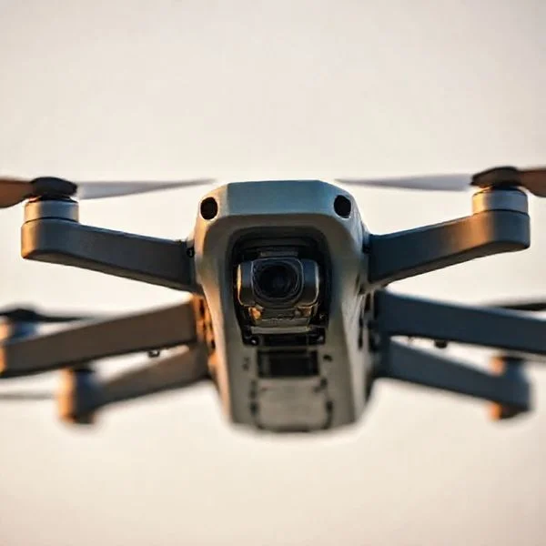
Instructions: Try to identify the physical characteristics of the drone. Is it a multi-rotor (like a quadcopter) or a fixed-wing aircraft (resembling a small airplane)? Note its primary color, size (roughly comparing it to a common object like a pizza box or a bicycle), and any distinctive markings. If you are close enough, look for a FAA registration number, which is required by law to be displayed on the exterior of any drone weighing over 250 grams. Take as many photos and videos as possible, ensuring you capture the drone in relation to fixed objects like buildings or trees to help authorities calculate its height and distance.
Pro Tip: Use the “Burst” mode on your smartphone camera to capture several frames quickly; this increases the likelihood of getting a sharp image of a fast-moving drone or its registration decals.
Step 3: Locate and Observe the Remote Pilot
What you need: A 360-degree scan of your surroundings and a way to record descriptions of people or vehicles.
Instructions: Most consumer drones have a limited signal range, meaning the operator is likely within a few hundred yards of the craft. Look for individuals holding a controller or wearing FPV (First Person View) goggles. They are often standing in open clearings, parking lots, or near elevated structures. If you spot a potential operator, do not confront them aggressively, as this may escalate the situation. Instead, note their appearance, the make and model of any vehicle they are associated with, and their license plate number. If they are operating from a vehicle, this is a critical piece of evidence for law enforcement to track down the individual later.
Pro Tip: If the pilot is wearing a high-visibility vest or has “Visual Observers” (assistants) with them, they may be a licensed commercial pilot. Note if they have any visible permits or signage displayed.
Prime for Young Adults — 6 Months Free
Exclusive Offer Amazon Prime for Young Adults, Students and 18–24s get six months of Prime free, then half price.
Start 6 Months Free As an Amazon Associate I earn from qualifying purchases.Step 4: Contact Local Law Enforcement for Immediate Threats
What you need: A telephone and your prepared notes from Steps 1 and 2.
Instructions: If the drone is creating an immediate safety hazard—such as flying over a crowded stadium, interfering with emergency responders, or hovering directly outside a bedroom window—call 911 or your local non-emergency police line immediately. Provide the dispatcher with your location and a description of the drone and pilot. Local police have the authority to investigate “nuisance” flying, trespassing, and harassment. When the officer arrives, provide them with your photographic evidence and any witness statements. Ensure you request a case or incident number for your records, as you will need this when filing a federal report with the FAA later.
Pro Tip: Specifically mention if the drone is flying over a “Critical Infrastructure” site, such as a power plant or water treatment facility, as this triggers higher-priority response protocols.
Step 5: File a Report with the FAA via the UAS InSight Portal
What you need: Access to a computer or smartphone, your police incident number, and your documented evidence.
Instructions: The Federal Aviation Administration (FAA) has ultimate jurisdiction over the national airspace. Visit the official FAA website and navigate to the “Report a Drone Incident” section or use the UAS InSight portal. You will be asked to provide the date, time, and location of the incident, as well as a description of the drone’s behavior. Be as clinical as possible in your description; use terms like “sustained flight over people” or “violation of 400ft altitude ceiling.” Upload your photos and videos through the portal. This report is crucial because it allows the FAA to track patterns of unauthorized flight and potentially fine or revoke the licenses of non-compliant pilots.
Pro Tip: Mention if the drone was flying during “Civil Twilight” or night hours without visible anti-collision lighting, as this is a specific violation of Part 107 regulations.
Step 6: Notify Airport Authorities or Air Traffic Control (ATC)
What you need: Contact information for the nearest airport’s administrative office or the FAA Regional Operations Center.
Instructions: If the sighting occurs within five miles of an airport or in a known flight path, you must notify airport management. Drones pose a significant risk to manned aircraft, particularly during takeoff and landing. Call the airport’s operations desk (often found on their official website) and report the altitude and heading of the drone. If the situation is an emergency—such as a drone hovering near a runway—and you cannot reach the airport, contact the nearest FAA Regional Operations Center. They have direct lines to Air Traffic Control and can alert incoming pilots to the hazard. Your quick action here could prevent a catastrophic mid-air collision.
Pro Tip: Use an app like “B4UFLY” or “Before You Fly” to see if your current location is within restricted “Class B” or “Class C” airspace, which makes the report even more urgent.
Step 7: Report Privacy Violations to State or Municipal Agencies
What you need: Knowledge of local drone ordinances and privacy laws.
Instructions: While the FAA regulates the “flight,” many states and municipalities have specific laws regarding “privacy” and “surveillance.” If a drone is filming you in a location where you have a reasonable expectation of privacy (like your backyard or through a window), this may be a violation of state Peeping Tom laws or specific UAS privacy statutes. Contact your District Attorney’s office or local city council to see if there are specific drone ordinances in place. Provide them with evidence of the drone’s proximity to your private spaces. Some states, like Florida or Texas, have very strict laws regarding capturing images of private property without consent.
Pro Tip: Keep a “privacy log” if the drone sightings are recurring. Note how often the drone appears and the duration of its stay over your property to establish a pattern of harassment.
Step 8: Preserve Digital Evidence and Metadata
What you need: Cloud storage (Google Drive, iCloud) and original unedited files.
Instructions: To make your report legally “bulletproof,” you must preserve the integrity of your digital evidence. Do not edit, crop, or apply filters to the photos or videos you took. These files contain “EXIF data” or metadata, which includes the exact timestamp and GPS coordinates of where the photo was taken. Investigators use this data to verify your claims. Upload the original files to a secure cloud storage folder and create a backup on a physical USB drive. If a legal case or FAA investigation proceeds, you may be asked to provide these original files to prove they haven’t been tampered with or manipulated.
Pro Tip: Rename your files using a standard format, such as “YYYY-MM-DD-Drone-Incident-01.jpg,” to help investigators keep your evidence organized during their review process.
✅ Final Checklist
- Verified the drone’s location, altitude, and direction of travel.
- Captured high-quality photos or video, including any visible registration numbers.
- Identified the remote pilot’s location and recorded vehicle descriptions/license plates.
- Contacted local law enforcement for immediate safety or privacy threats and obtained a case number.
- Submitted a formal report through the FAA UAS InSight portal with all supporting evidence.
- Stored original, unedited digital files in a secure location to preserve metadata.
Important Notes:
- Safety Warning: Never attempt to shoot down or jam a drone signal using electronic devices. This is a federal crime under the Aircraft Sabotage Act and can result in significant prison time.
- Seeking Help: If you believe you are being targeted by a drone for stalking or domestic harassment, contact a legal professional or a victim advocacy group in addition to law enforcement.
- Estimated Time and Cost: Filing reports usually takes 30–60 minutes. There is no cost to report a sighting to the authorities.
Distinguishing Between Safety Hazards and Privacy Concerns
Not every drone sighting requires the same level of response. To report effectively, you must distinguish between a safety hazard, which falls under aviation law, and a privacy concern, which falls under local and state criminal law. Knowing the difference prevents you from wasting time on the wrong reporting channel.
Immediate Safety Threats and Law Enforcement
An immediate safety threat occurs when a drone’s flight path puts people or property in physical danger. If a drone is flying aggressively low over a crowd, buzzing near power lines, or interfering with a medical helicopter, this is a police matter. In these cases, call 911 immediately. Local officers have the authority to approach a pilot and demand they cease operations if the public is in danger. Unlike the FAA, which focuses on the pilot’s license, local police focus on “reckless endangerment” and “breach of peace.”
Practical examples of safety threats include:
- A drone flying within the perimeter of a burning building or wildfire area.
- A pilot operating a drone while clearly intoxicated or impaired.
- Drones dropping objects or being used to transport dangerous materials.
Handling Privacy and Nuisance Complaints
If a drone is hovering outside your second-story window or following you in a park, this is typically categorized as a privacy or nuisance issue rather than an aviation hazard. The FAA generally does not have “privacy” rules; they have “safety” rules. Therefore, privacy complaints should be directed to your local police department’s non-emergency line. Most states have updated their “Peeping Tom” or anti-harassment laws to include drones. When reporting these, focus on the pilot’s behavior and your expectation of privacy in that specific location. Document if the drone has a camera and if it was pointed directly at private areas.
When filing a privacy report, provide the police with any video footage you have of the drone. Warning: Do not attempt to shoot down or physically disable the drone yourself. Drones are legally considered “aircraft” by the federal government, and damaging one can result in felony charges against you, regardless of where it was flying.
Critical Data Points Required for an Effective Report
When you encounter a drone operating in a way that causes concern, the quality of your report directly impacts the likelihood of a successful investigation. Authorities cannot act on vague descriptions; they need specific, objective data points to track down the operator or identify the specific aircraft involved. Think of yourself as an observer gathering evidence for a technical file rather than just reporting a nuisance.
Physical Descriptions and Flight Patterns
Drones come in various shapes and sizes, from palm-sized toys to large industrial heavy-lifters. Identifying the specific model or “class” of drone helps investigators determine its capabilities and potential origin. Pay close attention to the drone’s behavior, as flight patterns often reveal the operator’s intent.
- Visual Identifiers: Note the primary color, the number of rotors (most are quadcopters, but some have six or eight), and any visible lights. At night, record the color and blinking pattern of the navigation LEDs.
- Remote ID Broadcasts: If you have a drone-detecting app on your smartphone, check if the drone is broadcasting a Remote ID signal. This digital license plate provides the drone’s serial number and the pilot’s location in real-time.
- Operational Behavior: Was the drone hovering stationary for long periods, or was it following a specific person or vehicle? Did it appear to be flying autonomously in a straight line, or was it performing erratic maneuvers?
Environmental Context and Location Details
The “where” and “when” are just as vital as the “what.” Because drones are mobile, reporting a sighting even five minutes late can mean the pilot has already packed up and left. Providing precise environmental markers allows the FAA or local police to cross-reference flight logs and radar data.
- Precise Coordinates: Use a mapping app to drop a pin at your location and the estimated location of the drone. If the drone is near a landmark—like a cell tower, a specific park bench, or a bridge—include that in your notes.
- Altitude and Proximity: Estimate the drone’s height. Is it hovering at “tree-top level” (approx. 30-50 feet) or is it a “speck in the sky” (potentially above the 400-foot legal limit)?
- Duration of Flight: Most consumer drones have a battery life of 20 to 30 minutes. Noting how long the drone was in the air can help investigators narrow down where the pilot might be stationed nearby.
Local vs. Federal Jurisdictions in Drone Enforcement
Understanding who to call depends entirely on what the drone is doing. The legal landscape of the skies is a bit of a “double-decker” system. While the federal government owns the air, local governments have significant say over what happens on the ground. Knowing this distinction prevents your report from being bounced back and forth between agencies.
When Local Law Enforcement Takes the Lead
Local police and sheriff departments are generally the first responders for issues involving privacy, harassment, and noise. If a drone is hovering outside a bedroom window or being used to stalk someone, these are typically violations of state or local privacy laws, not just aviation regulations.
- Privacy Violations: Most “Peeping Tom” laws have been updated to include aerial surveillance. If the drone is capturing footage where there is a “reasonable expectation of privacy,” local police are your primary contact.
- Nuisance and Reckless Endangerment: If a pilot is flying low over a crowded backyard party or buzzing a public sidewalk, local authorities can often intervene based on public safety ordinances.
- Local No-Fly Zones: Many cities have banned drone take-offs and landings from municipal parks or specific “sensitive” areas. Local law enforcement enforces these ground-based restrictions.
The FAA’s Role in National Airspace Security
The Federal Aviation Administration (FAA) holds exclusive authority over the National Airspace System (NAS). They aren’t usually concerned with a drone being “annoying,” but they are hyper-focused on anything that threatens the safety of the skies or national infrastructure.
- Airspace Infringement: Any drone flying near an airport, interfering with manned aircraft, or operating in “Restricted Airspace” (like over a stadium or military base) is a federal matter.
- Commercial Compliance: The FAA handles cases where pilots are operating for-profit without the proper Part 107 certification.
- Safety Hazards: Flying over 400 feet, flying beyond visual line of sight (BVLOS), or flying over people without a waiver are technical violations that the FAA investigates through their Flight Standards District Offices (FSDO).
Conclusion
Reporting a drone sighting effectively requires a balance of quick thinking and detailed observation. By focusing on critical data points like Remote ID signals and flight behavior, you provide authorities with the evidence they need to take action. Remember that while local police handle privacy and immediate safety concerns, the FAA remains the ultimate authority for airspace violations and pilot licensing issues.
If you encounter a suspicious drone, your first step should be to safely document the scene with your own smartphone camera and check for a Remote ID broadcast. By staying informed and using the official reporting channels discussed in this guide, you contribute to a safer and more accountable drone community for everyone. Stay vigilant and keep your local reporting numbers saved for quick access!
❓ Frequently Asked Questions
What happens after I report a drone sighting to the FAA?
The FAA investigates reported safety violations and may issue warnings, fines, or civil penalties to the operator if evidence is found.
Where do I report drone sightings in the United Kingdom?
In the UK, safety concerns should be reported to the Civil Aviation Authority (CAA), while privacy complaints go to the police or ICO.
How do I report a drone pilot flying under the influence?
This is a serious safety emergency; you should contact local law enforcement immediately to intervene and ensure public safety.
What is the difference between a nuisance report and a safety report?
Nuisance reports involve noise or minor annoyance, while safety reports focus on flight maneuvers that risk injury or property damage.
Can I report a drone if I don’t know who is flying it?
Yes, documenting the drone’s flight path and physical appearance helps authorities monitor for recurring unauthorized activity in that specific area.
Are there specific reporting forms for commercial drone violations?
The FAA uses the same unified reporting system through DroneZone for both commercial and recreational drone sightings and violations.