You can fly a drone near an airport only if you have LAANC authorization in controlled airspace or are operating in uncontrolled Class G airspace. While the traditional 5-mile rule has evolved, you must always verify airspace classifications (Class B, C, D, E) using FAA-approved maps before takeoff.
🎯 Key Takeaways
- Use the B4UFLY app to check real-time airspace restrictions and airport proximity.
- Obtain digital authorization through LAANC for flights in controlled airspace areas.
- Recreational and commercial pilots must follow specific UAS Facility Map altitude ceilings.
- Always yield right-of-way to manned aircraft near runways and flight paths.
- Unauthorized flight near airports can result in federal fines and drone confiscation.
Under current FAA regulations, there is no single “magic number” like a three-mile or five-mile radius that applies to every airport. Instead, the legality of your flight depends entirely on the classification of the airspace. In most cases, if you are flying within five miles of a towered airport, you are likely inside controlled airspace (Class B, C, D, or E). To fly here, you must receive automated authorization before your props even spin. If you fly in these areas without a digital permit, you risk federal fines that can exceed $30,000 and the potential permanent loss of your pilot privileges.
Prime for Young Adults — 6 Months Free
Exclusive Offer Amazon Prime for Young Adults, Students and 18–24s get six months of Prime free, then half price.
Start 6 Months Free As an Amazon Associate I earn from qualifying purchases.
Practically speaking, knowing these distances is the difference between a successful afternoon of filming and a visit from local law enforcement. While uncontrolled airspace (Class G) allows for more freedom, airports are shielded by protective bubbles designed to keep drones away from manned aircraft flight paths. Understanding how to identify these bubbles on a map is the first and most important skill any drone pilot must master. You aren’t just staying away from a runway; you are staying out of specific “shelves” of protected sky that vary in size and shape based on the airport’s traffic volume.
Airspace Classifications and Their Impact on Drone Proximity
Recommended Best Deal Products


The FAA divides the sky into different classes, and four of these specifically restrict how close you can get to an airport. You cannot simply look at a physical fence line to determine safety. Instead, you must look at sectional charts or drone-specific maps to see where controlled airspace begins. If your drone enters these zones without authorization, you are violating federal law, regardless of your altitude.
The “Big Four” Controlled Airspaces
To understand proximity, you must recognize the four types of airspace that usually start at the surface around an airport. Each has a different “footprint” on the ground, which dictates how close you can fly:
- Class B (Blue Circles): These surround the busiest airports in the country, like LAX, O’Hare, or ATL. The airspace looks like an “upside-down wedding cake.” The inner circle usually extends 5 to 10 miles from the airport and starts at the surface. You must have explicit authorization to enter this zone.
- Class C (Magenta Circles): These protect mid-sized regional airports. The inner “surface area” typically has a 5-mile radius. While smaller than Class B, the restrictions for drone pilots are just as strict at ground level.
- Class D (Blue Dashed Lines): These surround smaller airports that still have an operational control tower. These areas are usually a simple cylinder with a 4-to-5-mile radius starting from the center of the airport.
- Class E Surface Areas (Magenta Dashed Lines): This is the one that trips up many pilots. Some airports without towers have “Class E to the surface” protections for instrument-rated planes. Even though there is no tower, you still need authorization to fly within these designated areas.
The 5-Mile Rule vs. Grid Altitudes
While the “five-mile rule” is an old hobbyist guideline, it has been replaced by more precise UAS Facility Maps. The FAA has mapped out the areas surrounding airports into a grid. Each square in that grid has a “ceiling” height (e.g., 0 feet, 100 feet, 200 feet). If you are in a “0-foot” grid, you are effectively banned from flying there unless you have a special coordination permit. These grids often extend several miles past the actual runway, meaning you might be three miles away from the airport but still in a “no-fly” 0-foot zone because you are directly under a landing path.
Comparing Recreational vs. Part 107 Rules for Airport Operations
How close you can fly also depends on why you are flying. The FAA distinguishes between recreational flyers (Section 44809) and commercial pilots (Part 107). While both are restricted by the same airspace classes, the process for navigating these boundaries differs slightly in terms of legal requirements and testing.
Requirements for Recreational Flyers
If you are flying purely for fun, you are still bound by the boundaries of controlled airspace. You cannot fly near a towered airport without following these specific steps:
- TRUST Certificate: You must carry proof that you passed the The Recreational UAS Safety Test (TRUST).
- LAANC Authorization: You must use a sanctioned app to request instant digital approval to fly in controlled airspace.
- Fixed Sites: In some cases, recreational flyers can operate at “FRIA” (FAA-Recognized Identification Areas) which are pre-approved flying club fields located within airport zones.
- Community Guidelines: You must follow the safety rules of a specific Community-Based Organization (CBO).
Requirements for Part 107 Commercial Pilots
Commercial pilots have a more rigorous set of rules but often have more tools at their disposal for getting closer to airports. Because Part 107 pilots have passed a formal aeronautical knowledge exam, the FAA grants them the ability to apply for more complex waivers.
Prime for Young Adults — 6 Months Free
Exclusive Offer Amazon Prime for Young Adults, Students and 18–24s get six months of Prime free, then half price.
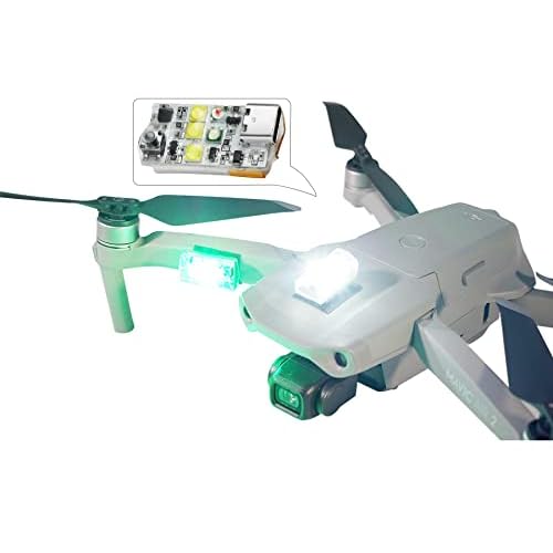
Start 6 Months Free As an Amazon Associate I earn from qualifying purchases.- Night Ops and Proximity: Part 107 pilots can fly in controlled airspace at night near airports provided they have the proper anti-collision lighting and LAANC approval.
- Manual Waivers: If a commercial pilot needs to fly in a “0-foot” grid area for a job (like a roof inspection right next to a runway), they can apply for a Rule 107.41 airspace authorization through the FAA DroneZone. This is a manual review process that allows for flights that recreational users simply cannot perform.
- Remote ID: Both groups must now comply with Remote ID requirements, but it is especially critical for commercial operations near airports, as the FAA and airport security use this “digital license plate” to monitor all drone activity within the five-mile perimeter.
Understanding UAS Facility Maps and Maximum Altitude Ceilings
Recommended Best Deal Products


When you are looking at how close you can fly to an airport, the FAA doesn’t just use a simple circle on a map. Instead, they use UAS Facility Maps (UASFM). These maps divide the airspace around airports into a grid of small squares. Each square has a specific number, which represents the maximum altitude (in feet) you can fly at while remaining safe from manned aircraft traffic.
The Logic of the Grid System
Think of these grids as a safety buffer. In squares directly over the runway or final approach paths, the number is usually 0. This means you cannot fly there without special, manual permission because planes are at their lowest point. As you move further away from the airport, the numbers increase—perhaps to 100, 200, or 400 feet. These maps are essential because they provide a clear, visual boundary for drone pilots, ensuring that even if you are “close” to an airport, you aren’t a hazard to a landing 747.
Navigating “Zero” Grids and Restricted Zones
Flying in a “zero” grid is generally off-limits for recreational flyers and requires significant justification for commercial pilots. Even if you are technically outside the airport fence, if you are in a zero-foot ceiling zone, you are legally grounded.
- Check the edges: Sometimes, one side of a street allows for 200 feet, while the other side is a zero-fly zone.
- Stay updated: These maps change as airport operations or construction projects evolve.
- Safety margins: Just because a grid allows 100 feet doesn’t mean you should push it to 99 feet if the wind is gusty.
Technology and Tools for Obtaining Legal Airspace Authorization
Gone are the days when you had to call an air traffic control tower on the phone to ask for permission. In fact, doing that today will likely get you a stern lecture. Modern drone pilots use a system called LAANC (Low Altitude Authorization and Notification Capability). This is a collaboration between the FAA and private industry to provide near-instant flight authorization.
The Power of Real-Time Authorization
LAANC is a game-changer for anyone wanting to fly near an airport. By using FAA-approved apps, you can submit a flight plan and get an approval text or email in seconds. This digital handshake tells the FAA where you are and how high you plan to go. If your request falls within the altitude limits of the UAS Facility Map, the system usually grants automatic approval. It is the most important “accessory” in your digital flight bag.
Essential Apps for Airspace Awareness
To stay legal, you need the right tools on your smartphone or tablet. These apps serve as your primary source of truth for local restrictions and weather.
- AirControl (formerly Aloft): Widely considered the gold standard for checking airspace and securing LAANC authorization.
- B4UFLY: An FAA-sponsored app that provides a simple “Clear for Takeoff” or “Check Restrictions” status based on your GPS location.
- SkyGrid: Excellent for visualizing complex flight paths and identifying temporary flight restrictions (TFRs) like those for sporting events or VIP movement.
Pro Tip: Always check these apps before you leave your house. There is nothing worse than arriving at a scenic location only to realize you are in a restricted “No Fly Zone” that your drone’s software won’t even let you take off in.
Prime for Young Adults — 6 Months Free
Exclusive Offer Amazon Prime for Young Adults, Students and 18–24s get six months of Prime free, then half price.
Start 6 Months Free As an Amazon Associate I earn from qualifying purchases.Conclusion
Recommended Best Deal Products

Flying a drone near an airport isn’t a “yes or no” question—it is a matter of knowing the rules and using the right tools. While the old “five-mile rule” has evolved into a more sophisticated system of controlled airspace and UAS Facility Maps, the goal remains the same: keeping the skies safe for everyone. By understanding your altitude ceilings and utilizing LAANC-enabled apps, you can enjoy your hobby without risking heavy fines or safety incidents.
Next Steps: Before your next flight, download a LAANC-compatible app and look up your favorite local park. You might be surprised at what the airspace overhead actually looks like! Stay informed, stay legal, and keep those rotors spinning safely.
❓ Frequently Asked Questions
How do I get permission to fly in controlled airspace near an airport?
You must use a LAANC-enabled app like AirControl or Kittyhawk to request near-instant digital authorization. For areas not covered by LAANC, you must apply for a manual waiver through the FAA DroneZone website.
What happens if I fly in a ‘No Fly Zone’ near an airport?
Flying in restricted airport airspace without authorization can lead to civil penalties exceeding $30,000, criminal charges, and the permanent revocation of your pilot certificate.
Are rules different for private landing strips and heliports?
Yes, while many private strips are in uncontrolled airspace, the FAA requires pilots to remain clear and not interfere with any manned operations regardless of the airport’s size.
What is a UAS Facility Map (UASFM)?
UASFMs are grids provided by the FAA that show the maximum altitudes at which drones can fly safely in controlled airspace. These maps dictate whether a LAANC request will be automatically approved.
Can I fly near an airport at night?
Yes, both recreational and Part 107 pilots can fly at night, but they must have proper anti-collision lighting and, if in controlled airspace, a valid LAANC authorization for that time.
What should I do if I see a manned aircraft while flying near an airport?
Immediately land your drone or descend to a safe altitude. The drone pilot always bears the responsibility to see and avoid manned aircraft to prevent mid-air collisions.