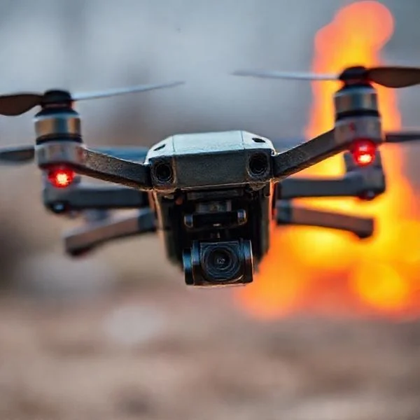
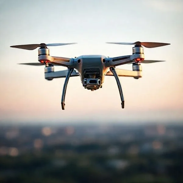
Drone shows are powered by autonomous fleet synchronization where a single computer manages hundreds of drones simultaneously via specialized software. These displays rely on RTK GPS technology for centimeter-level positioning and advanced 3D animation software to convert creative designs into precise flight coordinates.
🎯 Key Takeaways
- Drone shows utilize automated Ground Control software rather than individual pilots.
- RTK GPS provides the centimeter-level positioning necessary to prevent mid-air collisions.
- A single computer communicates with the entire fleet via encrypted wireless protocols.
- 3D animations are converted into coordinate-based ‘waypoints’ for every individual drone.
- Onboard high-intensity RGBW LEDs create the visible light patterns from the ground.
At the heart of every drone light show is a single, powerful computer running specialized Ground Control Station (GCS) software. Instead of individual pilots holding controllers, a sophisticated network orchestrates hundreds or even thousands of drones simultaneously. Each drone follows a precise, pre-calculated flight path synchronized to a master clock. This setup turns the fleet into a massive, three-dimensional digital display where each drone acts as a single, mobile pixel in a high-resolution sky canvas.
Prime for Young Adults — 6 Months Free
Exclusive Offer Amazon Prime for Young Adults, Students and 18–24s get six months of Prime free, then half price.
Start 6 Months Free As an Amazon Associate I earn from qualifying purchases.
Understanding this underlying architecture is vital if you are interested in the technical logistics of modern entertainment. The “magic” you see from the ground is actually a feat of high-speed networking and extreme data precision. Relying on human pilots for these complex formations would be impossible due to latency and human error. Instead, the technology ensures every bank, turn, and color change happens at the exact same millisecond across the entire fleet, maintaining safety while creating seamless, fluid animations.
The Role of Ground Control Stations (GCS) in Fleet Orchestration
Recommended Best Deal Products


The Ground Control Station serves as the “brain” of the entire operation. It is a centralized hub where the show’s choreography is translated into mathematical coordinates that the drones can understand. During the show, the GCS does not just watch the drones; it actively manages the state of every aircraft in the air. This orchestration requires massive bandwidth and specialized software designed to handle hundreds of simultaneous data streams without crashing.
Centralized Scripting and Pre-Flight Synchronization
Before the drones even leave the ground, the GCS software performs a process called “mission uploading.” Your show’s choreography is designed in 3D animation software and then sliced into individual flight paths for every single drone. These paths are uploaded into the onboard memory of each aircraft. This is a critical safety feature: if the communication link between the GCS and a drone is momentarily interrupted, the drone already knows exactly where it needs to be. The GCS then sends a “start” command that triggers all drones to begin their internal timers at the exact same microsecond.
- Software Examples: Professional operators often use platforms like Verge Aero or SPH Engineering’s Drone Show Software to manage these complex fleets.
- Data Redundancy: The GCS constantly monitors battery levels, motor temperature, and GPS health for every unit in the sky.
- Automated Safety: If a single drone deviates from its path by more than a few centimeters, the GCS can trigger an automatic “Return to Home” (RTH) command for that specific unit to prevent a collision.
High-Speed Wireless Protocols and Data Links
Maintaining a stable connection with 500 drones is a significant networking challenge. Standard Wi-Fi isn’t enough because the 2.4 GHz spectrum becomes incredibly crowded. Most professional shows utilize specialized, long-range radio frequency (RF) links and dual-band systems (typically 2.4 GHz and 5.8 GHz) to ensure a clean signal. The GCS uses a protocol—often a modified version of MAVLink—to send “heartbeat” signals. This keeps the fleet in a state of constant communication, allowing the operator to adjust the show in real-time if weather conditions change or an emergency arises.
The Ultimate Drone Light Show Walkthrough
Drone light shows are a breathtaking fusion of art and aerospace engineering, replacing traditional fireworks with sustainable, choreographed swarms of luminous robots. Understanding how these shows work requires a deep dive into 3D animation, satellite precision, and complex ground control systems. This guide will walk you through the intricate process of taking a creative vision from a digital storyboard to a synchronized performance in the night sky, ensuring you understand the technical rigor and safety protocols required for a successful mission.
Step 1: Concept Development and Storyboarding
What you need: Digital illustration software (Adobe Creative Suite or similar), storyboard templates, and a clear understanding of the client’s brand or theme.
Instructions: Every show begins on paper or a digital canvas. You must translate a creative vision into a series of keyframes. Start by sketching out the “hero” formations—such as logos, 3D shapes, or characters—that will anchor the performance. Consider the transitions between these shapes, as the most impressive part of a drone show is often the fluid movement between formations. During this stage, you must account for the “viewing angle” of the audience; unlike fireworks, drone formations are often designed to be viewed from a specific direction to ensure 3D shapes look correct. Map out a timeline, typically ranging from 8 to 12 minutes, which is the standard flight window for most light-show drones.
Prime for Young Adults — 6 Months Free
Exclusive Offer Amazon Prime for Young Adults, Students and 18–24s get six months of Prime free, then half price.
Start 6 Months Free As an Amazon Associate I earn from qualifying purchases.Pro Tip: Avoid overly complex transitions that require drones to travel long distances at high speeds. This consumes battery life quickly and increases the risk of mid-air turbulence.
Step 2: 3D Animation and Choreography
What you need: Specialized drone choreography software (like Blender with swarm plugins, Verge3D, or proprietary software like Drone Show Software by SPH Engineering).
Instructions: This is where the magic happens. You convert your storyboard into a 3D environment. Each drone is represented as a single point of light (a “pixel”). You must animate these points using a timeline, ensuring that no two drones ever come within a “safety sphere”—usually a 1.5 to 3-meter radius—to avoid propeller wash or collisions. The software uses “pathfinding” algorithms to calculate the most efficient route for each drone. You will also program the RGB LED parameters, defining the exact color, brightness, and strobe effects for every individual drone at every millisecond of the show. The final output is a massive coordinate file containing XYZ positions and color data for every drone in the swarm.
Pro Tip: Always run a collision detection simulation multiple times. Even a 10-centimeter error in the digital environment can lead to a catastrophic mid-air collision in the real world.
Step 3: Site Survey and Signal Analysis
What you need: Handheld GNSS signal tester, anemometer (wind gauge), spectrum analyzer, and local topographic maps.
Instructions: Before a single drone leaves the ground, the flight environment must be scrubbed for hazards. You need to identify a “Launch Box”—a flat, clear area where drones can be gridded out. More importantly, you must test the GNSS (Global Navigation Satellite System) strength. Drone shows rely on RTK (Real-Time Kinematic) GPS, which provides centimeter-level accuracy compared to the meter-level accuracy of standard GPS. Use a spectrum analyzer to check for electromagnetic interference (EMI) from local Wi-Fi towers or radio stations that could jam the command frequency. Finally, measure wind speeds at different altitudes; most show drones cannot safely perform in sustained winds exceeding 15-20 mph.
Pro Tip: Watch out for large glass buildings or metal structures near the launch site, as they can cause “multipath interference,” where GPS signals bounce off surfaces and confuse the drones’ positioning systems.
Prime for Young Adults — 6 Months Free
Exclusive Offer Amazon Prime for Young Adults, Students and 18–24s get six months of Prime free, then half price.
Start 6 Months Free As an Amazon Associate I earn from qualifying purchases.Step 4: Ground Control Station (GCS) Setup
What you need: High-performance laptop, primary and secondary (redundant) Wi-Fi routers, RTK Base Station, and industrial-grade power supply.
Instructions: The Ground Control Station is the “brain” of the operation. Set up your RTK Base Station first; this tripod-mounted device communicates with satellites and sends correction data to the drones to ensure they stay in their exact assigned coordinates. Connect your GCS laptop to a high-powered, long-range Wi-Fi network or a dedicated radio frequency (RF) link. Load the flight paths into the GCS software. This software will “handshake” with every drone in the fleet simultaneously. You must establish a “Geofence”—a virtual cylinder in the sky that the drones are programmed to never exit. If a drone hits the geofence boundary, it is programmed to immediately land or return to home (RTH).
Pro Tip: Always use a dedicated, shielded frequency for your drone communication. Using standard 2.4GHz Wi-Fi in a crowded public area can lead to signal drops due to audience members’ cell phones.
Step 5: Fleet Grid Layout and Pre-Flight Calibration
What you need: The drone fleet (e.g., 50 to 1,000+ units), fully charged LiPo batteries, a measuring tape or pre-marked grid mat, and a landing pad.
Instructions: Position the drones in a precise grid within the Launch Box. Each drone is assigned a specific ID number that corresponds to its unique flight path in the animation. Once placed, every drone must undergo a pre-flight “health check.” This involves calibrating the IMU (Inertial Measurement Unit) and the internal compass. Because the drones are packed closely together, their compasses can sometimes be affected by the metal in neighboring drones, so calibration is critical. You will use the GCS to push the flight data to each drone’s onboard memory. This ensures that even if the radio connection is momentarily lost during the show, the drone will continue its programmed path autonomously.
Pro Tip: Label your batteries with “Cycle Counts.” Using a battery that is slightly older or has a higher internal resistance than the others can cause one drone to land early, ruining the formation.
Step 6: Swarm Armed and Synchronized Launch
What you need: A team of spotters, two-way radios, and the GCS “Arm” command.
Instructions: With all systems green, the “Pilot in Command” (PIC) initiates the arming sequence. The GCS checks that every drone has a “3D Fix” (connection to at least 15-20 satellites) and that battery voltages are above the 4.1V per cell threshold. Once the “Launch” command is given, the drones don’t all jump at once; they typically launch in staggered waves to avoid the massive downdraft (propeller wash) that could destabilize the swarm. As the drones reach their “holding altitude,” they sync their internal clocks to the millisecond. On the GCS trigger, the animation begins, and the drones move from their staging positions into the first formation, activating their high-intensity RGB LEDs.
Pro Tip: Keep a “Kill Switch” or “Land All” command ready at all times. If a single drone begins to “toilet bowl” (swirl out of control), it is better to land that individual unit than to risk it hitting another drone.
Step 7: Recovery and Data Logging
What you need: Battery fire-safe bags, logbooks, and SD cards from the drones.
Instructions: After the show concludes, the drones return to their precise grid coordinates and land automatically. The crew must immediately approach the drones to power them down and check for any structural damage or heat issues in the motors. This is also the time to download the flight logs. These logs contain “telemetry data” that shows exactly how each drone performed, its battery consumption, and any GPS “glitches” it experienced. This data is vital for “predictive maintenance,” allowing you to replace motors or propellers before they fail during a future live performance. Batteries should be placed in storage charge (3.8V per cell) if another show isn’t scheduled within 24 hours.
Pro Tip: Create a “post-flight report” for every show. Documenting the specific atmospheric conditions and how the swarm reacted will help you refine your 3D choreography for future environments.
✅ Final Checklist
- Verify RTK Base Station has a “Fixed” solution with 20+ satellites.
- Ensure the “Geofence” is set at least 50 meters away from the nearest spectator.
- Confirm all drone batteries are at 95% charge or higher.
- Check that the “Emergency Land” command is responsive on the GCS.
- Validate that all FAA Part 107 waivers and local airspace permissions are active.
Important Notes:
- Safety First: Never fly directly over people. Even the lightest show drone can cause injury if a motor fails.
- Legal Requirements: In the US, drone shows require an FAA Part 107 license and often a “Section 107.35” waiver for multi-drone operation.
- Weather Limits: Do not fly in rain or during lightning storms, as moisture can short out the exposed LED controllers.
- Estimated Cost: Professional drone shows typically start at $15,000 for a small 50-drone display and can exceed $250,000 for large-scale, 1,000+ drone spectacles.
Precision Positioning: RTK GPS vs. Standard Satellite Navigation
If you have ever used a smartphone for navigation, you know that your location can “drift” by three to five meters. In a drone show where drones are flying just two meters apart, that level of error would result in a mid-air catastrophe. To achieve the tight, crisp formations required for logos and recognizable shapes, drone shows move beyond standard GPS and utilize a technology called Real-Time Kinematic (RTK) positioning.
The Limitations of Standard Satellite Fixing
Standard GPS relies on signals from satellites orbiting thousands of miles away. By the time those signals reach your drone, they have been distorted by the Earth’s atmosphere. This causes “noise” in the data, leading to a positioning error that is far too wide for formation flying. If your drones relied solely on this, your 3D shapes would look like a blurry cloud of lights rather than a sharp image. Standard GPS is fine for general flight, but it lacks the spatial awareness needed for choreographed displays.
How RTK Base Stations Eliminate Drift
RTK technology introduces a local reference point to fix these errors. You place an RTK Base Station on the ground at a known, fixed coordinate. This base station also listens to the GPS satellites. Because the base station knows exactly where it is, it can calculate the “error” in the satellite signal in real-time. It then broadcasts a correction signal to all the drones (the “rovers”) in the fleet. This allows the drones to correct their own positions instantly.
- Centimeter-Level Accuracy: RTK allows drones to maintain their position with an accuracy of 1 to 3 centimeters, compared to the 3 to 5 meters of standard GPS.
- XYZ Precision: This accuracy applies to all axes—latitude, longitude, and altitude—ensuring that the “pixel” stays exactly where the animation script dictates.
- Collision Avoidance: Because every drone has an ultra-accurate map of where every other drone is located, they can perform complex “interweaving” maneuvers that would be impossible with traditional navigation.
By combining the centralized “brain” of the GCS with the surgical precision of RTK positioning, a fleet of drones can move as a single, cohesive unit. This foundation of high-speed communication and hyper-accurate location data is what allows hundreds of independent machines to create a unified, breathtaking spectacle in the night sky.
Digital Choreography: Converting 3D Animations into Flight Paths
The magic of a drone show begins long before the first propeller spins. It starts in the digital realm, where creative designers treat the sky like a giant 3D canvas. Instead of thinking about individual drones, designers view the fleet as a single entity—a “swarming” mass of pixels that can be molded into any shape, from a spinning corporate logo to a galloping horse.
From Pixels to Flight Coordinates
Designers use specialized animation software, such as Blender or Cinema 4D, combined with proprietary drone show plugins. Every movement is choreographed in a 3D environment where the “z-axis” (height) is just as important as the ground coordinates. The software ensures that drones don’t just reach their destination, but do so without crossing paths with their neighbors. Key aspects of this digital stage include:
- Temporal Synchronization: Every drone follows a master clock, ensuring that 500 units change color or position at the exact same millisecond.
- Collision Avoidance Algorithms: The software automatically calculates “buffer zones” around each drone to prevent mid-air turbulence or physical contact.
- Color Mapping: Designers assign specific RGB values to the LED modules, allowing for smooth gradients and transitions across the entire fleet.
The Ground Control Station (GCS)
Once the animation is finalized, it isn’t just a video file; it is a massive dataset of waypoints. This data is uploaded to a Ground Control Station. Think of the GCS as the conductor of an orchestra. It doesn’t “remote control” the drones in real-time like a hobbyist would; instead, it monitors the health of the swarm and ensures every unit is executing its pre-programmed script perfectly. A single operator can oversee a show of 1,000 drones from one laptop, provided the communication links remain stable.
Safety Redundancies and Geofencing in Autonomous Light Shows
With hundreds of high-speed devices hovering over public spaces, safety is the industry’s highest priority. Modern drone shows are built on layers of “fail-safes” designed to handle hardware glitches, signal interference, or unexpected weather changes without putting the audience at risk.
Multi-Layered Fail-Safes
A professional light show drone is far more robust than a standard consumer model. They are equipped with redundant sensors and intelligent flight controllers that can make split-second decisions. If a drone detects a critical error, it doesn’t just fall; it follows a specific emergency protocol. Common safety features include:
- Battery Intelligence: If a drone’s battery drops below a safe threshold to finish the show, it will automatically break formation and land in a designated “dead zone.”
- Loss of Link Protocols: Should a drone lose its connection to the Ground Control Station, it is programmed to hover in place or return to the launch site autonomously.
- Dual GNSS Receivers: Many shows use multiple satellite constellations (GPS, GLONASS, Galileo) simultaneously to ensure position accuracy within centimeters.
The Virtual Cage: Geofencing
The most critical safety tool is the geofence. This is an invisible, three-dimensional digital “cage” that surrounds the performance area. Before the show begins, engineers program hard boundaries into the drones’ firmware. If a drone experiences a technical glitch and attempts to drift outside this box—toward the audience or into restricted airspace—the motors are programmed to shut down or force an immediate landing. This ensures that even in a worst-case scenario, the drones stay within a strictly controlled environment, far from the spectators.
Conclusion
Drone shows are a breathtaking marriage of art and aerospace engineering. By combining precision GNSS positioning, sophisticated 3D choreography software, and rigorous safety redundancies, these spectacles are quickly becoming the sustainable, high-tech alternative to traditional fireworks. Understanding the tech behind the lights only makes the experience more impressive, revealing the complex “digital brain” that keeps hundreds of units in perfect harmony.
If you are interested in seeing this tech in action, look for local drone show providers or major tech events in your area. For those looking to get involved in the industry, exploring 3D animation software like Blender is a fantastic first step into the world of aerial choreography. Keep an eye on the sky—the future of entertainment is flying right above us!
❓ Frequently Asked Questions
How do drones stay perfectly synced in the air?
A centralized Ground Control Station sends time-synced commands to every drone using a high-speed wireless network. Each drone follows a precise internal clock and pre-loaded trajectory to ensure the animation remains perfectly aligned throughout the performance.
What is RTK GPS and why is it necessary for drone shows?
Real-Time Kinematic (RTK) GPS is a satellite navigation technique that provides centimeter-level accuracy by using a local base station to correct satellite signals. Standard GPS is only accurate within meters, which is insufficient for the tight formations required in light shows.
Can drone shows fly in wind or rain?
Professional light show drones can typically handle moderate winds up to 20 mph, but rain is generally a dealbreaker due to electronics safety. Most operators utilize specialized weather monitoring to determine if it is safe to launch the fleet.
How are the visual patterns and shapes created?
Designers use 3D animation software like Blender or Maya to create the visual sequence. This animation is then processed through software that assigns a specific 3D flight path to every drone, effectively turning each aircraft into a flying pixel.
What kind of communication hardware is used?
The system uses high-gain antennas and specialized wireless protocols, often operating on 2.4GHz or 5.8GHz bands. These systems are designed to be robust against interference from local Wi-Fi or cell towers in urban environments.
How bright are the LEDs used on light show drones?
Show drones are equipped with high-intensity RGBW LEDs that are significantly more powerful than those on consumer drones. They are designed to be visible from miles away and can produce millions of color combinations to match branding or themes.