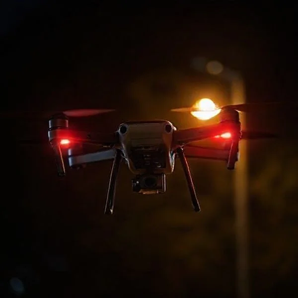
The standard legal maximum altitude for consumer drones is 400 feet (120 meters) above ground level (AGL) to prevent interference with manned aircraft. While many drones are technically capable of flying much higher, software geofencing and battery limitations often restrict their peak performance.
🎯 Key Takeaways
- The universal legal limit for recreational drones is 400 feet AGL.
- Manufacturers use geofencing software to enforce local altitude regulations.
- Part 107 pilots can fly higher near structures with specific waivers.
- High altitudes decrease air density, reducing battery life and lift.
- Exceeding limits can result in heavy fines or prison time.
The short answer is that you are legally capped at 400 feet (120 meters) above ground level in most countries, including the US, UK, and much of Europe. While many consumer drones are physically capable of reaching heights of 1,500 feet or more, doing so puts you in direct violation of aviation laws. These limits are not suggestions; they are strict safety barriers designed to prevent your drone from occupying the same airspace as manned aircraft.

Staying within these limits is vital for your survival as a drone pilot and the safety of people in the air. If you exceed the 400-foot ceiling, you risk catastrophic mid-air collisions with helicopters, private planes, or emergency medical flights. Furthermore, flying too high can lead to a total loss of your aircraft as wind speeds increase and battery efficiency drops at higher altitudes. Understanding the “how” and “why” of these limits ensures you keep your gear in one piece and your pilot’s license in good standing.
Understanding Legal Altitude Limits: The 400-Foot Rule
The 400-foot rule is the gold standard for drone safety across the globe. Under the Federal Aviation Administration (FAA) Part 107 and recreational rules in the United States, as well as Civil Aviation Authority (CAA) rules elsewhere, you must keep your drone below this ceiling to remain in uncontrolled airspace. This specific height was chosen because most manned aircraft are required to maintain a minimum altitude of 500 feet, creating a 100-foot safety buffer between your drone and a pilot’s cockpit.
The Logic Behind the 100-Foot Safety Buffer
In the world of aviation, visibility is everything. A drone is a small, fast-moving object that is incredibly difficult for a plane or helicopter pilot to spot until it is too late. By mandating that drones stay below 400 feet, regulators ensure that even if a manned aircraft descends to its lowest legal limit of 500 feet, there is still a vertical cushion to prevent an accident. You should always remember:
- Manned aircraft always have the right of way: If you hear a plane or helicopter, you must descend immediately.
- AGL vs. MSL: Legal limits are measured in Above Ground Level (AGL), not Mean Sea Level (MSL). If you fly off a cliff, your 400-foot limit follows the terrain down.
- Local Restrictions: Some areas, like those near airports (Class B, C, or D airspace), may have even lower limits, sometimes capping you at 50 feet or even 0 feet without prior authorization.
Exceptions for Flying Near Structures
There is one notable exception to the 400-foot rule for commercial pilots under Part 107. If you are inspecting a building, tower, or antenna, you are allowed to fly 400 feet above the top of that structure, provided you stay within a 400-foot radius of it. For example, if you are inspecting a 600-foot radio tower, you can legally fly at 1,000 feet as long as you remain close to the tower. This allows professionals to capture necessary data while remaining visible to other aircraft that would naturally avoid such a tall obstacle.
Technical vs. Software Height Limitations in Modern Drones
While the law says 400 feet, your drone’s hardware and software have their own ideas. Modern manufacturers like DJI, Autel, and Skydio build “digital fences” into their products to prevent users from accidentally breaking the law. These limits are a combination of firmware locks and the physical realities of aerodynamics. Even if you found a way to bypass the software, the environment itself becomes your enemy as you climb higher.
Software Caps and Geofencing
Most consumer drones come out of the box with a software height limit. For many DJI models, this is often set to a default of 120 meters (approx. 400 feet) to match local laws. While you can manually adjust this in the settings menu of your flight app, most manufacturers hard-cap the maximum height at 500 meters (1,640 feet). No matter how much you push the joystick, the drone will simply stop climbing once it hits this firmware wall.
- Geofencing (GEO 2.0): Drones use GPS data to identify “No Fly Zones” or “Altitude Restricted Zones.” If you are near an airport, the drone’s software may prevent you from taking off or automatically limit your height to 100 feet.
- Firmware Updates: Manufacturers frequently update these databases. A park that was legal to fly in last week might have a new height restriction today based on updated temporary flight restrictions (TFRs).
- Unlock Certificates: Commercial pilots can often request a “Custom Unlock” from the manufacturer to fly higher for specific, authorized missions.
The Physical Reality: Air Density and Battery Drain
Technically, a drone’s “service ceiling” is much higher than its legal limit, but physics eventually takes over. As you go higher, the air becomes thinner. Your propellers have to spin much faster to create the same amount of lift they generated at sea level. This leads to several technical hurdles:
First, the increased motor RPM required to stay airborne in thin air consumes battery power at an exponential rate. If you push for extreme heights, you may find that you don’t have enough energy left to make a safe descent. Second, wind speeds typically increase as you move away from the ground. A drone that feels stable at 50 feet might be tossed around violently at 400 feet, leading to a “flyaway” situation where the motors cannot fight the gust. Finally, colder temperatures at higher altitudes can cause your battery voltage to drop unexpectedly, which can trigger a forced emergency landing in an unsafe location.
Differentiating Between AGL (Above Ground Level) and MSL (Mean Sea Level)
Understanding the difference between AGL and MSL is vital for staying legal and keeping your drone airworthy. While your drone’s app might show you one number, the law often cares about another. Mixing these up can lead to accidental airspace violations, especially in hilly or mountainous terrain.
Understanding AGL for Legal Compliance
Above Ground Level (AGL) refers to the height of your drone relative to the ground directly beneath it. Most aviation authorities, including the FAA, base their height restrictions on AGL. If the limit is 400 feet, you must ensure you are no more than 400 feet above the earth at any given point during your flight path.
- The “Hill” Scenario: If you fly from a valley up toward a mountain peak, your AGL decreases as the ground rises toward the drone.
- The “Cliff” Scenario: If you launch from a cliff and fly out over a canyon, your AGL will instantly increase as the ground drops away.
- Legal Tip: Always adjust your altitude as the terrain changes to maintain a legal distance from the surface.
Why MSL Matters for High-Altitude Flying
Mean Sea Level (MSL) measures your altitude based on the average level of the ocean’s surface. This is the standard used by manned aircraft and air traffic control. While your drone uses a barometer or GPS to calculate AGL relative to your takeoff point, it is actually operating at a specific MSL altitude.
- Oxygen density: MSL determines how thin the air is, which directly impacts how hard your motors must work.
- Airspace charts: Pilots of planes and helicopters use MSL to navigate; knowing your MSL helps you understand where manned aircraft are likely to be.
- Practical Tip: If you are flying in a city like Denver (elevation 5,280 ft MSL), your drone is already at a high MSL the moment it leaves the ground, even if your AGL is only 5 feet.
Environmental Factors and Safety Risks of High-Altitude Flight
Pushing a drone to its maximum technical ceiling involves more than just a strong signal. The physics of flight change as you go higher, and the risks to your equipment—and others in the air—increase significantly. High-altitude environments are unforgiving and can lead to sudden “flyaways” or hardware failure.
Battery Performance and Thin Air
As you climb, the air becomes less dense. This “thin air” means your propellers have less “grip” to create lift. To stay airborne, your motors must spin significantly faster, which has a direct impact on your hardware and power consumption.
- Rapid Battery Drain: Expect your flight time to drop by 20% to 50% at high altitudes because the motors draw more current to maintain stability.
- Motor Heat: Running at higher RPMs generates more heat. In thin air, there are fewer molecules to pull that heat away, increasing the risk of an ESC (Electronic Speed Controller) burnout.
- High-Altitude Props: If you frequently fly in the mountains, consider “high-altitude propellers.” These are designed with a steeper pitch to move more air effectively.
Signal Interference and Visual Line of Sight (VLOS)
One of the biggest risks of flying high is losing your connection or losing sight of the aircraft. Even if your drone is technically capable of reaching 2,000 feet, your ability to control it safely diminishes long before that.
- Increased Wind Speeds: Ground-level winds are often deceptive. At 400 feet, wind speeds can be double or triple what you feel at the surface, potentially blowing your drone out of range.
- Visual Disappearance: A standard-sized drone becomes a tiny speck at 400 feet. Going higher makes it nearly impossible to determine its orientation, which is a requirement for safe flight.
- Radio Interference: As you gain altitude, your drone’s antenna has a “clearer view” of more distant cell towers and radio sources, which can actually increase signal noise and trigger a Return-to-Home (RTH) event.
Conclusion
Understanding how high a drone can fly requires balancing legal mandates with technical reality. While many consumer drones are physically capable of soaring thousands of feet into the air, the 400-foot AGL limit exists to protect the safety of the national airspace. Flying higher not only risks heavy fines but also puts your expensive gear at the mercy of thin air, high winds, and battery exhaustion.
Next Steps: Before your next flight, check a sectional chart or a drone airspace app to confirm the local height restrictions. If you plan to fly in high-elevation areas, consider investing in high-altitude propellers to protect your motors. Stay safe, stay legal, and enjoy the view from the top!
❓ Frequently Asked Questions
Why is the drone altitude limit set specifically at 400 feet?
This limit provides a 100-foot safety buffer because manned aircraft are generally required to stay at least 500 feet above the ground. By staying at or below 400 feet, drones avoid entering the same airspace as planes and helicopters.
Can a drone technically fly to 10,000 feet?
While most consumer drones are software-limited, high-end hardware could reach several thousand feet. However, at those altitudes, the air is too thin for standard propellers to generate sufficient lift, and the battery would likely die before the drone returned.
How does geofencing affect a drone’s maximum altitude?
Geofencing is built-in software that uses GPS to identify restricted zones and altitude caps. It prevents the drone from taking off or climbing past certain heights based on local aviation laws and proximity to airports.
What are the rules for flying drones over tall buildings or towers?
Under FAA Part 107 rules, commercial pilots can fly up to 400 feet above the top of a structure, provided they stay within a 400-foot horizontal radius of that structure. This allows for legal inspections of tall skyscrapers or cell towers.
Does wind speed change as you fly higher?
Yes, wind speeds typically increase significantly as altitude rises. A drone that feels stable at 50 feet may struggle to maintain its position or fight against gusts at 400 feet, which can lead to a ‘flyaway’ situation.
What are the legal consequences of exceeding altitude limits?
Violating altitude limits can result in thousands of dollars in civil penalties from the FAA, the suspension of pilot certifications, and in extreme cases involving airspace interference, criminal charges.