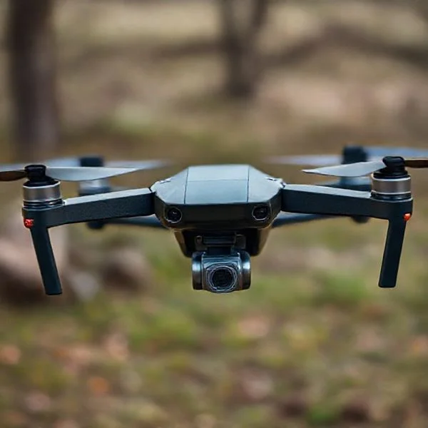
Recent reports of mysterious drone clusters have centered heavily on states like New Jersey, Pennsylvania, and New York, sparking intense federal investigations. While most drone activity is routine, these large-scale, unexplained night formations have also historically impacted Colorado, Nebraska, and Virginia.
🎯 Key Takeaways
- New Jersey and Pennsylvania are the current primary hotspots for unexplained drone clusters.
- Colorado and Nebraska experienced massive ‘night drone’ waves between 2019 and 2020.
- The FAA tracks and publishes quarterly reports of drone sightings across all 50 states.
- Investigations by the FBI and DHS often involve sightings near critical infrastructure.
- Virginia has reported significant mysterious drone activity near sensitive military installations.
If you are looking for the latest map of mysterious drone activity, you need to focus your attention on New Jersey, Virginia, Colorado, and Nebraska. These states have become the epicenter of large-scale, unidentified drone clusters that defy standard civilian flight patterns. These sightings often involve groups of five to twenty large aircraft flying in coordinated formations, frequently over sensitive locations like military bases, reservoirs, and pharmaceutical hubs. Unlike a neighbor’s hobbyist drone, these clusters appear at night and operate with a level of sophistication that has triggered multi-agency federal investigations.
Prime for Young Adults — 6 Months Free
Exclusive Offer Amazon Prime for Young Adults, Students and 18–24s get six months of Prime free, then half price.
Start 6 Months Free As an Amazon Associate I earn from qualifying purchases.
Understanding these locations is vital because it reveals a pattern of surveillance or testing that remains unexplained by the U.S. government. For residents and drone enthusiasts in these areas, these events are more than just campfire stories; they represent a significant gap in national airspace security. When dozens of large drones hover over a town for hours without any pilot coming forward, it changes how we view privacy and safety in our own backyards. By tracking these specific hotspots, you can stay informed about where the next “wave” of sightings is likely to occur and what the authorities are doing to identify the operators.
The Current Map: States with Recent Mysterious Drone Activity
Recommended Best Deal Products

As of late 2024 and early 2025, the most intense drone activity has shifted toward the East Coast. New Jersey has taken the lead as the primary state of interest, with reports flooding in from multiple counties. Residents have described drones the size of large cars hovering at altitudes of several hundred feet, often remaining stationary for extended periods before moving in unison. These aren’t the small, plastic drones you see at a local park; these are industrial-sized crafts with high-intensity lighting systems.
The East Coast Concentration: New Jersey and Virginia
The sightings in New Jersey have been concentrated in Morris County, specifically around the towns of Morris Township, Mendham, and Chester. Local law enforcement has been overwhelmed by hundreds of calls from concerned citizens. What makes these sightings unique is their proximity to the Picatinny Arsenal, a major military research and manufacturing facility. Similarly, Virginia has seen significant activity over Langley Air Force Base in Hampton. For several nights in late 2023 and throughout 2024, unidentified drones breached restricted airspace, causing the Air Force to scramble assets and monitor the intrusions.
- New Jersey: Multiple sightings in Morris, Somerset, and Bergen counties. Sightings often involve a “mother ship” drone surrounded by smaller units.
- Virginia: Persistent incursions over Langley Air Force Base and the Newport News area.
- Pennsylvania: Reports of similar large-scale clusters moving across the border from New Jersey, particularly in the Lehigh Valley area.
- Michigan: Reports of unidentified drones hovering near energy infrastructure and water treatment plants in the Detroit metro area.
The investigations into these specific incidents involve a high-level collaboration between the FBI, FAA, and the Department of Homeland Security (DHS). In New Jersey, the FBI has taken a lead role, though they have yet to announce any arrests or identify the source of the drones. Local police have been instructed not to attempt to shoot them down, as they fall under federal jurisdiction. In Virginia, the Pentagon has confirmed the sightings but remains tight-lipped about whether the craft were foreign-operated or part of a domestic testing program. The current status of these investigations is “active,” but answers remain elusive for the general public.
Historical Context: The 2019-2020 Colorado and Nebraska Drone Wave
To understand the current sightings, you have to look back at the massive wave that hit the high plains of Colorado and Nebraska in late 2019 and early 2020. This was the first time the American public witnessed large-scale, organized drone clusters that lasted for weeks. These drones, which reportedly had wingspans of up to six feet, flew in precise grid patterns across the rural landscape at night. They were primarily spotted in Phillips, Yuma, and Morgan counties in Colorado before moving into western Nebraska.
The Mystery of the High Plains Clusters
The Colorado/Nebraska wave was characterized by its sheer scale. On any given night, up to 30 drones could be seen flying in formation between 6:00 PM and 10:00 PM. These aircraft were notable because they flew despite high winds and freezing temperatures, conditions that would ground most consumer-grade drones. Local sheriffs formed a multi-county task force to track the vehicles, but the drones always seemed to disappear once they reached more populated areas or when helicopters were dispatched to intercept them.
- Geographic Reach: The “wave” covered over 100 square miles of rural territory across two states.
- Behavioral Patterns: Drones flew in 10-mile grids, suggesting a mapping or surveillance mission.
- The “Command” Drone: Witnesses often reported one larger, stationary drone that seemed to direct the movements of smaller units.
- Outcome: Despite a massive FAA investigation involving several federal agencies, the case was closed in 2020 with “no conclusive findings” regarding the owner or purpose of the drones.
The investigation into the Colorado wave remains one of the most frustrating chapters for drone researchers. The FAA checked with every major commercial drone operator and military branch, all of whom denied involvement. The lack of a resolution in Colorado set the stage for the current confusion in New Jersey and Virginia. It proved that large-scale drone operations could be conducted in U.S. airspace for weeks at a time without the operators being caught or even identified by the most sophisticated tracking technology available to the government.
Prime for Young Adults — 6 Months Free
Exclusive Offer Amazon Prime for Young Adults, Students and 18–24s get six months of Prime free, then half price.
Start 6 Months Free As an Amazon Associate I earn from qualifying purchases.Federal and Local Investigations: Current Status of FAA and FBI Inquiries
As drone clusters have moved from rural farmlands to populated suburban areas, federal agencies have stepped up their efforts to identify the operators. The Federal Aviation Administration (FAA) and the FBI are currently leading the charge, though many of these investigations remain classified or inconclusive. While local police often provide the first response, the technical nature of these sightings usually requires federal intervention to track high-altitude or “dark” drones that do not broadcast standard signals.
The FAA’s Remote ID Mandate and Tracking
One of the primary tools the FAA uses to manage these situations is the Remote ID requirement. Most modern drones are now required to act as a “digital license plate,” broadcasting identification and location information. However, the mystery drones reported in states like New Jersey and Colorado often operate outside these parameters, making them difficult to trace through conventional means.
- Regulatory Oversight: The FAA works closely with local law enforcement to determine if the drones are being operated by hobbyists, commercial entities, or foreign actors.
- Reporting Protocols: Pilots and citizens are encouraged to submit detailed reports, including flight duration, light patterns, and estimated altitude.
- Flight Restrictions: Temporary Flight Restrictions (TFRs) are sometimes enacted around sighting “hotspots” to clear the airspace for investigative aircraft.
The FBI’s Role in National Security Concerns
When drones are spotted hovering over critical infrastructure, the investigation shifts from a regulatory matter to a national security concern. The FBI has deployed counter-UAS (Unmanned Aircraft Systems) technology in several states to detect and mitigate unauthorized flights. These teams use specialized sensors to pick up radio frequencies used by operators, even if the drone isn’t using a standard GPS link.
Practical Tip: If you are a drone enthusiast, always ensure your firmware is updated to the latest version. This ensures your Remote ID is functioning correctly, preventing your legitimate flights from being flagged during active federal investigations.
Analyzing the Pattern: Proximity to Infrastructure and Military Airspace
A fascinating—and somewhat concerning—aspect of these sightings is their geographic consistency. Reports aren’t just happening randomly; they frequently occur near specific types of landmarks. By analyzing the data from sightings in the Midwest and the East Coast, a pattern emerges that suggests these drones are interested in strategic locations.
Strategic Sites and Sensitive Infrastructure
Many of the most significant drone clusters have been documented near sensitive areas. For example, the 2019-2020 sightings in Colorado and Nebraska were concentrated near ICBM (Intercontinental Ballistic Missile) silos. Similarly, recent sightings in the Northeast have occurred near chemical plants, water reservoirs, and power stations. This has led analysts to believe the drones might be engaged in mapping or surveillance of the nation’s “soft targets.”
- Nuclear Power Plants: Several reports have emerged from areas surrounding facilities like the Salem and Hope Creek Generating Stations.
- Communication Hubs: Sightings often align with major data centers or high-capacity cellular towers.
- Transportation Links: Clusters are frequently spotted near major ports or rail yards that handle hazardous materials.
Why Military Airspace Matters
Military bases are another common denominator. Installations such as Picatinny Arsenal in New Jersey and Warren Air Force Base in Wyoming have reported multiple incursions. These drones often display advanced flight characteristics, such as the ability to fly in high winds or maintain formation for hours, which far exceeds the capabilities of standard consumer-grade accessories.
Prime for Young Adults — 6 Months Free
Exclusive Offer Amazon Prime for Young Adults, Students and 18–24s get six months of Prime free, then half price.
Start 6 Months Free As an Amazon Associate I earn from qualifying purchases.Example: In some instances, drones have been observed flying in a “grid pattern” over military installations. This suggests a systematic approach to data collection rather than a hobbyist simply exploring the area. For the average drone pilot, staying clear of these No Fly Zones is essential to avoid heavy fines or equipment seizure.
Conclusion
The mystery of drone clusters across the United States remains a developing story. From the plains of Nebraska to the suburban corridors of New Jersey, these sightings have triggered significant concern among both the public and federal authorities. While many sightings may be attributed to corporate testing or hobbyists, the proximity to critical infrastructure suggests that a more coordinated effort may be at play. Staying informed about the latest FAA regulations and local airspace restrictions is the best way for responsible pilots to navigate this evolving landscape.
Next Steps: Check your local “B4UFLY” app regularly to see if new temporary flight restrictions have been added to your area. If you witness a suspicious drone cluster, try to record the direction of flight and any unique light patterns to assist local authorities. Stay curious, stay safe, and let’s keep our skies secure!
❓ Frequently Asked Questions
What happened during the New Jersey drone sightings?
In late 2024, residents across several New Jersey counties reported large, coordinated drones flying at night. The sightings prompted local police and federal agencies to monitor the situation, though no specific operators were immediately identified.
Were the Colorado and Nebraska drone sightings ever solved?
Despite a task force involving the FAA and FBI, the 2019-2020 sightings of large drone wings in Colorado and Nebraska ended without a definitive identification of the operators. Most theories point to high-tech mapping or military exercises, but nothing was officially confirmed.
Are sightings near military bases more common in certain states?
Yes, states like Virginia, California, and Nevada frequently report sightings near restricted airspace. These incidents are treated with high priority by the Department of Defense due to national security concerns.
How many drone sightings does the FAA report annually?
The FAA receives thousands of reports each year from pilots, law enforcement, and citizens. While the majority occur in high-population states like California, Florida, and Texas, ‘mysterious clusters’ are much rarer and geographically concentrated.
What should I do if I see a drone cluster in my state?
Witnesses are encouraged to report sightings to local law enforcement and the FAA. It is helpful to note the time, location, estimated altitude, and flight pattern of the drones without attempting to interfere with them.
Why is it difficult for authorities to track these drones?
Many drones involved in these sightings may not be broadcasting Remote ID signals, or they may be flying in areas with limited radar coverage. Their small size and high altitude at night make visual identification and physical tracking extremely challenging for ground units.