
To fly safely, you must always check real-time airspace maps using FAA-approved apps like Aloft or AirControl. Legal flight areas depend on a combination of federal airspace classifications and local land-use ordinances, such as those found in National or State Parks. Utilizing LAANC authorization is the key to unlocking access to many areas near airports that were previously restricted.
🎯 Key Takeaways
- Always verify airspace status using FAA-approved mobile apps before powering up.
- National Parks and military bases are strictly prohibited No-Fly Zones.
- LAANC provides near-instant authorization for flying in controlled airspace near airports.
- Local city or county ordinances may restrict drone takeoffs from public parks.
- Temporary Flight Restrictions (TFRs) can change flyable zones daily due to events.
To fly your drone legally and safely, you must operate within Uncontrolled (Class G) airspace or obtain digital authorization to enter Controlled (Class B, C, D, or E) airspace. Finding a legal flight zone isn’t just about finding an empty field; it is about verifying that your chosen spot is not restricted by the FAA or local ordinances. Most pilots can fly freely in Class G areas up to 400 feet, but you must constantly check for Temporary Flight Restrictions (TFRs) that can close the sky at a moment’s notice.
Prime for Young Adults — 6 Months Free
Exclusive Offer Amazon Prime for Young Adults, Students and 18–24s get six months of Prime free, then half price.
Start 6 Months Free As an Amazon Associate I earn from qualifying purchases.
Staying within legal boundaries is practically essential for every pilot. Violating restricted airspace can lead to massive fines reaching tens of thousands of dollars, the revocation of your pilot certificate, or even the seizure of your drone. Beyond the legal risks, knowing where you can fly protects manned aircraft and prevents dangerous interference with emergency services. Understanding the digital tools and airspace maps available today ensures you spend more time in the air and less time worrying about a knock on your door from the authorities.
Understanding FAA Airspace Classes and Permanent No-Fly Zones
Recommended Best Deal Products


The Difference Between Uncontrolled (Class G) and Controlled Airspace
The FAA divides the sky into different classes, but as a drone pilot, your primary focus is Class G. This is uncontrolled airspace where you do not need to ask for permission to fly, provided you stay below the 400-foot ceiling. Most rural areas and residential neighborhoods outside of major metropolitan centers fall into this category. It is the “gold standard” for hassle-free recreational and commercial flights.
Controlled airspace, specifically Classes B, C, D, and E, exists to protect manned aircraft near airports. You cannot simply take off in these zones. Class B surrounds the busiest airports in the country, while Class D usually covers smaller regional airports with control towers. If you are within these boundaries, you are legally required to have an active authorization before your propellers start spinning. Flying here without it is a major federal violation.
Permanent Prohibited Areas and Restricted Airspace
Some areas are permanently off-limits to drones, regardless of your experience level. These are marked on aeronautical charts as “Prohibited” or “Restricted” areas. You must avoid these locations at all costs:
- Washington D.C. Special Flight Rules Area: The 15-mile radius around Reagan National Airport is a strict “No Drone Zone.”
- Military Bases: Airspace over bases, coastal defense zones, and training ranges is strictly monitored and often jammed.
- Critical Infrastructure: Many power plants, dams, and correctional facilities are designated as restricted zones for national security.
- Temporary Flight Restrictions (TFRs): These are short-term “no-fly” orders. They are commonly issued for presidential movements, major sporting events (like NFL games), or active wildfires where firefighting aircraft are operating.
Everything You Need to Know About Finding the Perfect Drone Flight Zone
Navigating the skies with a drone is an exhilarating experience, but finding a legal and safe location to fly is the most critical hurdle for any pilot. This guide covers the essential steps to identify “green zones” where you can fly without interfering with manned aircraft or violating local privacy laws. Following these steps ensures you protect your expensive equipment, stay on the right side of the law, and maintain the public’s trust in drone technology.
Step 1: Determine Your Pilot Category and Legal Status
What you need: Access to the FAA (or your local aviation authority) website, your drone’s weight specifications, and a computer or smartphone.
Instructions: Before looking for a field, you must know which rules apply to you. In the United States, you are either a recreational flyer or a commercial pilot (Part 107). If your drone weighs more than 250 grams, you must register it with the FAA for a small fee ($5 for three years). Recreational flyers must also take the TRUST (The Recreational UAS Safety Test), which is free and provides a certificate you must carry. Understanding your category is vital because commercial pilots have more flexibility in certain airspaces with proper waivers, while recreational flyers must strictly adhere to the safety guidelines provided by a Community Based Organization (CBO).
Prime for Young Adults — 6 Months Free
Exclusive Offer Amazon Prime for Young Adults, Students and 18–24s get six months of Prime free, then half price.
Start 6 Months Free As an Amazon Associate I earn from qualifying purchases.Pro Tip: Even if your drone is under 250g, if you are using it for any business purpose—including YouTube monetization—you are legally a commercial pilot and must follow Part 107 rules.
Step 2: Consult Official Airspace Maps and Apps
What you need: A smartphone with apps like Air Control (Aloft), OpenSky, or the DJI Fly Safe map.
Instructions: Airspace is divided into “controlled” and “uncontrolled” categories. You should primarily look for Class G (uncontrolled) airspace, where you can fly up to 400 feet without specific authorization. Download a LAANC-enabled app (Low Altitude Authorization and Notification Capability). These apps use GPS to show your current location and provide a color-coded map. Green usually means you are clear to fly, while red signifies Restricted Airspace or a Prohibited Area (like a military base or Washington D.C.). Yellow or orange usually indicates controlled airspace near airports where you must request digital permission through the app before taking off.
Pro Tip: Check the “NOTAMs” (Notices to Air Missions) section in your app daily. These are temporary flight restrictions (TFRs) for events like VIP travel (the President), major sporting events, or wildfires.
Step 3: Secure LAANC Authorization for Controlled Areas
What you need: A LAANC-compatible app and a flight plan including your maximum altitude and duration.
Instructions: If your heart is set on a location that falls within Class B, C, D, or E airspace (typically near airports), you cannot simply take off. Open your app and find the “Check Map” or “Get Authorization” feature. Select your exact flight area on the map and input your planned altitude. Most airports have “grids” that tell you how high you can fly automatically (e.g., 100ft, 200ft, or 400ft). If your request is within these limits, the FAA usually grants near-instant digital authorization. You will receive a text message or an in-app confirmation. Keep this digital “boarding pass” active while you are in the air.
Pro Tip: Never “test” the system by requesting authorization for an area you don’t intend to fly in, as these are official federal records linked to your registration.
Prime for Young Adults — 6 Months Free
Exclusive Offer Amazon Prime for Young Adults, Students and 18–24s get six months of Prime free, then half price.
Start 6 Months Free As an Amazon Associate I earn from qualifying purchases.Step 4: Investigate Local and Municipal Ordinances
What you need: Google Search, the official website of your city or county, and local park signage.
Instructions: Federal law governs the air, but local laws often govern the “feet on the ground.” Even if the airspace is Class G (clear), a city ordinance might prohibit “launching, landing, or operating” a drone from within a public park. Search for “[City Name] drone ordinances” or “[County Name] park rules.” Many state parks have specific bans on drones to protect wildlife or maintain peace for hikers. If you are on private property with the owner’s permission, you are generally safe to launch, provided you don’t violate privacy laws by hovering over neighbor’s yards or windows at low altitudes.
Pro Tip: If a park ranger or security guard asks you to leave, do so politely even if you believe you are in the right. It is better to dispute a rule later through official channels than to face a “disorderly conduct” charge.
Step 5: Identify Physical Hazards and Interference Sources
What you need: A physical site walkthrough and a compass (or compass app).
Instructions: Once you find a legally clear spot, you must assess it for physical safety. Look up for high-tension power lines, which can cause electromagnetic interference with your drone’s GPS and compass. Identify “signal shadows” like tall concrete buildings or dense metal structures that could block your radio link. Note the location of trees, especially “drone-eating” branches that are hard to see through a camera feed. Ensure you have a clear “Home Point” (a flat, dry area at least 15 feet away from people or cars) where the drone can safely land automatically if the battery runs low or the signal is lost.
Pro Tip: Look for birds, specifically hawks or seagulls. Many birds are territorial and will attack a drone, potentially causing a crash and injuring the animal.
Step 6: Evaluate Environmental and Weather Constraints
What you need: A weather app like UAV Forecast or Windy.com.
Instructions: A location might be legal and clear of obstacles, but the weather can make it unflyable. Check the wind speeds at your planned flight altitude, not just on the ground; wind is often 2x stronger at 400 feet. Most consumer drones struggle in gusts over 20-25 mph. Check the “K-Index,” which measures geomagnetic activity. A high K-Index (above 4 or 5) can interfere with your drone’s GPS accuracy, leading to “toilet bowl” swirling or flyaways. Finally, ensure visibility is at least 3 statute miles, and you stay at least 500 feet below and 2,000 feet horizontally away from any clouds.
Pro Tip: Cold weather significantly reduces battery life. If flying in temperatures below 40°F (4°C), hover near the ground for one minute to warm the battery before ascending.
Step 7: Perform a Final Visual Line of Sight (VLOS) Check
What you need: Your eyes (and corrective lenses if required) and a clear 360-degree view of the horizon.
Instructions: Before you power on the motors, stand at your launch point and scan the horizon. You are legally required to maintain Visual Line of Sight (VLOS) at all times. This means you must be able to see the drone’s orientation and position with your naked eye (no binoculars or FPV goggles alone). If there is a large hill or building that will block your view once the drone moves 500 feet away, that location has a limited “operational radius.” Plan your flight path to ensure the drone never goes behind an object. If you are flying FPV (First Person View), you must have a human “Visual Observer” standing next to you to watch the sky for other aircraft.
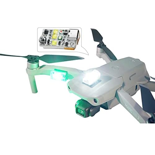
Pro Tip: Use “strobes” or high-visibility lights on your drone even during the day; they make it significantly easier to maintain VLOS against a bright sky or dark trees.
✅ Final Checklist
- Drone is registered and the TRUST/Part 107 certificate is in your kit.
- The airspace is checked via LAANC/B4UFLY and authorization is granted if needed.
- Ground launch point is legal according to city/park ordinances.
- Weather conditions (wind, K-Index, and visibility) are within safe operating limits.
- The flight path allows for continuous Visual Line of Sight (VLOS) without obstructions.
Important Notes:
- Safety First: Never fly over crowds of people, moving vehicles, or near emergency response efforts (like fires or accidents).
- Remote ID: As of 2026, most drones must broadcast Remote ID signals. Ensure your drone’s firmware is updated and Remote ID is functioning.
- Estimated Costs: Recreational registration ($5), TRUST Test (Free), Airspace Apps (Free). Fines for illegal flying can range from $1,500 to over $30,000 depending on the severity.
Essential Apps and Digital Tools for Real-Time Airspace Mapping
Recommended Best Deal Products


How to Use LAANC for Instant Authorization
In the past, getting permission to fly near an airport took weeks of paperwork. Today, you can use LAANC (Low Altitude Authorization and Notification Capability). This is a digital system that connects the FAA with drone pilots via third-party apps. If you want to fly in controlled airspace, you use a LAANC-enabled app to submit a request. In most cases, you receive an automated “Approved” text message in under thirty seconds.
When using LAANC, the app will show you a grid over the map. Each square in the grid has a number, such as “200” or “0.” This number represents the maximum altitude you can be granted instant approval for. If a square says “0,” you cannot fly there without a manual coordination request, which can take days. Always check the grid altitude for your specific takeoff point to ensure you are requesting a legal height for that zone.
Top-Rated Airspace Awareness Apps
You should never rely on the built-in maps provided by your drone manufacturer (like the DJI Fly app). These maps are often outdated or do not include temporary restrictions. To stay legal, you need a dedicated FAA-approved airspace app. These tools provide real-time data on TFRs, airport boundaries, and weather conditions. Consider these essential tools for your flight kit:
- Aloft (formerly Air Control): The industry leader for LAANC authorizations. It provides a clear “Proceed” or “Do Not Fly” indicator based on your GPS location.
- AutoPylot: A streamlined app that offers easy-to-read maps and quick LAANC filing for both recreational and Part 107 pilots.
- B4UFLY (Integrated): The FAA’s official awareness tool is now integrated into several partner apps, providing the most accurate data on ground-level restrictions and local park rules.
- SkyGrid: Excellent for commercial pilots who need deep data on airspace traffic and advanced flight planning features.
Using these apps is not optional; it is a core part of a pilot’s “pre-flight” checklist. Before you even unpack your drone, open your mapping app of choice and verify that your current GPS coordinate is green. If the app shows a yellow or red warning, read the specific restriction details. It might be a temporary restriction for a local stadium event that expires in two hours, or it might be a permanent restriction that requires you to move your flight location a few miles down the road.
Federal vs. Local Jurisdictions: Navigating Park and City Rules
One of the most confusing aspects of drone flight is understanding who actually has the authority to tell you “no.” While the FAA (Federal Aviation Administration) manages the actual airspace from the ground up, local municipalities and state governments often have a say in where you can physically stand while operating your aircraft. This “land use” versus “airspace” distinction is critical for staying out of legal trouble.
Land Use vs. Airspace Authority
In most regions, a city cannot legally ban you from flying over it, but they can absolutely ban you from taking off, landing, or operating the controls from within a city-owned park. This is why you might see signs in local green spaces prohibiting “model aircraft” or “unmanned aerial vehicles.” To stay compliant, always differentiate between where the drone is hovering and where your feet are planted.
- Check Municipal Codes: Many cities have updated their ordinances to include “Drone Launch Zones” or specific restrictions in crowded areas like downtown plazas.
- State Park Variations: State park rules vary wildly by state. For example, some states allow flight with a permit, while others have a blanket ban to protect local wildlife.
- Wildlife Refuges: These are almost always off-limits. Disturbing nesting birds or local fauna can result in heavy federal fines, even if the airspace technically looks clear on your map.
National Parks and Restricted Landmarks
If you are planning a trip to a major landmark, be extremely cautious. National Parks in the United States have a strict ban on launching, landing, or operating drones. This includes iconic spots like Yosemite, the Grand Canyon, and even smaller national monuments. These restrictions are primarily in place to preserve the “quiet enjoyment” of the park and to prevent interference with emergency services or local ecosystems.
The Role of LAANC in Accessing Controlled Airspace Legally
Recommended Best Deal Products

In the past, flying near an airport required weeks of paperwork and manual coordination with Air Traffic Control. Today, the process is digitized through LAANC (Low Altitude Authorization and Capability). This system is a collaboration between the FAA and private industry partners to provide near-instant access to controlled airspace for drone pilots.
Instant Permission via Authorized Apps
LAANC allows you to see “grids” around airports that indicate the maximum altitude you can fly without interfering with manned aircraft. In many cases, you can request digital authorization and receive a “green light” on your smartphone in seconds. This opens up thousands of miles of interesting urban and suburban terrain that was previously off-limits to the average hobbyist.
- Class B, C, D, and E Airspace: These are the zones surrounding airports where LAANC is most commonly used.
- Automated Approvals: If your request is below the pre-approved altitude (often 100 to 400 feet depending on the grid), the approval is usually immediate.
- Safety First: Even with a LAANC authorization, you are still required to yield the right of way to any manned aircraft in the area.
Operating Near Airports Without the Hassle
Flying near a small regional airport or a major international hub no longer has to be a guessing game. By using a LAANC-enabled app, you get a clear picture of the UAS Facility Maps (UASFM). These maps tell you exactly how high you can fly in specific blocks of land. For example, a block two miles from the runway might have a 0-foot ceiling (no flying allowed), while a block four miles away might allow for 200 feet. This data-driven approach ensures you are never “that pilot” who accidentally disrupts airport operations.
Conclusion
Finding a legal place to fly your drone is about balancing FAA regulations with local ground rules. By understanding the difference between controlled airspace and local land-use laws, you can explore the skies without the fear of fines or confiscated equipment. Always remember that tools like B4UFLY and LAANC are your best friends for real-time data, while a quick check of local city ordinances handles the rest. Safe flying is smart flying, and staying informed is the best way to protect the future of this hobby.
Next Steps:
- Download a verified airspace awareness app to check your current location.
- Research your local city or state park website for specific “take-off and landing” rules.
Ready to capture the world from above? Grab your gear, check your maps, and enjoy the view from the clouds!
❓ Frequently Asked Questions
What are the most common ‘No-Fly Zones’ I should avoid?
Common restricted areas include military bases, airports (without authorization), National Parks, critical infrastructure like power plants, and emergency scenes such as active wildfires. Additionally, areas around Washington D.C. are highly restricted.
How do I get permission to fly in controlled airspace?
The easiest way is through the Low Altitude Authorization and Notification Capability (LAANC). By using an approved app, you can request and receive digital authorization in seconds for altitudes up to the designated ceiling.
Why does an app say I can’t fly when there are no airports nearby?
You may be within a Temporary Flight Restriction (TFR), which are issued for high-profile events like NFL games, presidential movements, or during natural disasters to keep the sky clear for emergency aircraft.
Do I need to check local city laws if the FAA says the airspace is clear?
Yes. While the FAA controls the ‘air,’ local municipalities control the ‘ground.’ A city may legally prohibit you from taking off or landing your drone on city-owned property or public parks.
Can I fly over private property without the owner’s permission?
The FAA governs the airspace, meaning you generally can fly over private land. However, hovering low or filming into windows can lead to local privacy or harassment charges.
Are there different rules for flying in ‘Wilderness Areas’?
Yes, federally designated Wilderness Areas are off-limits to all motorized equipment, including drones, to maintain the primitive nature of the environment and protect wildlife.


