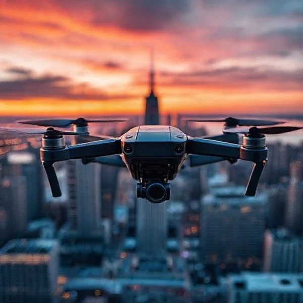
Drone shows are programmed using 3D animation software like Blender to convert artistic visuals into precise XYZ flight coordinates. These paths are synchronized via RTK GPS and Ground Control Stations to ensure centimeter-level accuracy and prevent mid-air collisions.
🎯 Key Takeaways
- Blender and Maya are the primary tools for designing 3D drone formations.
- RTK GPS technology is essential for centimeter-level positioning and safety.
- Flight paths are pre-loaded into drone memory to prevent signal lag.
- Virtual simulations are used to detect and fix potential mid-air collisions.
- Ground Control Stations monitor fleet health and trigger synchronized show starts.
Programming a drone show is the technical process of converting 3D digital animations into precise XYZ coordinates that individual aircraft execute over a synchronized timeline. You aren’t “flying” these drones with a joystick; you are deploying a pre-compiled set of flight paths where every drone acts as a single pixel in a larger volumetric display. This workflow relies on specialized software to translate creative vision into executable telemetry, ensuring that hundreds of drones move in harmony without colliding.
Prime for Young Adults — 6 Months Free
Exclusive Offer Amazon Prime for Young Adults, Students and 18–24s get six months of Prime free, then half price.
Start 6 Months Free As an Amazon Associate I earn from qualifying purchases.
Understanding this workflow matters because it is the foundation of modern aerial entertainment. Without the integration of animation software and Ground Control Stations (GCS), managing more than two or three drones simultaneously would be statistically impossible. By mastering the technical pipeline—from keyframe interpolation to RTK GPS correction—you move from manual operation to fleet-wide automation that operates with centimeter-level precision.
The Software Ecosystem for Professional Drone Choreography
The programming process begins in the world of 3D modeling and animation. Most professional drone shows start inside industry-standard software like Blender, Autodesk Maya, or Cinema 4D. In these environments, each drone is represented as a single point of light or a “particle.” Designers create the visual show by moving these points through 3D space, setting keyframes for position, rotation, and LED color values.
From Keyframes to CSV Data
Once the animation is finalized, the software must export the data into a format the flight controller can understand. This usually involves a plugin or a dedicated script that converts the animation into a set of coordinates. Each drone receives its own unique trajectory file, which dictates exactly where it needs to be at every fraction of a second during the performance. Key software components include:
- Design Software: Blender is the most popular choice due to its open-source nature and robust scripting capabilities.
- Path Planning Plugins: Tools like SPH Engineering’s Drone Show Software or proprietary scripts that check for “forbidden zones” and ensure minimum safety distances (usually 1.5 to 3 meters) between drones.
- Ground Control Station (GCS): This is the mission’s brain. It uploads the scripts to the drones via Wi-Fi or radio link and monitors the fleet’s health in real-time.
The software also performs “collision avoidance pre-checks.” It runs simulations to ensure that as Drone A moves to form a logo, it doesn’t cross the path of Drone B. If the software detects a conflict, the programmer must adjust the keyframes in the 3D environment before the code is ever sent to the hardware.
Precision Positioning with RTK GPS and Time-Coding
Standard GPS is not accurate enough for drone shows. A consumer-grade GPS has a margin of error of about 2 to 5 meters, which would result in messy formations and mid-air collisions. To achieve the tight, crisp shapes seen in professional displays, programmers utilize Real-Time Kinematic (RTK) GPS. This system provides centimeter-level accuracy by using a static ground-based station to correct the signals received from satellites.
The Role of the RTK Base Station
During the programming and setup phase, a base station is placed at a fixed, known coordinate on the show site. It compares its known location with the data it receives from the satellites and calculates the “offset” or error. It then broadcasts this correction data to the entire fleet in real-time. This allows the drones to maintain their precise position in the sky with an error margin of only 1-3 centimeters.
Synchronizing the Fleet Clock
Even with perfect positioning, a show will fail if the drones are not perfectly synchronized in time. Programming a show requires a Universal Time Code (UTC) sync. Each drone’s internal clock is synchronized to the GPS satellite clock, which is accurate to the nanosecond. This ensures that when the GCS sends the “Start” command:
Prime for Young Adults — 6 Months Free
Exclusive Offer Amazon Prime for Young Adults, Students and 18–24s get six months of Prime free, then half price.
Start 6 Months Free As an Amazon Associate I earn from qualifying purchases.- Every drone initiates its flight path at the exact same millisecond.
- LED color transitions happen simultaneously across the entire fleet to create seamless gradients.
- The “Home” positions are calibrated relative to a single origin point (0,0,0) on the field.
By locking every aircraft to a global time standard and using RTK for positioning, the programmed animation from the computer is translated perfectly to the physical sky. This level of synchronization is what allows hundreds of independent robots to behave like a single, cohesive screen.
Safety Protocols and Collision Avoidance Algorithms
When you have hundreds of drones flying in tight formations, “close enough” isn’t good enough. The margin for error is measured in centimeters, not meters. This is where advanced safety protocols and collision avoidance algorithms move from the background to the forefront of the programming workflow. These systems act as the invisible safety net that prevents a spectacular light show from becoming a high-tech fender bender.
Redundant Positioning with RTK GPS
Standard GPS is fine for driving to a grocery store, but it’s too imprecise for drone shows. Show drones utilize Real-Time Kinematic (RTK) GPS. This technology uses a static ground base station to provide corrections to the drones in real-time, narrowing the positioning error from several meters down to about 2-3 centimeters. This precision is what allows programmers to design complex 3D shapes where drones can pass within a few feet of each other safely.
- Proximity Buffers: Software automatically calculates a “safety bubble” around each drone. If a flight path violates this bubble, the software flags the error during the simulation phase.
- Wind Compensation: Algorithms constantly adjust motor output to keep the drone on its precise coordinate path, even when a sudden gust tries to push it off course.
- Electronic Geofencing: Virtual “cages” are programmed around the flight area. If a drone attempts to exit this boundary, it is programmed to automatically land or hover.
Automated Emergency Maneuvers
Modern drone show software includes fail-safe logic for every conceivable scenario. For example, if a drone’s battery drops below a critical threshold or it loses its GPS lock, it doesn’t just fall. It initiates a Fail-Safe Protocol. This might involve an immediate, vertical landing or a slow return to a designated “home” zone that is clear of the audience and other drones. Programmers often set “kill switches” that can ground the entire fleet or specific units instantly if a safety perimeter is breached.
Communication Architecture Between GCS and Drone Fleets
The Ground Control Station (GCS) is the “brain” of the entire operation. It doesn’t just start the show; it maintains a constant, high-speed dialogue with every single aircraft in the sky. This communication architecture must be incredibly robust to handle the massive amounts of data being exchanged without lag or interference.
The Ground Control Station (GCS) Command Hub
The GCS is typically a high-powered laptop or server connected to a long-range antenna array. Rather than sending manual joystick commands, the GCS broadcasts time-synced data packets. Each drone knows exactly where it needs to be at “01:05:03” into the show. The GCS monitors the health of the fleet, tracking telemetry data like battery voltage, motor temperature, and signal strength for every unit simultaneously.
- MAVLink Protocol: Most professional shows use the MAVLink communication protocol, which is lightweight and designed for high-frequency data exchange between the GCS and the drones.
- Mesh Networking: In some advanced setups, drones can talk to each other to maintain spacing, though most rely on the central GCS for primary commands.
- Pre-flight Syncing: Before take-off, the entire flight path is uploaded to the drones’ internal memory, so even a brief signal flicker won’t cause the show to stop.
Managing Radio Interference in Crowded Areas
One of the biggest technical hurdles is “signal noise.” In a stadium with 50,000 people, everyone has a smartphone with Wi-Fi and Bluetooth turned on. This creates a mess of radio frequency (RF) interference. To combat this, drone show providers use proprietary radio links or high-gain, directional antennas that operate on specific, less-crowded frequencies (often 2.4GHz or 5.8GHz with advanced frequency-hopping). This ensures the command signal remains clear even in the “loudest” RF environments.
Prime for Young Adults — 6 Months Free
Exclusive Offer Amazon Prime for Young Adults, Students and 18–24s get six months of Prime free, then half price.
Start 6 Months Free As an Amazon Associate I earn from qualifying purchases.Conclusion
Programming a drone show is a masterful blend of creative artistry and rigorous aerospace engineering. From the initial 3D choreography in software like Blender to the complex RTK positioning and communication networks that keep the fleet synchronized, every second of a light show is the result of thousands of lines of code and precise technical planning. It is a workflow where safety and precision are just as important as the visual spectacle itself.
If you are interested in entering the world of drone light shows, start by familiarizing yourself with 3D animation software and the basics of RTK GPS technology. As the hardware becomes more accessible, the only limit to these aerial displays will be the imagination of the programmers behind the screen. Ready to see your art take flight? Keep exploring the latest in drone accessories and flight controllers to stay ahead of the curve!
❓ Frequently Asked Questions
How does 3D animation translate into drone flight paths?
Animation software treats each drone as a ‘vertex’ or point in 3D space. The software exports the movement of these points over time into a coordinate file (CSV or XML) that the flight controller interprets as GPS waypoints.
What is the role of a Ground Control Station (GCS) in a drone show?
The GCS acts as the command center, monitoring telemetry data such as battery voltage, GPS signal strength, and motor health for every drone simultaneously. It ensures all units are ready before sending the synchronized ‘start’ command.
How do programmers prevent drones from colliding?
During the design phase, the software runs proximity checks to ensure a ‘safety sphere’ (usually 1.5 to 3 meters) is maintained between all drones. Any path intersections are flagged and corrected in the virtual environment before flight.
Why is RTK GPS used instead of standard GPS?
Standard GPS has an error margin of several meters, which is too dangerous for tight formations. RTK (Real-Time Kinematic) uses a local base station to provide corrections, reducing position error to just a few centimeters.
How is a drone show synchronized to music?
The music is triggered by the same master clock as the flight script. The Ground Control Station uses SMPTE time-code or similar protocols to ensure the audio and the drones’ light transitions are perfectly aligned.
Can weather conditions affect the programmed flight path?
Yes, while the programming remains the same, drones must have high-torque motors to resist wind drift. If wind speeds exceed the safety threshold programmed into the GCS, the show is typically delayed or cancelled.