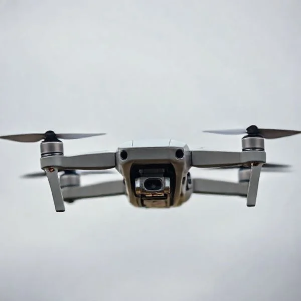
To operate a drone effectively, you must master the four main control axes: throttle, yaw, pitch, and roll. Success begins with a rigorous pre-flight checklist to ensure GPS lock and hardware stability before every takeoff. Understanding these mechanics ensures a safe and controlled flying experience for beginners.
🎯 Key Takeaways
- Master the left stick for throttle and yaw control.
- Use the right stick for pitch and roll movements.
- Always perform a compass calibration before every flight session.
- Maintain line-of-sight to ensure signal strength and safety.
- Check local regulations and no-fly zones before powering up.
Operating a drone effectively requires you to master four core flight axes: throttle, yaw, pitch, and roll. By coordinating these inputs through your remote controller’s joysticks, you translate finger movements into aerodynamic maneuvers. Precision here is the difference between a controlled flight and a costly collision. Whether you are flying a compact folding drone or a larger cinematic platform, the physics of flight remain the same.
Recommended Best Deal Products
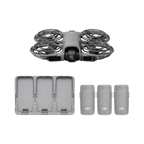


Mastering these controls allows you to maintain “situational awareness,” which is the ability to understand where your drone is in relation to its environment. This guide focuses on the mechanical steps needed to transition from a beginner to a confident pilot. We will start with the anatomy of your controller and the specific calibration steps required to keep your hardware stable in the air.
Understanding Remote Controller Anatomy and Joystick Functions
Most modern drones use a configuration known as Mode 2. In this setup, the left joystick handles the vertical and rotational movements, while the right joystick manages the horizontal direction. Understanding this layout is essential because it becomes muscle memory over time. When you move a joystick, the drone’s internal flight controller adjusts the speed of specific motors to create lift or tilt the airframe.
The Left Joystick: Managing Elevation and Orientation
The left joystick is your primary tool for controlling the drone’s height and the direction its “nose” is pointing. Because drones are symmetrical, it can be hard to tell which way they are facing from a distance. The left stick helps you orient the camera and sensors toward your target.
- Throttle (Up/Down): Pushing the stick forward increases the RPM of all motors equally. This generates more lift than gravity, causing the drone to ascend. Pulling back decreases RPM, allowing the drone to descend.
- Yaw (Left/Right): Moving the stick horizontally rotates the drone on its center axis. This does not move the drone in any direction; it simply spins the “nose” left or right. This is vital for panning your camera or changing the drone’s heading.
The Right Joystick: Navigating the Horizontal Plane
The right joystick controls the drone’s movement through 3D space. Imagine the drone is a marble on a flat plate; moving this stick tilts that plate, causing the drone to slide in that direction. This is where most of your active “driving” occurs.
- Pitch (Forward/Backward): Pushing this stick forward tilts the front of the drone down. The rear motors spin faster, pushing the drone forward. Pulling back tilts the nose up, moving the drone backward.
- Roll (Left/Right): Moving this stick to the side tilts the entire drone chassis. This allows you to “strafe” or move sideways without changing the direction the camera is facing.
Pro Tip: Always use “pinching” motions with your thumb and index finger for better precision, rather than just using your thumbs. This prevents over-correcting during delicate maneuvers.
Master Drone Flight in 8 Simple Steps
Operating a drone is an exhilarating blend of robotics, photography, and aviation. Whether you are looking to capture stunning cinematic landscapes or simply enjoy the thrill of flight, mastering the controls is essential for both your enjoyment and the safety of those around you. This guide is designed to take you from a complete novice to a confident pilot by breaking down the complexities of flight dynamics, pre-flight protocols, and environmental awareness. Following these steps systematically will ensure you protect your investment, comply with local regulations, and achieve the best possible aerial results from your very first takeoff.
Step 1: Pre-Flight Hardware Inspection
What you need: Your drone, fully charged flight batteries, a remote controller, a mobile device with the manufacturer’s app installed, and a high-speed microSD card (Class 10 or UHS-I/II).
Instructions: Before even heading outside, you must perform a thorough hardware check. Start by inspecting the propellers; run your fingers along the edges to feel for any nicks, cracks, or warping. Even a minor chip can cause vibrations that degrade image quality or, worse, lead to a mid-air structural failure. Ensure the battery is clicked firmly into the housing; a loose battery can disconnect during high-G maneuvers. Insert your formatted SD card and remove the gimbal cover—forgetting to remove this plastic guard before powering on can burn out the sensitive gimbal motors as they attempt to self-calibrate against the resistance.
Pro Tip: Always carry a small microfiber cloth and a spare set of propellers. Dust on the lens can ruin a sunset shoot, and a minor “prop strike” against a branch doesn’t have to end your day if you have replacements ready.
Step 2: Environmental and Legal Clearance
What you need: A smartphone with an airspace awareness app (like AirControl or B4UFLY), a weather app, and your pilot registration credentials.
Instructions: Check the “weather at altitude,” not just on the ground. Wind speeds are often much higher 100 feet in the air than they are at eye level. Most consumer drones should not be flown in winds exceeding 15-20 mph. Next, open your airspace app to ensure you are not in a No-Fly Zone (NFZ), such as near an airport, military base, or national park. If you are in the United States and your drone weighs over 250g, ensure your FAA registration number is clearly labeled on the exterior of the craft. Finally, scan your immediate surroundings for “line-of-sight” obstacles like power lines, which are notoriously difficult to see on a transmission feed.
Pro Tip: Use a dedicated “K-Index” weather app to check for solar flares; high geomagnetic activity can occasionally interfere with GPS signals and your drone’s internal compass.
Step 3: Powering Up and System Calibration
What you need: The drone and remote controller positioned on a flat, level surface away from large metal objects.
Instructions: Always follow the “Transmitter First” rule: turn on your remote controller and open the flight app before powering on the drone. This ensures the drone immediately finds a signal rather than drifting. Once connected, check the app for calibration prompts. If the app requests a “Compass Calibration,” pick up the drone and rotate it 360 degrees horizontally and then 360 degrees vertically as instructed. This aligns the internal sensors with the Earth’s magnetic field. Avoid calibrating near reinforced concrete or large vehicles, as the rebar and metal can distort the magnetic reading, leading to “toilet bowl” circling during flight.
Pro Tip: Wait for the drone to acquire at least 10-12 GPS satellites and for the app to announce “Home Point Updated” before you take off. This ensures the “Return to Home” feature works accurately.
Step 4: Executing a Controlled Takeoff
What you need: A flat takeoff surface or a portable landing pad.
Instructions: You have two choices: manual takeoff or auto-takeoff. For a manual start, pull both control sticks down and inward (or outward, depending on the brand) to arm the motors. Once the props are spinning, gently push the left stick (throttle) upward. The drone should rise smoothly. Bring it to an eye-level hover (about 6-10 feet) and let it stay there for 30 seconds. This is called a “hover check.” During this time, observe the drone for any drifting or unusual sounds. If the drone stays stable in place without your input, the GPS and internal IMU (Inertial Measurement Unit) are functioning correctly and you are ready to proceed.
Pro Tip: If you are taking off from tall grass or sand, use a landing pad. Grass can tangle in the motors, and sand can get sucked into the electromagnetic coils, causing permanent damage.
Step 5: Mastering Basic Flight Controls
What you need: An open field with at least 100 feet of clearance in all directions.
Instructions: Most drones use “Mode 2” controls. The Left Stick controls Throttle (up/down) and Yaw (rotating left/right). The Right Stick controls Pitch (moving forward/backward) and Roll (sliding left/right). Practice “Pitching” forward while maintaining a constant altitude. Then, practice “Rolling” to the side. The key is subtlety; modern drones are highly sensitive, so use small, “pinching” movements with your thumb and index finger rather than aggressive mashing with just your thumbs. Understand that if the drone is facing you, the controls will feel reversed (e.g., pushing right will move the drone to your left).
Pro Tip: Start in “Cine” or “Tripod” mode if your drone has it. This limits the maximum speed and increases stick sensitivity, making it much harder to make a catastrophic movement error.
Step 6: Navigating Complex Maneuvers
What you need: Sufficient battery life (at least 50% remaining) and a clear line of sight.
Instructions: Once you are comfortable with basic movement, combine the sticks. Try flying in a perfect square by moving forward, stopping, rolling right, stopping, and so on. Once you master the square, try a “Circle.” To do this, you must use the right stick to roll in one direction while using the left stick to yaw in the same direction. This keeps the camera pointed at a central object while the drone orbits it. This is the foundation of cinematic “Orbit” shots. Always keep your eyes on the drone rather than the screen during these early practice sessions to maintain spatial awareness.
Pro Tip: Practice the “Figure-8” maneuver. It forces you to manage orientation, speed, and turns simultaneously, which is the best way to build muscle memory for emergency situations.
Step 7: Camera Operation and Gimbal Control
What you need: A functioning gimbal and a clear video transmission on your mobile device.
Instructions: Flight is only half the battle; the other half is cinematography. Most controllers have a dial on the top left or right that controls the gimbal tilt (up and down). Practice “tilting” the camera smoothly while the drone is moving forward to create a “reveal” shot. In your app settings, adjust the “Gimbal Pitch Smoothness” to a higher value; this prevents the camera from jerking to a stop when you let go of the dial. Remember to monitor your exposure levels (indicated by the histogram or “zebras”) to ensure your highlights aren’t blown out by the bright sky.
Pro Tip: Use the “Rule of Thirds” gridlines on your screen. Placing the horizon on the top or bottom third line, rather than in the dead center, immediately makes your aerial footage look more professional.
Step 8: Safe Landing and Post-Flight Care
What you need: A clear landing zone and a visual on the drone’s orientation.
Instructions: When your battery hits 25-30%, it is time to return. Bring the drone back toward your position. Once it is directly over the landing pad, slowly pull the left stick down. Keep the stick held down even after the drone touches the ground; the sensors will realize the drone has landed and will automatically cut the motor power. Once the props stop, power off the drone first, then the remote. Inspect the drone briefly for any new damage or debris. Remove the battery and place the gimbal protector back on immediately to prevent the camera from flopping around during transport.
Pro Tip: If your drone has a “Return to Home” (RTH) button, use it only as a backup. Learning to land manually is a critical skill for when GPS is weak or when landing in tight spots.
✅ Final Checklist
- Verified that all batteries (drone, remote, phone) are at 100% capacity before leaving.
- Confirmed “Home Point” is updated on the map before exceeding 20 feet of altitude.
- Checked that the gimbal cover is removed and the microSD card has sufficient space.
- Performed a hover test to ensure the drone holds its position without stick input.
- Ensured the landing area is clear of people, pets, and loose debris like dry leaves.
Important Notes:
- Safety First: Never fly over crowds, near moving vehicles, or within 5 miles of an airport without specific authorization. Respect privacy and do not fly over private property without permission.
- Professional Help: If your drone suffers a “flyaway” or a hard crash where the frame is bent or the motors feel “crunchy,” do not attempt to fly again. Seek professional repair services or use the manufacturer’s replacement plan.
- Estimated Time and Cost: Basic flight training takes 2-4 hours of practice to feel comfortable. Drones range from $300 for hobbyist models to $2,000+ for professional setups. FAA registration for recreational flyers currently costs $5 for three years.
Essential Pre-Flight Calibration and Safety Requirements
Before you push the throttle, you must ensure the drone’s internal sensors are synchronized with the local environment. A drone relies on a Magnetometer (Compass) and an IMU (Inertial Measurement Unit) to stay level and navigate. If these are not calibrated, the drone may experience a “flyaway,” where it stops responding to your inputs and drifts with the wind.
Compass and IMU Calibration
The compass is sensitive to electromagnetic interference. If you move to a new flight location—especially one with different magnetic signatures—you must recalibrate. Most drones require you to spin the aircraft 360 degrees horizontally and then 360 degrees vertically. This tells the drone where “North” is, which is critical for its GPS functions.
- Check for Metal: Never calibrate near reinforced concrete, cars, or power lines. The rebar and metal will distort the magnetic field and lead to a failed calibration.
- The IMU Check: The IMU measures the drone’s attitude (levelness). If your drone drifts to one side even when there is no wind, your IMU likely needs a reset on a perfectly flat surface.
Establishing a Secure GPS Home Point
Safety starts with a strong GPS lock. Most drones require at least 8 to 12 satellites to establish a reliable “Home Point.” This is the exact coordinate the drone will return to if the signal is lost or the battery runs low. Wait for your controller to announce “The Home Point has been updated” before you take off.
Check your Return to Home (RTH) Altitude in the settings. You should set this higher than the tallest obstacle in your flight area (like trees or light poles). If the drone triggers an emergency return, it will climb to this height first before flying back to you, preventing a mid-air collision on the way home.
- Check battery levels for both the drone and the controller.
- Ensure the MicroSD card is formatted and has enough space.
- Verify that the propellers are securely tightened and free of chips or cracks.
- Confirm the “Max Altitude” and “Max Distance” settings are within your comfort zone.
Environmental Factors Affecting Drone Flight Stability
Even with the most advanced flight controllers, the environment remains a primary variable in how your drone behaves. Understanding external forces allows you to anticipate movements rather than just reacting to them. A pilot who respects the weather is a pilot who keeps their equipment in one piece.
Managing Wind Resistance and Turbulence
Wind is the most common challenge for drone stability. While high-end consumer drones have impressive wind resistance ratings, gusts can still cause “drift” or force the motors to work harder, significantly draining your battery. It is important to remember that wind behaves differently depending on your surroundings.
- The Altitude Rule: Remember that wind speeds are often twice as fast at 100 feet as they are at ground level. Just because it feels calm on the grass doesn’t mean it is calm in the clouds.
- The “Wind Shadow”: Flying near large buildings or cliffs can create unpredictable updrafts and “rotors”—pockets of air that can suddenly push your drone toward the ground or an obstacle.
- Flight Planning: Always try to fly into the wind at the start of your session. This ensures you have a tailwind to help push you back to your landing zone when your battery begins to run low.
Temperature and Electromagnetic Interference
Signal stability and battery health are heavily influenced by the invisible factors of temperature and magnetism. Large metal structures, power lines, and even reinforced concrete can interfere with the drone’s internal compass and GPS signal, leading to erratic behavior.
- Cold Weather Performance: Low temperatures reduce chemical activity in LiPo batteries. In temperatures below 40°F, your flight time might drop by 30% or more. Always hover for a minute after takeoff to let the battery warm up.
- Compass Calibration: If you are flying in a new location or near a large metal structure like a bridge, your drone may require a compass calibration. This ensures the drone knows exactly where “North” is, which is vital for GPS accuracy.
- Signal Shadowing: Avoid flying behind dense tree lines or structures. These can cause a sudden loss of control signal, even if the drone is physically close to you.
Modern Flight Modes: GPS vs. Manual (ATTI) Navigation
Modern drones offer different flight “philosophies” through their software. Choosing the right mode depends on your environment, your skill level, and your specific goals for the flight. Most pilots toggle between these modes depending on the shot they need.
The Safety Net of GPS Mode
Most consumer drones default to GPS mode (often called P-mode or Position mode). In this setting, the drone uses a network of satellites to lock its position in 3D space. If you let go of the controller sticks, the drone will hover perfectly in place, even if there is a stiff breeze.
- Return to Home (RTH): This critical feature relies on a strong GPS lock to bring the drone back to its takeoff point automatically if the signal is lost or the battery hits a critical level.
- Precision Hovering: This is the ideal mode for photography, as it provides a rock-steady platform for the camera without needing constant manual corrections from the pilot.
- Obstacle Avoidance: On many models, GPS mode is the only mode where the built-in sensors remain active to stop you from hitting walls or trees.
Mastering Manual and ATTI Modes
Manual or Attitude (ATTI) modes disable the GPS positioning. In these modes, the drone will maintain its altitude using a barometer, but it will drift freely with the wind. While this sounds daunting for beginners, it is a preferred mode for professional cinematographers and advanced pilots.
- Smoother Cinematic Motion: Without the GPS constantly “fighting” to stay in one spot, the drone’s movements are much more fluid and organic. This eliminates the “jerky” micro-corrections often seen in GPS mode.
- Indoor and Under-Bridge Flying: When flying in areas where GPS signals are blocked or reflected, the drone may automatically switch to ATTI mode. Practicing in this mode prepares you for these high-pressure moments.
- Increased Speed: Manual modes often unlock the full power of the motors, allowing for much faster travel speeds, though this comes at the cost of safety sensors being disabled.
Conclusion
Operating a drone is a rewarding blend of mastering physical controls and maintaining constant situational awareness. By understanding how environmental factors like wind and interference affect stability, and by choosing the right flight mode for your specific environment, you transform from a casual user into a confident pilot. The key is to respect the technology while always being prepared to take manual control if the automation fails.
To keep progressing, start by practicing basic maneuvers in wide-open spaces on calm days, and always check a dedicated drone weather app before heading out. Ready to take your flight experience to the next level? Explore our range of essential drone accessories to boost your signal range, safety, and total flight time!
❓ Frequently Asked Questions
What is the difference between yaw and roll?
Yaw rotates the drone’s nose left or right on a horizontal axis, while roll tilts the drone to move it sideways. Mastering the distinction between these two is essential for executing smooth, cinematic turns.
Why do I need to calibrate the compass before flying?
Compass calibration ensures the drone accurately understands its orientation relative to North. Without proper calibration, the drone may experience ‘toilet bowl’ circling or unexpected flyaways during flight.
What should I do if I lose the signal to my drone?
Most modern drones feature an automatic ‘Return-to-Home’ (RTH) protocol that activates upon signal loss. Ensure you have set your RTH altitude higher than the tallest obstacles in your area before taking off.
How does wind speed affect drone operation?
High winds can drastically reduce battery life as motors work harder to maintain position. It is critical to check your drone’s maximum wind resistance rating and avoid flying in gusty conditions.
What are the best environmental conditions for a first flight?
Beginners should seek out clear days with winds under 10mph and wide-open spaces. Avoiding trees, power lines, and magnetic interference from large metal structures will ensure a safer learning environment.
Can I operate a drone without a smartphone connected?
While some advanced controllers have built-in screens, most consumer drones require a smartphone to view the live camera feed and adjust critical flight settings. However, basic flight is often possible using just the remote.