
To effectively detect a drone, you must combine sensory observations like distinct buzzing sounds and LED strobe patterns with digital tools. Modern methods include using Remote ID scanning apps and RF detectors to identify the drone’s position and pilot information. Understanding the legal framework for reporting sightings ensures you handle unauthorized flights appropriately.
🎯 Key Takeaways
- Listen for high-pitched buzzing or ‘wasp-like’ sounds distinct from birds.
- Look for rhythmic blinking red, green, or white LED strobe lights.
- Use Remote ID apps to track a drone’s serial number and location.
- Drones move in straight lines or hover, unlike erratic bird flight.
- Document sightings with photos or video for reporting to authorities.
Detecting a drone in your immediate airspace requires a combination of sensory awareness and digital tools. To find one quickly, look for erratic hovering patterns or high-intensity strobe lights, listen for the distinct high-pitched whine of multi-rotor motors, and use Remote ID smartphone apps to track digital broadcast signals. While modern drones are becoming quieter and more compact, they cannot hide the physical and electronic signatures they leave behind during flight.
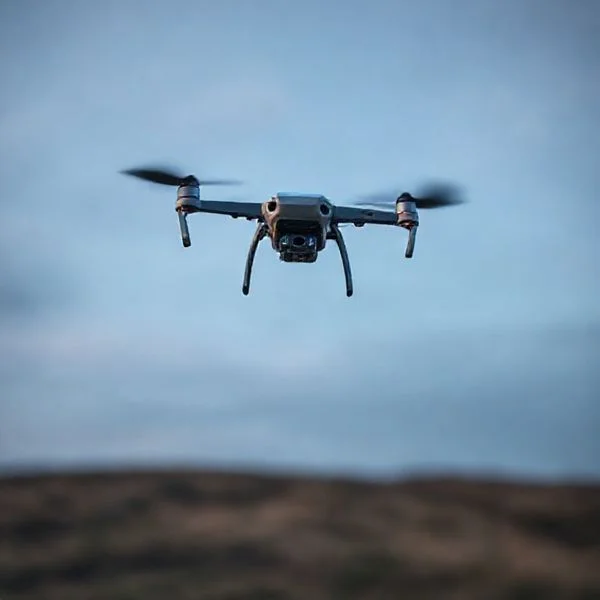
Understanding these detection methods is essential for maintaining privacy, ensuring site security, or simply satisfying your curiosity about local air traffic. Because most consumer drones operate on similar frequencies and flight physics, you can follow a standardized checklist to identify them. By training your eyes and ears for specific “unnatural” indicators, you can distinguish a drone from birds or planes in seconds, even in low-visibility conditions.
Visual and Auditory Indicators of Drone Activity
Your primary tools for drone detection are your natural senses. Unlike birds, drones exhibit rigid movement and consistent light patterns that the human eye can easily track once you know what to look for. During the day, drones appear as dark geometric shapes moving against the sky, often exhibiting a “stair-step” movement pattern rather than the fluid gliding of a bird. At night, the task becomes easier due to mandatory FAA anti-collision lighting.
Visual Identification: Hovering Patterns and Strobe Colors
Drones are characterized by their ability to remain perfectly stationary in the air. If you see an object that hovers for more than a few seconds without moving its “wings,” it is almost certainly a multi-rotor drone. Pay attention to the following visual cues:
- Strobe Light Colors: Most consumer drones use a combination of red, green, and white LEDs. Red and green lights are usually solid and help the pilot determine orientation, while a high-intensity white or red strobe is used for anti-collision. If you see a flashing light that blinks at a steady interval (usually 40 to 100 times per minute), it is likely a drone.
- Sun Glint: Drones are made of plastic and carbon fiber, but their camera gimbals use glass. On sunny days, look for a sharp, momentary flash of light. This is often the sun reflecting off the drone’s lens as it tilts to take a photo or change direction.
- The “Jerk” Movement: Drones use GPS to maintain position. In windy conditions, you will see the drone make micro-adjustments, tilting sharply in one direction and then snapping back to center. Birds do not move with this level of mechanical precision.
Auditory Identification: Multi-Rotor vs. Fixed-Wing Sounds
The sound of a drone is its most revealing characteristic. Multi-rotor drones (like the DJI Mavic or Phantom series) produce a sound often described as a “swarm of angry bees.” This high-frequency buzzing is caused by small propellers spinning at several thousand RPMs. Depending on the ambient noise, you can typically hear a medium-sized drone from about 300 to 500 feet away.
- Frequency Changes: A drone’s sound changes pitch when it moves. You will hear a higher-pitched whine as it accelerates or climbs and a lower, fluctuating hum as it hovers or descends.
- Fixed-Wing Distinction: Fixed-wing drones sound more like a lawnmower or a small airplane. They produce a consistent, lower-frequency drone (hence the name) because they must maintain forward momentum to stay airborne. Unlike multi-rotors, they cannot hover, so the sound will steadily grow louder and then fade as they pass over.
- Environmental Factors: Keep in mind that sound travels differently depending on the terrain. In a quiet suburban area, the motor whine will be obvious. In a city, the sound often reflects off buildings, making it difficult to pinpoint the exact location of the drone by ear alone.
How to Detect a Stealthy Drone Like a Pro: A Practical Walkthrough
In an era where consumer and commercial drones are becoming increasingly common, knowing how to identify an unmanned aerial vehicle (UAV) in your airspace is essential for maintaining privacy, security, and peace of mind. Whether you are concerned about unauthorized surveillance or simply curious about the buzzing sound above your backyard, this guide provides a comprehensive framework for locating and identifying drones using your natural senses, common technology, and specialized tools. Following these steps systematically will transform you from a confused bystander into a vigilant observer capable of distinguishing a hobbyist’s toy from a professional-grade aircraft.
Step 1: Master the Art of the Visual Grid Scan
What you need: A clear field of vision, polarized sunglasses (optional), and a fixed reference point like a building or tree line.
Instructions: Drones are often difficult to spot because they are small and move in three-dimensional space. To detect one, do not just stare aimlessly at the sky. Instead, divide the sky into a horizontal grid. Start at the horizon and scan slowly from left to right in a 10-degree arc. Once you reach the end of your field of view, move your gaze up another 10 degrees and scan back from right to left. Pay close attention to “anomalous motion”—anything that moves horizontally or hovers stationary against the clouds. Most consumer drones fly at altitudes between 100 and 400 feet, making them appear as small, dark dots or “X” shapes against the blue or grey backdrop of the sky.
Pro Tip: Look for “staccato” movement. Unlike birds, which glide or flap rhythmically, drones often move in perfectly straight lines or make abrupt, jerky 90-degree turns that are biologically impossible for avian life.
Step 2: Identify Acoustic Signatures and Frequency
What you need: A quiet environment and a basic understanding of “the bee swarm” sound profile.
Instructions: Your ears will often detect a drone before your eyes do. Small multi-rotors produce a high-pitched, whirring sound caused by the rapid rotation of plastic or carbon fiber propellers (usually spinning at 5,000 to 10,000 RPM). This sound is often compared to a “distant swarm of bees” or a high-frequency electric weed whacker. To locate the source, cup your hands behind your ears to create a parabolic reflector and rotate your head slowly. The sound will intensify when you are facing the drone. Be aware that wind direction plays a huge role; a drone upwind of you will be much easier to hear than one downwind, as the sound waves are literally carried toward or away from your position.
Pro Tip: If the sound pitch changes suddenly (a Doppler shift), the drone is likely changing altitude or accelerating toward or away from you. A steady, unchanging hum usually indicates a stationary hover.
Step 3: Decode Navigation Light Patterns
What you need: Low-light conditions (dusk, dawn, or night) and a basic knowledge of FAA/EASA lighting requirements.
Instructions: If you are detecting a drone at night, look for specific light configurations. Most commercial drones like DJI or Autel models feature “navigation lights” on the motor arms. Usually, these consist of solid or blinking red lights on the front arms and green or white lights on the rear arms to help the pilot determine orientation. Additionally, legal night flight often requires a high-intensity anti-collision strobe that flashes white or green and is visible for up to three statute miles. If you see a light that remains perfectly stationary for several minutes and then moves at high speed, it is almost certainly a drone rather than a star, planet, or manned aircraft (which must have specific red/green wingtip lights and flashing beacons).
Pro Tip: Use a “peripheral vision” technique at night. The human eye is more sensitive to light and motion at the edges of the retina; look slightly to the side of where you think the light is to see it more clearly.
Step 4: Utilize RF Scanning via Wi-Fi and Bluetooth
What you need: A smartphone or tablet with a Wi-Fi analyzer app (like Wi-Fi Analyzer for Android) or a laptop with NetSpot.
Instructions: Most consumer drones communicate with their controllers via 2.4GHz or 5.8GHz radio frequencies, often using modified Wi-Fi protocols. Open your device’s Wi-Fi settings or a dedicated analyzer app. Look for Service Set Identifiers (SSIDs) that look suspicious or include manufacturer names like “DJI-Control-XXXX,” “Autel-XXXX,” or “SkyViper.” If you see a strong Wi-Fi signal with no corresponding router nearby, a drone is likely in the immediate vicinity. You can use the signal strength meter (RSSI) in the app to “hunt” the drone; as the dBm value gets closer to zero (e.g., moving from -70dBm to -40dBm), you are getting physically closer to either the drone or the pilot’s remote controller.
Pro Tip: Be aware that professional-grade drones use proprietary transmission systems like OcuSync or Lightbridge, which may not show up as a standard Wi-Fi SSID but will still create significant “noise” on the 2.4GHz spectrum analyzer graph.
Step 5: Leverage Remote ID (RID) Tracking Apps
What you need: A smartphone with a “Remote ID” receiver app, such as Drone Scanner or OpenSky.
Instructions: As of late 2023 and early 2024, many regions (including the US) require drones to broadcast “Remote ID” information. This is essentially a digital license plate that broadcasts via Bluetooth Legacy, Bluetooth Long Range, or Wi-Fi NAN. Download a Remote ID scanner app from your app store. When a drone is flying within range (usually up to 1 km depending on conditions), the app will display the drone’s serial number, current latitude/longitude, altitude, speed, and even the location of the pilot’s ground station. This is the most definitive way to detect and identify a drone legally. If a drone is hovering over your property and does not appear on the app, it is either an older model, a home-built kit, or is being operated non-compliantly.
Pro Tip: Remote ID signals are often stronger than the drone’s video downlink. If your app catches a signal, it can often track the drone even if it goes behind a building or a cluster of trees.
Step 6: Employ Optical Aids for Confirmation
What you need: 8×42 or 10×50 binoculars or a camera with a high-zoom telephoto lens (200mm+).
Instructions: Once you have identified a suspicious dot in the sky using Step 1, use binoculars to confirm it is a drone. At 8x magnification, you will be able to clearly see the propellers, the camera gimbal (usually hanging underneath), and the landing gear. High-quality binoculars will also allow you to see the color of the chassis—white is common for DJI Phantoms, while grey or black is common for Mavic and Enterprise series. If you are using a camera, take a burst of photos. High-speed shutter settings (1/1000s or faster) are necessary to “freeze” the propeller motion, which helps in identifying the specific make and model for documentation purposes.
Pro Tip: When using binoculars, don’t move your head. Keep your eyes on the drone and bring the binoculars up to your eyes. This prevents you from “losing” the tiny object in the vastness of the sky.
Step 7: Conduct a Heat Signature Check (Thermal Detection)
What you need: A handheld thermal imaging camera (like a FLIR One or Seek Thermal attachment for smartphones).
Instructions: This is an advanced technique most effective at night or on overcast days. Drones generate a significant amount of heat in two specific areas: the lithium-polymer (LiPo) battery and the brushless motors. Even if a drone is painted matte black to avoid visual detection, it cannot hide its thermal signature. Point your thermal camera at the sky. A drone will appear as four bright “hot spots” (the motors) and one central hot mass (the battery/circuitry) against the cold background of the atmosphere. High-end thermal sensors can detect this heat differential from several hundred feet away, making it impossible for a drone to remain “stealthy” in the infrared spectrum.
Pro Tip: Thermal imaging is less effective in high-humidity or rain, as water molecules in the air dissipate heat signatures and can “blind” the sensor’s ability to see distant objects.
✅ Final Checklist
- Visual confirmation of non-biological movement (straight lines or hovering).
- Auditory match (high-pitched whirring or “buzz” detected).
- Signal detection via Wi-Fi scanner or Remote ID app confirmed.
- Optical verification of propellers and camera gimbal using binoculars.
- Documentation of the flight path and time of observation for legal records.
Important Notes:
- Safety Warning: Never attempt to “bring down” or disable a drone yourself. In many jurisdictions, drones are considered aircraft, and interfering with them is a federal crime.
- When to Seek Professional Help: If you believe you are being targeted for illegal surveillance or if a drone is interfering with critical infrastructure, contact local law enforcement or the FAA (in the US).
- Estimated Time and Cost: Basic detection takes 5-10 minutes. Costs range from $0 (using your senses/apps) to $500+ (for high-end binoculars and thermal sensors).
Technological Solutions: Remote ID and RF Scanning Tools
When a drone is too high to see or hidden behind trees, you must turn to digital detection. Modern drones are required by law in many regions to broadcast their identity and location. This is known as Remote ID, and it acts as a “digital license plate” that anyone with the right software can read. Beyond Remote ID, you can also detect the radio frequency (RF) signals that the drone uses to communicate with its controller.
Using Remote ID Apps for Real-Time Tracking
As of late 2023, most drones operating in the United States must broadcast Remote ID signals via Bluetooth or Wi-Fi. You can turn your smartphone into a drone detector by downloading a Remote ID scanner app. These apps intercept the broadcast signals and display the drone’s position on a map.
- DroneScanner & OpenSky: These are popular, free apps available for iOS and Android. They scan for Bluetooth Legacy, Bluetooth 5 (Long Range), and Wi-Fi Beacon signals.
- Data Provided: When a drone is detected, these apps often show the drone’s serial number, altitude, speed, and—most importantly—the location of the pilot. This is the fastest way to confirm if a drone is legally registered and where it originated.
- Limitations: These apps only work if the drone is equipped with Remote ID. Older drones or custom-built FPV (First Person View) drones may not broadcast this data unless they have a dedicated “broadcast module” attached.
Identifying Wi-Fi and Bluetooth Signals
Even without a dedicated Remote ID app, a drone’s presence is often visible in your phone’s standard Wi-Fi settings. Many consumer drones create a local Wi-Fi hotspot to transmit a live video feed to the pilot’s tablet or phone. If you are in a remote area and suddenly see a Wi-Fi network named “DJI-Control-XXXX” or “Mavic-Air-Link,” there is a drone within roughly 100 to 300 feet of your position.
- Wi-Fi Analyzers: You can use more advanced “Wi-Fi Analyzer” apps to see signal strength. As you move, the signal strength (measured in dBm) will increase as you get closer to the drone or the pilot’s controller.
- RF Sniffing: Basic RF scanners can detect the 2.4GHz and 5.8GHz frequencies used by drones. While these won’t show you a map, they will alert you to a spike in radio traffic that isn’t coming from a standard router or cell tower, indicating a nearby transmitter is active.
Nighttime vs. Daytime Detection Challenges and Strategies
Spotting a drone is a completely different experience depending on when you look at the sky. Lighting conditions change everything from visibility distance to the specific cues you need to look for. Whether it is high noon or midnight, knowing what to look for can save you a lot of frustration.
Spotting Drones in Broad Daylight
During the day, your biggest challenge is often the sun itself. Drones are relatively small, and a high-altitude flyer can easily blend into a bright sky or be lost in the glare. To find a drone during the day, look for movement patterns that differ from birds. Drones move in straight, rigid lines or hover perfectly still, which birds rarely do. You should also watch for the “glint”—the sun reflecting off the plastic casing or the camera lens. This sudden flash of light is often the first giveaway that an object is metallic or synthetic rather than biological.
- Silhouette Identification: Look for the distinct “X” or “H” shape against the clouds.
- Fixed Hovering: If an object stays perfectly still for more than thirty seconds, it is almost certainly a drone.
- Contrast: Try wearing polarized sunglasses to reduce glare and make the dark body of a drone stand out against a bright blue sky.
Identifying Drones After Dark
At night, you cannot rely on silhouettes. Instead, you must focus on navigation lights. Most commercial drones are equipped with internal LEDs to help the pilot maintain orientation. These typically consist of solid or blinking red, green, and white lights. Under FAA regulations, drones flying at night must also have anti-collision lighting visible for at least three statute miles. These are usually high-intensity strobes that flash white or red.
- Light Patterns: Drones often have red lights on the front and green on the back (or vice versa) to show direction.
- Speed of Flashing: Rapid, consistent blinking is a hallmark of drone tech, unlike the slower, rhythmic pulses of some manned aircraft.
- Altitude Cues: If the lights are below the cloud layer and moving slowly, you are likely looking at a drone rather than a high-altitude plane or a star.
Legal Protocols and Privacy Rights for Drone Sightings
Once you have detected a drone, the next question is often: Is it allowed to be there? Understanding the legal landscape helps you distinguish between a hobbyist enjoying a flight and a potential privacy violation. Modern drone laws are designed to balance the freedom of flight with the safety and privacy of people on the ground.
Understanding Your Privacy Rights
Privacy laws vary significantly by location, but the general rule is the “reasonable expectation of privacy.” If a drone is flying over a public park, it is generally legal. However, if a drone is hovering outside a second-story bedroom window or hovering low over a fenced backyard, it may be violating local privacy or harassment ordinances. It is important to remember that the airspace above your home is generally controlled by the FAA, not the homeowner, but “voyeurism” laws still apply to the person operating the camera.
- Remote ID: Most modern drones now broadcast a digital “license plate” called Remote ID, which local authorities can use to identify the pilot and their location.
- Public vs. Private: Photography of things visible from public spaces is usually legal, but targeted surveillance is a different legal matter.
- Local Ordinances: Many cities have specific “no-fly zones” in residential areas or near sensitive infrastructure.
What to Do if You Suspect Misuse
If you believe a drone is being used to harass you or violate your privacy, the best approach is to document rather than escalate. It is a federal crime to damage or “shoot down” a drone, even if it is over your property. Instead, focus on gathering information. Note the time, the description of the drone, and if possible, the location of the operator. Many pilots are within a few hundred yards of the craft.
- Avoid Physical Confrontation: Do not attempt to interfere with the flight path or the pilot.
- Contact the FAA: For safety violations, the Federal Aviation Administration is the primary reporting body.
- Call Local Law Enforcement: If you feel your immediate safety or privacy is being threatened, local police are the best point of contact.
Conclusion
Detecting a drone in the sky requires a mix of sharp observation and a basic understanding of how these machines operate. By training your ears for that signature high-pitched hum and your eyes for specific light patterns or rigid movements, you can stay aware of the technology in your vicinity. Whether you are using high-tech detection apps or simply relying on your natural senses, staying informed is your best defense against unwanted intrusions.
To take action, start by familiarizing yourself with the common drone models in your area and checking local flight maps to see where activity is highest. If you’re looking to enhance your detection capabilities even further, explore our range of drone accessories and monitoring tools to stay one step ahead of the tech in the sky!
❓ Frequently Asked Questions
How can I tell the difference between a bird and a drone at a distance?
Drones maintain fixed altitudes, move in perfectly straight lines, and can hover stationary for long periods. Birds have irregular wing-beat patterns and generally do not stay perfectly still in the air for extended durations.
What is Remote ID and how does it help with detection?
Remote ID is a ‘digital license plate’ broadcast by modern drones via Wi-Fi or Bluetooth. You can use a smartphone app to receive this signal, identifying the drone’s unique ID and the location of the pilot’s ground station.
What should I do if I find a drone hovering over my private property?
Document the drone with your own camera and note the time and location. Contact local law enforcement or the FAA to report a privacy concern, but avoid attempting to damage or disable the aircraft yourself.
Do all drones have lights for night flying?
Most consumer drones are equipped with LEDs for orientation, and the FAA requires high-intensity anti-collision strobes visible for 3 miles for any flight during civil twilight or at night.
Can standard Wi-Fi scanners detect drones that don’t have Remote ID?
Some Wi-Fi sniffing tools can detect the 2.4GHz or 5.8GHz signals used for drone telemetry, though they may only show that a signal is present rather than the exact location of the aircraft.
Are there affordable hardware devices for drone detection?
Personal RF (Radio Frequency) detectors and portable radio scanners can pick up drone transmission frequencies, providing an alert when a drone is operating nearby even if it is not yet visible.


