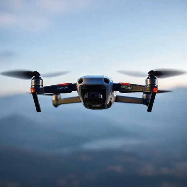
The most effective way to locate a lost drone is by interpreting the last known GPS coordinates found within your controller’s flight logs or the ‘Find My Drone’ app feature. Even without a dedicated tracker, you can use telemetry data and signal strength indicators to narrow down the search area before the battery dies. Combining technical data with a systematic physical search significantly increases your chances of a successful recovery.
🎯 Key Takeaways
- Check flight logs for the last recorded GPS coordinates immediately.
- Use the ‘Find My Drone’ feature in DJI or Autel apps.
- Keep the controller on to monitor signal strength while searching.
- Trigger the ESC beeping function if the battery is still active.
- Analyze the last frames of your FPV feed for visual landmarks.
If your drone has disappeared from view and you do not have a dedicated GPS tracker or AirTag attached, do not panic. Your most powerful recovery tool is the hardware you are already holding: your flight controller and the mobile device used to run your flight application. Modern drones are essentially flying computers that constantly stream telemetry data back to your remote. Even if the connection is lost, the last few seconds of that data are cached locally, providing a digital breadcrumb trail that can lead you directly to the crash site.
Recommended Best Deal Products

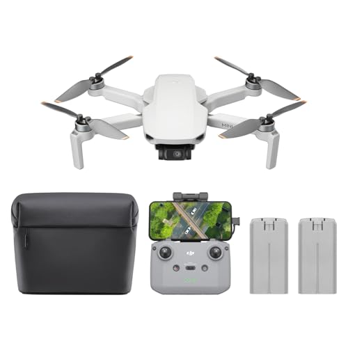


Acting quickly is the most critical factor in a successful recovery. You are racing against two primary threats: the drone’s remaining battery life and the potential for environmental interference. By shifting from a frantic visual search to a methodical, data-driven recovery process, you can transform a needle-in-a-haystack situation into a targeted mission. This guide focuses on extracting technical data and using radio frequency indicators to locate your aircraft using the tools already built into your flight system.
Essential Telemetry and Flight Log Analysis Techniques
Your drone communicates its precise position every fraction of a second via telemetry. Even without a third-party cellular tracker, this data is cached on your smartphone or tablet. This is the fastest way to narrow your search radius from several kilometers down to a specific backyard, tree line, or rooftop. Most pilots overlook the depth of information stored in these logs during a high-stress moment.
Using “Find My Drone” and Manual Coordinate Extraction
Apps like DJI Fly, DJI Go 4, Autel Explorer, and Parrot FreeFlight have built-in “Find My Drone” utilities. These tools overlay the drone’s last reported GPS coordinate onto a map relative to your current location. However, simply looking at the map icon isn’t enough for a precise recovery. You need to look at the raw data.
- Log the Coordinates: Don’t just follow the blue dot. Locate the exact decimal coordinates (e.g., 40.7128, -74.0060) within the app. Enter these directly into a secondary mapping app like Google Maps to get high-resolution satellite imagery of the terrain.
- Analyze the Flight Path: Replay the flight log from the beginning. Look at the trajectory in the final five seconds. If the drone was traveling at a high velocity when the signal cut, its momentum likely carried it 20 to 50 feet past the last recorded GPS point.
- Dynamic Home Point Data: Check if your home point was updated mid-flight. If you were walking or on a boat, the drone might be trying to return to a location you have already left, rather than where you are currently standing.
Interpreting Altitude and Battery Voltage Logs
Telemetry tells you more than just where the drone is; it tells you what state it was in when it went down. By looking at the final altitude readings and battery voltage in your flight log, you can predict exactly what kind of “landing” occurred.
- Altitude at Zero: If the altitude reading hit zero or a negative number (relative to your take-off point) while the GPS was still active, the drone is likely on the ground.
- Hovering Altitude: If the logs show the drone hovering at 50 feet and then the signal cuts, it is highly probable the aircraft is stuck in a tree or on a structure.
- Voltage Drop: A sudden drop in voltage right before the signal loss suggests a terminal hardware failure or a collision with an object, meaning the drone will be directly below the last coordinate. A steady voltage until signal loss suggests the drone simply flew out of range and may have initiated an automated Return to Home (RTH).
How to Recover a Downed Drone Like a Pro: A Practical Walkthrough
Losing sight of your drone or experiencing a sudden signal loss can be a heart-stopping moment for any pilot. Whether your craft suffered a mechanical failure, a “flyaway” due to interference, or simply ran out of battery, the recovery process requires a calm, methodical approach. This guide is designed to help you navigate the high-stress situation of losing a drone that isn’t equipped with a dedicated standalone GPS tracker. By following these professional recovery techniques, you significantly increase your chances of bringing your expensive equipment home safely before the elements or curious passersby get to it first.
Step 1: Freeze and Mark Your “Last Known Point”
What you need: Your smartphone, a physical landmark, or a map application (Google Maps/Apple Maps).
Instructions: The moment you realize your drone is no longer under your control or in your line of sight, stop moving. Do not panic and start running toward the last place you saw it. Instead, physically mark the exact spot where you are standing. If you are using a mobile device, drop a “current location” pin on your map app. Your position is the starting point for calculating the flight trajectory. Look toward the last known direction of the drone and identify a distant, stationary landmark—such as a specific tree, a power pole, or a building peak. This creates a “bearing line.” Most pilots lose their drone because they lose their sense of orientation during the initial panic; by establishing your exact position and the drone’s last heading, you create a search corridor that drastically narrows the search area.
Pro Tip: If you are in an open field, stick a branch in the ground or leave your backpack at your feet to ensure you don’t drift from your original pilot station while checking your screen.
Step 2: Scrutinize the Telemetry and “Find My Drone” Features
What you need: Your flight controller, tablet/smartphone, and the drone’s flight app (DJI Fly, Autel Explorer, etc.).
Instructions: Most modern drones, even without a dedicated tracker, record telemetry data to the flight app on your phone. Open your app’s settings and look for a “Find My Drone” or “Flight Logs” section. This tool usually shows the last recorded GPS coordinates sent by the drone before the connection was severed. Even if the drone has lost power, the app will show you exactly where it was when it last had a signal. Take a screenshot of these coordinates immediately. If your app provides a “Last Known Location” on a map, use your phone’s GPS to walk directly toward that point. Pay close attention to the battery level at the time of signal loss; if the battery was critically low (below 5%), the drone likely landed or crashed within a 50-meter radius of that last coordinate.
Pro Tip: If the signal was lost while the drone was still high in the air, remember that it likely drifted with the wind as it descended. Check the wind direction and search “downwind” from the last known coordinates.
Step 3: Analyze the “Crash Frame” Video Cache
What you need: The screen recording or cached video file on your mobile device.
Instructions: Most drone apps store a low-resolution version of the live video feed (the cache) directly on your phone. Play back the last 30 seconds of your flight in slow motion. Look for specific visual cues in the final frames. Are there unique rock formations, a specific type of tree, or a man-made structure like a fence or a path? Look at the horizon to see if the drone was tilting, which indicates the direction of a fall. If the video suddenly turns into a blur of colors, the drone was likely tumbling. If the video remains static for a few seconds before cutting out, the drone may have landed flat. Use these visual landmarks to cross-reference with satellite imagery on Google Maps to pinpoint a much smaller search zone, often down to a 10×10 meter square.
Pro Tip: Look for “leading lines” in the video—roads, rows of crops, or shoreline—that can act as a grid to guide your physical search.
Step 4: Execute a Systematic Grid Search
What you need: Comfortable hiking boots, a high-visibility vest (if near roads), and a stick for moving tall grass.
Instructions: Once you have reached the general area of the last known coordinates, do not wander aimlessly. Use a “mowing the lawn” search pattern. Start at the last known GPS point and walk in straight lines, moving 2-3 meters at a time before turning around and walking back parallel to your first path. If you are in tall grass or thick brush, the drone can be invisible from even a few feet away. Use a stick to gently part tall weeds or bushes. Drone bodies are often grey or white, which can blend in perfectly with dried grass or light-colored rocks. Keep your eyes peeled for “unnatural” colors like the bright orange or blue of propeller tips, or the reflective glint of the camera lens or glass sensors.
Pro Tip: If you are searching with a friend, stand 5 meters apart and walk in tandem to cover ground more efficiently and ensure no gaps are left in the search grid.
Step 5: Utilize Auditory and Visual Signaling
What you need: Your flight controller (still powered on) and a quiet environment.
Instructions: If your drone’s battery hasn’t died yet, you can use its internal systems to signal its location. Most flight apps have a “Start Beeping/Flashing” button within the “Find My Drone” menu. Even if you don’t have a video feed, the control link (RC signal) may still be active if you are close enough. Walk slowly through the search area and repeatedly trigger the “ESC Beep” or “Buzzer” function. Periodically stop, hold your breath, and listen for a high-pitched electronic chirping. If it is getting dark, the “Flash LEDs” command is incredibly effective; drone LEDs are designed to be bright and can often be seen through thick foliage or from the bottom of a ditch at dusk. If you see your controller’s signal bars increase as you move, you are getting warmer.
Pro Tip: Turn off any noisy equipment like cars or handheld radios while listening, as the internal buzzers on many drones are relatively quiet and easily masked by ambient noise.
Step 6: The “Vertical Plane” Inspection
What you need: Binoculars and a high-powered flashlight (even during the day).
Instructions: A common mistake is only looking at the ground. Drones are notorious for getting snagged in the upper canopy of trees or landing on the roofs of outbuildings. Use your binoculars to scan the branches of every tree within a 30-meter radius of your target zone. Look for broken twigs, disturbed leaves, or the silhouette of the drone’s arms. Use a high-powered flashlight to shine into the dark recesses of tree hollows or dense evergreen branches; the light will often reflect off the drone’s plastic body or the glass of the camera gimbal. If you are in a residential area, check gutters and chimneys. If you suspect the drone is in a tree, walk around the base of the tree and look straight up from multiple angles, as the foliage can easily hide a small craft from a single vantage point.
Pro Tip: Look for “shadows” that don’t belong. A square or geometric shadow in a tree is a dead giveaway for a stuck drone.
Step 7: Social and Community Crowdsourcing
What you need: Photos of your drone, local community Facebook groups, and Nextdoor app.
Instructions: If your physical search fails after several hours, it is time to enlist the help of the community. Take a photo of a similar drone model (or a photo you took of your drone previously) and post it to local neighborhood watch groups or “Lost and Found” forums. State clearly where you were flying and offer a small reward for its return. If your drone has your FAA registration number on it (which is required by law in the US), mention that it is identifiable. Contact local park rangers or property owners in the area. Leave your phone number with them in case a hiker or gardener stumbles upon it. Often, drones are found days later by people who have no idea how to find the owner.
Pro Tip: Check Craigslist and Facebook Marketplace in the “For Sale” section over the next 48 hours. Occasionally, someone may find a drone and try to sell it without realizing it can be traced.
✅ Final Checklist
- Confirm that you have synced your flight logs to the cloud to prevent data loss.
- Verify that the “last known coordinates” were cross-referenced with satellite imagery for accuracy.
- Ensure the entire 50-meter radius around the last signal point has been searched using a grid pattern.
- Check the tree canopy and rooflines within the search area using binoculars.
- Distribute contact information to local authorities or property managers in the vicinity.
Important Notes:
- Safety First: Never trespass on private property or climb dangerous trees/structures to recover a drone. Always ask for permission from landowners.
- Battery Life: Most drone batteries will only provide power for beeping or flashing for 15-45 minutes after a forced landing, so prioritize auditory searches immediately.
- Weathering: If rain is expected, prioritize your search as moisture can permanently damage the internal flight controller and ESCs.
- Estimated Time: A thorough search typically takes 2 to 6 hours depending on the terrain.
- Estimated Cost: $0 for the search; however, budget $50-$200 for potential motor or gimbal repairs if the landing was rough.
Signal Strength (RSSI) and Visual FPV Feed Indicators
If your drone still has battery power but you have lost visual contact, you can use the radio connection to triangulate its position. As you move closer to the downed aircraft, the signal strength between your remote controller and the drone will increase. This creates a digital “hot or cold” game that is incredibly effective in dense brush or tall grass.
Triangulating via RSSI (Signal Bars)
The Received Signal Strength Indicator (RSSI) is the set of “bars” or the percentage indicator shown on your controller’s screen. Even if you don’t have a live video feed, as long as the controller says “Connected,” the drone is within range and powered on.
- Antenna Directionality: Most drone antennas are directional. They emit a signal in a “donut” shape or a focused beam. Slowly rotate your body in a 360-degree circle while holding the controller. Note the direction where the signal bars are highest; your drone is almost certainly along that vector.
- The Step-and-Wait Method: Radio signals can bounce off buildings or trees (multipath interference). Walk 20 paces in one direction, then stop for 10 seconds to let the RSSI value stabilize. If the signal improves, continue; if it drops, turn 90 degrees and try again.
- Using the ESC Beep: If you are within 50 to 100 feet, use the “Start ESC Beeping” feature found in the settings of most modern flight apps. This forces the motors to vibrate at a high frequency, creating a loud, pulsing chirp that can be heard even through thick foliage.
Visual Landmark Analysis from the FPV Feed
If the FPV (First Person View) video feed is still active, it is your most valuable asset for visual confirmation. Even a frozen last frame can provide clues that GPS coordinates cannot. You must analyze the frame for environmental context.
- Horizon Line Analysis: Look at the gimbal’s tilt. If the horizon is perfectly level, the drone is likely flat on the ground. If the camera is angled sharply toward the sky or ground, the drone is tilted, likely caught in branches or resting on its side.
- Identifying Ground Cover: If the feed is mostly green or brown but you can see sunlight through gaps, the drone is in deep grass. If the feed is completely dark but the telemetry shows the camera is still functioning, the drone may have landed upside down or in mud.
- Shadow Direction: If you can see shadows in your last video frame, use the position of the sun to determine orientation. If it is 2:00 PM and shadows are pointing Northeast, you can determine which way the camera was facing at the time of the crash.
Environmental Factors Influencing Drone Crash Locations
When a drone loses power or disconnects, it rarely drops in a perfectly vertical line. Understanding the physics of your surroundings is essential for narrowing down the search radius. The environment acts as a silent director, pushing your aircraft toward specific “traps” based on its weight and the local weather conditions.
Wind Drift and Aerodynamic Descent
Even a light breeze can significantly alter where a drone lands, especially if it is a lightweight model like a DJI Mini series or a racing drone. When motors cut out, the props may still provide a small amount of lift or drag, causing the drone to “tumble-glide” downwind. If you were flying at an altitude of 100 feet in a 10 mph wind, your drone could easily land 50 to 100 feet away from its last known GPS coordinate.
- Weight-to-Wind Ratio: Heavier enterprise drones are less affected by gusts, while sub-250g drones can be carried several hundred feet off-course during a freefall.
- The “Leaf Effect”: Drones with large surface areas (like those with prop guards) tend to catch the wind more easily, leading to a wider search area.
- Updrafts: Near cliffs or tall buildings, thermal updrafts can actually keep a disconnected drone airborne longer than expected.
Vegetation and Terrain Traps
Nature has a way of hiding expensive electronics in the most inconvenient places. Different terrains offer unique challenges for recovery. For instance, a drone landing in a dense forest canopy often stays lodged in the branches rather than hitting the forest floor. Conversely, tall grass or wheat fields act as “acoustic dampeners,” making it nearly impossible to hear a low-battery beep or a motor chirp.
- Tree Canopies: Always look up. Many “lost” drones are simply sitting 30 feet above the pilot’s head, hidden by leaves.
- Water Margins: If you were flying near a lake, check the reeds and shoreline. Drones often clip branches overhanging water and tumble into the soft mud at the edge.
- Urban Obstacles: In city environments, flat rooftops and gutters are the most common landing spots for drones that lose signal mid-flight.
Comparison of Onboard Recovery Features vs. Physical Search Patterns
Modern drones come packed with “Find My Drone” features, but these digital tools have limitations. Comparing the effectiveness of software diagnostics against traditional physical search patterns is the best way to determine your recovery strategy. Sometimes the tech fails, and you have to rely on old-fashioned boots-on-the-ground logic.
Leveraging Software Diagnostics
Onboard features like telemetry logs and last-known-point mapping are your first line of defense. These tools provide a “digital breadcrumb” trail that shows the exact coordinate where the link was severed. However, these features rely on the drone’s battery remaining intact during the crash. If the battery ejects upon impact, the “beep” or “flash” functions will be useless, leaving you with only the last recorded coordinate on your screen.
- Telemetry Accuracy: GPS coordinates are usually accurate within 3-5 meters, which is a small area but still large enough to hide a drone in thick brush.
- Video Cache: Reviewing the cached video on your phone can provide visual landmarks (like a specific rock or tree) right before the feed cut out.
- Signal Strength Indicators: Walking toward the last known location while watching your remote’s signal bars can help “triangulate” the drone if it still has power.
Strategic Search Grids
When the electronics fail or the battery dies, physical search patterns become the gold standard for recovery. This method involves dividing the area into a structured grid to ensure no square foot is left unexamined. This is often more effective than wandering aimlessly because it accounts for the human tendency to overlook objects directly in front of them.
- The Expanding Square: Starting at the last known coordinate and walking in larger and larger squares is the most efficient method for a single searcher.
- Parallel Path Search: If you have friends helping, walking in a straight line spaced 5 feet apart ensures total coverage of a field or park.
- Changing Perspectives: Many pilots find their drones by walking the search grid backwards or from a different angle, as the sun reflecting off a lens or a white plastic shell might only be visible from one direction.
Conclusion
Finding a lost drone without a dedicated tracker is a test of patience and logic. By understanding how wind drift affects descent and recognizing the specific terrain traps in your area, you can significantly narrow your search. While onboard software features provide a great starting point, they are rarely perfect; combining digital data with a disciplined physical search grid is the most reliable way to bring your aircraft home. For your next flight, consider adding a simple reflective sticker or a bright LED strobe to make visual recovery easier. Stay calm, stay methodical, and don’t forget to look up in the trees!
❓ Frequently Asked Questions
What should I do the moment my drone loses signal and disappears?
Immediately check your flight app for the last known coordinates and take a screenshot of the map. This provides a precise starting point for your physical search even if the drone loses power or the app crashes later.
How do I use flight logs to pinpoint a location?
Access the ‘Flight Record’ section of your app, select the most recent flight, and scrub to the final seconds of the playback. The coordinates shown at the exact moment of disconnect are your most accurate lead for starting a search.
Is there a way to make the drone emit sound remotely without a tracker?
Many modern drones have an ‘ESC Beep’ or ‘Find My Drone’ sound trigger in the settings. This causes the motors to vibrate and emit a high-pitched noise, which is invaluable for finding drones hidden in thick brush or trees.
How does signal strength help in the recovery process?
If the drone still has battery power, your controller’s signal bars will increase as you get closer to the craft. By moving in different directions and watching the signal meter, you can effectively triangulate the drone’s position.
What are the most effective physical search patterns for a lost drone?
A systematic grid search is best; walk in parallel lines across the search area, keeping the last known point at the center. Be sure to look up in trees and down in thick vegetation, as drones often snag on branches or fall deep into weeds.
Can I find my drone if it didn’t have GPS capabilities?
Without GPS, you must rely on your last visual line of sight and recorded FPV video feed. Rewatch your cached footage to identify specific landmarks, trees, or structures that the drone was near before the video link was severed.