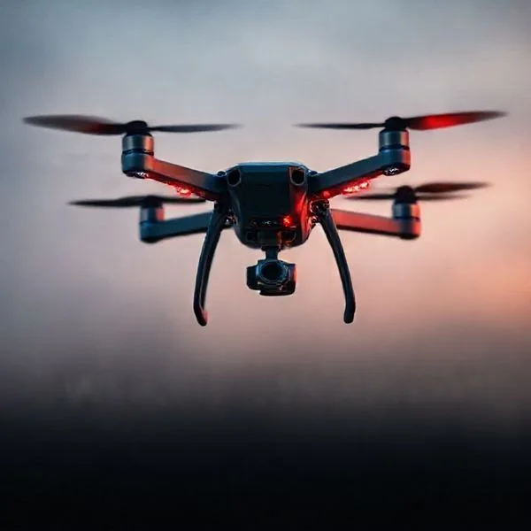
Identifying a police drone involves monitoring for enterprise-grade hardware, specific flight behaviors like persistent loitering, and technical broadcasts. Most law enforcement agencies use Remote ID technology that allows civilians to verify ownership through mobile apps.
🎯 Key Takeaways
- Look for large, industrial multi-rotor frames with dual-sensor thermal cameras.
- Police drones often maintain a fixed ‘overwatch’ position for long periods.
- Use Remote ID apps like DroneScanner to check for government registration.
- Identify high-intensity FAA-mandated strobes or red-and-blue emergency lighting.
- Grid-like flight paths usually indicate systematic search or mapping operations.
Spotting a police drone requires looking for industrial-grade hardware and specific flight behaviors that differentiate professional surveillance from a neighbor’s hobby. Most law enforcement agencies use high-end enterprise drones like the DJI Matrice series or the Mavic 3 Enterprise, which are significantly larger, louder, and more feature-heavy than standard consumer models. If you see a drone with a bulky, multi-lens camera system or one that maintains a fixed “orbit” around a specific property for an extended period, you are likely looking at a tactical surveillance operation.
Prime for Young Adults — 6 Months Free
Exclusive Offer Amazon Prime for Young Adults, Students and 18–24s get six months of Prime free, then half price.
Start 6 Months Free As an Amazon Associate I earn from qualifying purchases.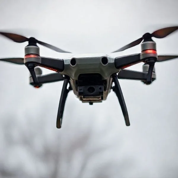
Understanding these indicators is essential for your privacy and situational awareness. Law enforcement drones are tools of precision, designed to capture high-resolution thermal data and maintain a steady eye on a target from several hundred feet away. While a hobbyist might zip around for fun, a police drone has a specific mission, often involving persistent loitering or perimeter monitoring. Identifying the hardware and the pilot’s intent helps you distinguish between a harmless flyover and active government monitoring.
Visual Identifiers of Law Enforcement and Enterprise Drones
Recommended Best Deal Products


The easiest way to identify a police drone is by its physical profile and the specialized gear it carries. Law enforcement agencies rarely use the small, white “toy” drones found in big-box stores. Instead, they opt for “Enterprise” or “Blue UAS” (government-approved) platforms. These machines are built for durability and advanced optics rather than sleek aesthetics.
Advanced Payloads and Thermal Optics
Police drones are defined by their “payload”—the equipment hanging beneath the frame. Unlike the single-lens cameras on consumer drones, police units often feature massive, multi-sensor gimbals. You will typically see a “dual-camera” or “triple-camera” setup that includes a standard high-resolution lens, a powerful optical zoom lens, and a thermal (FLIR) sensor. The thermal lens is a dead giveaway; it usually looks like a large, dull grey or black circular lens that stands out from the shiny glass of a standard camera. These allow officers to track heat signatures even in total darkness.
- Large Frame Size: Look for drones like the DJI Matrice 300 RTK. These have a wingspan of nearly three feet and high-clearance landing gear.
- Multiple Lenses: Visible “boxes” or “turrets” under the drone containing zoom and thermal optics.
- Fixed Landing Gear: Many industrial drones have sturdy, fixed legs designed for rugged environments, unlike the folding legs of a Mavic Air.
- External Attachments: Police drones often have modular mounts on top for high-intensity searchlights or digital loudspeakers used for communication.
Propeller Sound and Lighting Configurations
The “acoustic signature” of a police drone is distinct. Because enterprise drones are heavier—often weighing 10 to 20 pounds—their motors must work harder to stay airborne. This results in a much lower, deeper “thrum” or “growl” compared to the high-pitched “mosquito buzz” of a small racing or hobby drone. If the sound is deep and rhythmic, it is likely a heavy-lift enterprise craft.
Lighting is another critical clue. While the FAA requires anti-collision strobes for night flight, police drones often use specific configurations. You might see a high-intensity white strobe that flashes once per second, visible for miles. However, during “stealth” operations, they may use infrared (IR) strobes. These are invisible to the naked eye but appear as a bright, pulsing light if you look through a digital camera or a night-vision smartphone app.
The Ultimate Drone Surveillance Detection Walkthrough
In recent years, the use of Unmanned Aerial Vehicles (UAVs) by law enforcement agencies has surged for various purposes, including search and rescue, traffic management, and surveillance. While these tools offer efficiency for public safety, individuals often have valid concerns regarding their personal privacy and the extent of aerial monitoring in their neighborhoods. This guide provides a comprehensive, technical, and practical approach to identifying if a police drone is operating in your vicinity. By understanding the hardware, digital signatures, and behavioral patterns of professional-grade drones, you can better understand the environment around you and distinguish between a hobbyist flying for fun and a coordinated law enforcement operation.
Step 1: Perform a Visual Light Signature Analysis
What you need: A pair of 10×42 binoculars or a smartphone with at least 10x optical zoom capabilities.
Prime for Young Adults — 6 Months Free
Exclusive Offer Amazon Prime for Young Adults, Students and 18–24s get six months of Prime free, then half price.
Start 6 Months Free As an Amazon Associate I earn from qualifying purchases.Instructions: Most police drones, such as the DJI Matrice 300 RTK or the Skydio X10, are required by FAA regulations to have anti-collision lighting if flying at night or in low-light conditions. These lights are significantly brighter than standard consumer drone lights and are often visible for up to three miles. Look for a specific pattern: law enforcement drones frequently utilize high-intensity strobes that flash red and blue, or a steady white light positioned on the top and bottom of the airframe. During the day, look for larger, industrial-looking frames. Unlike small, white consumer drones, police models are typically matte gray, black, or carbon fiber to reduce glare and remain less conspicuous against the sky.
Pro Tip: Look for a “staring” behavior. If a light remains stationary in the sky for more than five minutes at an altitude of 200–400 feet, it is likely a professional drone utilizing a high-zoom gimbal camera to monitor a specific location rather than traveling from point A to point B.
Step 2: Listen for Specific Acoustic Signatures
What you need: A quiet environment and, optionally, a directional microphone or a sound-metering app.
Instructions: Police drones generally use larger propellers than hobbyist drones to carry heavy thermal cameras and sensors. This creates a distinct acoustic signature. While a small consumer drone sounds like a high-pitched “angry bee,” a heavy-duty police drone produces a deeper, more resonant hum or a “throbbing” sound. This is due to the lower RPM required to spin larger props. Position yourself away from walls to avoid echoes and listen for a steady, low-frequency buzzing. At an altitude of 300 feet, an industrial drone can produce roughly 50-60 decibels of sound. If the sound remains constant in volume and pitch, the drone is likely hovering in a stationary position, indicative of active surveillance rather than transit.
Pro Tip: If you hear the sound pitch change frequently (a “whining” up and down), the pilot is likely performing manual maneuvers. A steady, unchanging hum usually indicates an automated GPS-locked hover or a programmed flight path.
Step 3: Utilize Remote ID Monitoring Applications
What you need: A smartphone with Bluetooth 5.0 and a dedicated Remote ID app (such as Drone Scanner or OpenDroneID).
Instructions: As of 2026, the FAA requires most drones to broadcast “Remote ID” signals, which act as a digital license plate. Law enforcement drones are not exempt from this when flying in most public airspaces. Download a Remote ID scanner app and run it while you suspect a drone is nearby. These apps pick up Wi-Fi or Bluetooth signals transmitted by the drone. If a drone is watching your area, the app will display the drone’s serial number, current altitude, speed, and—most importantly—the location of the pilot. Police drones will often show up with industrial manufacturer names (like DJI or Autel) and high altitudes. If the app shows a drone hovering at exactly 390 feet (just under the legal 400ft limit) for an extended period, it is likely a professional operation.
Prime for Young Adults — 6 Months Free
Exclusive Offer Amazon Prime for Young Adults, Students and 18–24s get six months of Prime free, then half price.
Start 6 Months Free As an Amazon Associate I earn from qualifying purchases.Pro Tip: Note the “Pilot Location” on the app. If the pilot’s location matches a nearby police station, a parked patrol car, or a mobile command center, you have confirmed the drone’s ownership.
Step 4: Identify Flight Patterns and Loitering Behaviors
What you need: A notepad or a flight-tracking app like FlightRadar24 (for larger law enforcement UAVs).
Instructions: Professional surveillance follows a specific logic. Hobbyists usually fly in “freestyle” patterns (flips, dives) or straight lines to capture scenery. Police drones typically employ three specific patterns: 1. The “Stationary Orbit,” where the drone circles a specific building or intersection at a constant radius; 2. The “Grid Search,” where the drone moves back and forth in a “lawnmower” pattern over a specific neighborhood; and 3. The “Static Overlook,” where the drone remains perfectly still at a high altitude to use a high-powered zoom lens. Use your binoculars to watch the drone for 10 minutes. If it maintains a geometric precision that seems mechanical, it is likely being controlled by a professional pilot or an automated flight system used by authorities.
Pro Tip: Watch the “nose” of the drone. If the body of the drone rotates slowly while the craft stays in one spot, the pilot is likely panning a 360-degree camera to scan the entire perimeter of the area.
Step 5: Check for Radio Frequency (RF) Interference
What you need: An RF signal detector or a portable spectrum analyzer (2.4 GHz and 5.8 GHz bands).
Instructions: Most drones operate on the 2.4 GHz or 5.8 GHz frequency bands. High-end police drones use powerful transmission systems (like DJI’s OcuSync) to send high-definition video back to the pilot. If you have an RF detector, scan these frequencies. A strong, constant signal that doesn’t move suggests a nearby transmitter. If you notice your home Wi-Fi signal dropping or experiencing unusual lag specifically when you suspect a drone is outside, it could be due to signal “blooming” from a high-powered drone transmitter operating in close proximity. Move the detector around; if the signal strength increases as you move toward a window or outdoors, you are likely picking up the drone’s downlink (video transmission) or uplink (pilot commands).
Pro Tip: Professional drones often have “frequency hopping” capabilities. If your detector shows a signal that jumps rapidly across different channels within the 5.8 GHz band, it is a sign of a sophisticated, encrypted communication link typical of law enforcement hardware.
Step 6: Detect Infrared and Thermal Signatures
What you need: A consumer-grade thermal camera attachment for a smartphone (e.g., FLIR ONE or Seek Thermal).
Instructions: Most modern police drones are equipped with FLIR (Forward Looking Infrared) sensors for nighttime surveillance. These sensors themselves don’t emit much heat, but the drone’s motors and battery generate significant thermal energy. At night, point your thermal camera at the sky where you suspect the drone is. While the drone may be invisible to the naked eye, its four motors will appear as four bright “hot spots” against the cold background of the sky. Additionally, some industrial drones use infrared beacons to help ground teams identify them. A thermal camera will reveal these beacons as bright flashing lights that are completely invisible to anyone not using specialized equipment.
Pro Tip: Thermal imaging is most effective on clear, cold nights. The contrast between the 120°F drone motors and a 40°F sky makes the drone stand out like a flare on your screen.
Step 7: Search for Ground-Based Support Indicators
What you need: A quick walk or drive around a 2-block radius.
Instructions: Drones have limited battery life (usually 20–40 minutes). This means a pilot must be relatively close—usually within a mile—to maintain a strong signal and manage battery swaps. Look for unmarked SUVs or vans parked with several large antennas on the roof. Police “Drone as a First Responder” (DFR) programs often use “Nests” or “Docks”—white, box-like structures placed on top of buildings or in parking lots that automatically open to launch a drone. If you see a vehicle with a “Pilot” vest-wearing individual holding a large tablet or a controller with a sun hood, you have found the ground station. Police pilots are often required to wear high-visibility vests for safety, even if the drone is unmarked.
Pro Tip: Check for “Extended Range” antennas on vehicles. These are often flat, rectangular panels (patch antennas) aimed toward the sky, rather than the whip antennas used for standard police radios.
✅ Final Checklist
- Identified a matte-colored, large-frame aircraft with high-intensity strobes.
- Detected a Remote ID signal identifying the craft as an industrial or law enforcement model.
- Observed a mechanical flight pattern (Orbit, Grid, or Static Hover).
- Confirmed a deep, low-frequency acoustic signature distinct from hobbyist drones.
- Located potential ground support, such as an antenna-equipped vehicle or a pilot in a safety vest nearby.
Important Notes:
- Safety First: Never attempt to interfere with, shoot at, or jam a drone signal. This is a federal crime in many jurisdictions and can lead to severe legal consequences.
- Legal Rights: In many areas, police must have a warrant for targeted surveillance, though “plain view” doctrine often applies to public spaces. Consult a legal professional if you feel your privacy rights are being violated.
- Estimated Cost: Detection tools range from free (Remote ID apps) to $300-$500 (Thermal cameras/RF scanners).
- Timeframe: A thorough detection scan usually takes 15 to 30 minutes of observation.
Behavioral Indicators of Active Surveillance Operations
Recommended Best Deal Products


How a drone moves tells you more than what it looks like. Professional pilots, especially those in law enforcement, fly with a level of precision and “purposeful stillness” that hobbyists rarely mimic. They aren’t interested in cinematic “sweeping” shots; they are interested in data collection and persistent observation.
Station Keeping and Perimeter Orbits
The most common sign of surveillance is “station keeping” or “loitering.” A police drone will often sit in a single GPS-locked position for 20 to 30 minutes at a time. It will be positioned at an angle that allows the zoom lens to look into windows or over fences from a distance, rather than hovering directly over the target. This “stand-off” distance makes the drone less noticeable while the optics do the work.
- The Orbit Pattern: The drone flies a perfect circle around a house or vehicle. This is an automated “Point of Interest” flight used to create a 360-degree view of a scene.
- Grid Scanning: The drone moves back and forth in a “mowing the lawn” pattern. This is usually for mapping a crime scene or searching for a person in a specific area.
- Battery Swapping Persistence: If one drone leaves and another identical drone appears minutes later to take its place, you are being monitored by an agency with multiple batteries and a mission to maintain a continuous “eyes-on” presence.
Reaction to Movement
If you move and the drone subtly adjusts its heading to keep you centered in its field of view, it is likely using “ActiveTrack” or a manual camera lock. In these scenarios, the drone’s body might not move much, but you will see the camera gimbal tilting and turning to follow your path. While some consumer drones have this feature, police pilots use it from a much higher altitude—often 200 to 400 feet—to remain discreet while keeping you in the frame. If the drone mimics your changes in direction while maintaining a high altitude, it is a focused surveillance flight.
Furthermore, pay attention to where the drone goes when it finishes its flight. Hobbyists usually land in their backyards or nearby parks. Police drones frequently return to a command vehicle, such as a marked or unmarked SUV with several antennas on the roof, or they land at a dedicated mobile “drone-in-a-box” station. Tracking the “return to home” path can often reveal the operator’s identity.
Technical Verification Methods and Remote ID Tracking
While visual and auditory cues are helpful, they aren’t always definitive. To truly confirm if a drone belongs to a law enforcement agency, you have to look at the digital footprint it leaves behind. Modern drone technology is increasingly regulated, meaning these aircraft are constantly “talking” to the world around them through broadcast signals.
Remote ID: The Digital License Plate
The FAA now requires most drones to equipped with Remote ID technology. Think of this as a digital license plate that broadcasts the drone’s position, its serial number, and the location of the pilot. Because police departments use sophisticated enterprise-grade drones, they almost always have these features enabled to maintain compliance with federal airspace regulations.
- Smartphone Apps: You can download apps like DroneScanner or OpenSky that use your phone’s Bluetooth and Wi-Fi receivers to pick up Remote ID signals.
- Identification: If a drone is hovering nearby and appears on your app with a registration linked to a government entity, you have your answer.
- Flight Path Tracking: These apps often show the flight path, allowing you to see if the drone is specifically circling your location or just passing through.
Radio Frequency (RF) and Signal Detection
Drones rely on specific radio frequencies to transmit high-definition video feeds back to the operator—usually 2.4GHz or 5.8GHz. Advanced drone enthusiasts and privacy advocates sometimes use RF detectors to spot these transmissions. While a standard Wi-Fi router also uses these frequencies, a drone’s signal is distinct because it moves and fluctuates in strength as the aircraft maneuvers. If you notice a spike in RF activity that moves in sync with a suspicious light in the sky, there is a high probability of a drone being present.
Privacy Regulations and Law Enforcement Transparency Reports
Recommended Best Deal Products


Understanding the legal framework behind drone use is just as important as spotting the hardware. Police departments aren’t typically allowed to fly drones wherever they want without oversight. Most agencies are bound by strict privacy policies and state laws that dictate when and where they can record footage.
Public Transparency and Flight Logs
Many progressive police departments use transparency portals to maintain public trust. These portals provide “flight maps” that show exactly where their drones have been deployed. If you suspect a drone is watching your neighborhood, you can often verify it after the fact by checking these official resources.
- Agency Dashboards: Check your local police department’s website for “UAS (Unmanned Aircraft Systems) Transparency” pages.
- Purpose of Flight: These logs often categorize missions, such as “Search and Rescue,” “Traffic Accident Documentation,” or “Tactical Support.”
- Warrant Requirements: In many jurisdictions, police cannot use drones for targeted surveillance of a specific person’s backyard without a warrant, providing you a legal layer of protection.
Local Ordinances and “No Fly” Zones
Even police drones must follow certain rules, especially near airports or sensitive infrastructure. However, law enforcement often operates under a Certificate of Waiver or Authorization (COA) from the FAA, which gives them more flexibility than a hobbyist. By researching your local drone ordinances, you can learn if your city has specific “privacy buffer” rules that prohibit drones from hovering at low altitudes over private residential property. Knowing these rules helps you distinguish between a legal police operation and potentially invasive behavior that warrants a formal complaint.
Conclusion: Staying Informed in an Eye-in-the-Sky Era
Spotting a police drone requires a mix of situational awareness and the right technical tools. From the distinct high-pitched buzz of multi-rotor motors to the digital breadcrumbs left by Remote ID broadcasts, the signs are there if you know where to look. Remember that most law enforcement drone use is focused on public safety and emergency response rather than individual surveillance. However, staying informed about your local privacy laws and using signal-tracking technology ensures you aren’t left in the dark.
If you are concerned about privacy, your next steps should be downloading a Remote ID tracking app and reviewing your local police department’s drone policy. Want to learn more about the tech that keeps these birds in the sky? Check out our latest guides on drone accessories to stay ahead of the curve!
❓ Frequently Asked Questions
How do I distinguish between a hobbyist and a police drone?
Police drones are usually ‘Enterprise’ models like the DJI Matrice series, which are significantly larger than consumer drones and feature massive camera payloads, including thermal and zoom lenses.
What kind of flight patterns suggest I am being watched?
A drone ‘watching’ you will typically loiter in a stationary position with its camera gimbal tilted toward you, or it will follow your movement at a consistent distance and altitude.
What technical tools can I use to identify a drone overhead?
You can use smartphone apps like DroneScanner or OpenSky; these pick up the FAA-mandated Remote ID signals that broadcast the drone’s position and the pilot’s registration type.
Can police drones see through my curtains with thermal imaging?
No, thermal sensors detect surface heat and cannot see through glass or solid walls, though they can detect heat ‘leaks’ from windows or rooftops.
What should I look for in the drone’s lighting?
While all drones use lights, police drones may use specific red-and-blue flashing strobes during active pursuits or high-visibility operations to signal their presence to ground units.
Is it legal for a police drone to hover over my backyard?
Laws vary, but generally, police require a warrant for targeted surveillance of private property where a ‘reasonable expectation of privacy’ exists, though public ‘plain view’ rules often apply.