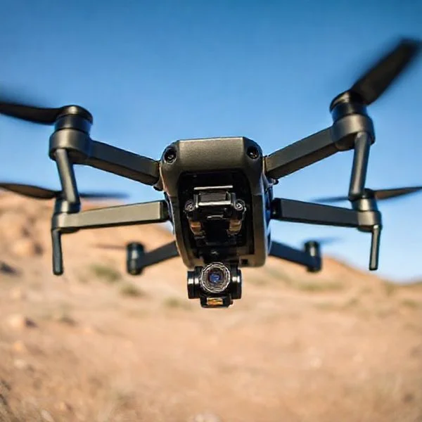
Flying a drone in Las Vegas requires navigating heavy Class B airspace and strict no-fly zones like the Las Vegas Strip and Red Rock Canyon. For legal flights, pilots should head to designated RC parks like Bennett Airfield or utilize the LAANC system for authorization in controlled areas.
🎯 Key Takeaways
- Takeaway 1:The Las Vegas Strip is a strictly prohibited no-fly zone.
- Takeaway 2:Use the B4UFLY app to check real-time airspace restrictions.
- Takeaway 3:Red Rock Canyon is federally protected; drone flight is banned.
- Takeaway 4:Bennett Airfield is the premier designated park for RC enthusiasts.
- Takeaway 5:Obtain LAANC authorization before flying in controlled valley airspace.
Finding a legal spot to launch your drone in Las Vegas requires navigating one of the most complex airspaces in the country. To get right to the point: you cannot fly on the Las Vegas Strip or within five miles of Harry Reid International Airport without specific FAA authorization. However, Clark County provides several designated Green Zones and RC-specific airfields like the William Bennett RC Airfield where you can fly legally and safely.
Prime for Young Adults — 6 Months Free
Exclusive Offer Amazon Prime for Young Adults, Students and 18–24s get six months of Prime free, then half price.
Start 6 Months Free As an Amazon Associate I earn from qualifying purchases.Understanding these boundaries is the difference between capturing an epic desert sunset and facing thousands of dollars in FAA fines or equipment seizure. Because Las Vegas is surrounded by military bases, national conservation areas, and a massive international airport, your “open” desert flight might actually be restricted airspace. This guide focuses on the specific GPS-mapped locations where your drone is actually welcome and the hard boundaries you must never cross.
Designated Green Zones and Legal Drone Parks in Clark County
Recommended Best Deal Products


While much of the valley is covered by controlled airspace, local authorities have established specific “safe havens” for hobbyists. These locations are the most reliable spots for recreational flyers because they sit outside the immediate flight paths of commercial airliners or have established agreements with the FAA.
William Bennett RC Airfield
Located on the far east side of the valley, this is the premier spot for drone pilots in Southern Nevada. Managed by Clark County Parks and Recreation, it features paved runways, shaded pit areas, and dedicated flight lines. It is specifically designed for remote-controlled aircraft, meaning you won’t have to worry about bothering neighbors or violating local noise ordinances.
- Location: Near Sam Boyd Stadium and the Clark County Wetlands Park.
- Access: The park is generally open to the public, though some areas require an Academy of Model Aeronautics (AMA) membership for full use of the specialized facilities.
- Flight Profile: This area is excellent for testing high-speed FPV (First Person View) drones because of the wide-open sightlines and lack of vertical obstacles.
Approved Community Parks in Henderson and Clark County
Outside of dedicated airfields, you can fly in several public parks, provided you follow “Rule 30” guidelines which mandate staying away from organized sports, playgrounds, and crowded pavilions. Henderson, in particular, offers more flexibility for drone pilots than the central Strip area.
- Cornerstone Park: This Henderson park features a large central lake and modern architecture. It is a favorite for aerial photographers looking for water reflections. Always stay over the water or open grass to avoid walking paths.
- Mission Hills Park: Located in the southern part of Henderson, this park provides significant open space. It sits in a pocket of relatively “quiet” airspace compared to the rest of the valley.
- Amargosa Park: This is a smaller, quieter neighborhood option that typically falls into uncontrolled airspace, making it perfect for a quick practice session or battery test.
- Fox Hill Park: Located in the Summerlin area, this park offers elevated views of the city skyline from a distance, safely away from the airport’s restricted zone.
Flying Your Drone in Las Vegas Made Easy: Your Essential Action Plan
Operating a drone in the “Entertainment Capital of the World” offers breathtaking aerial opportunities, from the neon-soaked Las Vegas Strip to the rugged beauty of the Mojave Desert. However, Las Vegas is home to some of the most complex and strictly regulated airspace in the United States due to the proximity of Harry Reid International Airport, Nellis Air Force Base, and numerous heliports. This guide provides a comprehensive roadmap to ensure you fly legally, safely, and capture the best possible footage without running afoul of the FAA or local law enforcement. Following these steps is critical to avoid heavy fines, equipment confiscation, or potential legal action.
Step 1: Confirm Your Pilot Credentials and Drone Registration
What you need: A drone weighing over 0.55 lbs, a computer or smartphone, $5 for FAA registration, and access to the TRUST (The Recreational UAS Safety Test) portal.
Instructions: Before you even think about powering up your rotors in Nevada, you must ensure your drone is legal. If your drone weighs more than 250 grams (0.55 lbs), you must register it through the FAA DroneZone website. Once registered, you must physically label your drone with your registration number. Furthermore, all recreational pilots must pass the TRUST exam—a free online safety test—and carry the certificate with them at all times. If you are flying for any commercial purpose (including YouTube monetization), you must possess a Remote Pilot Certificate under Part 107. In Las Vegas, park rangers and Metro Police are known to ask for these documents if they spot a drone operator in high-traffic areas.
Prime for Young Adults — 6 Months Free
Exclusive Offer Amazon Prime for Young Adults, Students and 18–24s get six months of Prime free, then half price.
Start 6 Months Free As an Amazon Associate I earn from qualifying purchases.Pro Tip: Take a screenshot of your TRUST certificate and your FAA registration and save them in a dedicated “Drone Info” album on your phone so they are accessible even if you lose cell service in the desert.
Step 2: Master the Airspace Map Using LAANC Apps
What you need: A smartphone and an FAA-approved UAS Service Supplier app like AirControl (formerly Aloft) or OpenSky.
Instructions: Las Vegas is essentially a “no-fly” patchwork for the uninitiated. Harry Reid International Airport (LAS) sits directly adjacent to the Strip, creating a massive Class B airspace cylinder. You must download a LAANC-enabled app to see exactly where you are. Open the app and look for your desired flight location. You will see a grid with numbers; these numbers indicate the maximum altitude (in feet) you are allowed to fly with an automated authorization. If you are in a “0” zone, you cannot fly without a specialized manual waiver from the FAA, which can take weeks to process. Many areas around the Strip are restricted to 0 or 100 feet due to constant helicopter traffic.
Pro Tip: Never rely on the “built-in” maps provided by drone manufacturers like DJI or Autel alone; they are often outdated or less precise than official FAA-connected LAANC apps.
Step 3: Secure Instant Authorization via LAANC
What you need: An FAA-approved app (AirControl or OpenSky) and a specific flight plan (time, date, and altitude).
Instructions: Once you have identified a legal area (for example, a park 5 miles away from the airport with a 200ft ceiling), you must request Low Altitude Authorization and Notification Capability (LAANC). Enter your flight details into the app, including your drone’s registration number and your contact information. If your request is within the pre-approved altitude for that grid, you will receive a digital authorization via text message or app notification almost instantly. This authorization is your legal “green light” to operate in controlled airspace. Keep this digital “boarding pass” active during your entire flight session. If you are flying in “Uncontrolled” Class G airspace (further out in the desert), you do not need LAANC, but checking the app is still mandatory to ensure no Temporary Flight Restrictions (TFRs) are active.
Pro Tip: Apply for your LAANC authorization about 15 minutes before you plan to take off to ensure the system processes your request before you start burning through your drone batteries.
Prime for Young Adults — 6 Months Free
Exclusive Offer Amazon Prime for Young Adults, Students and 18–24s get six months of Prime free, then half price.
Start 6 Months Free As an Amazon Associate I earn from qualifying purchases.Step 4: Identifying Legal Launch Points Near the Strip
What you need: A map of public vs. private property and knowledge of local Clark County ordinances.
Instructions: One of the biggest hurdles in Las Vegas is finding a place to physically stand. Most major resorts on the Strip are private property and have strict “No Drone” policies; launching from a casino balcony or parking garage will likely lead to security intervention. To capture the Strip, you should find public sidewalks or public parks located just outside the Class B “0-foot” zones. Areas like Sunset Park offer some legal flying zones, though you must stay clear of the airport approach paths. Always ensure you are not launching from “Red Rock Canyon National Conservation Area” or “Lake Mead National Recreation Area,” as the National Park Service has a blanket ban on taking off or landing drones within their boundaries.
Pro Tip: Check out the “Seven Magic Mountains” art installation south of the city. It is located on BLM land, which is generally drone-friendly, provided you don’t harass the crowds or wildlife.
Step 5: Account for Extreme Desert Weather Conditions
What you need: The UAV Forecast app and an anemometer (handheld wind speed gauge) if available.
Instructions: Las Vegas weather is deceptively dangerous for drones. The heat in the summer can easily exceed 110°F, which can cause battery swelling or internal electronics to overheat and fail mid-flight. Additionally, the Las Vegas Valley acts as a wind tunnel. Check the “UAV Forecast” app for “Wind” and “Gusts” at your specific flight altitude, not just at ground level. Winds above 20 mph can make most consumer drones difficult to control and will drastically reduce your battery life as the motors work harder to stay stable. If the “Kp-index” (geomagnetic interference) is above 4, avoid flying near the high-interference environment of the Strip’s massive LED screens and radio towers, as this can cause GPS loss.
Pro Tip: Fly during “Civil Twilight” (30 minutes before sunrise or after sunset) for the best lighting and the calmest winds, but ensure your drone has anti-collision lighting visible for 3 statute miles.
Step 6: Perform a Pre-Flight Safety Scan and Calibration
What you need: A flat landing pad, a clear line of sight, and your drone’s remote controller.
Instructions: In a high-interference environment like Las Vegas, compass and IMU calibration are vital. Before taking off, ensure your drone has locked onto at least 12-15 satellites to ensure a stable “Return to Home” (RTH) point. Check your surroundings for power lines and hidden “monopine” cell towers disguised as trees, which are common in the Vegas suburbs. If you are near the Strip, be hyper-aware of “Tour Helicopters.” These pilots fly low and fast. If you hear a helicopter, the law requires you to yield the right of way immediately. Descend to a safe altitude or land until the manned aircraft has cleared the area. Never fly over crowds, as the Strip is almost always populated.
Pro Tip: Set your “Return to Home” altitude higher than the tallest obstacle in your immediate vicinity (usually around 200-300 feet in residential Vegas) to prevent the drone from crashing into a building during an emergency signal loss.
Step 7: Executing the Flight and Maintaining Documentation
What you need: Your drone, a charged controller, and a digital or physical flight log.
Instructions: Once in the air, maintain Visual Line of Sight (VLOS) at all times. In the bright Nevada sun, it is easy to lose track of a small grey drone against the glare; use a high-brightness monitor or a hood for your tablet. Capture your footage, but remain mindful of your battery levels; desert winds can make the return trip take twice as long as the flight out. Once you land, it is a “Best Practice” to log your flight. Note the location, the duration, and any issues encountered. In the event you are questioned by the FAA or local authorities later, a detailed logbook demonstrates that you are a professional, safety-conscious operator who follows federal guidelines.
Pro Tip: Use a landing pad to prevent the fine desert sand from entering your drone’s gimbal motors and cooling fans, which can cause permanent hardware damage over time.
✅ Final Checklist
- Registration number is clearly visible on the drone’s exterior.
- TRUST certificate or Part 107 license is physically or digitally present.
- LAANC authorization has been received and confirmed for the current location.
- Weather conditions (wind and temperature) are within the manufacturer’s safe operating limits.
- Pre-flight compass calibration is complete and GPS lock is confirmed with 12+ satellites.
Important Notes:
- Safety Warning: Flying near Nellis Air Force Base is extremely dangerous due to high-speed fighter jet activity; never attempt to bypass geofencing in this area.
- Privacy Laws: Nevada has strict privacy laws (NRS 493.103); flying a drone to surreptitiously observe someone where they have a reasonable expectation of privacy can lead to felony charges.
- Professional Help: If you are planning a large-scale commercial shoot on the Strip, consider hiring a local “Fixer” or a Part 107 consultant to handle the complex Clark County film permits and FAA waivers.
- Estimated Cost: $0 to $5 for registration; fines for illegal flying in restricted Vegas airspace can reach $20,000+ per violation.
Prohibited Airspace: The Strip, Airports, and National Conservation Areas
Recommended Best Deal Products


Las Vegas is a “no-go” zone for drones in more locations than almost any other major US city. If you ignite your motors in these areas without a Part 107 waiver and LAANC (Low Altitude Authorization and Notification Capability) clearance, you are risking immediate law enforcement intervention.
The Las Vegas Strip and Airport Radius
The entire Las Vegas Strip is strictly off-limits to recreational flyers. This is not just a local preference; it is due to the five-mile radius surrounding Harry Reid International Airport (LAS). The Strip sits directly under the approach and departure paths for hundreds of daily commercial flights. Even if you are flying at a low altitude, you are violating Class B airspace. Furthermore, many major resorts have installed drone detection technology. They actively monitor for unauthorized flights and will contact the Las Vegas Metropolitan Police Department (LVMPD) immediately upon detection.
National Conservation Areas and Military Zones
You might think the outskirts of the city offer total freedom, but Las Vegas is hemmed in by federal land and high-security military installations. You must avoid the following areas entirely:
- Red Rock Canyon National Conservation Area: Launching, landing, or operating a drone within the boundaries of Red Rock is prohibited by the Bureau of Land Management (BLM). This is strictly enforced to protect local wildlife and the wilderness experience for hikers.
- Lake Mead National Recreation Area: As a National Park Service unit, drone flight is illegal here. Do not attempt to film the Hoover Dam; it is a high-security infrastructure site with significant federal penalties for drone incursions.
- Nellis Air Force Base: The northern part of the valley is heavily restricted due to the “Home of the Fighter Pilot.” Flying near Nellis or the Creech Air Force Base corridor can interfere with military training exercises and will result in a rapid security response.
- Sloan Canyon Conservation Area: Similar to Red Rock, this southern conservation area prohibits drone use to protect petroglyphs and sensitive biological resources.
Understanding Las Vegas Airspace Classes and LAANC Requirements
Navigating the skies over Las Vegas is unique because of how much controlled airspace blankets the valley. Unlike rural areas where you can simply power up and fly, the majority of the Las Vegas metropolitan area sits under Class B, Class D, or restricted airspace. This is primarily due to the heavy commercial traffic at Harry Reid International Airport and the tactical military operations at Nellis Air Force Base.
The Complex Web of Controlled Airspace
In Las Vegas, the airspace is often described as an upside-down wedding cake. Close to the Strip and Harry Reid International, the controlled airspace starts right at the surface. As you move further toward the outskirts, like Summerlin or Henderson, the “floor” of that controlled airspace might rise, but you are still likely within a zone that requires communication with Air Traffic Control (ATC). For example:
- Harry Reid International (KLAS): High-density Class B airspace where surface-level flight is strictly controlled.
- Nellis Air Force Base: Restricted zones to the northeast where drone flight is often completely prohibited due to high-speed military maneuvers.
- North Las Vegas Airport (KVGT): Busy Class D airspace serving general aviation that requires coordination for nearby flights.
Unlocking the Sky with LAANC
The Low Altitude Authorization and Capability (LAANC) system is a pilot’s best friend in Southern Nevada. It provides near-instant digital authorization to fly in controlled airspace under 400 feet. Instead of waiting weeks for manual FAA approval, you can see exactly what altitude limits apply to your specific GPS coordinates. Many areas in the valley have “grids” that allow flights up to 100 or 200 feet, even if they are relatively close to an airport. Always check your preferred airspace app to see if your chosen spot falls within a 0-foot grid, which signifies a total no-fly zone without special waivers.
Local Ordinances and Privacy Regulations for Nevada Drone Pilots
Recommended Best Deal Products

While the FAA dictates what happens in the air, the state of Nevada and Clark County have specific rules regarding where you can stand when you operate your drone. Understanding the “ground rules” is just as important as knowing the airspace. Nevada has been proactive in establishing laws that protect privacy and critical infrastructure, meaning you need to be aware of more than just altitude limits.
Privacy Laws and Critical Infrastructure
Nevada Revised Statutes (specifically NRS 493) include clear language about drone operations. It is illegal to use a drone to “harass” or “surveil” individuals in a way that violates their reasonable expectation of privacy. In a city full of high-rise hotels and private pool decks, this is a major legal consideration. Additionally, flying over critical infrastructure is strictly prohibited. This includes:
- Power plants and electrical substations.
- Water treatment facilities.
- Large correctional facilities (jails and prisons).
- The Hoover Dam (which is heavily patrolled and features a strict No-Fly Zone).
Park Restrictions and Public Events
Clark County has specific ordinances regarding take-off and landing in public parks. While you might see people flying, it is vital to check for posted signage. Furthermore, Las Vegas is a hub for “National Security Sensitive Flights.” During major events at Allegiant Stadium or high-profile conventions at the Las Vegas Convention Center, the FAA often issues Temporary Flight Restrictions (TFRs). These TFRs can shut down drone hobbyist activity for miles around the venue for the duration of the event. Always verify if a TFR is active before heading out to capture footage of the stadium or the Strip during a game day.
Conclusion: Flying Safely in Sin City
Flying a drone in Las Vegas offers the chance to capture some of the most iconic desert and urban landscapes in the world. However, the proximity to major airports and strict local privacy laws means you must be a diligent pilot. By respecting the 400-foot ceiling, using LAANC for authorizations, and staying clear of sensitive infrastructure, you can enjoy the hobby without legal headaches.
Before your next flight, make it a habit to check a real-time airspace map and inspect your surroundings for any local signage. Stay safe, respect your neighbors’ privacy, and enjoy the incredible aerial views that only Nevada can provide. Ready to take off? Double-check your battery levels and fly responsibly!
💬 Quick Questions & Answers
Can I fly my drone over the Las Vegas Strip?
No, the Strip is within the restricted radius of Harry Reid International Airport and is a strictly prohibited zone.
Is drone flight allowed in Red Rock Canyon?
No, Red Rock Canyon is a National Conservation Area where drone launching and landing are prohibited.
Do I need a permit for recreational flying in Vegas parks?
Most Clark County parks allow drones if they aren’t near airports, but you must check specific park signage and FAA maps.
What is the best designated field for drones in Las Vegas?
William Bennett R/C Airfield is the most popular and officially recognized location for drone and RC flight.
How high can I fly my drone in Las Vegas?
You must stay below 400 feet, though many local LAANC zones have significantly lower altitude ceilings.
❓ Frequently Asked Questions
Are there any specific hotels that allow drone photography from their property?
Generally, no; major resorts on the Strip have strict policies against drone use on their premises due to safety and privacy concerns. Always contact hotel security for written permission, though it is rarely granted to hobbyists.
Why is Nellis Air Force Base a major factor for drone pilots?
Nellis AFB covers a massive portion of the northeast valley, creating Restricted Area R-4808N. Unauthorized flight here can lead to federal charges and immediate military intervention.
Can I fly a drone at Lake Mead National Recreation Area?
Launching, landing, or operating a drone from lands and waters administered by the National Park Service is prohibited unless you have a Special Use Permit for commercial purposes.
What apps are recommended for checking Vegas airspace?
Use the FAA-approved B4UFLY app for general awareness and Air Control (Aloft) or OpenSky to secure instant LAANC authorization for controlled airspace.
Are there night flying restrictions in Las Vegas?
Recreational pilots must follow FAA safety guidelines, which include having anti-collision lighting visible for three statute miles if flying during civil twilight or night.
What happens if I fly in a restricted zone without LAANC?
You face significant civil fines from the FAA, potential local law enforcement citations, and your drone may be confiscated if you interfere with manned aircraft operations.