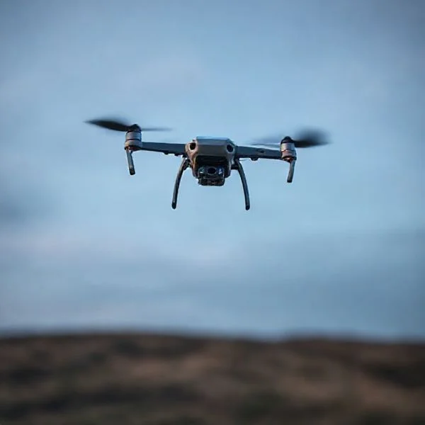
Finding a legal flight zone requires cross-referencing FAA airspace restrictions with local municipal ordinances. Use verified flight maps to identify approved recreational spots like state parks or AMA-designated fields. Always verify temporary flight restrictions (TFRs) before powering up your drone.
🎯 Key Takeaways
- Use FAA-approved apps to check real-time airspace restrictions instantly.
- Designated AMA flying fields offer the safest legal flight environments.
- Most national parks are strictly no-fly zones for recreational drones.
- Check municipal websites for specific city or county park bans.
- Open public beaches often permit flight during off-peak hours.
- Always maintain a visual line of sight regardless of location.
To find legal drone spots near you right now, you must identify “Class G” uncontrolled airspace using industry-standard mapping tools like B4UFLY, AirControl, or AutoPylot. These applications provide real-time data on No-Fly Zones (NFZs) surrounding airports, military installations, and sensitive government infrastructure within your immediate driving radius. Finding a “drone-friendly” spot is not just about clear skies; it requires confirming that your specific takeoff and landing coordinates do not violate municipal park ordinances or privacy laws.
Prime for Young Adults — 6 Months Free
Exclusive Offer Amazon Prime for Young Adults, Students and 18–24s get six months of Prime free, then half price.
Start 6 Months Free As an Amazon Associate I earn from qualifying purchases.Mastering this search is critical for protecting your pilot’s license and your equipment. The legal landscape for drone flight is a dual-layered system where federal and local rules often overlap. By identifying authorized zones before you leave the house, you avoid the risk of heavy FAA fines, local police intervention, and potential signal interference from restricted frequency jammers. This guide cuts through the noise to show you exactly where you can legally fly today.
Understanding Local vs. Federal Airspace Jurisdictions
Recommended Best Deal Products


One of the most common mistakes drone pilots make is assuming that “clear airspace” on a map means they have permission to fly. You must navigate two different authorities: the Federal Aviation Administration (FAA) and your local government. The FAA owns the air from the grass up, meaning they dictate whether the sky above you is safe for flight. However, local cities and counties often control the “dirt.” This means while the FAA might say the air is clear, a local city ordinance might prohibit you from operating or launching a drone from within the boundaries of a specific city park.
The “Takeoff and Landing” Loophole
In many regions, local authorities cannot legally regulate the airspace itself, but they can regulate “land use.” This distinction is vital for your flight planning. If a local park has a “No Drones” sign, it usually means you cannot stand on their grass to launch or land. However, if you are standing on a public sidewalk adjacent to that park (where no such ordinance exists), you may be able to fly over the park legally, provided you follow all FAA Part 107 or recreational safety guidelines. Always check for specific signage regarding “unmanned aircraft systems” (UAS) at the entrance of local recreational areas.
LAANC and Controlled Airspace Authorization
If your “near me” search places you inside controlled airspace (Class B, C, D, or E), you aren’t necessarily grounded. You simply need digital authorization. The Low Altitude Authorization and Notification Capability (LAANC) allows you to get near-instant approval to fly in controlled zones, often up to specific altitude ceilings (e.g., 100 or 200 feet). When checking your map, look for the following data points:
- UAS Facility Maps (UASFM): These show the maximum altitudes you can fly at in specific grid squares near airports.
- Red Zones (Prohibited): Areas like Washington D.C. or military bases where flight is strictly forbidden regardless of your tech.
- TFRs (Temporary Flight Restrictions): These are “pop-up” no-fly zones caused by sporting events, VIP movement (like the President), or wildfires. Always check these 15 minutes before you take off.
The Ultimate “Safe Skies” Drone Flight Location Walkthrough
Finding the perfect spot to launch your drone involves much more than just looking for a clear patch of grass. This guide covers the essential technical, legal, and environmental steps required to identify safe, legal, and visually stunning flight locations near you. Following these steps ensures you avoid heavy fines, prevent equipment damage, and respect the privacy of those around you, allowing you to focus entirely on the joy of flight and aerial cinematography.
Step 1: Understand Your Legal Airspace Classification
What you need: Access to your country’s civil aviation authority website (e.g., FAA in the US, CAA in the UK) and your pilot registration/certification documents.
Instructions: Before even opening a map, you must determine what category of airspace you are standing in. Airspace is generally divided into “controlled” and “uncontrolled” categories. In the United States, Class G airspace is uncontrolled and usually allows for flight up to 400 feet without prior authorization. However, if you are within a specific radius of an airport (Class B, C, D, or E airspace), you cannot simply take off. Use the official government charts to see if your desired neighborhood falls under a restricted zone. Even if a park looks “empty,” it may be directly in the approach path of a local hospital helicopter or a small municipal landing strip.
Prime for Young Adults — 6 Months Free
Exclusive Offer Amazon Prime for Young Adults, Students and 18–24s get six months of Prime free, then half price.
Start 6 Months Free As an Amazon Associate I earn from qualifying purchases.Pro Tip: Always keep a digital or physical copy of your TRUST certificate (for recreational flyers) or Part 107 license (for commercial flyers) on your person, as local law enforcement may ask for it if you are flying in public areas.
Step 2: Utilize Specialized Airspace Management Apps
What you need: A smartphone with apps like Aloft (Air Control), B4UFLY, or OpenSky installed and updated.
Instructions: Download and open a LAANC-enabled (Low Altitude Authorization and Notification Capability) app. These apps use your GPS location to provide a real-time “Green,” “Yellow,” or “Red” status for your current position. If the area is green, you are good to go. If it is yellow, there may be “Caution” advisories like nearby power lines or frequent low-flying gliders. If it is red, flight is prohibited. Use the app to check for Temporary Flight Restrictions (TFRs), which are often put in place for sporting events, VIP movement (like Presidential visits), or emergency operations like wildfires.
Pro Tip: Check the app 24 hours before your planned flight and again 5 minutes before takeoff, as TFRs can be issued with very little notice for emergency situations.
Step 3: Conduct a Digital Terrain Scout via Satellite Imagery
What you need: Google Maps or Google Earth Pro (desktop version is preferred for 3D terrain viewing).
Instructions: Once you have found a legal “Green” zone, use satellite imagery to look for physical obstacles that aren’t marked on aviation charts. Look for wide-open spaces like soccer fields, empty parking lots, or large meadows. Use the “3D View” or “Street View” to estimate the height of surrounding trees and buildings. You want to ensure there is a clear “Return to Home” (RTH) path. If you fly behind a tall building or a dense cluster of trees, you risk losing your radio signal. Ensure there are no schools or government buildings within 500 feet of your planned flight path to avoid unnecessary security scrutiny.
Pro Tip: Look for “paved” takeoff spots like a sidewalk or a concrete pad; taking off from dry dirt or sand can suck debris into your drone’s brushless motors, causing long-term damage.
Prime for Young Adults — 6 Months Free
Exclusive Offer Amazon Prime for Young Adults, Students and 18–24s get six months of Prime free, then half price.
Start 6 Months Free As an Amazon Associate I earn from qualifying purchases.Step 4: Analyze Local Ordinances and Park Rules
What you need: A web browser to search local municipal codes or city council websites.
Instructions: Airspace is regulated at the federal level, but the ground you stand on is regulated at the local level. Many city parks or state beaches have specific bylaws prohibiting the “launching or landing” of unmanned aircraft within park boundaries. Search for “[City Name] + Drone Laws” or “[Park Name] + UAS rules.” If the local ordinance prohibits takeoff from the park, you may need to find a nearby public sidewalk (which is often city-owned transit space) and fly over the park once you are airborne, provided you maintain a safe distance from people.
Pro Tip: If you are unsure, look for a physical sign at the park entrance. If there are no signs and no mention of drones on the city website, you are generally in the clear, but always be prepared to land politely if asked by a park ranger.
Step 5: Check Hyper-Local Weather and Solar Activity
What you need: An app like UAV Forecast or Windy.com.
Instructions: General weather apps aren’t detailed enough for drone flight. Use UAV Forecast to check the wind speeds at the specific altitude you plan to fly (e.g., 200 feet), as wind is significantly stronger higher up than it is on the ground. Check the “KP-Index,” which measures geomagnetic activity. A KP-index over 5 can interfere with your drone’s GPS and compass, leading to “toilet bowl effect” or flyaways. Ensure visibility is at least 3 statute miles, which is the legal minimum for most drone operations to ensure you can see other aircraft.
Pro Tip: Pay close attention to “Wind Gusts” rather than “Average Wind.” A steady 10mph wind is manageable, but sudden 25mph gusts can flip a lightweight consumer drone.
Step 6: Identify Signal Interference and Magnetic Hazards
What you need: Visual inspection of the immediate area (200-foot radius).
Instructions: Before unpacking your drone, look up for high-voltage power lines and cell towers. These are massive sources of Electromagnetic Interference (EMI) that can disconnect your controller from the aircraft. Avoid taking off directly from reinforced concrete (like some parking garages), as the steel rebar inside the concrete can mess with your drone’s internal compass calibration. Find a location at least 20 feet away from large metal structures, parked cars, or industrial transformers to ensure your drone’s sensors stay accurate throughout the flight.
Pro Tip: If your drone app gives you a “Compass Error” or “IMU Calibration” warning, do not just click “Ignore.” Move your takeoff location by 10 feet and see if the error clears.
Step 7: Perform a Final Visual Line of Sight (VLOS) Assessment
What you need: Your eyes and a pair of polarized sunglasses.
Instructions: Stand at your planned takeoff point and turn 360 degrees. Can you see the horizon clearly? You are legally required to maintain Visual Line of Sight (VLOS) with your drone at all times. If there is a large hill or a massive forest in one direction, you must plan your flight so the drone never disappears behind those objects. Identify a “dead zone” where you will NOT fly—for example, over a busy highway or a crowded playground. Your chosen location should have a clear “safety corridor” where you can safely ditch the drone in an emergency without hitting people or property.
Pro Tip: Use a bright, fluorescent landing pad. It helps you maintain VLOS when the drone is high up, as your eyes can easily track the drone’s position relative to the bright spot on the ground.
✅ Final Checklist
- Confirmed the airspace is Class G or obtained LAANC authorization for controlled airspace.
- Verified that local city ordinances do not prohibit drone takeoff/landing at this specific spot.
- Checked UAV Forecast to ensure wind gusts are below 20mph and KP-index is below 5.
- Identified a clear takeoff/landing zone free of sand, tall grass, and metal interference.
- Established a 360-degree clear line of sight to maintain legal VLOS throughout the flight.
Important Notes:
- Safety First: Never fly over moving vehicles or unprotected groups of people, even if the location is otherwise legal.
- Professional Help: If you are planning to fly for a business or a large event, consider hiring a spotter or “Visual Observer” to help you scan the sky for manned aircraft.
- Time and Cost: Researching a new location usually takes 20-30 minutes. The apps mentioned are mostly free for basic use, though some professional features may require a subscription ($10-$20/month).
Top Categories of Drone-Friendly Locations and Amenities
Recommended Best Deal Products


When searching for a flight location, you want more than just “legal” status; you want an environment that minimizes risk to your drone. The best spots are those that offer high visibility, low electromagnetic interference, and plenty of “outs”—areas where you can land safely if your battery runs low or you lose GPS signal. National Forests and Bureau of Land Management (BLM) lands are the gold standard for drone pilots, as they generally allow UAS flight as long as you don’t disturb wildlife or fly in designated “Wilderness Areas.”
AMA Sanctioned Flying Fields
The Academy of Model Aeronautics (AMA) maintains thousands of sanctioned flying fields across the country. These are often the best “drone spots near me” because they are specifically designed for remote-controlled flight. These locations often feature mowed runways, charging stations, and a community of pilots who understand the local wind patterns and obstacles. Most AMA fields require a membership, but they offer the highest level of legal protection and safety amenities available to a recreational pilot.
State Parks and Open Space Preserves
While National Parks are strictly off-limits for drone takeoffs and landings, State Parks vary wildly by state. For example, some states require a permit, while others have designated “airports for models.” To find these, look for “Multi-Use Open Spaces” on your local county map. These areas are typically preferred because they lack the high-tension power lines and cell towers that can cause “Fly-Aways” due to signal interference. When scouting these locations, look for the following features:
- Line of Sight (VLOS) Corridors: Large meadows or valleys where you can keep the drone visible for at least 1,500 to 2,000 feet.
- High Elevation Launch Points: Hills or ridges that allow you to stay above the tree line without exceeding the 400-foot AGL (Above Ground Level) limit.
- Low Pedestrian Traffic: Avoid crowded “scenic overlooks” to comply with FAA rules regarding flying over people.
- Water Proximity: Coastal areas and large lakes offer excellent visibility and photographic opportunities, but require “Return to Home” (RTH) settings to be adjusted for altitude to avoid hitting cliffs or trees on the way back.
Comparing Mobile Apps for Real-Time Flight Clearance
Gone are the days of guessing whether a local park is in restricted airspace. Today, specialized mobile apps provide immediate visual maps that update in real-time based on your GPS coordinates. These tools are your first line of defense against accidental violations and costly fines, transforming complex federal data into an easy-to-read interface on your smartphone.
Popular Apps for Instant Verification
While several options exist, a few stand out for their accuracy and user experience. AirAware (powered by Aloft) is a primary choice for many, as it serves as a reliable successor to the original B4UFLY app. It provides clear, color-coded safety indicators that tell you exactly where you stand. For those who prefer a cleaner, more streamlined experience, Google’s OpenSky provides a simplified view of where you can and cannot fly without the clutter of advanced professional telemetry data.
- Aloft Air Control: The gold standard for pilots who want detailed airspace maps and professional logging features.
- OpenSky: Best for recreational flyers who want a “green light, red light” simplicity for quick checks.
- UAV Forecast: While not a clearance app, it is essential for checking wind speeds at different altitudes and satellite locking conditions.
The Power of LAANC Integration
The most critical feature of any modern drone app is its ability to provide LAANC (Low Altitude Authorization and Capability) access. This system allows pilots to receive near-instant digital approval to fly in controlled airspace that would otherwise be off-limits. If you are scouting a spot near a mid-sized airport, you may see a grid with numbers (like 100 or 200). These represent the maximum altitude allowed for instant clearance. Choosing an app that handles these requests within seconds is a total game-changer for spontaneous weekend flights.
Factors That Determine Site Suitability for Safe Flying
Recommended Best Deal Products

Just because an area is legally “green” on a map doesn’t mean it is the best place to launch your drone. Site suitability involves assessing the physical environment to ensure you don’t lose your equipment or pose a risk to people on the ground. A legal spot is only a “good” spot if it allows for a controlled and predictable flight.
Identifying Physical and Signal Obstructions
When scouting a location, look up and look around. High-tension power lines are notorious for causing electromagnetic interference, which can disrupt the connection between your controller and the drone. Similarly, dense tree canopies or tall concrete structures can block GPS signals, leading to “toilet bowl” drifting or total loss of control. A truly safe spot should offer a clear line of sight and minimal metallic structures that could mess with your internal compass.
- Takeoff Zones: Look for flat, dry surfaces away from tall grass, sand, or loose gravel to protect your gimbal and motors.
- Privacy Barriers: Avoid flying too close to residential windows or fenced backyards to stay within local “good neighbor” guidelines and avoid complaints.
- Crowd Density: Popular tourist spots may be legal, but flying over large groups of people is strictly regulated and often creates unnecessary stress for the pilot.
Environmental and Weather Constraints
The weather at ground level rarely matches the conditions at 200 or 400 feet. Wind gusts can be significantly stronger once you clear the tree line or the top of a hill. Before committing to a flight, check for local “micro-climates.” For example, flying near a canyon or a large body of water can create unpredictable drafts that drain your battery significantly faster than expected. Always prioritize spots that offer a clear “return to home” path that doesn’t require fighting a heavy head-wind on the way back.
Conclusion
Finding the perfect place to fly your drone is a balance of legal compliance, technical safety, and environmental awareness. By utilizing modern mapping tools and real-time clearance apps like Aloft or OpenSky, you can take to the skies with confidence. Remember that the “perfect” spot is one where you have a clear line of sight, a strong GPS signal, and the proper authorization to be there.
As a next step, download a LAANC-enabled app today and check your favorite local park for any hidden restrictions. Before you head out, double-check your battery levels and ensure your firmware is updated for a seamless experience. Stay informed, fly responsibly, and enjoy the incredible perspective that only a drone can provide. Ready to upgrade your flight kit? Explore our latest range of drone accessories to enhance your next adventure today.
❓ Frequently Asked Questions
What is an AMA field and can I use one?
AMA fields are sanctioned flying sites managed by the Academy of Model Aeronautics. While they offer the best infrastructure, they typically require an annual membership for access.
How do I know if I’m currently in a No-Fly Zone (NFZ)?
Check an FAA-approved UAS Service Supplier (USS) app like B4UFLY. These apps use GPS to show circular ‘red zones’ where flight is prohibited due to airports or sensitive sites.
Can I fly my drone at the beach?
Most public beaches are legal unless they are part of a National Seashore or a protected wildlife sanctuary. Always check for local ‘No Drone’ signage at beach entrances.
What happens if I accidentally fly in a restricted area?
You may receive a warning, but serious violations can lead to heavy FAA fines, equipment confiscation, and potential criminal charges for endangering manned aircraft.
Why are national parks off-limits to drones?
The National Park Service implemented a ban to protect sensitive wildlife, maintain the ‘natural quiet’ for visitors, and prevent accidents in crowded scenic areas.
Are there specific distance requirements from airports?
In the US, you must obtain LAANC authorization to fly in controlled airspace near airports; otherwise, staying 5 miles away is a general safety best practice.