NYC drone flight is restricted to designated parks and requires a special NYPD permit for most operations outside these specific zones. Pilots must strictly follow FAA Part 107 or recreational guidelines while avoiding sensitive infrastructure and major airports.
🎯 Key Takeaways
- Only fly in NYC Parks’ designated Model Aircraft Fields.
- New NYPD permits are required for city takeoffs/landings.
- Keep drones within visual line of sight at all times.
- Avoid flying near airports, bridges, and crowded public events.
- Always check for Temporary Flight Restrictions (TFRs) before launching.
Flying a drone in New York City is strictly regulated, but it is not impossible. To fly legally within the five boroughs, you must operate within designated NYC Parks “Model Aircraft Fields” or secure a specific permit from the NYPD. Outside of these handful of authorized zones, New York City Administrative Code § 10-126 effectively prohibits the takeoff or landing of unmanned aircraft without prior written authorization.
Navigating these rules is essential for protecting your equipment and avoiding heavy fines. This guide cuts through the confusion to show you exactly where you can launch today and how to navigate the city’s rigorous permitting system for flights in other locations. Whether you are a hobbyist or a professional, staying within these boundaries ensures your flight remains legal and your gear stays in your hands.
Prime for Young Adults — 6 Months Free
Exclusive Offer Amazon Prime for Young Adults, Students and 18–24s get six months of Prime free, then half price.
Start 6 Months Free As an Amazon Associate I earn from qualifying purchases.Designated Drone Fly Zones within NYC Parks
Recommended Best Deal Products


The NYC Department of Parks & Recreation maintains five primary locations where drone flight is permitted without a special NYPD permit. These are known as Model Aircraft Fields. While these areas allow for takeoff and landing, you must still follow specific site rules, which often include holding a current Academy of Model Aeronautics (AMA) membership. These fields are the only “open” spots in the city where you can practice your maneuvers without a lengthy application process.
Brooklyn and Queens Authorized Fields
Brooklyn and Queens offer the most accessible spots for local flyers. These parks feature dedicated spaces away from heavy pedestrian traffic and airports. You must stay within the visual line of sight and remain inside the park’s designated boundaries at all times.
- Marine Park (Brooklyn): Located at Gerritsen Avenue and Seba Avenue. This is one of the most popular spots for local hobbyists. It offers wide-open spaces, but you must be mindful of the salt marsh and wildlife.
- Calvert Vaux Park (Brooklyn): Situated along Shore Parkway. This field provides excellent views of the Gravesend Bay. It is a dedicated space for model aircraft, making it safer for high-speed drone maneuvers.
- Flushing Meadows Corona Park (Queens): The flying area is located near Meadow Lake. This is a historic spot for model aviation, but it is also near major highways. You must maintain strict control to avoid drifting toward Citi Field or the local expressways.
- Forest Park (Queens): Found at Woodhaven Boulevard and Forest Park Drive. This location is smaller and surrounded by trees, making it better for experienced pilots who want to practice precision flying.
Staten Island and The Bronx Locations
For those in the northern or southernmost boroughs, the city provides two additional sanctioned zones. These areas are generally less crowded than the Brooklyn fields, giving you more room to test your drone accessories and camera settings.
- LaTourette Park (Staten Island): Located at Richmond Hill Road. This site offers a vast green space. It is arguably the most secluded spot in the city, making it ideal for testing new hardware or long-duration flights.
- Ferry Point Park (The Bronx): Situated near the Whitestone Bridge. This field offers unique views of the bridge and East River. However, wind gusts near the water can be challenging, so check your drone’s wind resistance ratings before taking off here.
Everything You Need to Know About Navigating the Skies of NYC
Flying a drone in New York City is a complex endeavor that requires navigating a dense web of federal regulations, local administrative codes, and newly established permitting processes. For years, NYC was effectively a “no-fly zone” due to strict interpretations of Administrative Code 10-126, but the landscape changed significantly in 2023 with the introduction of a formal permit system. This guide will walk you through the essential steps to identify legal take-off zones, obtain the necessary authorizations, and fly responsibly within the five boroughs. Following these steps is critical not just for safety, but to avoid heavy fines from the NYPD and potential federal enforcement actions from the FAA.
Step 1: Master the NYC Administrative Code and FAA Basics
What you need: Access to the official NYC.gov website, a copy of NYC Administrative Code 10-126, and a basic understanding of FAA Part 107 (Commercial) or TRUST (Recreational) regulations.
Instructions: Before you even charge your batteries, you must understand that in NYC, you cannot take off, land, or operate a drone from any property that is not specifically designated by the Department of Transportation (DOT) or the Parks Department. While the FAA controls the “airspace,” the city controls the “dirt.” This means you need dual compliance. Read the 2023 NYC Drone Rules which established a formal permitting process managed by the NYPD. You must also ensure your drone is registered with the FAA and equipped with Remote ID, which is now a mandatory federal requirement for almost all drones flown in the United States.
Pro Tip: Do not rely on old blog posts from before July 2023; the laws have changed drastically, and what was once a “gray area” is now a strictly regulated permit-based system.
Prime for Young Adults — 6 Months Free
Exclusive Offer Amazon Prime for Young Adults, Students and 18–24s get six months of Prime free, then half price.
Start 6 Months Free As an Amazon Associate I earn from qualifying purchases.Step 2: Obtain Necessary Pilot Certifications
What you need: A computer, approximately $5 to $175 depending on the license type, and 30 to 120 minutes of time for testing/registration.
Instructions: You cannot fly legally in NYC without proper federal credentials. If you are flying for fun, you must pass the The Recreational UAS Safety Test (TRUST) and carry the certificate with you. If you are flying for any business purpose—including YouTube monetization or real estate photography—you must obtain a Remote Pilot Certificate under FAA Part 107. This involves passing a proctored exam at an FAA-approved testing center. Additionally, if your drone weighs more than 250 grams (0.55 lbs), you must register it at the FAA DroneZone website and display the registration number on the exterior of the aircraft.
Pro Tip: Even if your drone is a “mini” (under 250g), you still need the TRUST certificate to fly recreationally in the city’s designated parks.
Step 3: Utilize Designated NYC Parks Flight Areas
What you need: A list of the five official NYC Parks Department sanctioned flying sites and a GPS-enabled map.
Instructions: For most hobbyists who don’t want to deal with the $150 permit fee, the only legal places to fly are the five designated areas within NYC Parks. These include: Flushing Meadows Corona Park (Queens), Marine Park (Brooklyn), Lakeview Park (Staten Island), Ward’s Point Park (Staten Island), and Forest Park (Queens). In these specific zones, you do not need a city permit, but you must still follow FAA rules, stay within the designated boundaries of the “flying field,” and yield to any manned aircraft. Note that Manhattan currently has no designated hobbyist flight zones in its parks.
Pro Tip: Check the “Model Aircraft Field” signage at these parks; some require membership in the Academy of Model Aeronautics (AMA) to use their specific runways or facilities.
Step 4: Apply for a NYC Drone Flight Permit
What you need: A $150 non-refundable application fee, a detailed flight plan, and at least 14 days of lead time.
Prime for Young Adults — 6 Months Free
Exclusive Offer Amazon Prime for Young Adults, Students and 18–24s get six months of Prime free, then half price.
Start 6 Months Free As an Amazon Associate I earn from qualifying purchases.Instructions: If you want to fly outside the five designated parks (for example, to film a building in Manhattan), you must apply for a permit through the NYPD’s online portal. You will need to provide the exact date, time, and GPS coordinates for your take-off and landing sites. You must also submit a “Data Privacy Plan” explaining how you will handle any captured imagery of New Yorkers. The application must be submitted at least 14 days in advance but no more than 30 days before the flight. Be prepared for a background check of your FAA records and a review of your safety protocols.
Pro Tip: Be as specific as possible in your flight path description; vague applications are frequently rejected, and the $150 fee is not returned if you are denied.
Step 5: Secure High-Limit Liability Insurance
What you need: An insurance policy with a minimum of $1,000,000 in liability coverage, typically via apps like SkyWatch.ai or Verifly.
Instructions: To be granted an NYC Drone Permit for flights outside of designated parks, the city requires proof of specialized aviation liability insurance. This is not standard homeowner’s insurance. You must provide a Certificate of Insurance (COI) that specifically names the City of New York as an “Additionally Insured” party. For commercial pilots, this is a standard cost of business, but for individuals, you can often purchase “on-demand” insurance that covers you for a specific 4-hour window for roughly $30 to $60 depending on the location and drone type.
Pro Tip: Ensure the COI exactly matches the name on your FAA registration and your NYC permit application to avoid administrative delays.
Step 6: Navigate Complex FAA Airspace and LAANC
What you need: A smartphone with an FAA-approved UAS Service Supplier (USS) app like Air Control (Aloft) or AirMap.
Instructions: NYC is home to some of the busiest airspace in the world. Most of the city falls under Class B airspace (JFK, LGA, EWR). Even if you have a city permit, you still need FAA authorization to enter this controlled airspace. Open your LAANC-enabled app, input your flight location and altitude (usually capped at 400ft, though often much lower in NYC), and receive an automated text-back authorization. If you are near a heliport (common along the Manhattan waterfront), you may need to apply for a manual authorization through the FAA DroneZone, which can take several days.
Pro Tip: Always check for Temporary Flight Restrictions (TFRs). If the President is at the UN or visiting Manhattan, the entire city becomes a total no-fly zone for all drones.
Step 7: Perform a Pre-Flight Site Survey
What you need: An anemometer (wind gauge), a high-visibility safety vest, and a physical inspection of the area.
Instructions: NYC presents unique physical hazards. Before taking off, walk your flight area. Look for “urban canyons” where GPS signals might bounce off glass skyscrapers (multipath interference), causing your drone to lose its position. Check for high-tension power lines and 5G cellular arrays which can interfere with your radio signal. Use your anemometer to check wind speeds; while it might be calm at street level, the “Venturi effect” between buildings can create gusts that exceed your drone’s maximum tilt angle. Ensure you have a clear, cordoned-off landing zone where pedestrians won’t accidentally walk under your aircraft.
Pro Tip: Wear a high-visibility “Drone Pilot” vest. It makes you look official and significantly reduces the number of confrontational questions from passersby or security guards.
Step 8: Execute the Flight and Manage Public Relations
What you need: Printed copies of your permit, FAA registration, insurance COI, and a visual observer (VO).
Instructions: Once you begin your flight, maintain a Visual Line of Sight (VLOS) at all times. In the crowded environment of NYC, use a Visual Observer to watch the sky for helicopters while you focus on the drone. If approached by the NYPD, remain calm and professional. Hand them your folder containing your NYC Permit, FAA Part 107/TRUST card, and insurance documents. Most officers are simply checking to see if you have the paperwork. Once the mission is complete, log your flight time and any incidents in a digital or physical logbook as required by best practices and some insurance policies.
Pro Tip: If a member of the public complains about privacy, be prepared to show them your “Data Privacy Plan” from your permit application to de-escalate the situation.
✅ Final Checklist
- Verify that your drone has a functional Remote ID broadcast and is registered with the FAA.
- Ensure you have a printed copy of your NYC Permit (if flying outside designated parks) or are within the boundaries of a sanctioned Park flight zone.
- Check for active TFRs (Temporary Flight Restrictions) and obtain LAANC authorization for controlled airspace.
- Confirm that your liability insurance is active and names the City of New York as additionally insured.
- Perform a final compass and IMU calibration away from large metal structures before take-off.
Important Notes:
- Safety First: Never fly over people or moving vehicles. NYC streets are almost never empty, so finding a legal flight path often requires flying over water or private cordoned-off areas.
- When to Seek Professional Help: If you are planning a high-budget commercial shoot or a drone light show, hire a specialized NYC drone production company to handle the extensive multi-agency permitting (DOT, NYPD, FAA, Mayor’s Office of Media and Entertainment).
- Estimated Time and Cost: Permitting takes 14-30 days. Costs range from $5 (recreational registration) to $300+ (Permit fee + insurance + commercial licensing).
Understanding the NYC Drone Permit System and FAA Compliance
Recommended Best Deal Products


If you want to fly outside the five parks listed above, you must deal with the NYPD’s permitting infrastructure. In 2023, New York City streamlined this process with a dedicated online portal. This permit is mandatory for any drone flight that takes off or lands on city-owned property, including sidewalks, streets, and non-designated parks. This applies to both commercial cinematographers and recreational flyers looking to capture a specific landmark.
The NYPD Drone Permit Application Process
The permit process is not instantaneous. You must plan your flight at least 30 days in advance to allow for NYPD review. The application requires specific documentation that proves you are a responsible operator. Failure to provide any of these elements will result in an automatic denial of your flight request.
- Insurance Requirements: You must provide proof of a commercial general liability insurance policy. For NYC permits, the city typically requires a policy with a limit of no less than $2 million per occurrence.
- Flight Plan Data: You must submit a detailed description of your flight path, including the exact coordinates for takeoff and landing zones.
- Data Privacy Plan: Applicants must explain how they will handle any captured data and ensure they are not infringing on the privacy of New Yorkers.
- Site Authorization: If you are flying over private property, you need written permission from the property owner in addition to the NYPD permit.
FAA Trust vs. Part 107 in the City
Regardless of city permits, you must still follow federal law. The FAA dictates your pilot certification based on the intent of your flight. In NYC, the NYPD will check your FAA credentials as part of your permit application. You cannot skip federal compliance just because you have city permission.
If you are flying purely for fun, you must pass the The Recreational UAS Safety Test (TRUST) and carry the certificate with you. If you are flying for any business purpose—including YouTube monetization or real estate photography—you must hold a Remote Pilot Certificate (Part 107). In NYC, even “prosumer” flights are often scrutinized under Part 107 standards due to the complexity of the airspace. Ensure your drone is registered with the FAA and that your registration number is clearly labeled on the exterior of the aircraft before you enter any NYC flight zone.
Critical Flight Restrictions: Bridges, Airports, and No-Fly Zones
Even if you find a patch of green space that allows for legal takeoff, the air above New York City is some of the most complex and heavily regulated in the world. Between three major international airports and dozens of active heliports, your drone is rarely alone in the sky. Understanding these invisible boundaries is the difference between a successful flight and a federal fine.
Navigating the Airport “Bubble” and Heliports
The biggest hurdle for NYC pilots is the overlapping Class B airspace. Large portions of Queens, Brooklyn, and the Bronx fall within five miles of JFK or LaGuardia. In these areas, the rules change instantly, and the “canyon effect” of the city can often mask the sound of approaching low-altitude aircraft.
- Check Your Apps Constantly: Always use tools like B4UFLY or AirAware before powering up. Just because you see a clear sky doesn’t mean the airspace is open.
- LAANC is Essential: In many restricted zones, you can get near-instant digital authorization for low-altitude flights through the Low Altitude Authorization and Notification Capability system.
- The Heliport Factor: NYC has high helicopter traffic along the Hudson and East Rivers. Stay vigilant near the Wall Street, West 30th Street, and East 34th Street heliports, as these areas see constant takeoffs and landings.
The Golden Rule: Stay Away from Infrastructure
New York takes its bridge and tunnel security very seriously. Flying near the Brooklyn Bridge, the Verrazzano-Narrows, or the George Washington Bridge isn’t just a safety risk; it is a fast track to having your gear confiscated and facing NYPD scrutiny. These structures are considered “critical infrastructure,” and drones are viewed as potential security threats.
- The 500-Foot Buffer: As a rule of thumb, maintain at least a 500-foot distance from any bridge structure or tunnel entrance to avoid triggering security protocols.
- Respect Sensitive Sites: This includes power plants, water treatment facilities, government buildings, and high-profile international landmarks like the United Nations Headquarters.
- Avoid Prison Airspace: Several facilities, such as Rikers Island, have strict no-fly zones that are strictly enforced.
Liability and Safety Essentials for NYC Drone Pilots
Recommended Best Deal Products

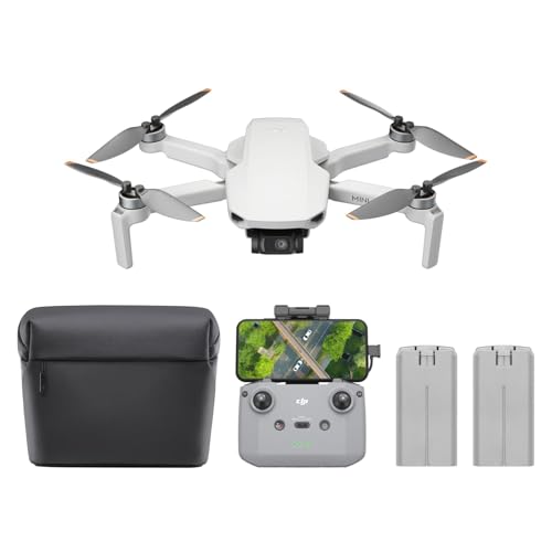
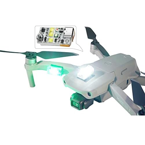
In a city of over 8 million people, there is no such thing as a truly “empty” space. Operating a drone in NYC requires a higher level of preparedness than flying in a suburban backyard. Your accessories and your mindset need to be optimized for high-density environments where the margin for error is razor-thin.
Why Insurance and Spotters are Non-Negotiable
Liability insurance isn’t just for professional cinematographers anymore. One unexpected gust of wind between skyscrapers—known as the Venturi effect—can send a drone into a glass window or toward a pedestrian. On-demand insurance apps allow you to buy coverage for a specific window of time, providing peace of mind in the “Concrete Jungle.”
- Hull and Liability Coverage: Ensure your policy covers both the equipment and third-party property damage.
- The Power of a Visual Observer: In NYC, a second pair of eyes is invaluable. A spotter can watch for low-flying news helicopters or approaching crowds while you focus on the flight telemetry.
- Crowd Management: Never fly directly over people. Even in “legal” parks, you must maintain a safe distance from sunbathers and joggers.
Optimizing Your Gear for Urban Missions
The city presents unique technical challenges, including massive amounts of electromagnetic interference from cell towers and Wi-Fi routers. Using the right accessories can help maintain a stable connection and protect your investment.
- High-Visibility Strobe Lights: Even during daylight, a bright strobe helps you maintain a visual line-of-sight against the complex backdrop of grey buildings and bright glass.
- Portable Landing Pads: NYC ground is often dirty, dusty, or uneven. A foldable landing pad protects your gimbal and sensors from debris during takeoff and landing.
- Signal Hoods and Boosters: Use a screen hood to combat the intense glare from glass buildings, ensuring you can always read your battery levels and GPS strength clearly.
Final Thoughts on NYC Drone Flight
Flying a drone in New York City is a rewarding challenge that offers perspectives few people ever get to see. However, the prestige of a Manhattan skyline shot comes with the heavy responsibility of following strict local laws and FAA regulations. By prioritizing legal takeoff zones, respecting the complex airspace, and keeping your gear maintained, you protect the hobby for the entire community. Your next move is simple: double-check your FAA registration, verify your permit status on the NYC.gov portal, and download the latest airspace maps. Ready to capture the city? Pack your landing pad, watch the wind, and fly responsibly!
❓ Frequently Asked Questions
What are the primary legal ‘Model Aircraft’ locations in NYC?
The NYC Parks Department maintains specific areas like Calvert Vaux Park in Brooklyn, Flushing Meadows in Queens, and Marine Park in Brooklyn where flying is permitted. These sites often require AMA membership and strict adherence to localized field safety rules.
How has the 2023 NYPD drone permit system changed regulations?
The 2023 rules created a formal application process for pilots to legally take off and land in the city. This process requires a 30-day lead time for applications and includes a background check to ensure public safety.
Are there restrictions near LaGuardia or JFK airports?
Yes, a significant portion of NYC falls under Class B controlled airspace, requiring FAA LAANC authorization. Pilots must coordinate with air traffic control through authorized apps before launching any craft.
Can I fly a drone for real estate photography in NYC?
Commercial flight is possible if you hold a Part 107 license and obtain both a city-issued drone permit and FAA clearance. Flying for profit without these documents is strictly prohibited and heavily fined.
Why is flying over NYC bridges and tunnels prohibited?
Bridges and tunnels are classified as critical infrastructure and high-security zones. Flying near them is considered a security threat and can result in immediate law enforcement intervention and federal charges.
Do I need insurance to fly a drone in New York City?
While recreational flyers may not always be legally required to have it, the NYC permit application for commercial use requires proof of liability insurance. It is highly recommended due to the city’s density.