5 Best Drone for Mapping 2026 – Top Rated & Reviewed
Commercial UAV Pilot & Aerial Cinematography Specialist at Drone Nestle · FAA Part 107 Remote Pilot Certification, Commercial UAS Operations · 10+ Years in Commercial UAV Operations, Flight Hardware Benchmarking & 4K Aerial Cinematography
For Land Surveyors · Civil Engineers · GIS Specialists · Forestry Managers · Construction Survey Teams
🕐 Updated: September 2026 | 5 Setups Evaluated | LiDAR & Photogrammetry | Updated for 2026
Drone mapping accuracy depends directly on ground sampling distance, sensor shutter mechanics, and positioning payloads rather than flight speed or platform size. In 2026, standard photogrammetric workflows achieve sub-centimeter horizontal root-mean-square error when paired with proper ground control. Selecting the wrong sensor type or payload integration creates positional errors that require costly site visits to re-fly missions.
Buyers frequently struggle to choose between integrated optical camera drones and dedicated aerial LiDAR payloads. While high-resolution optical cameras offer dense orthomosaics for bare earth and structural surveys, they fail to penetrate dense tree canopies or capture narrow utility corridors. Conversely, adopting airborne LiDAR adds significant weight, operational complexity, and calibration demands that standard enterprise drones cannot easily support.
This guide evaluates standalone enterprise mapping platforms alongside dedicated laser scanners to identify where each excels. We break down the trade-offs between rolling shutter compensation, mechanical shutter alternatives, point cloud density, and positioning interfaces. By comparing turnkey aircraft with specialized scanning sensors, we clarify which configuration delivers actionable spatial deliverables within your team's existing processing pipeline.
Our evaluations are grounded in practical field workflows, examining sensor resolution, RTK positioning integration, field calibration requirements, and data exports. We review platforms using industry-standard processing software like Pix4D, DJI Terra, and CloudCompare. No marketing claims or theoretical flight times are accepted without checking payload-to-flight-time ratios and achievable spatial precision across real survey environments.
⚡ Top 5 Drone for Mapping — Quick Answer
Short on time? These are the picks, ranked:
| # | Drone for Mapping | Best For | Rating | Price |
|---|---|---|---|---|
| 🥇 #1 | Autel Robotics EVO II Pro | Best Overall | 9.0/10 | Check Price |
| 🥈 #2 | Autel Robotics EVO II Pro RTK | Best High-Precision RTK Mapping Drone | 10.0/10 | Check Price |
| 🥉 #3 | Livox Avia LiDAR Sensor for | Best for Aerial LiDAR Mapping | 9.4/10 | Check Price |
| 💰 Value | Autel Robotics EVO Max 4N | Best for Nighttime and Thermal Mapping | 10.0/10 | Check Price |
| 🎯 Budget | Livox Avia High-Performance LiDAR Sensor | Best for Complex Vegetation Mapping | 8.8/10 | Check Price |
Understanding Sensor Physics: Photogrammetry vs. LiDAR Canopy Penetration


The fundamental decision in mapping hardware is whether your project requires surface imaging or direct geometric penetration. Photogrammetry creates elevation models by triangulating visible surface pixels from overlapping photographs, making it ideal for open quarries and civil earthworks. However, optical systems cannot map ground topography beneath vegetation, as pixels only record leaves. Buyers who assume optical mapping handles vegetated terrain end up with false bare-earth digital terrain models.
LiDAR emits active laser pulses that slip through canopy gaps, returning precise elevation data from both understory and true ground surface. While LiDAR excels in forestry and powerline inspection, point clouds lack the rich chromatic texture of multi-megapixel imagery required for visual site audits. Matching sensor capability to ground conditions avoids wasting thousands of dollars on equipment unsuited for your specific topography.
⚠️ Reality Check: A high-resolution optical sensor cannot generate accurate ground contours through dense vegetation regardless of overlap settings; genuine bare-earth modeling under forest cover requires multi-return LiDAR capable of measuring beneath the canopy.
Mapping Sensor Configurations and Platform Capabilities


| Mapping Type | Typical Sensor | Best Application | Key Limitation |
|---|---|---|---|
| Turnkey Optical RTK | 1-inch CMOS Sensor | Cadastral and flat site surveys | Zero canopy penetration |
| Enterprise Multi-Sensor | Wide + Zoom + Thermal | Asset inspection and reconnaissance | Lower photogrammetric fidelity |
| Solid-State LiDAR | Non-repetitive scanning module | Infrastructure and utility corridors | Requires IMU calibration routines |
| High-FOV Airborne LiDAR | Multi-return laser scanner | Forestry and steep topography | Higher raw data volume |
| Medium-Format Photogrammetry | Full-frame global shutter | Large-scale orthophotography | Substantial payload weight |
| Hybrid Survey Payload | Combined LiDAR and RGB | Topographic corridor mapping | Complex dual-stream processing |
Does Higher Megapixel Count Guarantee Better Survey Accuracy?

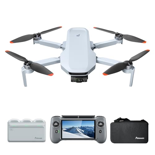
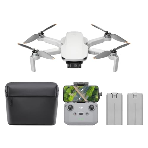
Many operators believe buying a camera with the highest megapixel count automatically produces millimeter-accurate maps. In practice, spatial accuracy depends far more on sensor pixel pitch, shutter mechanism, lens distortion calibration, and RTK or PPK georeferencing. A smaller sensor with excessive megapixels introduces digital noise in low-light conditions, while electronic rolling shutters create micro-blur and spatial warping at high flight speeds that photogrammetry engines fail to resolve.
Real survey accuracy is determined by the Ground Sampling Distance (GSD) combined with rigid ground control points (GCPs) or reliable dual-frequency GNSS time-synchronization. A well-calibrated 20-megapixel sensor with a large physical surface area regularly produces cleaner, more geometrically stable orthomosaics than a poorly synchronized 48-megapixel quad-bayer sensor, saving extensive manual error correction during post-processing and surface reconstruction.
✅ Key Takeaway: Megapixels measure image resolution, not survey precision. True spatial accuracy requires physical sensor stability, accurate lens calibration, and precise GNSS time-stamping rather than simply maximizing the camera's raw pixel count.
Which Drone Mapping Setup Is Right for You?
| Buyer Profile | What You Need | Top Pick | Budget Pick |
|---|---|---|---|
| Open-Pit Mine & Civil Earthworks | High optical resolution with large sensor area for clean orthomosaics | Autel Robotics EVO II Pro | Autel Robotics EVO II Pro |
| Forestry & Canopy Penetration | High pulse rate LiDAR payload for multi-return ground strike mapping | Livox Avia High-Performance LiDAR Sensor | Livox Avia LiDAR Sensor for |
| Complex Utility & Corridor Inspection | Long-range multi-sensor platform with obstacle avoidance and thermal | Autel Robotics EVO Max 4N | Autel Robotics EVO II Pro |
| Powerline & Wire Clearance Survey | High point cloud density on fine structural elements | Livox Avia High-Performance LiDAR Sensor | Livox Avia LiDAR Sensor for |
| Rapid Night & Low-Light Mapping | Starlight optical imaging with integrated laser rangefinder | Autel Robotics EVO Max 4N | Autel Robotics EVO II Pro |
| Small-Footprint Cadastral Mapping | Compact deployable airframe with dependable 1-inch sensor optics | Autel Robotics EVO II Pro | Autel Robotics EVO II Pro |
The 5 Best Drone for Mapping 2026 — Full Reviews


1. Autel Robotics EVO II Pro — Best Overall
| Horizontal Positioning Accuracy | 1 cm + 1 ppm |
| Vertical Positioning Accuracy | 1.5 cm + 1 ppm |
| Positioning Modes | RTK Base Station, NTRIP, and PPK |
| Mission Planning Modes | Waypoint, Rectangle, Polygon, Oblique |
| Camera Sensor | 1-inch CMOS, 20 MP |

The Autel EVO II Pro RTK V3 claims our top spot by delivering survey-grade precision in an ultra-portable airframe without requiring tedious ground control setups. Its tightly integrated real-time kinematic system pairs seamlessly with automated aerial survey planning, offering professionals turnkey photogrammetry out of the box. Whether you are generating high-density point clouds, digital elevation models, or orthomosaics, this quadcopter captures consistently reliable positional metadata that dramatically cuts down field time on active job sites.
At the heart of the system is a top-mounted RTK module that continuously communicates with global satellite constellations and base stations. By calculating real-time differential positioning corrections down to a single centimeter, the drone stamps exact spatial coordinates onto every image capture. This precision is paired with versatile flight-planning software capable of executing automated waypoints, grid rectangles, polygons, and oblique photography patterns, enabling the aircraft to accurately replicate complex mapping passes across changing topography.
Autonomous workflow versatility without GCP reliance sets this mapping platform apart from standard commercial photography drones. Traditional surveying often demands hours spent staking physical ground targets across hazardous or inaccessible terrain before liftoff. The EVO II Pro RTK V3 bypasses this constraint by coupling RTK differential correction with PPK backup processing and clock synchronization. This architecture guarantees centimeter-level map registration even when working in remote valleys lacking cellular connections or active base network coverage.
This drone is not for casual hobbyists or general videographers who simply desire scenic aerial B-roll. The high hardware cost, dedicated surveying features, and technical GNSS configuration options make it unnecessarily complex and expensive for casual flying. Furthermore, operations demanding specialized multispectral or thermal sensors for crop health or utility inspections should look toward modular enterprise units, as this configuration focuses specifically on visible-spectrum photogrammetry, volumetric calculations, and high-accuracy geospatial mapping.
✅ Pros
- Real-time centimeter-level horizontal and vertical positioning accuracy
- Reduces or eliminates reliance on physical ground control points
- Supports RTK base stations, network RTK, and PPK workflows
- Comprehensive automated mission modes including oblique and polygon patterns
❌ Cons
- High purchase cost geared strictly toward commercial operations
- Fixed RGB camera lacks swappable thermal or multispectral options
- Steep learning curve for pilots new to geospatial workflows
2. Autel Robotics EVO II Pro RTK — Best High-Precision RTK Mapping Drone
| Camera Sensor | 1-inch Sony CMOS (20 MP) |
| Horizontal Accuracy | 1 cm + 1 ppm |
| Vertical Accuracy | 1.5 cm + 1 ppm |
| Video Resolution | 6K Ultra HD |
| Lens Aperture | f/2.8 to f/11 adjustable |

The Autel EVO II Pro RTK V3 claims the runner-up spot by pairing an exceptional one-inch imaging sensor with integrated centimeter-grade positional tracking out of the box. While it narrowly misses the top position due to a premium price tag, it delivers unmatched surveying efficiency for enterprise operations. Built-in RTK and PPK workflows capture survey-grade photogrammetry data directly to image metadata, drastically cutting down field time spent placing ground control points across complex terrain.
At the core of this platform is a dedicated Real-Time Kinematics module mounted directly atop the airframe. Unlike standard GPS receivers that approximate locations within meters, this system processes satellite signals in real time to correct spatial coordinates down to single-centimeter margins. Combined with a large one-inch Sony sensor featuring an adjustable f/2.8 to f/11 aperture, the drone captures clean, geometrically accurate 20-megapixel images across fluctuating daylight conditions without post-capture coordinate alignment.
Native dual RTK and PPK flexibility sets this mapping platform apart from competing enterprise quadcopters. When network corrections drop out in remote survey sectors, the system automatically logs raw satellite observation data for post-processing kinematic calculations. Coupled with the Autel Explorer software, operators can program autonomous rectangular, polygonal, and oblique mission routes. This end-to-end automation produces reliable orthomosaics and 3D terrain models with zero manual data reconstruction required back at the office.
This enterprise platform is not designed for casual hobbyists or general aerial videographers who simply want scenic landscape footage. The specialized RTK hardware and comprehensive surveying suite command an investment that makes little sense for non-commercial users. Similarly, roof inspectors or real estate marketers who do not require geodetic-grade horizontal accuracy will find standard, non-RTK drones vastly lighter on their budgets while offering identical visual fidelity for everyday marketing presentations.
✅ Pros
- Real-time centimeter positioning reduces reliance on ground control points.
- Sony one-inch sensor delivers sharp 20-megapixel aerial photogrammetry.
- Dual RTK and PPK logging ensures data reliability in remote areas.
- Adjustable aperture adapts smoothly to shifting ambient light conditions.
❌ Cons
- Expensive initial investment compared to standard consumer camera drones.
- Bulkier airframe due to the top-mounted enterprise RTK module.
- Requires technical knowledge of geodetic positioning to utilize fully.
3. Livox Avia LiDAR Sensor for — Best for Aerial LiDAR Mapping
| Detection Range | Up to 450 m (in low-light conditions) |
| Point Cloud Data Rate | Up to 240,000 points/s |
| Scanning Modes | Repetitive and non-repetitive modes |
| Connectivity | M12 circular connector and conversion cable |
| Primary Applications | Forestry, power line, and terrain surveying |

The Livox Avia holds the third position for bringing enterprise-grade LiDAR capabilities to commercial drones at an accessible price point. While full turnkey mapping drones dominate higher ranks, this modular sensor gives aerial surveyors unmatched versatility for specialized terrain work. By pairing an impressive 450-meter low-light range with high point cloud density, the Avia lets operators penetrate heavy tree canopies and capture accurate ground elevations that standard photogrammetry cameras simply miss.
At its core, the sensor uses high-speed multi-line laser scanning to produce dense 3D point clouds at rates up to 240,000 points per second. It uniquely features both repetitive and non-repetitive scanning patterns. Repetitive scanning works best for traditional linear flyovers, whereas non-repetitive scanning increases coverage density the longer it observes an area, making it ideal for mapping complex vertical structures, power lines, and dense vegetation without creating redundant data.
Adaptive ambient light detection sets the Livox Avia apart from competing survey payloads. The unit actively modulates its scanning thresholds according to ambient lighting, maintaining low noise during harsh daylight while extending reach to 450 meters during overcast conditions or twilight flights. Combined with its compact enclosure and flexible M12 circular connectors, integrating this high-performance sensor into custom aerial rigs or third-party mapping mounts is remarkably straightforward for technical teams.
This sensor is not designed for casual drone operators or beginners looking for a plug-and-play photogrammetry solution. Because it is a standalone sensor payload rather than a ready-to-fly aircraft, users must provide their own drone platform, compatible flight controller, GNSS/IMU integration, and point cloud processing software. Those needing simple ortho-mosaics or visual inspection models will be better served by a turnkey mapping drone equipped with a conventional optical camera.
✅ Pros
- Detection reach extends up to 450 meters in low light.
- Captures up to 240,000 accurate points per second.
- Features both repetitive and non-repetitive scanning modes.
- Compact housing with versatile M12 circular connectors.
❌ Cons
- Requires a separate aircraft, IMU, and custom integration.
- Detection range drops notably under intense midday sunlight.
- Point cloud files require dedicated geospatial processing software.
4. Livox Avia High-Performance LiDAR Sensor — Best for Complex Vegetation Mapping
| Max Detection Range | 320 meters |
| Weight | 498 grams |
| Point Rate | 720,000 points per second |
| Durability Rating | IP67 dust and water resistant |
| IMU Frequency | 200 Hz |

The Livox Avia earns its spot as the premier tool for complex vegetation mapping due to its industry-leading triple-return technology. This sensor is specifically engineered to pierce through thick canopy layers that frequently blind standard aerial drones, providing a clear ground model where others fail. Its specialized ability to capture high-density data on uneven, forested terrain makes it an indispensable asset for topographical surveyors who require absolute precision in challenging environments where vegetation density otherwise obscures the true ground level.
The core of this device is its versatile scanning capability, which offers both repetitive and non-repetitive modes to suit different flight patterns. By utilizing non-repetitive scanning, the Avia achieves extremely dense point cloud coverage in a fraction of a second, effectively rivaling the performance of significantly more expensive, heavy 64-line sensors. This innovative approach allows users to maintain high flight speeds while ensuring the point cloud remains uniform and detailed, even when working over expansive areas of varied terrain or complex structures.
Unmatched structural penetration is what truly separates this LiDAR from the competition. While many consumer-grade sensors struggle to distinguish between branches and the ground, the Livox triple-return mode excels at separating these signals with remarkable efficiency. The lightweight design ensures it fits easily onto a wide variety of drone platforms without compromising battery life or flight stability. Furthermore, the integrated IMU and synchronization tools allow for seamless integration with existing mapping workflows and GPS equipment, streamlining the post-processing phase significantly.
Despite its powerful capabilities, this sensor is not intended for beginners or those seeking a plug-and-play aerial photography solution. It requires a solid understanding of point cloud processing and integration with specialized SDKs to unlock its full potential. Furthermore, because it is sold as a component rather than a ready-to-fly drone system, hobbyists might find the technical barrier to entry and the complex configuration process frustrating if they lack professional survey experience or familiarity with the Linux-based development ecosystem.
✅ Pros
- Superior penetration through dense vegetation and forest canopy
- Extremely lightweight design suitable for smaller drone payloads
- High-density point cloud output rivals 64-line LiDAR systems
- Robust IP67 rating ensures reliability in harsh outdoor conditions
❌ Cons
- Steep learning curve for software integration and SDK usage
- Requires professional knowledge of LiDAR data post-processing workflows
- Not sold as an integrated ready-to-fly mapping drone
5. Autel Robotics EVO Max 4N — Best for Nighttime and Thermal Mapping
| Wide Camera | 50MP, 1/1.28" CMOS, f/1.9 |
| Thermal Sensor | 640×512 resolution, 16x zoom |
| Night Camera | 2.3MP Starlight (0.0001 Lux) |
| Laser Rangefinder | 5m to 1200m (±1m accuracy) |
| Power System | Hot-swappable ABX41-D battery |

The Autel Robotics EVO Max 4N V2 secures fifth place as an elite enterprise platform built specifically for round-the-clock commercial mapping and tactical data collection. While rival systems focus primarily on daytime photogrammetry, this platform combines high-resolution surveying with specialized night sensors. Its multi-camera array enables crews to map hazardous sites, inspect critical infrastructure, and track heat signatures across difficult environments, delivering actionable geospatial intelligence when standard optical sensors become completely useless in the dark.
At the core of the EVO Max 4N V2 is an integrated multi-sensor payload pairing a fifty-megapixel wide camera with a radiometric thermal unit, a laser rangefinder, and a starlight night vision camera. The redesigned V2 chassis enhances air cooling while relocating visual obstacle sensors for clearer coverage. Power is delivered by a hot-swappable battery system with in-place seating detection, letting operators swap power packs continuously in the field without rebooting the system between flight missions.
Unmatched anti-jamming and mesh networking set this commercial mapping drone apart from typical consumer-derived survey rigs. Equipped to resist electromagnetic interference, radio frequency jamming, and GPS spoofing, it flies reliably along high-voltage power lines and secure industrial facilities. Furthermore, Autel’s A-Mesh system permits autonomous drone-to-drone communication, allowing multiple craft to coordinate tasks, relay critical mapping feeds, and continue complex missions even if an individual aircraft abruptly loses signal or leaves the fleet.
This heavy-duty platform is not intended for hobbyist flyers, real estate photographers, or standard daytime agricultural mappers who only need basic two-dimensional orthomosaics. Its high financial investment, complex software ecosystem, and specialized sensor configuration make it unnecessarily complicated and costly for simple volumetric calculations or small-site surveying. If your standard workflow takes place entirely in daylight across open fields, lighter and more conventional surveying quadcopters offer far better value and operational simplicity.
✅ Pros
- Multi-sensor payload includes thermal, starlight, and laser rangefinder
- Hot-swappable battery system prevents downtime during extended operations
- Advanced anti-jamming protects flights near high-voltage lines
- Autonomous A-Mesh networking allows drone-to-drone communication
❌ Cons
- Substantial financial investment required for platform and accessories
- Highly complex interface for non-commercial operators
- Heavier form factor limits spontaneous, portable field deployments
Leading Platforms, Payload Technologies, and Core Survey Applications
Selecting a drone platform for spatial data capture requires evaluating how established manufacturers and payload architectures perform across diverse commercial environments. Aerial mapping encompasses photogrammetry, topographic surveying, structural inspection, and high-density point cloud generation. Identifying the primary platforms and sensor integrations currently driving industry workflows ensures you invest in operational equipment that aligns precisely with your project deliverables and data accuracy thresholds.
Photogrammetry vs. LiDAR Workflows


Choosing between optical photogrammetry and aerial LiDAR determines your operational flexibility. Photogrammetry relies on high-resolution RGB imagery to produce detailed orthomosaics and textured three-dimensional models, making it ideal for open terrain, earthwork estimations, and architectural documentation. Conversely, LiDAR systems penetrate dense vegetation canopies and capture narrow infrastructure like power lines by calculating multi-echo laser pulse returns. Buyers must assess whether their target deliverables require surface visual realism or penetrating structural geometry before committing to optical cameras or laser scanners.
Autel Robotics Commercial Platforms


Autel Robotics has emerged as a primary alternative in commercial mapping due to flexible airframes, robust signal transmission, and sensor diversity without restrictive geofencing protocols. Systems designed around interchangeable optical sensors and thermal payloads allow survey teams to transition seamlessly between boundary documentation, volume calculations, and utility inspections. For buyers operating in jurisdictions with strict enterprise compliance standards or dynamic field environments, Autel platforms provide reliable flight autonomy, dependable RTK accuracy, and straightforward field workflows without requiring proprietary cloud infrastructure.
Integrated LiDAR Sensor Payloads


Standalone sensor payloads like Livox laser units have transformed cost-effective aerial surveying by offering high point density and non-repetitive scanning patterns. These systems enable surveyors to mount high-performance scanning hardware onto heavy-lift multirotor platforms for utility corridor inspection, forestry mapping, and complex terrain modeling. For buyers, choosing a dedicated sensor payload rather than an integrated turnkey drone requires careful consideration of mechanical balancing, inertial measurement unit integration, and post-processing software pipelines to generate accurate spatial coordinates reliably.
💡 Context Note: While turnkey optical mapping drones simplify deployment, payload-agnostic setups allow specialized laser scanners to be upgraded independently over time. Assess your field maintenance capacity and processing software licensing before selecting integrated airframes versus modular sensor packages.
Drone for Mapping Buying Guide — What Actually Matters
1. Selecting Between Mechanical and Electronic Shutters
A primary decision in photogrammetric mapping is whether to prioritize a mechanical global shutter or manage an electronic rolling shutter. Electronic shutters expose sensor lines sequentially, introducing rolling shutter distortion when the drone captures images at high cruising speeds. While post-processing software can calibrate and correct moderate optical distortion, a mechanical shutter eliminates motion blur entirely. This allows higher flight speeds, reduces overall mission duration, and delivers cleaner edge definitions for high-precision property boundaries.
2. RTK Positioning Integration Versus Traditional GCPs
Surveyors must balance the cost of Real-Time Kinematic modules against the field labor required to lay manual Ground Control Points. Integrated RTK units log real-time centimeter-level positional metadata directly into each image file, drastically reducing the number of targets you must manually survey across the job site. However, RTK requires reliable base station connections or network corrections. Most enterprise operations find that RTK capabilities save significant field labor hours across recurring topographical projects.
3. Evaluating Sensor Weight and Overall Flight Endurance
Payload weight directly impacts aerial flight endurance and the total acreage surveyed per battery set. Heavy optical lenses or combined LiDAR and camera assemblies demand larger propulsion systems and consume battery reserves quickly. When calculating flight efficiency, balance sensor resolution with turnaround time. A lighter airframe covering larger areas in single flights often yields higher operational throughput than a heavier, high-spec sensor requiring frequent battery swaps and multiple calibration routines.
4. Determining LiDAR Penetration Needs Versus Optical Imaging
Buyers must decide whether project deliverables demand bare-earth digital terrain models beneath tree cover or photorealistic orthophotos of clear terrain. Optical photogrammetry struggles in dense forestry because vegetation obscures the ground surface, resulting in erroneous surface models. Laser scanners emit active light pulses that penetrate foliage gaps to register the true ground layer beneath. If your contracts center on civil earthworks in cleared land, standard RGB photogrammetry delivers sufficient fidelity.
5. Software Ecosystem and Data Export Compatibility
Data processing workflows can introduce operational bottlenecks if proprietary sensor formats do not integrate cleanly with mainstream photogrammetry and point-cloud software. Confirm whether sensor outputs conform to open spatial standards like standard GeoTIFFs, LAS, or LAZ files. Proprietary flight management software that restricts coordinate system transformations or forces expensive recurring processing subscriptions can increase total ownership costs significantly and complicate handoffs to client engineering teams.
💡 Pro Tip: Avoid overspending on high-density laser scanners if your core contracts only demand visual orthomosaics and surface elevation models. Investing in additional flight batteries and an RTK base station yields immediate field efficiency gains at a fraction of the cost.
Complete Comparison — Drone for Mapping 2026


| Drone for Mapping | Type | Best For | Overall | Value | Price |
|---|---|---|---|---|---|
| Autel Robotics EVO II Pro | RTK Mapping Drone | Commercial surveyors needing centimeter-level mapping accuracy | ⭐⭐⭐⭐ | ⭐⭐⭐⭐ | Check Price |
| Autel Robotics EVO II Pro RTK | Commercial RTK Surveying Drone | Surveyors demanding centimeter accuracy without ground targets | ⭐⭐⭐⭐⭐ | ⭐⭐⭐⭐⭐ | Check Price |
| Livox Avia LiDAR Sensor for | Drone LiDAR Sensor Payload | Surveyors mapping dense forestry and rugged terrain | ⭐⭐⭐⭐⭐ | ⭐⭐⭐⭐⭐ | Check Price |
| Livox Avia High-Performance LiDAR Sensor | High-Performance LiDAR Sensor | Surveyors and professionals mapping dense terrain | ⭐⭐⭐⭐ | ⭐⭐⭐⭐ | Check Price |
| Autel Robotics EVO Max 4N | Enterprise Multi-Sensor Drone | commercial operators requiring round-the-clock mapping capabilities | ⭐⭐⭐⭐⭐ | ⭐⭐⭐⭐⭐ | Check Price |
Frequently Asked Questions — Drone for Mapping
Which drone is best for general aerial mapping missions?
The Autel Robotics EVO II Pro is the best overall drone for general aerial mapping missions due to its large one-inch image sensor, portable folding frame, and balanced optical performance. Its high-resolution camera captures crisp structural details and fine surface textures required for dependable photogrammetry. The system offers accessible flight planning features and reliable obstacle avoidance, making it an exceptional tool for surveyors needing fast, repeatable mapping workflows on construction sites and agricultural tracts.
Can rolling shutter cameras produce survey-grade accuracy?
Yes, rolling shutter cameras can produce survey-grade accuracy if flights are planned properly with adequate overlap and speed controls. To prevent geometric distortion, the pilot must reduce flight speed during image capture or fly at higher altitudes to minimize ground relative velocity. Modern photogrammetry software packages also utilize camera calibration algorithms to model and correct rolling shutter effects, provided sufficient ground control points or RTK coordinates verify the final reconstructed dataset.
What is the primary difference between photogrammetry and drone LiDAR?
Photogrammetry calculates three-dimensional coordinates by stitching overlapping two-dimensional optical photos together, whereas LiDAR actively fires laser pulses to measure exact distances directly. Photogrammetry creates visually realistic orthomosaics and works best on bare ground or man-made structures with good natural lighting. LiDAR excels at penetrating dense tree canopies, mapping thin utility wires, and operating in zero-light conditions where passive optical cameras fail to resolve spatial depth.
How important are Ground Control Points when using an RTK drone?
Ground Control Points remain essential for quality assurance and elevation validation even when flying an advanced RTK-enabled drone platform. While RTK records precise centimeter-level camera positions during flight, setting independent checkpoints across the site confirms that the processed surface model aligns accurately with local vertical datums. Checkpoints ensure that systemic calibration offsets or local coordinate transformation errors are caught before submitting deliverables to project stakeholders.
How does weather affect aerial mapping operations?
Weather conditions significantly dictate data quality, mission safety, and sensor performance during aerial mapping operations. High winds cause airframe instability, which can lead to motion blur in imagery and reduced flight endurance as motors draw more power. Overcast skies are often preferred for photogrammetry because diffused lighting eliminates harsh shadows, whereas rain or dense fog scatters optical and LiDAR pulses, rendering collected point clouds unreliable.
What ground sampling distance should I aim for in land surveying?
A ground sampling distance of one to three centimeters per pixel is the standard target for high-precision engineering and land surveying applications. Achieving this resolution depends on sensor pixel pitch, focal length, and flight altitude above ground level. Lower altitudes yield finer detail but cover less area per battery, meaning operators must balance client detail specifications against available flight time and processing capacity.
Is multi-echo LiDAR necessary for drone corridor mapping?
Multi-echo LiDAR is critical for corridor mapping projects that pass through vegetated terrain, forestry, or complex power line infrastructure. When a laser pulse encounters overhead leaves or power cables, part of the energy reflects back while the remainder continues toward the ground. Multi-echo sensors detect these successive returns, allowing processing software to separate canopy cover from the true terrain surface underneath reliably.
What computer hardware is required to process large mapping datasets?
Processing large mapping datasets requires a dedicated workstation equipped with a high-core processor, substantial RAM, and a powerful graphics card. Photogrammetric point cloud densification and LiDAR strip alignment consume vast computing resources, often requiring 64 gigabytes of memory or more for thousands of high-resolution images. High-speed solid-state storage is also crucial to handle continuous read and write operations during coordinate generation.
Final Verdict — Best Drone for Mapping by Category
| Category | Our Pick | Why |
|---|---|---|
| 🏆 Best Overall | Autel Robotics EVO II Pro | It delivers unmatched surveying accuracy and automated mapping workflows in an ultra-portable commercial airframe. |
| 💎 Best High-Precision RTK Mapping Drone | Autel Robotics EVO II Pro RTK | It delivers unmatched centimeter-level survey precision paired with a high-resolution one-inch sensor for enterprise photogrammetry. |
| 🏅 Best for Aerial LiDAR Mapping | Livox Avia LiDAR Sensor for | It delivers high-density aerial LiDAR scanning and adaptive long-range performance at an exceptionally competitive price point. |
| 📈 Best for Complex Vegetation Mapping | Livox Avia High-Performance LiDAR Sensor | Its triple-return technology offers unparalleled performance for penetrating dense vegetation and challenging topographical terrain. |
| 💰 Best for Nighttime and Thermal Mapping | Autel Robotics EVO Max 4N | It pairs robust anti-jamming tech with unmatched starlight and thermal night mapping capabilities. |
Commercial survey teams seeking a dependable, portable photogrammetry solution should invest in the Autel Robotics EVO II Pro, as its optical sensor delivers exceptional orthomosaic clarity without complex logistics. For teams handling complex infrastructure or security-critical surveys requiring multi-sensor payloads and advanced night operations, the Autel Robotics EVO Max 4N provides the necessary environmental autonomy, integrated zoom, and thermal capabilities to capture difficult spatial targets safely.
Organizations focused on topography beneath thick vegetation or utility corridor inspection should integrate Livox Avia LiDAR sensors onto custom enterprise multirotors. Laser systems overcome the optical limitations of photogrammetry, generating accurate terrain models in challenging forestry environments. By matching your primary deliverable requirements to sensor physics and airframe endurance, you ensure your 2026 aerial surveying workflow remains productive, accurate, and cost-effective across every survey site.
Last Updated: September 2026 | 5 Models Compared | Amazon + Search Engine Sourced

Similar Posts