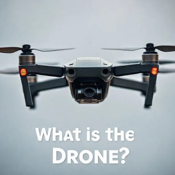
Recent drone sightings are concentrated primarily in the Northeastern United States, specifically across New Jersey and near sensitive military installations like Langley Air Force Base. Federal authorities including the FAA and FBI are currently investigating these recurring swarm patterns that often occur in clusters at night.
🎯 Key Takeaways
- Sightings are currently clustered in New Jersey and near East Coast military bases.
- Most reported drones appear in swarms or formations during nighttime hours.
- The FAA maintains a public database for official drone sighting reports.
- Authorities are monitoring proximity to critical infrastructure and restricted airspace.
- Public reports help officials track patterns but require verification by experts.
The recent surge in drone sightings is no longer limited to isolated reports by enthusiasts. Since late 2024 and continuing into 2025, a massive wave of unidentified aerial activity has centered on the Northeast United States, specifically targeting suburban New Jersey, Eastern Pennsylvania, and parts of New York. These are not small, off-the-shelf quadcopters; official reports and witness footage describe large, fixed-wing-style craft often flying in highly organized formations of five to fifteen units at a time.
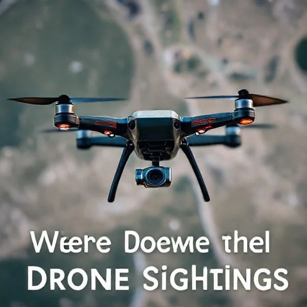
This matters to you because these sightings are occurring over densely populated residential areas and critical infrastructure, far outside the typical operating zones for hobbyist drones. Understanding the geographic hotspots and the specific patterns of these flights is essential for situational awareness. Whether you are a pilot concerned about airspace safety or a resident looking for answers, the data shows a deliberate and sustained presence in specific corridors that suggests professional, high-level coordination.
Prime for Young Adults — 6 Months Free
Exclusive Offer Amazon Prime for Young Adults, Students and 18–24s get six months of Prime free, then half price.
Start 6 Months Free As an Amazon Associate I earn from qualifying purchases.Geographic Hotspots: Mapping Recent Sightings in New Jersey and Beyond
Recommended Best Deal Products

The epicenter of current drone activity is the Tri-State area, with the focus shifting rapidly from rural landscapes to major suburban hubs. Unlike sporadic “UFO” reports of the past, the 2024-2025 sightings are characterized by their extreme density. Residents in specific New Jersey counties have reported seeing multiple lights in the sky every night for weeks on end, often moving in a “follow-the-leader” style across county lines.
The New Jersey “Swarm” Corridor
The highest concentration of documented reports has emerged from a cluster of counties in Northern and Central New Jersey. Local law enforcement agencies have received hundreds of calls, leading to the involvement of the FBI and state police. Key hotspots include:
- Morris County: This is currently “ground zero.” Towns like Morristown, Mendham, and Morris Township have seen the most consistent nightly activity.
- Somerset County: Significant sightings have been logged over Bedminster and Bernardsville, often involving drones larger than a standard car.
- Hunterdon and Warren Counties: Large, silent crafts have been spotted moving west toward the Pennsylvania border, frequently following the path of major highways like I-78.
- The Jersey Shore: Reports have recently spiked near Ocean and Monmouth counties, with craft seen hovering over the coastline before heading out to sea.
Beyond the Tri-State: Military Base Incursions
While New Jersey dominates the current news cycle, the pattern actually began with high-profile incursions at sensitive federal sites. In late 2023 and throughout 2024, Langley Air Force Base in Virginia reported nearly three weeks of consecutive drone swarms that bypassed standard detection systems. Similar activity has been documented near Edwards Air Force Base in California and Bucks County, Pennsylvania. These locations share a common thread: they are either near military installations or major water and power reservoirs, suggesting a strategic interest in critical infrastructure.
The Ultimate Drone Sighting Discovery Walkthrough
With the rapid proliferation of unmanned aerial vehicles (UAVs) for commercial, recreational, and governmental use, the skies are busier than ever. Whether you are a hobbyist looking to avoid restricted airspace, an investigator tracking unauthorized activity, or a curious citizen wondering about mysterious lights in the sky, finding where drone sightings are occurring requires a multi-faceted approach. This guide covers everything from digital tracking tools and crowdsourced databases to physical observation techniques, ensuring you have a clear picture of drone activity in your specific region.
Step 1: Access Crowdsourced Reporting Databases
What you need: A computer or smartphone with internet access and a list of reporting websites such as UAV Reports, the National UFO Reporting Center (NUFORC), or specialized local community forums.
Instructions: Start by visiting established crowdsourced databases. While some sightings are reported as “unidentified,” a significant percentage are actually commercial or hobbyist drones. Search these databases using keywords like “drone,” “quadcopter,” or “multi-rotor.” Filter your search by geographic location—specifically your city or county—and look for clusters of reports. Many of these sites allow you to view a map interface where users have pinned the exact coordinates of their sightings. Pay close attention to the descriptions; look for mentions of “strobe lights” or “hovering patterns,” which are characteristic of drone behavior compared to traditional aircraft.
Pro Tip: Don’t just look for “drone” sightings; many people report drones as UFOs/UAPs. Cross-referencing UFO databases with local drone flight patterns can often reveal hidden hotspots.
Prime for Young Adults — 6 Months Free
Exclusive Offer Amazon Prime for Young Adults, Students and 18–24s get six months of Prime free, then half price.
Start 6 Months Free As an Amazon Associate I earn from qualifying purchases.Step 2: Utilize Real-Time Flight Tracking Apps
What you need: Applications like FlightRadar24, ADS-B Exchange, or OpenSky Network installed on your mobile device or accessed via a web browser.
Instructions: Most commercial drones and larger UAVs are now required to broadcast their position via ADS-B or similar transponder technology. Open your tracking app and apply filters to show only “Unmanned” or “Light Aircraft.” Focus your search on altitudes below 400 feet, as this is the standard legal ceiling for most drone operations. Observe the flight paths over a period of several days to identify “launch points” or frequent patrol routes. If you see a drone icon on the map, you can often click it to see the owner (if registered commercially) or the specific model of the drone, such as a DJI Mavic or a Wing delivery drone.
Pro Tip: Use ADS-B Exchange specifically for drone tracking, as it does not filter out or censor aircraft data that other commercial apps might hide at the request of the owner.
Step 3: Monitor Remote ID Broadcasts Locally
What you need: A smartphone with a Remote ID (RID) scanning app (such as Drone Scanner or OpenDroneID) or a dedicated Bluetooth/Wi-Fi signal analyzer.
Instructions: As of recent FAA and international regulations, most modern drones are required to broadcast “Remote ID” signals, which act as a digital license plate. To find sightings in your immediate vicinity (within 1-3 miles), open a Remote ID scanning app while outdoors. These apps use your phone’s Wi-Fi and Bluetooth receivers to pick up signals being broadcast by drones in the air. The app will display the drone’s location, its altitude, its speed, and even the location of the pilot/ground station. This is the most accurate way to verify a sighting in real-time as it is happening right above you.
Pro Tip: If you aren’t seeing any signals but can see a drone, the pilot may be using an older model or have the Remote ID feature disabled, which is a common occurrence in rural areas.
Step 4: Scan Social Media Geo-Tags and Local Groups
What you need: Accounts on platforms like X (formerly Twitter), Facebook, and Nextdoor.
Prime for Young Adults — 6 Months Free
Exclusive Offer Amazon Prime for Young Adults, Students and 18–24s get six months of Prime free, then half price.
Start 6 Months Free As an Amazon Associate I earn from qualifying purchases.Instructions: People often take to social media the moment they see something unusual. Use the search functions on these platforms to look for terms like “drone over [Your City]” or “mystery lights tonight.” On Facebook, join local “Community Watch” or “Residents” groups, as these are the primary places where neighbors discuss unauthorized drone activity over their homes. On X, use the “Latest” tab to see real-time posts and check for photos or videos tagged with your current location. This qualitative data is essential for finding sightings that never make it into official databases or flight tracking software.
Pro Tip: Set up “Google Alerts” for the phrase “drone sighting” plus your city name to receive email notifications whenever a local news outlet or blog mentions new activity.
Step 5: Inspect FAA Part 107 Waiver Maps
What you need: Access to the FAA’s “B4UFLY” or “Visualize it” maps and the FAA UAS Data Exchange (LAANC) portal.
Instructions: To find where drones will be, rather than just where they have been, you should check for authorized flight areas. Look at the FAA’s Visualize it map to see where “Part 107” commercial operators have requested waivers to fly in restricted airspace or over people. Areas with frequent “Night Waiver” approvals are prime locations for drone sightings. Additionally, check for “Drone Zones” or areas near airports where LAANC (Low Altitude Authorization and Notification Capability) authorizations are frequently granted. By understanding where the legal “hot zones” are, you can predict where the majority of sightings will occur in your region.
Pro Tip: Commercial delivery drones (like those from Amazon or Alphabet’s Wing) have very specific, repeatable flight corridors. Identify these corridors to see drones daily at scheduled intervals.
Step 6: Deploy Software Defined Radio (SDR) Tools
What you need: An RTL-SDR USB dongle (approx. $30), a laptop, and software like SDR# (SDR Sharp) or Dump1090.
Instructions: For a more advanced technical approach, you can set up a home station to intercept drone telemetry and video transmission frequencies. Most consumer drones operate on 2.4 GHz or 5.8 GHz bands. Connect your SDR dongle to your laptop and scan the 2.4 GHz spectrum. You will see distinct “frequency hopping” patterns that indicate a drone’s control link or video feed. While you won’t be able to “see” the video without complex decryption, the presence of these signals is a 100% reliable indicator that a drone is operating within several kilometers of your location. This allows you to track “silent” or “dark” drones that aren’t using Remote ID.
Pro Tip: Look for a steady signal at 1090 MHz to pick up ADS-B transmissions from larger, professional-grade surveillance or military drones.
Step 7: Conduct Physical Nighttime Surveillance
What you need: High-powered binoculars (8×42 or better), a tripod, and a low-light or infrared camera if possible.
Instructions: Many drone sightings happen at night because drone anti-collision lights (required by law to be visible for 3 miles) are highly visible against a dark sky. Find a high vantage point with a clear view of the horizon. Set up your tripod and scan the sky slowly. Drones typically exhibit “rectilinear” movement—meaning they move in straight lines and make sharp, 90-degree turns that birds or planes cannot. Look for flashing red, green, or white strobes. If the light remains stationary for long periods but then moves rapidly, it is almost certainly a drone. Record the direction of travel and the time to cross-reference with flight apps later.
Pro Tip: Use a “Sky Quality Meter” or a light pollution map to find the darkest spots near you; drone lights are much easier to distinguish from stars in these areas.
Step 8: Cross-Reference with RC Club Airfields
What you need: A directory of AMA (Academy of Model Aeronautics) clubs and local hobbyist maps.
Instructions: A massive percentage of drone sightings occur near designated “FRIA” (FAA-Recognized Identification Areas). These are locations where hobbyists are allowed to fly drones without Remote ID equipment. Use the AMA website’s “Club Finder” tool to locate airfields and parks within a 20-mile radius of your search area. Visit these locations on weekends or clear afternoons. By documenting the activity at these sites, you can account for a large portion of local sightings and differentiate between “normal” hobbyist activity and “unusual” sightings in residential or restricted areas.
Pro Tip: Talk to the club members; they are the most knowledgeable people in the region regarding who is flying what, and they often know about “rogue” pilots in the area.
✅ Final Checklist
- Check local crowdsourced databases (NUFORC/UAV Reports) for historical clusters.
- Run a Remote ID scanner app to detect active digital “license plates” nearby.
- Monitor 2.4 GHz and 5.8 GHz radio frequencies for active control links.
- Verify the sighting against the FAA “Visualize it” map for authorized flight zones.
- Confirm that the movement pattern matches UAV capabilities (hovering, sharp turns).
Important Notes:
- Safety and Privacy: Always respect privacy laws; do not use tracking data to harass pilots or interfere with legal flight operations.
- Legal Warnings: Never attempt to “bring down” or interfere with a drone, even if it seems to be flying illegally, as this is a federal crime in many jurisdictions.
- Professional Help: If you suspect a drone is being used for illegal surveillance of your property, contact local law enforcement rather than confronting the operator.
- Estimated Cost: $0 (using free apps) to $150 (for basic SDR hardware and binoculars).
- Estimated Time: 1-2 hours for initial digital setup; ongoing observation as needed.
Patterns of Activity: Nighttime Formations and Proximity to Infrastructure
These sightings are not random or accidental. Data collected from local police departments, civilian flight trackers, and official FAA statements shows a distinct “modus operandi.” These drones do not behave like commercial delivery units or photography drones. Instead, they exhibit sophisticated coordination, long-range battery life, and a complete lack of concern for being detected by the public or authorities.
The 6:00 PM Window: Predictable Flight Schedules
One of the most startling aspects of the recent New Jersey sightings is their regularity. While you might expect clandestine drones to fly in total darkness, these groups often appear shortly after sunset. This timing ensures they are visible to the public while making it difficult for standard consumer cameras to capture clear details of the airframe. Key flight characteristics observed include:
- Active Hours: Most sightings occur in a window between 6:00 PM and 10:00 PM, though some continue until 2:00 AM.
- Altitude: They typically maintain a steady altitude between 500 and 1,000 feet—above the legal hobbyist limit but low enough to be unmistakable.
- Formation: Craft are frequently seen in groups of 3 to 9, moving in “V” or “diamond” formations at steady speeds of roughly 35 to 45 miles per hour.
- Navigation: Many witnesses report the drones using bright, pulsing white and red lights, which is counterintuitive for a “secret” operation.
Official Data and Authority Responses
The FAA (Federal Aviation Administration) and the FBI have officially acknowledged the sightings, though they have yet to identify the operators. In response to the New Jersey activity, the FAA has recently implemented temporary flight restrictions (TFRs) over certain areas to allow law enforcement helicopters to investigate without interference. Data from the Department of Defense indicates that these craft often evade standard radar because of their size and “low-and-slow” flight profiles. To date, no civilian or commercial entity has claimed responsibility for these flights, and the FAA has confirmed that no “Remote ID” signals—the digital license plates required for most drones—are being broadcast by these mystery swarms.
Official Data Sources: How the FAA and DoD Track Unidentified Drones
The FAA’s Quarterly Sighting Database
The Federal Aviation Administration (FAA) is the primary watchdog for domestic airspace, and they maintain a comprehensive public log known as the UAS Sighting Reports. This database is updated every few months and compiles thousands of accounts from commercial pilots, law enforcement officers, and citizens. For those wondering where the “hotspots” truly are, these spreadsheets offer a granular look at the coordinates, altitudes, and specific behaviors of drones that have entered restricted or sensitive areas. These reports are essential for distinguishing between a localized hobbyist trend and a broader security concern.
Military Monitoring and the Rise of Remote ID
On a more sophisticated level, the Department of Defense (DoD) utilizes advanced radar and electronic warfare sensors to monitor “unidentified aerial phenomena” near military installations. While much of this data remains classified, the civilian world is moving toward total transparency via Remote ID. Often described as a “digital license plate,” Remote ID allows both authorities and the general public to identify a drone’s takeoff point and serial number using simple smartphone applications. This technology is rapidly turning mysterious sightings into identifiable, logged events, making it much harder for “ghost drones” to operate unnoticed in urban centers.
- FAA UAS Data: Publicly accessible records showing the date, time, and city of reported drone encounters.
- Remote ID Broadcasts: Real-time identification protocols that help separate authorized flights from intruders.
- AARO Reports: Focused on high-security sightings that move beyond the capabilities of standard civilian hardware.
Identifying the Source: Distinguishing Between Civilian Craft and Unknown Intrusions
Visual Signatures and Lighting Patterns
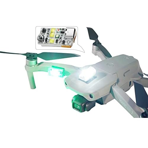
The vast majority of reported “UFOs” or unidentified drones are actually standard consumer models equipped with high-intensity LEDs. Most civilian drones, such as those used for photography, feature standardized lighting—typically blinking red or green lights on the front arms and solid lights on the rear. If you see a bright, flashing white light visible from several miles away, you are likely looking at a professional pilot using anti-collision strobe accessories. These are required by the FAA for any flight occurring during civil twilight or at night, and they are a dead giveaway that the operator is following legal safety protocols.
Flight Behavior and Acoustic Cues
You can often identify a drone’s source by how it moves and sounds. Consumer-grade multi-rotors have a distinctive high-pitched “buzz” caused by small, high-RPM propellers. These craft are generally limited by battery life to about 20-30 minutes of flight. In contrast, industrial or military fixed-wing drones fly much faster, often exceeding 60 mph, and have a deeper, more consistent engine hum. If a craft is hovering perfectly still in high winds, it is likely a high-end civilian model using GPS-stabilization and sophisticated internal sensors to maintain its position.
- Propeller Pitch: High-pitched buzzing usually indicates a small consumer drone; lower hums suggest larger, industrial platforms.
- Flight Path Geometry: Hobbyists tend to fly erratically, while commercial drones usually follow precise, automated “lawnmower” patterns for mapping.
- Endurance: If a drone stays in the air for over an hour, it is likely a specialized gas-powered or fixed-wing craft rather than a standard hobbyist quadcopter.
Conclusion
The mystery surrounding drone sightings is often a byproduct of the technology’s rapid growth outpacing our general familiarity with it. By leveraging official FAA data and understanding the visual and acoustic signatures of modern craft, we can begin to separate sensationalist rumors from everyday aerial activity. As Remote ID becomes the industry standard, the “unknown” element of our skies will continue to shrink, replaced by a transparent system of accountability and safety.
Next Steps: If you want to stay ahead of the curve, download a drone tracking app to see live flight data in your neighborhood, and check the latest FAA quarterly reports to see if your city is a rising hotspot. Always ensure your own craft is equipped with the latest safety strobes and Remote ID modules to stay visible and compliant. Let us know in the comments—have you spotted anything unusual in your local airspace lately?
❓ Frequently Asked Questions
Why is there a sudden surge in drone sightings in the Northeast?
While the exact cause is under investigation, the density of sightings in areas like New Jersey is attributed to increased public awareness and potential unauthorized operations near major airports and power grids. Federal agencies are currently analyzing flight patterns to determine if these are coordinated events.
Are the drones being reported dangerous to commercial aircraft?
The FAA investigates sightings primarily because drones in restricted airspace pose a collision risk to manned aircraft. Pilots often report these drones at altitudes where they could interfere with approach or departure paths of commercial flights, leading to temporary ground stops.
Is there a map showing where all drone sightings occur?
While there isn’t one real-time official map, the FAA’s UAS sighting data and crowdsourced sites like DroneSec or news-driven trackers provide geographic visualizations of report clusters. These maps frequently highlight hotspots near military bases and urban centers.
What are authorities doing about the unidentified drone swarms?
The FBI, FAA, and local law enforcement have formed task forces to track the origin of these drones, though they face challenges due to the drones’ ability to disappear before being intercepted. Some military bases have recently increased their counter-UAS (Unmanned Aircraft Systems) surveillance and jamming capabilities.
How do I tell if a drone sighting is official or just a hobbyist?
Official reports usually come from pilots or law enforcement and are logged in the FAA database. Hobbyist flights are generally restricted to under 400 feet and are not permitted near sensitive infrastructure or at night without specific anti-collision lighting.
Can civilian drone accessories help in identifying these sightings?
High-quality optics and thermal imaging accessories can assist in documenting sightings from a distance for evidence. However, it is illegal and dangerous for civilians to attempt to chase or interfere with unidentified drones in restricted airspace.