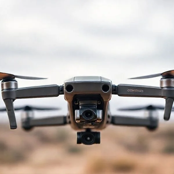
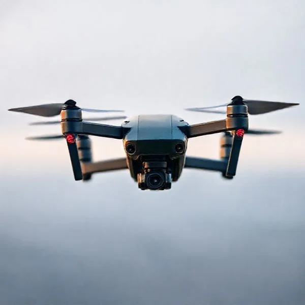
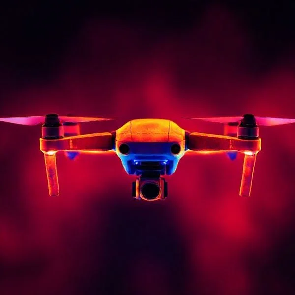
To track a drone effectively, you must utilize built-in flight logs and GPS coordinates provided by your flight app immediately after a signal loss. Combining integrated software features with dedicated hardware trackers provides the most reliable multilayered security net for recovery.
🎯 Key Takeaways
- Access flight logs immediately via your controller app for the last known coordinates.
- Take screenshots of telemetry data before the signal drops completely during flight.
- Use dedicated GPS trackers like Tracki for independent, long-range location updates.
- Enable ‘Find My Drone’ features before takeoff to facilitate audio-visual alerts.
- Remote ID broadcasts real-time identification data which can assist in legal recovery.
To track a lost drone or monitor its real-time position, you must first access the “Find My Drone” feature within your flight control app or analyze the last recorded GPS coordinates in your telemetry logs. These tools provide a digital breadcrumb trail that leads directly to the drone’s final latitude and longitude. Whether you are dealing with a mid-air signal loss or a total power failure, these digital records are your primary recovery asset.
Recommended Best Deal Products


Every second is critical following a flyaway or an unexpected crash. Knowing how to extract real-time data or utilize external tracking hardware ensures you do not lose a significant investment to a remote field or dense forest canopy. This guide focuses on the technical steps required to utilize integrated software and external hardware to pinpoint your aircraft’s exact location.
Built-in Software Solutions and Integrated Flight Telemetry
Modern consumer drones from manufacturers like DJI, Autel, and Parrot automatically record detailed flight telemetry. This data is synced in real-time between the aircraft and your mobile device or smart controller. Even if the drone loses power, the last transmitted packet of data contains the precise coordinates of its location at the moment of impact or signal disconnection.
Utilizing “Find My Drone” and Live Map Overlays
Most flight apps, such as DJI Fly or DJI Go 4, include a dedicated recovery interface. To access this, navigate to your profile or settings menu and select “Find My Drone.” This interface overlays the drone’s last known position onto a Google Maps or Apple Maps framework, allowing you to see your own position relative to the aircraft.
- Coordinate Accuracy: The app displays the exact latitude and longitude. Copy these into a dedicated GPS app if you need offline topographic maps.
- Visual and Audible Alerts: If the drone still has battery power and a connection, you can tap the “Start Beeping and Flashing” button. The Electronic Speed Controllers (ESCs) will emit a high-pitched pulse to help you find the drone in tall grass.
- Directional Arrow: The app provides a compass-driven arrow that points toward the drone, compensating for your movement as you walk.
Analyzing Local Flight Logs for Manual Recovery
If your flight app crashes or the map fails to load, you can manually retrieve the data from the flight logs stored on your device’s internal memory. These logs are often saved as .DAT or .TXT files and can be uploaded to third-party analysis platforms for a more granular look at the flight path.
- Third-Party Tools: Upload your log files to AirData UAV or DroneLogbook. These platforms provide a second-by-second replay, showing you the exact wind speed, battery voltage, and GPS health leading up to the crash.
- Final Telemetry Ping: Look for the “Last Record” timestamp. This provides the most accurate ground-zero location before the signal was lost.
- Cache Maps: Always ensure your maps are cached for offline use before flying. If you lose signal in a dead zone, the map overlay may not load, leaving you with coordinates but no visual context.
Master Drone Tracking in 8 Simple Steps
Tracking a drone is a vital skill for pilots, whether you are trying to recover a lost craft after a signal drop, monitoring your flight path for regulatory compliance, or identifying drones flying in your immediate airspace. This guide provides a comprehensive walkthrough on the technical and physical methods used to maintain a lock on a drone’s position. Following these steps ensures that you maximize the safety of your equipment and adhere to modern aviation standards, such as Remote ID requirements, while providing a clear roadmap for recovery in the event of a flyaway.
Step 1: Calibrate GPS and Establish a Home Point
What you need: A GPS-enabled drone, a compatible flight controller, and an open outdoor area with a clear view of the sky.
Instructions: Before the propellers even spin, you must ensure your drone has a solid GPS lock. Power on your drone and wait for the flight software to “acquire satellites.” You should aim for a minimum of 10 to 12 satellites for a reliable positional lock. Once the satellites are acquired, the flight app will typically announce that the “Home Point has been updated.” This coordinate is the foundation of all tracking; it is the zero-point the drone uses to calculate its relative position. Ensure your Return to Home (RTH) altitude is set higher than the tallest obstacle in the area (usually 60-100 meters) to ensure that if tracking becomes necessary during a failsafe, the drone can navigate back without collision.
Pro Tip: Never take off in “ATTI” mode (non-GPS mode) if you intend to track the drone accurately, as the aircraft will drift with the wind without recorded coordinates.
Step 2: Utilize Integrated Manufacturer “Find My Drone” Tools
What you need: A smartphone or tablet with the manufacturer’s app (e.g., DJI Fly, Autel Explorer, or Parrot FreeFlight).
Instructions: Most modern consumer drones have a built-in “Find My Drone” feature. If you lose visual line of sight or the drone goes down, do not close the app. Navigate to the settings or profile menu and select the tracking tool. This interface will display a map showing the drone’s last known GPS coordinates and its current position relative to your controller. Many apps also allow you to trigger the drone’s internal LED lights to flash and its motors to emit a high-pitched beeping sound. This is incredibly effective if the drone is stuck in a tree or hidden in tall grass where it is not visible to the naked eye. Follow the blue line on the map, which represents your path toward the drone’s location.
Pro Tip: Take a screenshot of the coordinates immediately upon losing signal, as some apps may refresh or clear data if the battery dies or the app crashes.
Step 3: Enable and Monitor Remote ID Broadcasts
What you need: A Remote ID-compliant drone (standard in the US as of 2024) and a Remote ID receiver app like DroneScanner or OpenSky.
Instructions: Under modern FAA and international regulations, drones are required to broadcast their identification and location via “Remote ID.” This works like a digital license plate. Even if your main flight app loses connection, the drone continues to broadcast its position via Bluetooth or Wi-Fi signals. By using a secondary device with a Remote ID scanning app, you can track the drone’s live telemetry, including its altitude, speed, and exact latitude/longitude. This is also the primary method for tracking drones that do not belong to you. Simply open the scanning app, and any compliant drone within a roughly 1-mile radius will appear as a selectable icon on your screen, providing real-time movement data.
Pro Tip: Use a high-gain Bluetooth antenna on your smartphone or a dedicated receiver to extend the range of Remote ID tracking in rural or congested environments.
Step 4: Install and Sync Secondary GPS Trackers
What you need: A lightweight independent GPS tracker (e.g., Trackimo, Flytrex, or an Apple AirTag) and industrial-strength mounting tape.
Instructions: For professional or long-range flights, relying solely on the drone’s internal systems is a risk. Affix an independent GPS tracker to the drone’s chassis, ensuring it does not block the internal GPS module or interfere with the propellers. These devices have their own SIM cards or use “Find My” networks to report location independently of the drone’s battery. If the drone’s main power fails or the flight battery is ejected during a crash, the secondary tracker remains active. Before flight, open the tracker’s dedicated app and verify that the signal is “Live.” Check the update interval; for drone tracking, you want the device to report its position every 10 to 30 seconds to provide a granular path for recovery.
Pro Tip: Always weigh your drone after adding a tracker to ensure you haven’t exceeded the 250g weight limit if you are flying under Category 1/Subpart A regulations.
Step 5: Analyze Real-Time Flight Telemetry Data
What you need: A flight controller display or an OSD (On-Screen Display) for FPV goggles.
Instructions: While the drone is in the air, tracking is done by monitoring the telemetry stream. Pay close attention to the “Distance” (D) and “Height” (H) indicators on your screen. In FPV (First Person View) racing or freestyle, this is often displayed as an arrow pointing back to the takeoff point (the “Home Arrow”). If you lose video feed, the last numbers shown on your telemetry are your best clues. If the distance was 500 meters and the bearing was 180 degrees, you have a specific vector to search. Advanced pilots use “Crossfire” or “ELRS” radio links that provide telemetry directly to the handheld radio transmitter, allowing you to see coordinates even if your video goggles go black.
Pro Tip: Practice reading your OSD coordinates aloud or recording your flight screen so you have a video record of the telemetry leading up to a signal loss.
Step 6: Leverage Cloud-Based Flight Logging Services
What you need: An account with a service like AirData UAV or DroneLogbook and an internet connection.
Instructions: Sync your flight controller with a cloud-based logging service. These platforms automatically upload your flight data (including battery health, GPS coordinates, and signal strength) the moment your tablet or phone connects to the internet. If a drone is lost, you can log into these services from a desktop computer to see a high-resolution “play-by-play” of the flight. This is superior to basic manufacturer apps because it provides detailed environmental data, such as wind speed at specific altitudes, which can help you calculate where a drone might have drifted during a forced landing or a “flyaway” event. You can export these logs as KML files to view the path in Google Earth for a 3D perspective of the tracking area.
Pro Tip: Enable “Auto-Sync” in your flight app settings to ensure data is uploaded instantly before you have a chance to forget or lose the mobile device.
Step 7: Deploy Radio Direction Finding (RDF) Techniques
What you need: A directional antenna (patch or helical) and a signal strength meter (often built into the RC transmitter).
Instructions: If the drone is down but still powered on, it is still emitting a radio frequency (RF) signal (usually at 2.4GHz or 5.8GHz). You can track it using “triangulation.” Hold your controller and point the antenna in a circle. Observe the RSSI (Received Signal Strength Indicator) or the “DBm” value on your screen. The signal will be strongest when the antenna is pointed directly at the drone. Move in the direction of the strongest signal. As the DBm value gets closer to zero (e.g., moving from -90dBm to -30dBm), you are getting closer to the craft. This “hot or cold” method is the most reliable way to find a drone in dense forest or urban “canyons” where GPS signals might bounce or be inaccurate.
Pro Tip: If the signal is too strong to determine direction, remove the antenna from your controller to intentionally reduce sensitivity, forcing you to be very close to the drone to get a reading.
Step 8: Perform a Coordinated Physical Search Grid
What you need: A handheld GPS unit or smartphone with Google Maps, high-visibility vest, and a search partner.
Instructions: Once you have narrowed down the coordinates from your digital tracking tools, you must transition to a physical search. Input the last known coordinates into a handheld GPS or Google Maps. Do not walk in a straight line to the point; instead, use a “Grid Search” pattern. Start at the coordinates and walk 10 meters north, then 20 meters south, expanding your radius. Drones often deflect off trees or skip across the ground upon impact, so the final resting place may be 15-30 meters away from the last broadcast coordinate. Have a partner stay at a higher vantage point to guide you via walkie-talkie, as they may see the drone’s reflection or colors from a distance that you cannot see from the ground.
Pro Tip: Search during the “Golden Hour” (shortly before sunset). The low angle of the sun often reflects off the drone’s camera glass or plastic body, making it pop out against the background.
✅ Final Checklist
- Confirm GPS lock (10+ satellites) and Home Point update before takeoff.
- Verify that Remote ID is broadcasting and visible on a secondary scanning app.
- Ensure flight logs are set to “Auto-Sync” with a cloud service like AirData.
- Test the “Find My Drone” audible alarm and LED flash triggers.
- Record or screenshot the last known coordinates immediately if the link is severed.
Important Notes:
- Safety First: Never attempt to recover a drone from high-voltage power lines, active roadways, or dangerous terrain without professional assistance.
- Legal Compliance: Tracking a drone that does not belong to you must be done for safety or identification purposes only; avoid infringing on privacy or trespassing on private property during recovery.
- Professional Help: If a drone is lost in a sensitive area (like an airport or government facility), contact the facility manager or local authorities rather than attempting to track and retrieve it yourself.
- Estimated Cost: Software tracking is usually free; hardware GPS trackers range from $30 to $200 plus potential monthly subscription fees for LTE service.
Comparing Dedicated GPS Trackers vs. Bluetooth Recovery Tags
Integrated software is only effective if the drone maintains a signal or the battery remains connected. In high-impact crashes, the battery often ejects, rendering the internal GPS useless. This is where dedicated hardware trackers become essential. These accessories operate on independent power sources and communication networks.
Dedicated GPS Trackers for Long-Range Recovery
Hardware like the Trackimo or 4G LTE trackers are the gold standard for professional pilots. These devices contain their own GPS module and a SIM card, allowing them to broadcast their location over cellular networks independently of the drone’s systems.
- Independent Power: These trackers feature internal batteries that typically last between 48 and 72 hours, giving you days to locate the drone.
- Unlimited Range: As long as there is cellular service, you can track the drone from miles away via a mobile app or SMS ping.
- Real-Time Updates: You can set “Geofences” that alert your phone the moment the drone leaves a specific radius, which is useful for monitoring automated flight missions.
Bluetooth Tags and Ultra-Wideband (UWB) Locators
Devices like the Apple AirTag or Tile Pro are popular due to their low weight (approx. 11g) and ease of use. However, they are “last-mile” tools rather than long-range solutions. They are most effective for finding a drone hidden in thick brush once you have used GPS to reach the general vicinity.
- Proximity Limitations: Standard Bluetooth trackers have a range of 30 to 200 feet. They are ineffective for tracking a drone that has drifted miles away in a rural area.
- UWB Precision Finding: If you use an AirTag with a compatible iPhone, the “Precision Finding” feature uses Ultra-Wideband technology to give you an on-screen arrow and distance meter, accurate to within inches.
- Crowd-Sourced Network: These tags rely on the “Find My” network of other passing smartphones. In remote areas where no people are present, the tag will not update its position.
Radio Frequency (RF) Trackers for Remote Areas
For pilots flying in wilderness areas without cellular coverage, Marco Polo RF trackers are the preferred tool. These do not require GPS or cellular signals. Instead, they use a handheld locator that “pings” a tag on the drone via radio waves.
- No Subscription Required: Unlike cellular trackers, RF trackers don’t require monthly fees.
- Signal Penetration: RF signals can penetrate thick foliage and terrain better than high-frequency Bluetooth signals.
- Directional Tracking: The handheld unit acts as a digital bloodhound, showing you the signal strength as you turn in different directions.
The Role of Remote ID in Modern Drone Tracking
The drone landscape is shifting rapidly, and Remote ID is at the forefront of this evolution. Often described as a “digital license plate,” Remote ID is a system that allows a drone in flight to provide identification and location information to other parties. While its primary purpose is safety and security within the national airspace, it has become an invaluable secondary tool for pilots trying to locate a downed craft.
Understanding Remote ID Technology
Most modern drones now come equipped with internal Remote ID capabilities, while older models can be retrofitted with dedicated broadcast modules. This technology broadcasts signals—usually via Bluetooth or Wi-Fi—that include the drone’s current position, altitude, and its point of origin. This constant data stream ensures that even if you lose your telemetry link on your controller, the drone is still announcing its presence to anyone with a compatible receiver or smartphone app nearby.
- Broadcasting Range: Remote ID signals typically have a range of several hundred yards, depending on environmental interference and the specific broadcast method used.
- Accessibility: Public safety officials and other pilots can use specialized apps to see your drone’s path in real-time, which is crucial in high-traffic areas.
- Legal Compliance: In many regions, including the United States, Remote ID is now a legal requirement for most drone operations, making it a standard part of your tracking toolkit.
How Remote ID Aids Recovery
If your drone experiences a localized failure or a “flyaway,” Remote ID acts as a beacon. Unlike traditional GPS trackers that might require a cellular subscription, Remote ID broadcasts locally. This means that if your drone lands in a thicket or behind a building, you can use a smartphone equipped with a Remote ID scanner app to home in on the signal. It bridges the gap between the last known coordinates on your controller and the actual physical location of the drone on the ground.
Pre-Flight Preventative Measures for Enhanced Drone Security
The best way to “track” a drone is to ensure you have multiple layers of security active before the propellers even start spinning. Many pilots overlook the software settings and physical preparations that make recovery much easier. By treating every flight as if a signal loss could happen, you significantly increase the chances of bringing your expensive gear back home safely.
Optimizing Return-to-Home (RTH) Settings
Every professional-grade drone features a Return-to-Home (RTH) function, but its effectiveness depends entirely on your pre-flight configuration. If your RTH altitude is set too low, the drone might hit a tree on its way back; if it’s too high, it might struggle against strong upper-level winds. Setting these parameters based on your specific environment is the most effective preventative measure you can take.
- Home Point Updates: Always ensure the drone has a strong GPS lock and has recorded a “Home Point” before taking off.
- Failsafe Behavior: Configure what the drone should do upon signal loss—whether to hover, land immediately, or initiate an automated RTH sequence.
- Altitude Awareness: Adjust your RTH altitude to be at least 20-30 feet higher than the tallest obstacle in your flight area, such as power lines or buildings.
Physical Identification and Visibility
Sometimes, high-tech tools fail, and you have to rely on “old-school” methods. Physical identification is a low-cost, high-reward strategy. If a bystander finds your drone before you do, having your contact information clearly visible can be the difference between a permanent loss and a quick recovery. Additionally, enhancing the drone’s visibility helps you maintain visual line of sight, preventing it from getting lost in the first place.
- FAA Registration Labels: Ensure your registration number is clearly marked on the exterior of the drone as required by law.
- Contact Stickers: Use a small, weather-resistant label with your phone number and “Reward if Found” to encourage return by a Good Samaritan.
- High-Visibility Skin: Applying a bright orange or neon yellow wrap can make a drone much easier to spot against green foliage or grey pavement from a distance.
Conclusion
Tracking a lost drone doesn’t have to be a nightmare if you are equipped with the right tools and knowledge. From leveraging dedicated GPS trackers to understanding the nuances of Remote ID, the technology available today offers a robust safety net for every pilot. Remember that successful recovery starts long before you lose signal; it begins with proper pre-flight settings and a proactive approach to drone security.
As a next step, take five minutes during your next flight session to double-check your Return-to-Home altitude and ensure your contact information is firmly attached to the airframe. Investing in a dedicated GPS tracker is also a wise move for anyone flying expensive cinema or enterprise gear. Stay prepared, fly responsibly, and enjoy the peace of mind that comes with knowing you can always find your way back.
❓ Frequently Asked Questions
How do I find my drone if it loses signal and crashes?
Check the ‘Flight Logs’ on your controller or smartphone app to find the exact GPS coordinates recorded right before the signal was lost. You can then input these coordinates into Google Maps to navigate directly to the search area.
What are the best third-party GPS trackers for drones?
Tracki and Flytrex are top choices because they utilize cellular networks and have their own power supplies. These devices provide continuous location updates even if the drone’s main battery is disconnected or dead.
Is Remote ID useful for finding a lost drone?
Yes, Remote ID acts as a digital broadcast that can be picked up by specialized smartphone apps. It provides a secondary way to pinpoint a drone’s location even if your primary flight app fails to record the crash point.
Why should I use an external tracker if my drone has GPS?
The drone’s internal GPS system relies on the main battery; if the battery is destroyed or ejected in a crash, tracking stops instantly. An external tracker operates independently, ensuring you can still find the aircraft.
Can I use a Tile tracker for my drone?
Tile is a Bluetooth-based tracker best suited for short-range recovery, usually within 200-400 feet. It is very helpful for finding a drone hidden in thick grass or trees once you have reached the general vicinity.
How do flight logs help in drone recovery?
Flight logs record telemetry data, including altitude, heading, and GPS position, every second of the flight. By reviewing the very last entry in the log, you can narrow down the search radius to just a few meters.