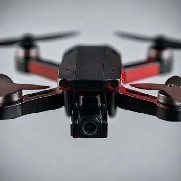
DroneDeploy is a leading cloud-based software platform that automates drone flight and converts aerial imagery into actionable data like high-resolution 2D maps and 3D models. It is designed to provide professionals with real-time site insights across industries like construction, agriculture, and energy.
🎯 Key Takeaways
- Takeaway 1:DroneDeploy automates flight planning and data capture for professional accuracy.
- Takeaway 2:It converts aerial photos into high-resolution 2D maps and 3D models.
- Takeaway 3:Cloud-based processing allows for seamless collaboration across remote teams.
- Takeaway 4:Industry-specific tools provide ROI through volume measurements and crop health analysis.
- Takeaway 5:It integrates with existing software like Autodesk and Procore for efficient workflows.
DroneDeploy is the industry-standard cloud platform that transforms commercial drones from simple flying cameras into powerful data collection tools. At its core, it is a comprehensive software ecosystem designed to capture, process, and analyze aerial imagery. For professionals across various sectors, it provides a centralized hub to manage drone operations and turn raw photos into high-resolution 2D maps, 3D models, and actionable reports. It essentially acts as the bridge between hardware and the business intelligence you need to make informed decisions.

The practical value of this platform lies in its ability to digitize physical job sites with extreme precision. Instead of relying on manual ground measurements or expensive, time-consuming manned aircraft surveys, you can deploy a drone to gather site-specific data in a fraction of the time. This allows project managers, engineers, and surveyors to track progress, identify hazards, and communicate with stakeholders using a single “source of truth” accessible from any web browser or mobile device. In short, DroneDeploy solves the problem of site visibility by making accurate data accessible to everyone on a team.
Prime for Young Adults — 6 Months Free
Exclusive Offer Amazon Prime for Young Adults, Students and 18–24s get six months of Prime free, then half price.
Start 6 Months Free As an Amazon Associate I earn from qualifying purchases.Understanding the DroneDeploy Ecosystem and Core Functions
Recommended Best Deal Products


The primary function of DroneDeploy is to convert massive sets of overlapping aerial photographs into georeferenced digital assets. This process, known as photogrammetry, allows the software to calculate distances and elevations for every pixel in a map. By offloading the heavy computational lifting to the cloud, DroneDeploy enables users to generate complex outputs without needing specialized high-end computer hardware on-site.
From Visuals to Verifiable Data
The software does not just produce a flat image; it creates a “digital twin” of a site. When you upload photos from a flight, DroneDeploy processes them into several distinct layers that serve different professional needs. These outputs are highly accurate and can be integrated directly into existing workflows like CAD or BIM software. The core outputs include:
- Orthomosaic Maps: High-resolution, corrected maps that allow for accurate horizontal measurements of distance and area.
- Digital Elevation Models (DEMs): Visual representations of the site’s topography, essential for drainage analysis and grading.
- 3D Point Clouds: Dense sets of data points used for detailed 3D modeling and architectural planning.
- Plant Health Layers: Specialized maps for agriculture that use NDVI algorithms to highlight crop stress before it is visible to the naked eye.
Industry-Specific Problem Solving
DroneDeploy is designed to solve specific bottlenecks in heavy industries. In construction, it eliminates the “information gap” between the office and the field by providing daily or weekly site updates. For the energy sector, it automates the inspection of solar panels or wind turbines, identifying thermal anomalies or structural defects safely from the ground. In every case, the goal is to replace manual, high-risk tasks with automated, data-driven workflows that save both time and capital.
Key Features: From Automated Flight to 3D Modeling
What sets DroneDeploy apart is its end-to-end workflow. It manages the entire lifecycle of a drone mission, beginning before the drone even leaves the ground. The platform is built to be “hardware agnostic,” meaning it works seamlessly with most professional drone systems, particularly those from DJI and Skydio. This flexibility ensures that businesses can scale their drone programs without being locked into a single type of aircraft.
Precision Automated Flight Planning
One of the most critical professional features is the DroneDeploy flight app. You do not need to be an expert pilot to capture survey-grade data. You simply outline the area you want to map on a mobile device, and the software automatically calculates the optimal flight path, altitude, and photo overlap needed for high-quality reconstruction. This automation ensures consistency across multiple flights, which is vital for comparing site changes over time. Key flight features include:
- Terrain Follow: Automatically adjusts the drone’s altitude based on the ground’s elevation to maintain consistent data resolution.
- Live Map: Generates a low-resolution map on your screen in real-time as the drone flies, ensuring you have the coverage you need before leaving the site.
- Pre-flight Checklists: Ensures all safety and hardware requirements are met before the mission begins, reducing the risk of equipment failure.
The Power of Cloud-Based Processing and 3D Modeling
Once the flight is complete, the data is uploaded to DroneDeploy’s cloud servers. This is where the secondary focus of the platform shines: collaborative analysis. Because the processing happens in the cloud, you can share a 3D model with a client or colleague via a simple link. They can then rotate the model, zoom in on specific details, and even perform volumetric measurements of stockpiles directly within their browser. This democratization of data means that a superintendent on-site and an executive in a different city can look at the same 3D model simultaneously to discuss project hurdles.
Collaborative Tools and Integration
DroneDeploy acts as a central repository for all site data. Users can drop “issue pins” on specific locations on a map to highlight safety hazards or areas requiring rework. These pins can include photos and comments, creating a visual audit trail. Furthermore, the platform integrates with industry-standard tools like Procore, Autodesk BIM 360, and Bluebeam. This means your drone data doesn’t live in a silo; it flows directly into the project management software your team already uses every day.
Prime for Young Adults — 6 Months Free
Exclusive Offer Amazon Prime for Young Adults, Students and 18–24s get six months of Prime free, then half price.
Start 6 Months Free As an Amazon Associate I earn from qualifying purchases.Industry Applications: Solving Problems in Construction and Agriculture
Recommended Best Deal Products


While DroneDeploy is a versatile tool for any aerial data enthusiast, its true power shines in specialized industries. By turning raw images into actionable intelligence, it bridges the gap between seeing a problem and solving it. Here is how professional sectors are utilizing the platform to save time and reduce overhead costs.
Streamlining the Construction Lifecycle
In the construction world, information is the most valuable currency. Project managers use DroneDeploy to maintain a “digital twin” of their job sites. This allows teams to track progress without physically walking the entire site every day. Instead of relying on manual surveys, which can take days, a single drone flight provides an updated map in hours.
- Stockpile Volumetrics: Instantly calculate the volume of soil, gravel, or debris piles to manage inventory and logistics.
- BIM Comparison: Overlay architectural blueprints (BIM) onto real-time drone maps to catch alignment errors before they become expensive mistakes.
- Site Safety: Identify potential hazards like unstable slopes or equipment bottlenecks from a safe, overhead perspective.
Precision Insights for Modern Agriculture
For farmers and agronomists, DroneDeploy acts as a high-tech scout. It provides a “macro” view of crop health that is impossible to get from the ground. By using specialized sensors, the software helps identify stressed areas before the damage becomes visible to the naked eye.
- Plant Health Mapping (NDVI): Use specialized filters to visualize chlorophyll levels, allowing for targeted fertilizer or pesticide application.
- Stand Count: Automate the tedious process of counting emerging plants to evaluate germination rates and yield potential.
- Irrigation Management: Quickly spot broken pipes, leaks, or drainage issues by identifying unusual moisture patterns in the soil.
Factors to Consider: Pricing, Compatibility, and Alternatives
Before integrating DroneDeploy into your workflow, it is essential to understand the logistical side of the platform. It is a premium service designed for professional results, meaning there are specific hardware requirements and costs to keep in mind.
Understanding the Cost of Entry
DroneDeploy operates on a Software as a Service (SaaS) model. While they offer a basic trial, the professional features required for high-accuracy mapping require a paid subscription. These plans are generally divided into tiers: Individual, Advanced, and Enterprise.
- Individual Plans: Great for freelancers, offering standard mapping and basic measurements.
- Advanced/Enterprise Plans: Necessary for teams needing high-accuracy RTK data, thermal imaging, and advanced API integrations.
- Tip: Always look for annual billing options, as they typically offer a significant discount over month-to-month payments.
Hardware Compatibility and Competitors
DroneDeploy is heavily optimized for the DJI ecosystem. If you fly a Mavic, Phantom, or Matrice series drone, the integration is almost seamless. However, if you use hardware from other manufacturers like Autel or Skydio, you must verify compatibility before committing, as some features may be limited.
It is also worth noting the competition. While DroneDeploy is the leader in cloud-based ease of use, you might consider alternatives depending on your needs:
Prime for Young Adults — 6 Months Free
Exclusive Offer Amazon Prime for Young Adults, Students and 18–24s get six months of Prime free, then half price.
Start 6 Months Free As an Amazon Associate I earn from qualifying purchases.- Pix4D: Often preferred for high-end photogrammetry where offline, local processing is required.
- Propeller: Highly specialized for heavy civil engineering and quarry operations.
- Esri Site Scan: A top choice for organizations already deeply embedded in the ArcGIS ecosystem.
Conclusion
Recommended Best Deal Products


DroneDeploy has fundamentally changed how we interact with aerial data. By moving the complex processing of photogrammetry to the cloud, it has made professional-grade mapping accessible to everyone from independent contractors to global construction firms. Whether you are measuring the volume of a mulch pile or monitoring a thousand-acre cornfield, the platform provides the clarity needed to make smarter, faster decisions.
If you are ready to take your drone operations to the next level, your next steps are simple. First, verify that your current drone hardware is compatible with the DroneDeploy mobile app. Second, sign up for a 14-day trial to test the interface with a small project. Embracing this technology doesn’t just give you a better view—it gives you a competitive edge in an increasingly digital world. Happy flying!
❓ Frequently Asked Questions
What is the primary purpose of DroneDeploy for business?
DroneDeploy is designed to streamline the capture and analysis of aerial data to improve commercial decision-making. It eliminates manual mapping processes by automating flight and utilizing cloud photogrammetry to create digital twins of physical sites.
How does DroneDeploy benefit the construction industry?
It allows project managers to track progress, verify work against CAD designs, and perform safety inspections remotely. This reduces the need for manual surveying and helps identify costly errors before they become permanent.
What kind of maps can DroneDeploy generate?
The software generates orthomosaic maps, digital elevation models (DEM), 3D point clouds, and plant health maps. These outputs provide a comprehensive view of a site’s geography and structural status for detailed analysis.
Is DroneDeploy suitable for precision agriculture?
Yes, farmers use it to monitor crop health through NDVI mapping and to identify drainage issues or pest infestations. This data-driven approach helps optimize chemical application and increase overall yield through targeted interventions.
Can multiple team members collaborate on the platform?
DroneDeploy features robust collaboration tools that allow users to share maps, add annotations, and generate reports for stakeholders. This ensures everyone on the team has access to the most recent and accurate site data.
What are the main alternatives to DroneDeploy?
While DroneDeploy is a market leader, other professional alternatives include Pix4D, Propeller, and Esri’s Site Scan. Each offers different strengths in specialized mapping, though DroneDeploy is often preferred for its user-friendly interface.