Drone technology encompasses the integrated systems of hardware and software that allow Unmanned Aerial Vehicles (UAVs) to fly without a human pilot on board. This includes sophisticated flight controllers, GPS navigation, and specialized sensors like LiDAR and thermal imaging. Understanding these components is essential for maximizing industrial efficiency and data collection in modern applications.
🎯 Key Takeaways
- Drones are part of a larger Unmanned Aircraft System (UAS) including controllers and data links.
- Flight controllers act as the ‘brain,’ processing sensor data to maintain stability and orientation.
- Advanced sensors like IMUs and barometers enable precise hovering and obstacle avoidance.
- Industrial drone tech utilizes multispectral and thermal sensors for specialized data gathering.
- Remote communication happens via radio frequency or satellite links between the GCS and aircraft.
Drone technology, or Unmanned Aerial Vehicle (UAV) systems, is a sophisticated integration of aerodynamics, robotics, and high-speed telecommunications. At its most fundamental level, a drone is a pilotless aircraft that relies on a combination of onboard processors, sensors, and remote data links to maintain flight and execute complex tasks. Instead of a human cockpit, these systems use a Ground Control Station (GCS) and automated software to navigate environments that are often inaccessible or dangerous for traditional aircraft.
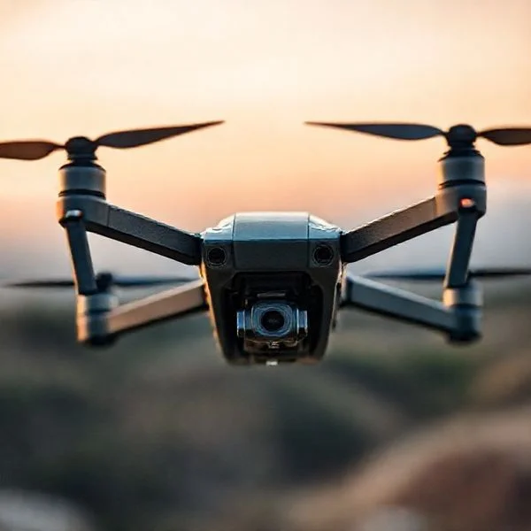
Understanding the technical architecture of a UAV is essential for anyone looking to leverage these tools for professional applications. Whether you are conducting industrial inspections, precision mapping, or high-end cinematography, the performance of your mission depends on the synergy between the hardware and the software protocols. By mastering the internal mechanics of drone technology, you can better manage system redundancies, optimize data payload delivery, and ensure operational safety in diverse environments.
Prime for Young Adults — 6 Months Free
Exclusive Offer Amazon Prime for Young Adults, Students and 18–24s get six months of Prime free, then half price.
Start 6 Months Free As an Amazon Associate I earn from qualifying purchases.Anatomy of a UAV: Core Components and Internal Systems
Recommended Best Deal Products


Every professional UAV is a sum of critical sub-systems that must communicate in near real-time. The aircraft is not merely a frame with motors; it is a flying computer designed to process thousands of data points per second. The physical structure, or airframe, is usually composed of lightweight composites like carbon fiber to maximize the power-to-weight ratio, allowing for larger batteries and specialized sensors.
The Communication Link and GCS
The “nervous system” of the drone is the communication link between the aircraft and the Ground Control Station (GCS). This link typically operates on radio frequencies (often 2.4GHz or 5.8GHz), but advanced industrial units may use LTE or satellite links for beyond-visual-line-of-sight (BVLOS) operations. This connection handles two primary streams of data:
- Uplink: The commands you send from the GCS to the drone, such as manual directional inputs or updated waypoint coordinates.
- Downlink (Telemetry): Real-time data sent from the drone back to your interface, including battery voltage, GPS coordinates, altitude, and live video feeds.
Most modern systems utilize Mavlink or similar protocols to ensure these data packets are small, fast, and resilient against interference. If the link is severed, high-end drones are programmed with “failsafe” protocols, using saved GPS data to return to the launch point automatically.
Specialized Sensor Arrays
While the flight system keeps the drone in the air, the sensor payload defines its utility. Drone technology has evolved far beyond simple RGB cameras. Professional UAVs now integrate a variety of “exotic” sensors to perceive the world in three dimensions and different spectrums:
- LIDAR (Light Detection and Ranging): Uses laser pulses to create highly accurate 3D maps of the terrain. It can “see” through dense vegetation to map the ground below.
- Thermal Sensors: Detect infrared radiation, allowing you to identify heat signatures in search and rescue missions or find energy leaks in utility grids.
- Ultrasonic and Monocular Vision: These sensors are usually bottom-facing or perimeter-mounted. They provide “ground truth” data for stable hovering when GPS is unavailable, such as inside warehouses or under bridges.
- IMU (Inertial Measurement Unit): A combination of accelerometers and gyroscopes that tells the drone its exact orientation (pitch, roll, and yaw) relative to gravity.
The Role of the Flight Controller and Autonomous Navigation
The Flight Controller (FC) is the “brain” of the UAV. It is a specialized microprocessor running complex flight stack software like ArduPilot or PX4. The FC’s job is to take your high-level commands and translate them into specific motor speeds. If you want the drone to move forward, the FC calculates exactly how much to increase the RPM of the rear motors while slowing the front ones, all while compensating for wind gusts in milliseconds.
Achieving Autonomous Flight and Waypoints
Drones achieve autonomy through a process called Waypoint Navigation. Using the onboard Global Navigation Satellite System (GNSS)—which includes GPS, GLONASS, and Galileo—you can pre-program a flight path into the GCS. The drone then follows these coordinates with centimeter-level accuracy when using RTK (Real-Time Kinematic) positioning. This autonomy is crucial for industries like agriculture, where a drone must fly perfectly parallel lines to spray crops or capture multispectral imagery without human intervention.
Obstacle Avoidance and AI Integration
Modern drone technology relies heavily on Computer Vision and AI to navigate complex environments. Advanced UAVs utilize “Sensing and Avoidance” systems that create a 360-degree virtual map of their surroundings. This is often achieved through SLAM (Simultaneous Localization and Mapping) technology.
Prime for Young Adults — 6 Months Free
Exclusive Offer Amazon Prime for Young Adults, Students and 18–24s get six months of Prime free, then half price.
Start 6 Months Free As an Amazon Associate I earn from qualifying purchases.When the drone’s cameras or sensors detect an object—like a power line or a tree branch—the Flight Controller doesn’t just stop. It uses AI algorithms to calculate a new path around the obstacle in real-time while maintaining its original mission objective. This level of edge computing allows for high-speed flight in forested areas or tight urban canyons where manual piloting would be nearly impossible. By offloading the mechanical task of “not crashing” to the software, you can focus entirely on the data collection or the creative aspect of the mission.
Specialized Sensor Integration: Beyond Standard Visual Imaging
While most people associate drones with stunning 4K aerial photography, the true power of modern UAV systems lies in their ability to carry specialized sensors. These advanced payloads transform a drone from a simple flying camera into a sophisticated data-gathering tool capable of seeing what the human eye cannot.
Thermal and Multispectral Capabilities
Thermal sensors detect heat signatures, making them indispensable for search and rescue operations or identifying energy leaks in high-voltage power lines. Similarly, multispectral sensors are revolutionizing precision agriculture. These sensors capture specific wavelengths of light—such as near-infrared—to measure plant health and chlorophyll levels across vast fields.
- Practical Example: Firefighters use thermal-equipped drones to identify “hot spots” through thick smoke, allowing them to direct water more effectively.
- Pro Tip: When selecting a sensor, always check the payload weight capacity of your drone, as heavier specialized cameras can significantly reduce flight time.
- Practical Tip: Use multispectral data to create “variable rate” maps, ensuring you only apply fertilizer where crops are actually struggling.
LiDAR: The Future of High-Precision Mapping
LiDAR (Light Detection and Ranging) technology uses laser pulses to create incredibly accurate 3D models of the environment. Unlike traditional photogrammetry, LiDAR can “see through” dense vegetation to map the ground surface underneath, making it a favorite for surveyors and archaeologists.
- Accuracy: LiDAR can provide centimeter-level precision, which is essential for construction site planning and topographic surveys.
- Efficiency: It allows for rapid data collection over rugged terrain that would be dangerous or time-consuming to traverse on foot.
Distinguishing Between Recreational and Industrial-Grade Technology
Not all drones are created equal. Understanding the gap between consumer-grade “toys” and enterprise-level machines is vital for anyone looking to invest in drone technology. The difference usually comes down to redundancy, durability, and data security.
Build Quality and Reliability
Recreational drones are often built for portability and ease of use, using lightweight plastics. In contrast, industrial drones utilize carbon fiber and reinforced alloys to withstand harsh weather conditions, including high winds and light rain (IP-rated protection). These systems also feature redundant batteries and IMUs (Inertial Measurement Units) to prevent crashes if a single component fails.
- Example: An industrial-grade drone like the DJI Matrice series can fly in sub-zero temperatures, whereas a standard consumer drone’s battery might fail instantly.
- Flight Time: Expect 40–50 minutes of flight time on high-end industrial units compared to the 20–30 minutes typical of hobbyist models.
Software and Connectivity Protocols
Industrial systems often use encrypted transmission protocols to protect sensitive data from being intercepted. They also integrate with specialized software for real-time mission planning and automated flight paths. This allows for repeatable data collection, which is critical for monitoring progress on construction sites over several months.
Prime for Young Adults — 6 Months Free
Exclusive Offer Amazon Prime for Young Adults, Students and 18–24s get six months of Prime free, then half price.
Start 6 Months Free As an Amazon Associate I earn from qualifying purchases.- RTK Connectivity: Industrial drones often feature Real-Time Kinematic (RTK) positioning, which provides much higher location accuracy than standard GPS.
- Practical Tip: If you are moving into professional work, prioritize drones with open SDKs (Software Development Kits) so you can customize the flight behavior for specific tasks.
- Key Insight: Industrial tech focuses on “data output” while recreational tech focuses on “user experience.”
Conclusion
Drone technology has evolved from a niche hobby into a cornerstone of modern industry. By understanding the intricate balance between flight controllers, specialized sensors, and the rugged builds of industrial systems, you can better appreciate the complexity of these “computers in the sky.” Whether you are looking at drones for creative expression or high-level data analysis, the technology continues to advance at a breathtaking pace.
Next Steps: Start by identifying your specific needs—are you looking for visual beauty or technical data? Once you know your goal, research the specific sensor requirements and local regulations for your intended use. The world of UAVs is vast, so stay curious and keep exploring the latest accessory upgrades to get the most out of your flight experience!
❓ Frequently Asked Questions
How does GPS technology work within a drone?
GPS provides the drone with precise coordinate data, allowing for features like ‘Return to Home’ and fixed-point hovering. It often works alongside GLONASS or Galileo systems to ensure high-accuracy positioning even in challenging environments.
What is the importance of the telemetry link?
The telemetry link provides real-time data back to the operator, including battery life, altitude, and signal strength. This two-way communication is vital for both safety and the execution of complex flight missions.
Why are specialized sensors like LiDAR used in drone technology?
LiDAR sensors use laser pulses to create highly accurate 3D maps of terrain and structures. This technology is superior to standard photogrammetry for penetrating dense vegetation or capturing thin objects like power lines.
How does drone propulsion technology differ from traditional aircraft?
Drones primarily use brushless DC motors and Electronic Speed Controllers (ESCs) to provide instant torque and precise RPM adjustments. This allows for the high-frequency corrections needed to maintain stability in multi-rotor configurations.
What role does AI play in modern drone technology?
AI enables advanced features such as target tracking, real-time object recognition, and complex path planning. It allows drones to make split-second decisions to avoid obstacles without human intervention.
What are the key differences between fixed-wing and multi-rotor drone technology?
Fixed-wing drones use wings for lift and are more efficient for long-distance surveillance, whereas multi-rotor drones use vertical thrust. Multi-rotors offer superior maneuverability and the ability to hover, making them better for detailed inspections.