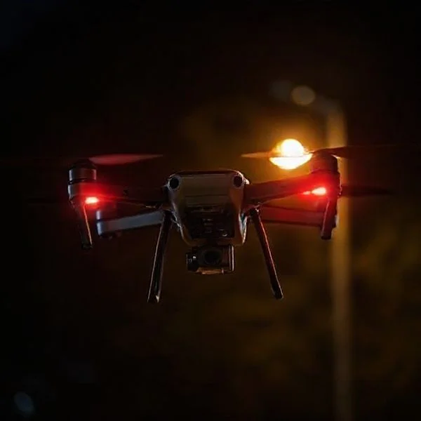
Drone flight is strictly prohibited in restricted airspaces such as National Parks, military bases, and critical infrastructure like power plants or prisons. Pilots must also avoid controlled airspace near airports without LAANC authorization and stay clear of emergency response scenes or major sporting events.
🎯 Key Takeaways
- Avoid all airports and helipads unless you have specific LAANC authorization.
- National Parks and military installations are strictly prohibited permanent no-fly zones.
- Use mobile apps to check for real-time Temporary Flight Restrictions (TFRs).
- Never fly over crowds, stadiums, or emergency response scenes like wildfires.
- Critical infrastructure, including power plants and prisons, often carries flight restrictions.
You cannot fly your drone in controlled airspace near airports, inside National Parks, over military bases, or near active emergency scenes without specific federal authorization. These prohibited areas, often called No-Fly Zones (NFZs), are strictly enforced by the FAA and local law enforcement to ensure public safety and national security. If you ignore these boundaries, you face heavy fines, drone confiscation, and potential criminal charges.
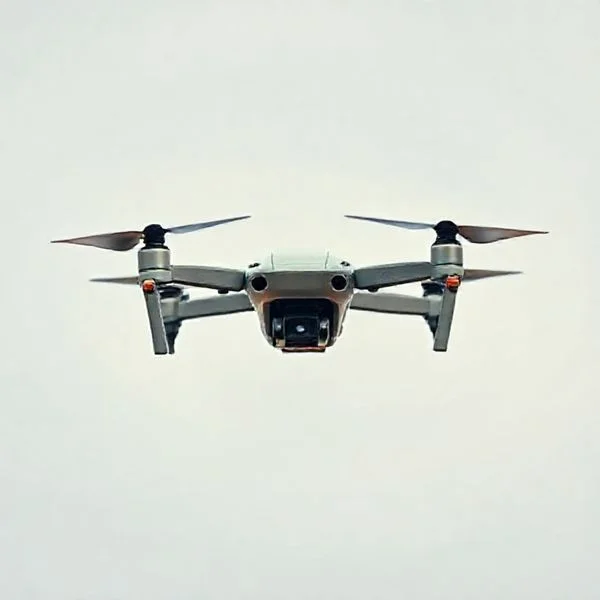
Understanding these restrictions is about more than avoiding a ticket; it is about preventing mid-air collisions and protecting sensitive environments. Before you even power on your controller, you must identify whether your intended flight path crosses into “red zones.” These areas are permanently or temporarily closed to civilian unmanned aircraft systems (UAS) to protect people on the ground and pilots in the air.
Major Categories of Permanent No-Fly Zones
Permanent No-Fly Zones are locations where drone flight is restricted 24/7 due to high-risk safety or security concerns. Many modern drones use internal GPS and “geofencing” software to identify these areas. However, the responsibility falls on you to know the boundaries, as software can sometimes fail to update in real-time.
Airports and Controlled Airspace
The most critical restriction involves the airspace surrounding airports, known as Class B, C, D, and E airspace. You should never fly within five miles of a major airport without explicit LAANC (Low Altitude Authorization and Notification Capability) approval. Even if you are outside that radius, you may still be in a restricted approach path where planes fly low. These zones are designed to prevent catastrophic collisions between drones and manned aircraft carrying hundreds of passengers.
- Class B Airspace: Surrounds the nation’s busiest airports. These are the most restrictive environments.
- Class C and D: Regional and local airports with active control towers.
- Heliports: Hospitals and police stations often have pads that require extreme caution and often have their own restricted bubbles.
National Parks and Government Property
Since 2014, the National Park Service (NPS) has banned the launching, landing, or operating of drones from within all National Park boundaries. This includes iconic spots like Yosemite, Yellowstone, and the Grand Canyon. The ban exists to protect wildlife from stress and to preserve the “natural quiet” for other visitors. Additionally, certain federal lands and critical infrastructure are off-limits for security reasons.
- Military Bases: Designated as National Security UAS Flight Restrictions (NSUs), these are strictly off-limits.
- Critical Infrastructure: Avoid flying near power plants, dams, water treatment facilities, and correctional institutions.
- Washington, D.C.: A 15-mile radius around our nation’s capital is a total no-drone zone for hobbyists.
Master Drone Airspace in 8 Simple Steps
Operating a drone is an exhilarating experience, but the sky is far from a lawless frontier. Between federal regulations, local ordinances, and safety protocols, knowing where you cannot fly is the most critical skill a pilot can possess. This guide will walk you through the process of identifying “No-Fly Zones,” understanding complex airspace classifications, and using the latest digital tools to ensure every takeoff is legal and safe. By following these steps, you will protect yourself from heavy FAA fines, potential equipment seizure, and the risk of endangering manned aircraft or public safety.
Step 1: Understand Federal Airspace Classifications
What you need: Access to the FAA’s sectional charts (digital or paper) and a basic understanding of Airspace Classes A, B, C, D, E, and G.
Instructions: Before you even power on your controller, you must understand that the sky is divided into specific layers. In the United States, you are generally permitted to fly in Class G (uncontrolled) airspace without specific prior authorization, provided you stay below 400 feet. However, Classes B, C, D, and E (surface-level) represent controlled airspace surrounding airports. You cannot fly in these areas without explicit permission. Use a sectional chart to identify the “blue circles” and “magenta circles” that indicate controlled zones. If your desired flight path falls within these shaded areas, you are in a “No-Fly Zone” until you receive official clearance from the FAA.
Pro Tip: Always remember that the 400-foot ceiling is not a suggestion; it is a federal limit. Even in uncontrolled airspace, flying higher than 400 feet puts you in the path of general aviation, which is a major violation.
Step 2: Configure and Calibrate Mapping Applications
What you need: A smartphone or tablet with GPS capabilities and verified apps like “AutoPylot,” “Air Control (Aloft),” or “OpenSky.”
Instructions: Relying on your eyes alone to spot an airport is a recipe for disaster. Download a dedicated drone mapping app that uses your GPS location to provide real-time airspace data. Open the app and enable all “Warning” and “Restricted” layers in the settings. These apps will show you color-coded maps: red usually indicates Prohibited Areas (where flight is strictly forbidden), while yellow or orange indicates Caution Areas or Controlled Airspace. Move your pin to your intended launch site and check the “Status” indicator. If the app displays a “Takeoff Prohibited” or “Restricted” message, you must find a different location.
Pro Tip: Do not rely solely on the manufacturer’s built-in geofencing (like DJI’s FlySafe). These maps are often outdated or less restrictive than actual FAA law. Always cross-reference with a third-party FAA-approved app.
Step 3: Identify Permanent Prohibited and Restricted Areas
What you need: Knowledge of special use airspace (SUA) symbols and a reliable internet connection for regulatory lookups.
Instructions: Some locations are “Permanent No-Fly Zones” regardless of your pilot status. You must never fly over Washington D.C. (the Special Flight Rules Area), near military bases, or over certain government facilities like the White House or the Pentagon. These are marked as “P” (Prohibited) or “R” (Restricted) on aeronautical charts. Additionally, you cannot fly within a 15-mile radius of the inner ring of D.C. without high-level security clearance. Use your apps to scan for blue-hashed borders on the map. If you see an “R” followed by a number (e.g., R-2508), assume it is active and off-limits to avoid triggering a national security response.
Pro Tip: Avoid “Special Use Airspace” even if it appears empty. These areas are often used for live-fire military exercises or high-speed jet maneuvers that you will not see coming until it is too late.
Step 4: Check for Temporary Flight Restrictions (TFRs)
What you need: The FAA TFR portal website or a drone app with real-time TFR notifications enabled.
Instructions: Airspace can change from “Open” to “Closed” in a matter of minutes. Temporary Flight Restrictions (TFRs) are issued for short-term events. You are prohibited from flying near major sporting events (stadiums with a capacity of 30,000+ people), presidential movements, or emergency response efforts like wildfires. Before every flight, refresh your mapping app. If a bright red circle appears that wasn’t there yesterday, it is likely a TFR. For example, if a wildfire is within several miles, the FAA will shut down drone flight to allow firefighting helicopters and tankers to operate safely. Flying in a TFR is a felony offense in many jurisdictions.
Pro Tip: Be especially careful during the “Post-Season” for sports. TFRs are automatically active for one hour before to one hour after games at MLB, NFL, and NCAA Division I stadiums.
Step 5: Navigate National Parks and Wildlife Refuges
What you need: Access to the National Park Service (NPS) website and local signage maps.
Instructions: Under 36 CFR 1.5, the National Park Service has banned the launching, landing, or operating of unmanned aircraft from lands and waters administered by the NPS. This includes National Parks, National Monuments, and many National Seashores. You cannot fly in places like Yosemite, the Grand Canyon, or even local historic sites managed by the federal government. Similarly, many National Wildlife Refuges prohibit drone flight to prevent the harassment of animals. Check your location against the NPS “Find a Park” map. If the land is shaded green and managed by the NPS, your drone must stay in the car.
Pro Tip: While you can technically fly “over” a park if you launch and land from outside its borders, you must still maintain a visual line of sight and ensure you aren’t disturbing wildlife, which is often a separate violation.
Step 6: Assess Critical Infrastructure and Privacy Zones
What you need: Physical awareness of your surroundings and a “common sense” safety check of the local geography.
Instructions: Federal law and various state statutes prohibit flying over “Critical Infrastructure.” This includes power plants, water treatment facilities, correctional facilities (prisons), oil refineries, and busy highways. Flying near a prison is particularly dangerous, as it can be interpreted as an attempt to smuggle contraband, leading to immediate arrest. Furthermore, check local privacy laws. Many states prohibit flying over private property in a way that “disturbs the peace” or captures images of people where they have a reasonable expectation of privacy (like backyards or windows). If your flight path is directly over a sensitive industrial site or a neighbor’s pool, you are likely in a restricted zone.
Pro Tip: Use “Satellite View” on Google Maps during your planning phase to spot industrial chimneys or high-tension power lines that might not be clearly marked on aeronautical maps.
Step 7: Verify Local and Municipal Ordinances
What you need: City or county government websites and local park department rulebooks.
Instructions: While the FAA controls the “air,” local governments often control the “ground.” Many cities have passed ordinances that prohibit drones from taking off or landing in city parks or public plazas. To find these restrictions, search for “[City Name] drone ordinances” or “[County Name] municipal code.” Some locations, like New York City or certain beaches in California, have extremely strict rules that effectively make the entire area a “No-Fly Zone” for hobbyists. Always look for physical signage at park entrances. If a sign says “No Remote Controlled Aircraft,” you must honor the ground-based restriction even if the FAA airspace above is technically clear.
Pro Tip: If you are unsure, call the local Parks and Recreation department. They would much rather answer a five-minute phone call than have to send a ranger to issue a citation.
Step 8: Utilize LAANC for Instant Authorizations
What you need: A smartphone with an FAA-approved UAS Service Supplier (USS) app like Aloft or AirControl.
Instructions: If you discover that your desired flight area is in controlled airspace (Class B, C, D, or E), you may still be able to fly by using the Low Altitude Authorization and Notification Capability (LAANC). Open your app, select your flight area, and input your flight details (max altitude and time). The system will check the “UAS Facility Maps” for that airport. If your requested altitude is within the “auto-approval” grid (e.g., 200 feet), the app will grant you a digital authorization code instantly. If you do not have this LAANC authorization, that controlled airspace remains a strict No-Fly Zone for you.
Pro Tip: Even with LAANC approval, you must still yield the right of way to any manned aircraft. The authorization gives you permission to be there, but it does not give you priority.
✅ Final Checklist
- Is the drone registered with the FAA and the ID number displayed on the exterior?
- Have you checked for TFRs that may have been issued within the last hour?
- Did you verify that the takeoff and landing zones are not on National Park or Restricted state land?
- Is your planned altitude at or below 400 feet (or the LAANC approved limit)?
- Do you have a clear visual line of sight of the entire flight path?
Important Notes:
- Safety First: Never fly near emergency response activities, including ambulance flight paths or police cordons.
- Legal Consequences: FAA fines for unauthorized flight in restricted areas can exceed $27,500 per violation, and criminal charges can apply for interfering with law enforcement.
- Professional Help: For complex commercial missions near major international airports, consider hiring a consultant or using a Part 107 certified pilot for advanced waivers.
- Estimated Planning Time: 15–30 minutes per flight location. Cost is generally free, though some professional airspace apps require a subscription for advanced features.
Understanding Temporary Flight Restrictions (TFRs) and Special Events
Temporary Flight Restrictions (TFRs) are “pop-up” no-fly zones that override standard permissions. These are issued via Notices to Air Missions (NOTAMs) and can be implemented with very little warning. Because these zones change daily, a location that was legal to fly in yesterday might be prohibited today.
Emergency Scenes and VIP Movement
If there is an active wildfire, search and rescue operation, or a major traffic accident, the area becomes an immediate No-Fly Zone. Flying near a wildfire is a federal offense because it forces firefighting aircraft to ground their fleets. “If you fly, they can’t,” is the industry standard rule. Similarly, “VIP TFRs” follow the President and Vice President. When the President travels, the FAA shuts down airspace for miles around their location and transit route.
- Wildfires: Drones interfere with low-flying water tankers and helicopters.
- Major Sporting Events: The FAA prohibits flights within three nautical miles of any stadium seating 30,000+ people during NFL, MLB, or NCAA Division I games.
- Space Operations: Airspace around launch sites like Cape Canaveral is restricted during active launch windows.
Using Digital Tools for Real-Time Verification
To stay compliant, you must use airspace awareness tools before every takeoff. These apps use your GPS coordinates to overlay all permanent and temporary restrictions onto a map. They provide a “Clear for Takeoff” or “Restricted” status instantly, saving you from accidental violations. Relying on your eyes alone is not enough; many restricted zones start hundreds of feet in the air or are invisible on the ground.
- B4UFLY: The FAA’s official app for checking airspace restrictions.
- Aloft (formerly Kittyhawk): A robust tool for checking TFRs and requesting instant LAANC authorization.
- UAV Forecast: Excellent for checking both legal restrictions and local weather conditions.
Digital Tools and Apps for Real-Time Airspace Awareness
Knowing where you stand (and fly) is significantly easier thanks to modern technology. Your smartphone is arguably the most essential drone accessory in your kit because it provides real-time data on airspace restrictions that can change in an instant. Relying on memory or outdated maps is a recipe for a hefty fine.
The Power of B4UFLY and LAANC Integration
The FAA’s B4UFLY app (now powered by partners like Aloft) is the gold standard for recreational and commercial pilots in the United States. It uses your GPS location to provide a simple “clear for takeoff” or “restricted” status. For those looking to fly in controlled airspace, LAANC (Low Altitude Authorization and Notification Capability) is a game-changer. It allows you to request near-instant permission to fly in areas that were previously off-limits.
- Aloft (Air Control): Excellent for detailed maps and logging flights.
- OpenSky: A clean, user-friendly interface for quick checks.
- UAV Forecast: Beyond no-fly zones, it tracks wind speeds and satellite visibility.
Manufacturer-Specific Geofencing
Many modern drones, particularly from brands like DJI, come with built-in geofencing software. This “virtual cage” prevents the drone from entering high-risk areas like airports or nuclear power plants. While helpful, never rely solely on this. Software glitches happen, and manufacturer maps aren’t always as updated as federal databases. Always cross-reference your drone’s internal map with a third-party airspace app before you power up your motors.
Navigating Local, State, and Federal Drone Ordinances
Airspace is managed federally, but the ground you stand on is often governed by local authorities. This “jurisdictional sandwich” is where many pilots get confused. Even if the FAA says the air is clear, a local city ordinance might prohibit you from operating the controller from a specific public park or beach.
Beyond the FAA: Local Park Rules and Privacy Laws
While the FAA controls the “highways in the sky,” municipalities often control takeoff and landing zones. Many cities have passed bylaws preventing drone operation in crowded downtown squares or near sensitive wildlife habitats. Furthermore, privacy laws are increasingly strict. Flying over a neighbor’s backyard might not be a “no-fly zone” in the technical sense, but it could land you in legal trouble regarding harassment or privacy invasion.
- Check signage: Look for “No Drone” signs at park entrances.
- Respect privacy: Avoid hovering over private residential property without permission.
- State Parks: Many states require specific permits that differ from federal requirements.
National Parks and Wilderness Areas
The most important rule for nature lovers: National Parks are strictly off-limits for drone takeoff and landing. This regulation is designed to protect wildlife and maintain the quiet enjoyment of the park for other visitors. Similarly, designated “Wilderness Areas” carry heavy restrictions. If you are caught flying in a National Park like Yellowstone or Yosemite, you face potential drone confiscation and thousands of dollars in fines. Always look for National Forest land instead, which often has much more relaxed rules for hobbyists.
Conclusion: Fly Smart and Stay Informed
Mastering the “where” of drone flight is just as important as mastering the controls. By combining high-tech apps with a solid understanding of local and federal laws, you protect your gear, your wallet, and the reputation of the drone community. Remember that airspace is dynamic; a clear spot today could be a Temporary Flight Restriction (TFR) tomorrow due to a local sporting event or emergency response.
Your next steps are simple: download a reputable airspace app like Aloft, check your local city’s website for park ordinances, and always perform a quick site survey before you take off. Stay curious, stay respectful of others’ privacy, and most importantly, enjoy the view from above! Happy flying!
❓ Frequently Asked Questions
How do I know if I am in a Temporary Flight Restriction (TFR) zone?
TFRs are issued by the FAA for VIP travel, space launches, or security events. You should check for active TFRs using real-time airspace apps like B4UFLY or AirAware before every takeoff.
Can I fly my drone over private property without permission?
While the FAA controls the airspace, local privacy and trespass laws often apply at low altitudes. It is highly recommended to seek permission to avoid civil liability or privacy complaints.
Why are drones banned in National Parks but allowed in some State Parks?
National Parks are federally protected areas with specific rules regarding wildlife and wilderness conservation. State Park regulations vary significantly by state, with some requiring permits and others allowing recreational flight.
Are government buildings and prisons considered no-fly zones?
Yes, these are classified as critical infrastructure and are protected by security-sensitive airspace restrictions. Flying near these locations can trigger immediate law enforcement response and federal investigation.
What is LAANC and how does it affect where I can fly?
LAANC stands for Low Altitude Authorization and Notification Capability. It provides drone pilots with automated access to controlled airspace near airports that would otherwise be off-limits.
Are there specific altitude limits in restricted areas?
Even in areas where flight is permitted, you must stay below 400 feet. In some controlled zones near airports, your authorized altitude may be limited to as low as 50 or 100 feet.