New York Drone Sightings: Latest Updates and Investigations
Commercial UAV Pilot & Aerial Cinematography Specialist at Drone Nestle · FAA Part 107 Remote Pilot Certification, Commercial UAS Operations · 10+ Years in Commercial UAV Operations, Flight Hardware Benchmarking & 4K Aerial Cinematography
Mysterious large-scale drone activity has been reported across New York and New Jersey, prompting intensive investigations by the FAA, FBI, and local law enforcement. While many sightings remain unexplained, officials are currently tracking these unauthorized flights to determine their origin and purpose.
🎯 Key Takeaways
- Takeaway 1:Sightings span northern New Jersey and several New York City boroughs.
- Takeaway 2:The FAA and FBI are actively investigating unauthorized night flights.
- Takeaway 3:Most reported drones are large, fixed-wing, or high-end industrial models.
- Takeaway 4:No immediate threat to public safety has been confirmed by officials.
- Takeaway 5:Reports of large ‘mother ships’ remain unverified by formal agencies.
You aren’t imagining things if you’ve seen strange lights over the New York skyline or the New Jersey suburbs recently. Since late November 2024, a wave of mysterious, large-scale drone sightings has surged across the tri-state area, sparking massive security concerns and leaving residents searching for answers. This is not a case of a few hobbyists in a park; we are seeing coordinated groups of large aircraft navigating some of the most restricted airspace in the world.

This situation matters because these sightings have moved past being a mere curiosity and into the realm of a serious security investigation. These drones are appearing near critical infrastructure, interfering with airport flight paths, and hovering over residential neighborhoods for hours at a time. To understand what is happening, you need to look at the specific locations being targeted and the high-level federal response currently trying to solve the mystery.

Timeline and Geographic Reach of Recent NY/NJ Drone Activity
The current surge of activity began in mid-to-late November 2024 and escalated rapidly through the first weeks of December. What started as isolated reports in rural New Jersey quickly expanded into a regional phenomenon. These drones typically appear after sunset, usually between 6:00 PM and midnight, making them highly visible against the night sky due to their distinctive lighting patterns.
Key Hotspots and Regional Clusters
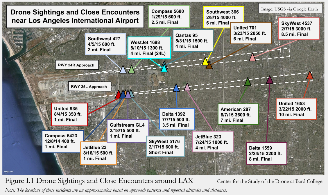
The geographic spread of these sightings suggests a highly organized operation. While reports have come from all over the tri-state area, several specific “hotspots” have emerged as centers of activity. Understanding where these drones are appearing helps paint a picture of their possible flight paths and objectives.
- Morris County, NJ (The Epicenter): The highest concentration of reports has centered on Morris County, specifically around Parsippany, Morristown, and Rockaway. Residents here have reported seeing groups of up to 15 drones at once.
- Picatinny Arsenal: A significant number of sightings have occurred near this military research and manufacturing facility. This has raised the stakes of the investigation from a local nuisance to a national security concern.
- New York City Waterways: In the last two weeks, activity has shifted toward the Hudson River and the Arthur Kill. Drones have been spotted hovering near the Bayonne Bridge and the Outerbridge Crossing.
- Staten Island and Manhattan: Reliable reports have placed these craft over the South Shore of Staten Island and moving north toward the lights of Lower Manhattan, often maintaining a steady altitude of 500 to 1,000 feet.
Movement Patterns and Sighting Characteristics
What makes these sightings unique is the behavior of the craft. Unlike typical consumer drones that you might buy at a store, these units are reported to be much larger, with some witnesses estimating wingspans of four to six feet. They do not behave like toys; they exhibit sophisticated flight characteristics that suggest professional-grade technology.
Most witnesses describe the drones as having blinking red and green lights, occasionally accompanied by a steady white light. They often fly in a “V” or “grid” formation, moving with a level of precision that suggests they are following pre-programmed GPS coordinates or are being controlled by a sophisticated swarm intelligence system. Perhaps most interestingly, they have been observed staying airborne for several hours at a time, which far exceeds the 20-30 minute battery life of standard hobbyist drones.
Official Response: Investigations by the FAA, FBI, and Law Enforcement
Because these drones are operating in some of the busiest and most sensitive airspace in the United States, the response has been swift, though many questions remain unanswered. A multi-agency task force has been established to track the objects and identify the operators, but as of now, no one has been caught in the act.
Federal Agency Involvement and Public Statements
The Federal Aviation Administration (FAA) and the Federal Bureau of Investigation (FBI) are leading the charge. The FAA’s primary concern is the safety of the National Airspace System. These drones have been spotted at altitudes that directly conflict with the approach paths for Newark Liberty International (EWR) and John F. Kennedy International (JFK) airports.
- The FAA Investigation: The agency is using sophisticated radar and drone-detection sensors to try and pinpoint the “home” location of these craft. They have confirmed that the drones are not broadcasting “Remote ID” signals, which is a federal requirement for most drones.
- FBI Intelligence Gathering: The FBI has officially opened a file on the sightings. They are currently focusing on whether these drones originate from a domestic source or a foreign actor, and they have requested that the public submit any high-quality video or photo evidence to their dedicated tip portal.
- Department of Homeland Security (DHS): DHS is involved due to the drones’ proximity to critical infrastructure, including power plants and military installations, monitoring for any signs of hostile intent or surveillance.
Local Law Enforcement and Monitoring Efforts
On the local level, the New Jersey State Police and the NYPD have increased their aerial surveillance. However, law enforcement faces a major hurdle: under current federal law, it is illegal for local police to shoot down or physically disable a drone in flight, even if it is in restricted airspace. This has led to a “detect and follow” strategy.
Local police departments are currently using “radio frequency (RF) sniffers” to try and detect the control signals between the drones and their pilots. Despite these efforts, the drones seem to be using encrypted or highly directional signals that make them difficult to trace back to a ground station. Governors in both New York and New Jersey have held briefings to reassure the public, but they have admitted that the source of the drones remains a mystery. The lack of a clear “pilot” on the ground suggests these drones may be launched from a moving vehicle or even a watercraft, making the search even more difficult for authorities on the ground.
Analyzing Credible Theories vs. Unverified Rumors of Drone Origins
The mystery surrounding the recent New York drone sightings has sparked a wave of speculation. While social media is buzzing with wild theories, investigators are sifting through data to separate fact from fiction. Determining the origin of these aircraft is complex because of the proximity to sensitive infrastructure and the sheer volume of sightings reported across the tristate area.
Government Testing and Commercial Research
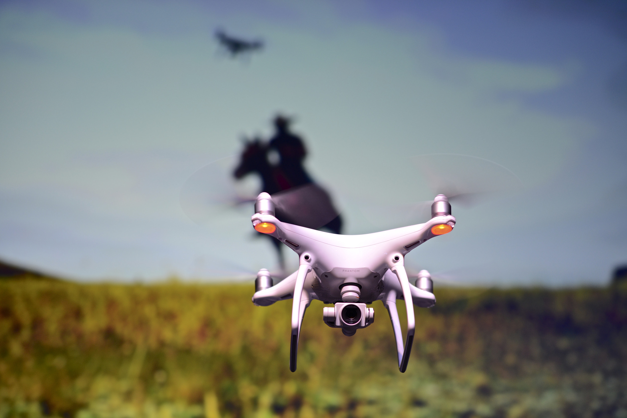
One of the most credible theories involves government or large-scale commercial testing. New York and New Jersey house critical logistics hubs where companies like Amazon or specialized defense contractors often test autonomous delivery and surveillance systems. While these entities usually coordinate with the FAA, some analysts suggest that experimental hardware might occasionally bypass standard public notifications.
- Infrastructure Inspection: Many large-scale drones are used to monitor bridges, power lines, and railways without much fanfare.
- Military Drills: Proximity to military bases means training exercises involving electronic warfare or drone swarms are always a possibility.
- Mapping Projects: High-resolution urban mapping often requires sustained flights that can look suspicious to the untrained eye.
Hobbyist Groups and Unauthorized Operations
Despite the sophisticated appearance of some sightings, experts haven’t ruled out coordinated hobbyist activity. As drone technology becomes more accessible, groups of enthusiasts may be testing the limits of their gear in ways that violate local ordinances. However, the size and persistence of these recent “swarms” suggest a level of coordination rarely seen in the casual pilot community.
Pro Tip: If you are a legitimate pilot, always use a Remote ID module. This is one of the most essential drone accessories today, as it helps authorities distinguish your legal flight from unauthorized activity, potentially saving you from a knock at the door during an active investigation.
The Impact of Unauthorized Drone Swarms on Local Airspace Safety
The presence of unidentified drones in the busy New York corridor isn’t just a curiosity; it is a significant safety concern. New York City and its surrounding areas manage some of the most congested airspace in the world. When unauthorized drones enter these zones, the ripple effect can cause massive disruptions to commercial aviation and emergency services.
Disruption of Commercial Aviation and Airports
Major hubs like JFK, LaGuardia, and Newark are extremely sensitive to low-altitude interference. A single drone sighting can lead to immediate ground stops, costing airlines thousands of dollars and delaying thousands of passengers. The risk of a mid-air collision, even with a small consumer drone, is a scenario that the FAA takes incredibly seriously.
- Flight Diversions: Pilots are often forced to take longer routes or circle the airport until the airspace is cleared.
- Increased Pilot Stress: Constant vigilance for small, fast-moving objects adds an extra layer of difficulty during takeoff and landing.
- Grounding of Emergency Aircraft: Medevac and police helicopters may be forced to stay on the ground if a swarm is detected in their flight path.
Privacy and Public Anxiety
Beyond physical safety, the psychological impact on residents is significant. People feel a loss of privacy when unidentified drones hover over residential neighborhoods or near high-rise windows. This has led to a push for stricter local regulations and better enforcement of existing drone laws. For professional pilots, this means it is more important than ever to fly responsibly to avoid further stigmatizing the hobby.
Practical Example: Consider using anti-collision lighting (strobe lights) even during the day. This simple accessory makes your drone highly visible to other aircraft and signals that you are a responsible operator following safety protocols, rather than a “stealth” intruder.
Conclusion
The drone sightings in New York highlight the growing tension between rapid technological advancement and public safety. While theories range from secret government tests to rogue hobbyists, the investigation remains ongoing. What is clear is that these events are accelerating the need for better tracking, stricter Remote ID compliance, and a more robust understanding of how drones integrate into our urban skies. For the responsible pilot, staying informed and equipped with the right safety accessories is the best way to navigate this changing landscape.
Next Steps:
- Check the latest FAA B4UFLY app updates before every flight to ensure you aren’t entering temporary flight restriction zones.
- Review your drone’s Remote ID status to ensure you are flying legally and transparently.
Stay vigilant, keep your gear updated, and let’s work together to keep the New York skies safe for everyone!
❓ Frequently Asked Questions
What should I do if I see a mysterious drone in New York?
Report the sighting to local law enforcement immediately and include details like the time, exact location, and flight direction. Do not attempt to interfere with the drone yourself, as it is illegal to shoot down any aircraft under federal law.
Why hasn’t the government released more information about the drones?
The investigation involves multiple federal agencies like the FBI and DHS, and information is often withheld to avoid compromising ongoing surveillance efforts. Official updates are released only after data is thoroughly verified to prevent misinformation.
Are these drones related to sanctioned military exercises?
While the military occasionally conducts drills, several defense agencies have confirmed that these specific sightings are not part of any sanctioned domestic military operation or training program.
How large are the drones reported in the New York area?
Reports vary, but many witnesses and officials describe industrial-sized drones significantly larger than standard consumer models, with some estimated at several feet in diameter with high-intensity lighting.
Is it legal for these drones to be flying at night in NY?
Most commercial and recreational drone flights at night require specific FAA authorization and must be equipped with anti-collision lighting visible for three miles. The current sightings appear to be unauthorized.
Could these drones be from a foreign adversary?
This is one of the many theories being investigated by federal intelligence agencies, though no definitive evidence of foreign involvement has been made public as of yet.

Similar Posts