Best Apps to Spot Police Drones at Night: A Tracking Guide
Commercial UAV Pilot & Aerial Cinematography Specialist at Drone Nestle · FAA Part 107 Remote Pilot Certification, Commercial UAS Operations · 10+ Years in Commercial UAV Operations, Flight Hardware Benchmarking & 4K Aerial Cinematography
Identifying police drones at night requires a combination of Remote ID and ADS-B tracking apps like Drone Scanner or Flightradar24. While these tools provide data on nearby aircraft, users must also recognize specific FAA-mandated navigation light patterns to distinguish law enforcement from hobbyists.
🎯 Key Takeaways
- Use Drone Scanner to detect Remote ID signals from nearby drones.
- ADS-B Exchange tracks larger police drones equipped with transponders.
- Red and green lights indicate the drone’s directional orientation.
- High-intensity white strobes are common for night visibility compliance.
- Law enforcement may fly ‘dark’ during authorized covert operations.
Identifying a police drone at night requires a combination of signal-tracking technology and a sharp eye for specific light patterns. While law enforcement drones are increasingly sophisticated, they are legally required in most jurisdictions to broadcast identification signals. By using apps that scan for Remote ID and ADS-B broadcasts, you can turn your smartphone into a localized radar system that detects these aircraft before they are even visible to the naked eye.



Staying informed about overhead surveillance is a matter of privacy and situational awareness. Whether you are concerned about local noise ordinances or simply curious about the “eye in the sky” patrolling your neighborhood, these tools provide transparency. This guide focuses on the most effective software for real-time tracking and the specific visual cues that distinguish a professional law enforcement drone from a hobbyist’s quadcopter.
Essential Apps for Real-Time Drone Signal Tracking


The most effective way to spot a police drone is by intercepting its digital footprint. Since late 2023, the FAA has mandated that most drones operating in U.S. airspace broadcast “Remote ID” information. This digital license plate includes the drone’s location, its pilot’s location, and its altitude. Because police departments must comply with these safety regulations, their patrol drones are often visible on high-end signal-scanning applications.


Drone Scanner (by Dronetag)
Drone Scanner is currently the gold standard for identifying nearby drones via your smartphone. It uses your phone’s Bluetooth and Wi-Fi receivers to pick up Remote ID beacons. Unlike aircraft tracking apps that rely on internet databases, this app “listens” to the actual radio frequencies used by the drone in real-time. To use it effectively at night, simply open the app and look for the “Map View.” Police drones often appear as distinct icons, and the app will provide the drone’s manufacturer and current speed. If you see a drone hovering at a fixed altitude for more than ten minutes, it is likely a surveillance unit rather than a hobbyist passing through.
Flightradar24 and OpenSky Network

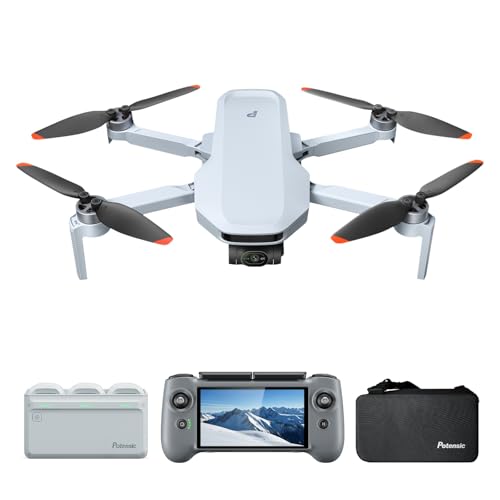

While standard consumer drones use Remote ID, larger police surveillance craft—like fixed-wing drones or large VTOL (Vertical Take-Off and Landing) aircraft—often use ADS-B transponders. Apps like Flightradar24 or OpenSky are essential for tracking these high-altitude assets.


- Filtering: Use the “Filters” tab to select “Aircraft Category” and look for “Unmanned Aerial Vehicles.”
- ICAO Hex Codes: Many police departments register their drones under municipal government accounts. If you see an aircraft with no callsign but a registered municipal owner, it is likely a law enforcement asset.
- Coverage: Keep in mind that ADS-B tracking works best for drones flying above 500 feet, which is where many tactical police drones operate to remain discreet.
How to Spot Police Drones at Night Like a Pro: A Practical Walkthrough
As unmanned aerial vehicles (UAVs) become a standard tool for law enforcement agencies worldwide, many citizens are looking for ways to identify their presence for privacy and safety reasons. Spotting a drone at night is significantly more challenging than during the day, as the physical frame is often invisible against the dark sky. This guide covers the integration of specialized mobile applications, radio frequency (RF) detection, and visual cues to help you accurately identify police drones. By following these steps, you will learn how to distinguish between a hobbyist’s toy, a commercial delivery drone, and a sophisticated police surveillance craft using the technology already in your pocket.
Step 1: Choose and Install a Remote ID Detection App
What you need: A smartphone (iOS or Android) with Bluetooth and Wi-Fi capabilities and an app like “DroneScanner” or “OpenSky.”
Instructions: The most effective way to spot a drone in the modern era is through Remote ID (RID). As of early 2026, the FAA requires most drones operating in U.S. airspace to broadcast identification and location information. Download a dedicated Remote ID scanner app from your device’s app store. Once installed, grant the app permission to access your location and Bluetooth settings. These apps work by “listening” for the digital license plate that drones broadcast. When you are outside at night, open the app and let it scan the surrounding 2.4 GHz and 5.8 GHz frequencies. If a police drone is operating nearby and is RID-compliant, it will appear on your map with its altitude, speed, and takeoff point.
Pro Tip: Many law enforcement agencies use DJI Enterprise models. If your app detects a “DJI” manufacturer ID with a flight path that shows a consistent “grid” or “loitering” pattern, there is a high probability it is a surveillance or search-and-rescue mission.
Step 2: Calibrate Your Internal Sensors for Accurate Tracking
What you need: Your smartphone and a clear area away from large metal structures or high-voltage power lines.
Instructions: For any drone-spotting app to work correctly, your phone’s internal magnetometer (compass) and GPS must be precise. Before heading out, open your compass app and perform a “Figure 8” motion with your phone to calibrate it. This ensures that when the app points you toward a detected signal in the sky, the direction is actually accurate. At night, your depth perception is diminished, so you rely entirely on the app’s directional arrow. Ensure “High Accuracy” location services are enabled in your phone’s settings. If your calibration is off by even five degrees, you might spend twenty minutes looking at the wrong patch of sky while the drone operates silently behind you.
Pro Tip: Avoid standing near parked cars or chain-link fences while using these apps, as the large amount of metal can interfere with the magnetometer and cause the “detected drone” icon to jump sporadically on your screen.
Step 3: Analyze Flight Patterns and Altitude Data
What you need: A drone tracking app and a basic understanding of aviation movement.
Instructions: Once your app detects a signal, look closely at the “Flight Telemetry” screen. Police drones behave differently than hobbyist drones. A hobbyist usually flies in a straight line or performs “cinematic” orbits around a single point of interest. In contrast, police drones often perform “lawnmower” patterns (back-and-forth parallel lines) for mapping or “stationary loitering” at high altitudes (300-400 feet) to provide an overwatch of a specific area. If the app shows the craft maintaining a static position for more than five minutes while at the maximum legal altitude, it is likely a surveillance craft. Use the app’s “History” or “Breadcrumb” feature to see where the drone started; police drones often launch from the roof of a precinct or a mobile command vehicle.
Pro Tip: Watch for sudden altitude drops. Police drones equipped with thermal cameras will often descend rapidly once they “lock on” to a heat signature to get a clearer visual, which is a telltale sign of active law enforcement activity.
Step 4: Identify Anti-Collision Light Signatures
What you need: Your eyes and the “AR View” (Augmented Reality) feature within your detection app.
Instructions: Federal regulations require drones flown at night to have anti-collision lighting visible for at least three statute miles. Use the AR feature in your app to overlay the detected drone’s digital icon onto your camera’s live view. Look for a flashing light that is distinct from a star or a plane. Police drones frequently use high-intensity white strobes or a combination of red and green navigation lights. However, during specific tactical operations, they may use “discreet” mode, where standard lights are dimmed. By using the AR view, you can pinpoint exactly where the drone should be in the sky. If you see a flickering light that matches the movement of the icon on your screen, you have successfully confirmed its location.
Pro Tip: Do not confuse a drone with a satellite. Satellites move at a constant speed in a straight line across the horizon, whereas a drone will often hover, jitter slightly in the wind, or change direction abruptly.
Step 5: Utilize Radio Frequency (RF) Signal Strength Indicators
What you need: An app with an “RSSI” (Received Signal Strength Indicator) meter, such as “WiFi Analyzer” (for older drones) or specialized RF apps.
Instructions: Not all police drones broadcast Remote ID, especially older models or those with specific federal waivers. In these cases, you must look for the RF signature. Open an RF signal app and look for spikes in the 2.4 GHz or 5.8 GHz bands. Unlike a home router, which has a static signal strength, a drone’s signal will fluctuate as it moves. Walk in a small circle and observe the decibel (dBm) levels. If the signal strength increases as you move in one direction, you are moving toward the controller or the drone. Police controllers often have very high-gain antennas, creating a “bubble” of RF noise that is much stronger than a standard consumer drone.
Pro Tip: If the signal strength is exceptionally high but you see no lights in the sky, the operator is likely very close to you on the ground. Police drone pilots often operate from inside unmarked SUVs to stay hidden at night.
Step 6: Listen for Acoustic Cues and Propeller Pitch
What you need: A quiet environment and a “Spectrogram” app to visualize sound frequencies.
Instructions: At night, sound carries further due to lower ambient noise. Even at 400 feet, the high-pitched “whine” of drone propellers is audible. Use a spectrogram app to see if there is a consistent frequency spike between 5 kHz and 10 kHz. Police drones are often larger (like the DJI Matrice series) and produce a lower-frequency, more rhythmic “thrumming” sound compared to the high-pitched “buzz” of a small racing drone. If your app detects a signal and you can hear a low-frequency mechanical hum that stays consistent for long periods, you are likely under the flight path of a heavy-duty professional UAV used by emergency services.
Pro Tip: Be aware that wind can carry sound away from you. If you hear the drone but the signal on your app is weakening, the drone is likely “downwind” and moving away, even if it sounds like it is getting closer.
Step 7: Check Local Flight Logs and Public ADS-B Data
What you need: An app like “Flightradar24” or “ADS-B Exchange.”
Instructions: While many small drones don’t appear on standard aviation radar, larger police UAVs used for border patrol or wide-area surveillance are often equipped with ADS-B Out transponders. Open a flight tracking app and filter for “N-registered” aircraft or “Special Missions.” These drones will show up alongside commercial airplanes. If you see an aircraft icon orbiting a small neighborhood at 500-1,000 feet with no call sign, it is almost certainly a large-scale police or government drone. Combine this data with your Remote ID app; if the Remote ID app is silent but the flight tracker shows an orbit overhead, you are dealing with a much larger, fixed-wing surveillance craft rather than a quadcopter.
Pro Tip: Look for “Blocked” or “No Callsign” entries on these apps. Law enforcement sometimes requests their hex codes be hidden from commercial apps, but they often still appear on “ADS-B Exchange,” which does not filter its data.
Step 8: Document and Cross-Reference Your Findings
What you need: A screen recording app and a notepad.
Instructions: Once you have identified a drone, use your phone’s built-in screen recorder to capture the app’s map, the telemetry data, and the AR view. Note the exact time and your GPS coordinates. Many police departments are required to log their drone flights in public databases or report them to city councils. By documenting the flight ID or the manufacturer ID shown in your app, you can later cross-reference this information with public records to confirm it was a legitimate police operation. This step turns a “hunch” into a verified data point, allowing you to understand the frequency of surveillance in your specific area.
Pro Tip: If the drone follows you specifically, keep the recording running. This data can be vital for reporting privacy violations if the drone is operating outside of its legal mission parameters.
✅ Final Checklist
- Remote ID app is updated and all permissions (Bluetooth/Location) are enabled.
- Phone compass is calibrated using the “Figure 8” motion to ensure AR accuracy.
- Visual confirmation of anti-collision lights (strobe or red/green) matches the app’s digital icon.
- Flight pattern analyzed: “Lawnmower” or “High-Altitude Hover” confirmed via breadcrumb trail.
- RF signal strength (RSSI) monitored to ensure the signal is from a nearby mobile source, not a stationary router.
Important Notes:
- Safety: Never shine a laser pointer at a drone; this is a federal crime and can lead to immediate arrest and heavy fines.
- Legal: Drone laws vary by state and country. While spotting them is legal, interfering with their flight is not.
- Professional Help: If you believe you are being targeted for illegal surveillance, contact a privacy rights attorney or the ACLU.
- Estimated Time and Cost: 15 minutes to set up; Apps are generally free or have a small one-time fee ($0 – $10).
Decoding Nighttime Navigation Lights and Strobe Patterns

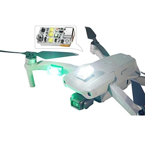

When an app identifies a drone in your vicinity, you need to verify it visually. Law enforcement drones follow strict FAA Part 107 lighting requirements for nighttime flight, but they often feature higher-intensity strobes than consumer models to ensure they are visible to manned aircraft. Learning the color code of these lights will help you determine the drone’s heading and intent.
Standard FAA Anti-Collision Lights


Most police drones are equipped with high-intensity white or red strobes that are visible for at least three statute miles. Unlike the soft, constant glow of a hobbyist drone, police units often utilize “strobe bursts.” You will typically see a fast, repeating white flash. If the drone is moving toward you, you will see a green light on the right side and a red light on the left. If it is moving away, you will see the white strobe or a solid white light. Police drones often hover at “stand-off” distances, meaning they stay far enough away to use their zoom cameras without being easily heard, making the strobe your primary visual indicator.


Specific Law Enforcement Light Behaviors


While many believe police drones use blue and red flashing lights like squad cars, this is actually rare because it can interfere with the pilot’s night vision or give away their position too easily. However, look for these specific behaviors:
- High-Altitude Hovering: If you see a stationary white and red light pattern that stays fixed for 20+ minutes, it is likely a police drone monitoring a specific perimeter.
- Grid Patterns: Police often use automated flight paths to scan areas. If the lights move in a perfect “mowing the lawn” pattern (back and forth in parallel lines), it is a professional search or surveillance operation.
- Infrared (IR) Illuminators: You cannot see IR with the naked eye, but if you look through your smartphone camera, you might see a faint purple or white glow coming from the drone’s underside. This is the thermal camera’s assist light in action.
Remote ID vs. ADS-B: Understanding Tracking Limitations


When you are using a police drone tracker app, it is vital to understand the technology powering the data on your screen. Not all drones broadcast their location in the same way, and knowing the difference between Remote ID and ADS-B can help you interpret why some aircraft appear while others remain invisible.
Remote ID: The Digital License Plate
Most modern drones, including those used by local law enforcement, are now required to broadcast Remote ID signals. Think of this as a digital license plate that transmits the drone’s position, altitude, and the location of the pilot. Apps that utilize your phone’s Wi-Fi or Bluetooth sensors are specifically looking for these Remote ID packets. However, there are limitations to keep in mind:
- Range Constraints: Since Remote ID often relies on Bluetooth or Wi-Fi, your phone may only pick up the signal if the drone is within a few hundred yards.
- Signal Interference: In dense urban environments, tall buildings and electronic noise can prevent your app from “hearing” the drone’s broadcast.
- Phased Rollouts: While mandatory for most, some older police “legacy” drones may still be in the process of being retrofitted with broadcast modules.
ADS-B: Tracking the “Big Players”
While small quadcopters use Remote ID, larger police surveillance drones or high-altitude unmanned aerial vehicles (UAVs) often utilize ADS-B (Automatic Dependent Surveillance-Broadcast). This is the same technology used by commercial airplanes. If a police department is using a large fixed-wing drone for border patrol or wide-area surveillance, it will likely show up on aviation-grade tracking apps rather than standard drone scanners. These signals can be detected from miles away, providing a much broader view of the sky than local Bluetooth-based tracking.
Distinguishing Police Surveillance from Commercial Drone Activity


Once you see a dot on your drone tracking app, the next challenge is determining if it belongs to the local precinct or a neighbor flying for fun. At night, every flashing light in the sky can look suspicious, but specific flight behaviors and data profiles usually give the operator away.


Flight Patterns and Hovering Behavior
Commercial and recreational drones usually have very specific “missions.” A delivery drone follows a straight, efficient path from point A to point B. A hobbyist usually flies in wide, sweeping loops or stays within a very small radius. Police drones, however, exhibit distinct tactical behaviors:
- Stationary Hovering: If a drone stays perfectly still at a high altitude over a specific intersection or building for 15 minutes or more, it is likely a surveillance platform.
- Orbital Patterns: Law enforcement often uses “Point of Interest” modes, where the drone circles a specific location autonomously to keep a camera centered on a target.
- Grid Searches: During missing person cases or suspect pursuits, you will see the drone moving in a tight “lawnmower” pattern, covering every inch of a specific sector.
Identifying Operator Profiles in Apps
High-end tracking apps often provide metadata about the drone’s manufacturer and model. Most police departments favor specific hardware, such as the DJI Matrice series or Autel EVO II Dual. These are large, industrial-grade drones with thermal capabilities. If your app identifies a drone as a “Matrice 300” at 2:00 AM, there is a significantly higher probability that it is a professional or government craft rather than a casual hobbyist flying a lightweight toy. Furthermore, police drones are often registered under “Public Safety” or “Government” categories in more advanced database-linked tracking software.
Conclusion
Spotting police drones at night is becoming easier thanks to the integration of Remote ID and sophisticated tracking apps. By understanding how these drones broadcast their presence—and learning to distinguish between a delivery flight and a surveillance “hover”—you can gain a much clearer picture of what is happening in the airspace above you. While no app is 100% foolproof due to signal limitations and hardware variations, these tools offer a level of transparency that was impossible just a few years ago.
To get started, your best next step is to download a reputable Remote ID scanner and test it in a local park during the day to see how different drones appear on the map. Stay observant, stay informed, and keep your eyes on the digital horizon!
❓ Frequently Asked Questions
Which app is best for detecting police drones?
The most effective apps are Drone Scanner and OpenSky, which detect Remote ID broadcasts required by the FAA. For larger agency drones, ADS-B Exchange offers the most unfiltered data compared to other flight trackers.
How can I tell if a drone at night belongs to the police?
Look for consistent hovering patterns over specific areas and high-intensity strobe lights. Police drones often display standard aviation colors but may be larger and louder than typical hobbyist models.
Why don’t some drones show up on tracking apps?
Drones might be too small for ADS-B requirements, or the agency may be operating under a ‘dark’ waiver for sensitive missions. Additionally, older drones might not have Remote ID hardware installed yet.
Do police drones use thermal imaging at night?
Yes, many law enforcement drones are equipped with thermal cameras to locate heat signatures in the dark. This technology doesn’t emit visible light, making the drone harder to spot if its LEDs are deactivated.
What is the range of a drone tracking app?
Remote ID apps generally have a range of about 0.5 to 1.5 miles depending on your phone’s receiver. ADS-B apps can track drones from much further away if the drone is broadcasting a powerful transponder signal.
Are there specific frequencies police drones use?
Most police drones operate on standard 2.4GHz or 5.8GHz frequencies, but some use encrypted cellular links. Tracking these requires specialized radio frequency (RF) scanners rather than standard mobile apps.