Where Are Drone Sightings? Recent Hotspots and Map Data
Commercial UAV Pilot & Aerial Cinematography Specialist at Drone Nestle · FAA Part 107 Remote Pilot Certification, Commercial UAS Operations · 10+ Years in Commercial UAV Operations, Flight Hardware Benchmarking & 4K Aerial Cinematography
Recent drone sightings are concentrated in the Northeast US, specifically across several counties in New Jersey and near sensitive military sites like Langley AFB. Official tracking data and eyewitness reports indicate persistent nocturnal activity involving large-scale swarms of unidentified craft.
🎯 Key Takeaways
- New Jersey is currently the primary hotspot for unidentified drone swarm reports.
- Sightings frequently occur near critical infrastructure and restricted military airspace zones.
- Most reports describe large, illuminated craft flying in coordinated formations at night.
- Official investigations by the FBI and FAA are currently ongoing and active.
- Public tracking maps offer real-time updates based on vetted law enforcement data.
Recent dronesightings are currently concentrated in the Northeastern United States, with a specific surge in New Jersey, Pennsylvania, and Virginia. Unlike the occasional hobbyist drone, these sightings involve organized swarms of large, unidentified craft hovering near residential areas, military installations, and critical infrastructure. Understanding these hotspots helps you stay informed about potential privacy risks and local security measures being implemented in your area.


Tracking this data matters because it reveals patterns in unauthorized surveillance and potential breaches of sensitive airspace. Whether you are a drone enthusiast or a concerned resident, knowing the specific coordinates and frequency of these events allows you to distinguish between normal aerial activity and significant security incidents. Currently, the data points to a high volume of activity near power grids, water reservoirs, and military training grounds, often occurring under the cover of darkness.
Major Hotspots: Tracking Recent Sightings in New Jersey and the Northeast


The Garden State has become the epicenter for unidentified drone activity in late 2024 and early 2025. Residents across Morris, Somerset, and Hunterdon counties have reported seeing multiple craft operating in tight formations. These are not your typical consumer drones; witnesses describe them as large, fixed-wing or heavy-lift multirotors that remain airborne for several hours at a time, far exceeding the battery life of standard commercial units.


The Morris County Cluster
In December 2024, reports spiked in the Morris County area, specifically near the Boonton Reservoir and the Picatinny Arsenal. Local law enforcement confirmed that the drones were flying at altitudes between 500 and 1,000 feet, often during evening hours between 6:00 PM and 10:00 PM. Here are the specific locations with the highest reporting density:
- Mendham and Chester: Frequent sightings of 5 to 7 drones moving in a grid pattern over forested areas.
- Parsippany-Troy Hills: Reports of large craft hovering directly over major utility substations and switching stations.
- Bedminster: Multiple sightings near high-profile private estates and the proximity of the Trump National Golf Club.
- Wharton: Sightings reported near the Route 15 corridor involving craft with “pulsing” white and green lights.
Regional Expansion into Pennsylvania and New York


The activity is not limited to New Jersey. Similar patterns have emerged in Bucks County, Pennsylvania and parts of the Hudson Valley in New York. Data from local tracking groups shows the drones often originate from the east and move westward across the Delaware River. These craft often feature high-intensity strobe lights but show no signs of ADS-B transponders, making them “dark” to standard civilian flight tracking software. In Pennsylvania, sightings have been clustered near the Limerick Generating Station, suggesting a specific interest in nuclear power infrastructure.


Everything You Need to Know About Tracking and Identifying Drone Sightings
This comprehensive guide provides a structured approach to locating, identifying, and documenting drone sightings in your vicinity. Whether you are a concerned citizen, an aviation enthusiast, or a security professional, understanding how to monitor the skies is crucial for safety and privacy. By following these steps, you will learn to distinguish between different types of unmanned aerial systems (UAS), utilize digital tracking tools, and understand the legal frameworks governing drone flight paths. This guide ensures you have the technical knowledge to find where drones are operating and how to record their activity accurately.
Step 1: Identify Geographically Likely Hotspots
What you need: A local map, access to Google Earth, and a basic understanding of local zoning laws.
Instructions: Drones are not flown randomly; pilots typically favor specific environments based on their objectives. To find drone sightings, start by identifying “hotspots.” These include large open public parks, construction sites where aerial surveys are common, and transit corridors near industrial zones. Real estate developments are also primary locations for drone activity, as photographers frequently capture aerial footage of new listings. Additionally, check for proximity to Restricted Operations Areas (ROAs) or “No Fly Zones” near airports; ironically, sightings are often reported on the fringes of these zones where hobbyists push the limits of legal boundaries. Map out these areas within a 5-mile radius of your location to narrow your search field.
Pro Tip: Look for “scenic overlooks” or high-elevation points in your city. Drone pilots often launch from these spots to maintain a better line-of-sight and achieve higher signal range for their controllers.
Step 2: Leverage Digital Flight Tracking Applications
What you need: A smartphone or computer with apps such as Flightradar24, AirMap (now part of DroneUp), or the OpenSky Network.
Instructions: While many hobbyist drones do not appear on standard ADS-B (Automatic Dependent Surveillance-Broadcast) transponders used by commercial aircraft, larger commercial drones often do. Download a flight tracking app and filter for “General Aviation” or specific “UAS” tags if available. For consumer-grade drones, the FAA’s Remote ID rule is becoming the standard. You can use specialized “Remote ID” scanner apps on a smartphone with Bluetooth and Wi-Fi capabilities to detect the digital “license plate” of drones flying within a few hundred meters. These apps will show you the drone’s serial number, its current altitude, and often the location of the pilot. Spend 15 minutes daily monitoring these apps during peak hours (usually sunrise and sunset) to establish patterns of activity.
Pro Tip: Use the “AR View” feature in some flight tracking apps. By pointing your phone at the sky, the app overlays the data of any registered aircraft or drone currently in the air directly onto your camera feed.
Step 3: Utilize Crowdsourced Reporting Platforms
What you need: Access to social media platforms (X/Twitter, Reddit) and community-driven apps like Nextdoor.
Instructions: One of the fastest ways to find where drone sightings are occurring is through crowdsourced data. On Reddit, search for subreddits like r/drones or local city-specific boards where residents often post about “mystery lights” or “hovering objects.” On X (formerly Twitter), use hashtags such as #DroneSighting or #UAS and include your city name. Community safety apps like Nextdoor or Citizen are also invaluable; neighbors often report drones they perceive as intrusive. When you see a report, take note of the time, weather conditions, and the specific neighborhood mentioned. Over time, you will notice that certain areas have recurring sightings, often linked to local infrastructure inspections or recurring hobbyist meetups.
Pro Tip: Join local Facebook groups dedicated to RC (Radio Control) hobbyists. These groups often discuss the best places to fly, which serves as a roadmap for where you are most likely to see drones in action.
Step 4: Implement Radio Frequency (RF) Monitoring
What you need: A Software Defined Radio (SDR) dongle and a laptop with software like SDR# or GQRX.
Instructions: Most consumer drones operate on the 2.4 GHz or 5.8 GHz radio frequency bands. While you cannot usually “see” the video feed due to encryption, you can detect the “noise” or signal spikes that indicate a drone is nearby. Connect your SDR dongle to your laptop and tune into these frequencies. A drone’s control link typically shows up as a wide, hopping signal on the waterfall display. If you see a sudden increase in signal strength in these bands, a drone is likely operating within a 1-kilometer radius. This technical approach is the most reliable way to detect “dark” drones that are not broadcasting Remote ID or using standard flight paths. It requires some technical setup but provides a scientific way to confirm sightings that the naked eye might miss.
Pro Tip: Watch for the 5.8 GHz band specifically. This is the primary frequency for FPV (First Person View) racing drones, which are smaller, faster, and much harder to spot visually than standard camera drones.
Step 5: Master Visual Scanning and Acoustic Recognition
What you need: Binoculars (8×42 is ideal) and a quiet environment.
Instructions: Visual and acoustic detection remains the most common way sightings are confirmed. To find drones, scan the horizon using the “box method”—divide the sky into quadrants and scan each methodically from left to right. Drones often look like small, dark specks that move with a non-ballistic trajectory (sudden stops or 90-degree turns). Acoustically, drones have a distinct high-pitched “whining” or “buzzing” sound, often compared to a swarm of bees. This sound carries significantly better in humid or cold air. If you hear this sound, stop moving and rotate your head slowly to triangulate the source. Most consumer drones are audible from up to 150-200 meters away, depending on ambient noise levels and the drone’s size.
Pro Tip: During “Golden Hour” (the hour after sunrise or before sunset), the low angle of the sun often reflects off the drone’s plastic hull or camera lens, creating a bright glint that makes them visible from miles away.
Step 6: Analyze Public FAA Incident Databases
What you need: Access to the FAA (Federal Aviation Administration) UAS Sightings Report database online.
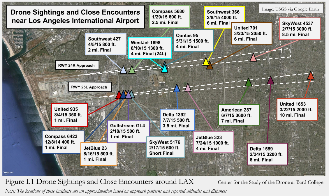
Instructions: The FAA publishes quarterly reports detailing drone sightings reported by pilots, air traffic controllers, and law enforcement. To find where drones are being sighted officially, download these spreadsheets from the FAA’s website. You can filter the data by city, state, or airport identifier. This data is incredibly detailed, often providing the altitude of the drone, its proximity to commercial aircraft, and a brief description of the event. Analyzing this data helps you understand “risk corridors”—areas where drones are frequently spotted in dangerous proximity to manned aircraft. By studying the historical data for your region, you can identify which months and times of day have the highest frequency of sightings, allowing you to focus your monitoring efforts more effectively.
Pro Tip: Pay attention to the “Altitude” column in these reports. If you see recurring sightings above 400 feet, it indicates illegal high-altitude drone activity in that specific area, which is a major safety concern for local aviation.
Step 7: Decode Light Patterns for Nighttime Identification
What you need: A clear night sky and a basic understanding of FAA lighting requirements.
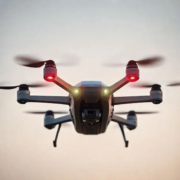
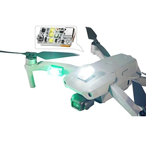
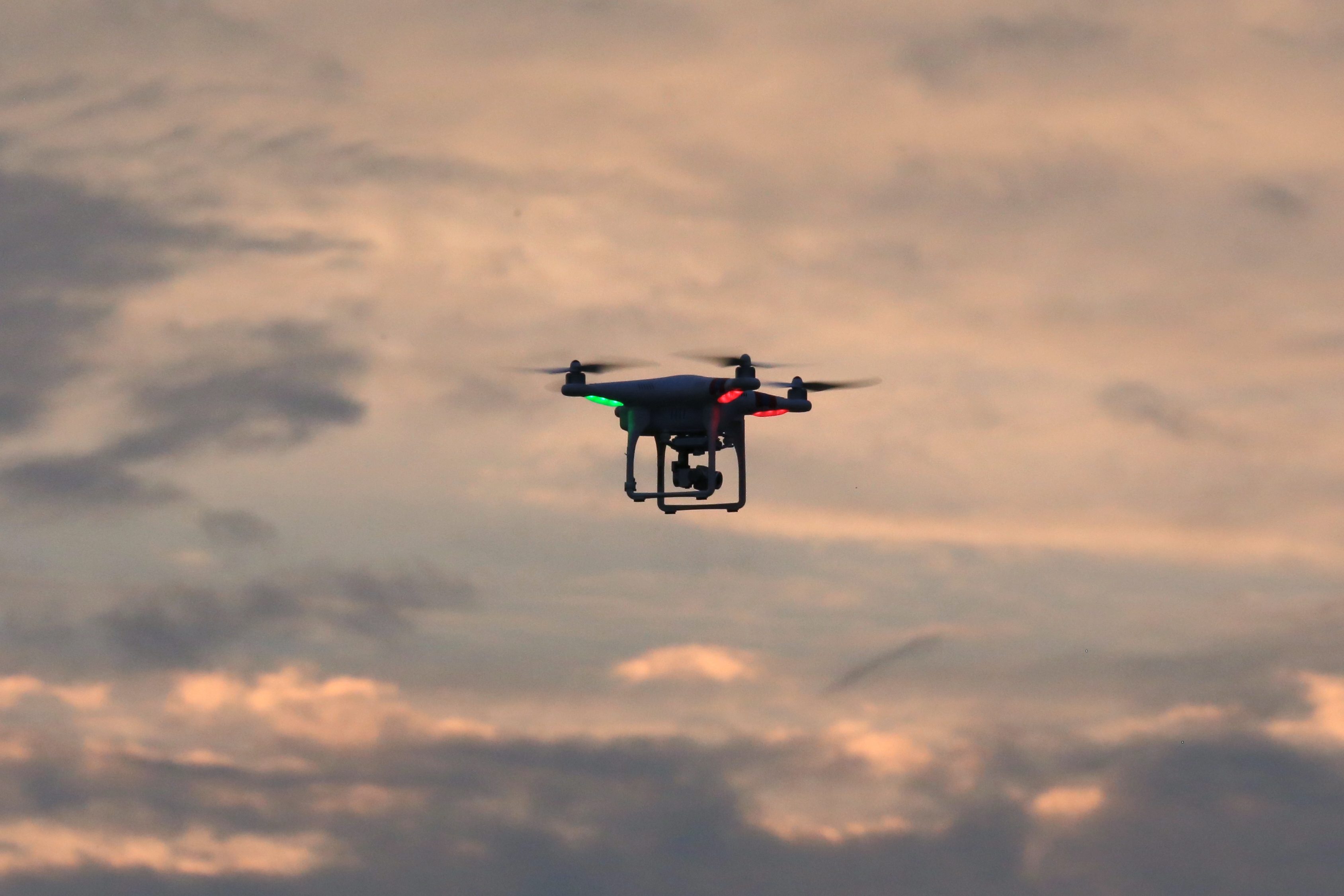
Instructions: Drones are significantly easier to spot at night due to their required anti-collision lighting. To find drones after dark, look for lights that do not follow standard aviation patterns. Commercial and larger hobbyist drones must have lights visible for at least 3 statute miles. Typically, a drone will have solid or blinking red and green lights on the front/rear arms to indicate orientation, and a white or red strobe light for visibility. Unlike stars, drones move; unlike planes, they can hover perfectly still for long periods. If you see a light that remains stationary for three minutes and then zips away at a high speed, it is almost certainly a drone. Use your binoculars to check if the light is “flashing” in a specific cadence, which is often a signal for low battery or GPS lock on consumer models.
Pro Tip: Use a night-vision monocular if available. Many drone sensors and internal components emit small amounts of Infrared (IR) light that are invisible to the naked eye but glow brightly under night-vision equipment.
Step 8: Documenting the Sighting for Official Record
What you need: A high-quality camera (preferably with a telephoto lens) and a GPS-enabled smartphone.
Instructions: Once you have located a drone, documentation is the final step. Take a video rather than a photo; video captures the flight movement, which is essential for identifying the drone’s type and the pilot’s intent. Use a reference point in your frame (like a building or a tree) to help investigators estimate the drone’s altitude and size. While filming, use a second device to record your exact GPS coordinates and the direction you are facing. Note the weather conditions, especially wind speed, as this affects how drones fly. If the drone is flying in a restricted area or harassing wildlife, this documentation can be submitted to the FAA’s Local Flight Standards District Office (FSDO). Proper documentation turns a casual sighting into actionable data.
Pro Tip: If you can see the pilot, do not confront them. Instead, photograph their vehicle and license plate from a distance. Law enforcement is much more likely to follow up on a sighting if there is a link to a specific individual or vehicle.
✅ Final Checklist
- Identified at least three local hotspots based on zoning and terrain.
- Installed and tested a Remote ID or flight tracking application.
- Checked the FAA UAS Sightings database for historical data in your zip code.
- Verified the drone’s flight pattern (hovering vs. linear travel) to rule out birds or planes.
- Documented the time, date, and precise location of the sighting.
Important Notes:
- Safety First: Never attempt to “bring down” or interfere with a drone’s flight. This is a federal crime in many jurisdictions and can cause dangerous crashes.
- Legal Boundaries: Taking photos of a drone in public airspace is generally legal, but hovering a drone over private property to “spy” on the pilot may violate local privacy ordinances.
- Estimated Time and Cost: Setting up a basic monitoring station takes about 2 hours. Costs range from $0 (using free apps) to $50 (for a basic SDR dongle).
- Seek Professional Help: If a drone is repeatedly hovering near your windows or interfering with critical infrastructure, contact local law enforcement or the FAA directly.
Security Incidents: Unidentified Drone Activity Near Military Installations


Military installations are experiencing a dramatic rise in unauthorized drone incursions. These events are highly concerning because they involve coordinated flight paths directly over restricted hangars, testing facilities, and sensitive equipment. You should note that these drones often demonstrate advanced flight characteristics, such as the ability to maintain station in high-wind conditions that would ground most consumer models. They also appear to possess sophisticated electronic warfare resistance, as many standard jamming attempts have proven ineffective.
Breaches at Langley Air Force Base


One of the most significant hotspots is Langley Air Force Base in Virginia. For several weeks, the base reported nightly swarms of up to a dozen drones. These craft were observed entering the restricted airspace over the flight line, where F-22 Raptor stealth fighters are stationed. The drones typically arrived shortly after sunset and departed toward the Chesapeake Bay before sunrise, suggesting a maritime launch or recovery point. This series of events led to a massive multi-agency response involving the FBI and the Department of Defense.


- Date Range: Frequent incursions recorded throughout December 2023 and early 2024.
- Craft Description: Large platforms, approximately 20 feet in wingspan, accompanied by smaller “escort” quadcopters.
- Flight Behavior: Coordinated group maneuvers with consistent spacing and altitude changes.
- Duration: Sustained flights lasting over four hours without landing, indicating a non-traditional power source.
Picatinny Arsenal and Domestic Defense Infrastructure



In the Northeast, the Picatinny Arsenal has been a frequent target for “overflight” incidents. The sightings here often correlate with activity over nearby water supplies and ammunition storage areas. Security personnel have noted that the drones seem to be performing “mapping” behaviors, flying back and forth in straight lines over perimeter fences. This suggests a sophisticated level of autonomous programming rather than manual remote control by a nearby hobbyist. You can see these patterns repeated across other sensitive sites, including the Naval Weapons Station Earle in Monmouth County, NJ, where craft have been spotted hovering near pier installations.
Southwest Border and Critical Infrastructure
Beyond the Northeast, the Southwest border near Eagle Pass and McAllen, Texas, remains a hotspot. Border Patrol agents have reported swarms used to monitor agent movements. These drones are often used to identify gaps in surveillance or to distract from ground-based activity. Unlike the mystery swarms in the Northeast, these are frequently identified as high-end consumer models modified for extended range and night vision capabilities. However, the sheer volume of sightings—sometimes dozens in a single night—indicates a highly organized logistical operation behind the flights.
Analysis of Flight Patterns and Craft Characteristics in Swarm Reports


When analyzing recent hotspots, the behavior of the drones often provides more clues than their location alone. Many reported “swarms” exhibit highly coordinated movement that suggests sophisticated autonomous programming rather than individual hobbyist control. These sightings frequently occur at twilight or during the night, making visual identification difficult but highlighting specific flight signatures.
Precision Movements and Grid Formations
Unlike casual flyers who move erratically, recent sightings in states like Colorado and Nebraska featured drones flying in perfect “search grid” patterns. These crafts maintain consistent altitudes and spacing, often covering dozens of miles in a single night. This level of precision is typically associated with large-scale mapping, agricultural surveying, or industrial inspections.
- Consistent Altitudes: Most reports indicate crafts staying between 200 and 500 feet, just at the edge of legal limits.
- Stationary Hovering: Observers often report drones remaining perfectly still over critical infrastructure like power plants or water towers.
- Simultaneous Battery Depletion: Swarms often vanish at the same time, suggesting a coordinated return-to-home command when power runs low.
Physical Traits and Lighting Signatures
Witnesses often describe these drones as significantly larger than standard consumer models. Some reports suggest wingspans of up to six feet, pointing toward fixed-wing “VTOL” (Vertical Take-Off and Landing) aircraft rather than the common quadcopters found in electronics stores. The lighting configurations are also distinct, frequently featuring high-intensity white strobes that can be seen from several miles away.


- Fixed-Wing Design: Many hotspot reports involve crafts that look more like small planes than multi-rotor drones.
- Anti-Collision Lighting: The presence of red, green, and white strobes often indicates a professional-grade craft designed to meet FAA nighttime flight requirements.
- Silent Operation: At higher altitudes, these crafts are nearly silent, contributing to the “ghostly” reputation of many sightings.
Official Responses and Monitoring Tools from the FAA and FBI


As sightings increase, federal agencies have ramped up their oversight and reporting mechanisms. The FAA (Federal Aviation Administration) and the FBI take unauthorized drone activity near airports and restricted airspace very seriously. Understanding how these agencies monitor the skies can help the public distinguish between a “mystery” drone and a legitimate, registered operation.
Remote ID: The Digital License Plate
The biggest shift in drone monitoring is the implementation of Remote ID. This technology acts as a digital license plate, broadcasting the drone’s identity, location, and control station position. For those wondering “where are the drones,” this system allows law enforcement to identify the pilot in real-time. If you see a drone and want to know if it is “official,” many smartphone apps can now pick up these Remote ID signals if the craft is compliant.
- Increased Accountability: Most professional operators are now required to broadcast their data, making “mystery” flights much rarer.
- Geofencing Technology: Major manufacturers like DJI include software that prevents drones from taking off in restricted “hotspots” like DC or near major airports.
- Public Airspace Maps: The FAA’s Visualize It map provides a clear view of where drones are allowed to fly and at what heights.
Law Enforcement Investigative Tactics
When a swarm is reported, the FBI often collaborates with local police to track the “launch and recovery” points. They utilize specialized radar and radio frequency (RF) sensors that can detect a drone’s signal even if it isn’t broadcasting Remote ID data. While many investigations end without a public explanation, the primary goal is ensuring that the drones aren’t interfering with manned aircraft or sensitive government sites.
- Aeroscope Systems: These specialized tools allow authorities to track drone telemetry and pilot locations instantly.
- Reporting Protocols: The FAA encourages citizens to report suspicious drone activity through their regional Flight Standards District Offices (FSDO).
- Inter-Agency Cooperation: The Department of Homeland Security (DHS) often steps in when sightings occur near borders or critical utility grids.
Conclusion: Navigating the Changing Skies
The increase in drone sightings across various hotspots is a natural byproduct of a rapidly growing industry. While “mystery swarms” can be unsettling, most are linked to commercial surveying, mapping, or infrastructure inspections that keep our modern world running. By understanding the flight patterns, craft characteristics, and the regulatory frameworks like Remote ID, we can better interpret what we see in the night sky. The transparency provided by the FAA and FBI continues to improve, turning “UFOs” into identifiable, manageable technology.
If you want to stay ahead of the curve, consider downloading a drone airspace map or a Remote ID scanner app to identify crafts in your area. To ensure your own flights are always visible and legal, explore our latest range of high-visibility drone strobe lights and Remote ID modules. Stay informed, fly safe, and keep an eye on the horizon!
❓ Frequently Asked Questions
Why are drone sightings increasing in New Jersey specifically?
While the exact reason remains unknown, the density of reports in NJ stems from high-profile swarm activity over populated areas and critical infrastructure. This has led to increased public vigilance and more frequent reporting to local authorities.
What do the reported drones look like?
Witnesses generally describe the craft as being larger than consumer drones, often the size of a small car, featuring bright, blinking lights. They frequently move in coordinated groups or ‘swarms’ rather than flying solo.
Is there a map showing where drones have been seen?
Several independent researchers and news organizations have created interactive maps using police scanner data and eyewitness logs. These maps highlight ‘hot zones’ where clusters of sightings occur over consecutive nights.
What should I do if I see an unidentified drone?
Authorities recommend documenting the location, time, and direction of travel without attempting to interfere with the craft. You should report the sighting to local law enforcement or through the FAA’s official reporting portal.
Are these drones related to foreign surveillance?
While there is speculation regarding foreign technology, federal agencies have not confirmed the origin of the drones. Investigations are currently focused on determining if they are hobbyist, commercial, or state-sponsored.
Are any specific accessories being used to track these drones?
Specialized equipment like radio frequency (RF) scanners and high-powered thermal optics are being utilized by researchers to monitor the swarms. These tools help identify the communication frequencies used by the drones.

Similar Posts